“The Complete South Pacific”
Part 2
The Australian Outback
Getting there:
OK, just as a review, let’s take a look at the tour map again.
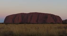
We just left Cairns and the Great Barrier Reef behind and are on the way to Ayers Rock in the middle of the Australian Outback. On the way from Cairns to Ayers Rock we had a very quick example of a form of “Climate Change”. The terrain quickly went from the ocean and tropical rain forest climate of Cairns to the really hot and dry desert of Ayers Rock. The change was really a bit of a shock. (I’m going to generally use the Aboriginal name of Uluru rather than Ayers Rock from now on since it is really preferred these days and is shorter and easier to type.)
The flight was just a little under three hours but we had a time zone change of 1.5 hours (yes, as in 90 minutes) so we gained back some of the time. We got through the airport and into a bus/coach to start looking around. Because it was still mid-morning and too early to check into our hotel, we did some sightseeing first.
Activities
Thursday, Feb. 28: Our first point of interest was a grouping of large (LARGE!) rocks called Kata Tjuta. You could see Uluru from Kata Tjuta, but it was impressive in its’ own right. We stopped at a small park with a viewing area for a better look. In this video you can see two things: the rock formations and some of the flies we were warned about that kept flying in front of the camera. Within 10 minutes of getting out of the bus, we were glad that we had bought the fly-nets.
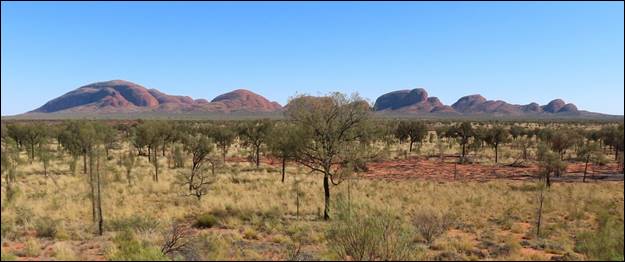
On the otherwise flat desert, these rocks were impressive.
After taking a good look from the overlook, we loaded up on the bus again and drove around to a parking area close to the rocks where a trail started. The bus driver said that we would leave there in 45 minutes and if we were real good, we might be able to get to the end of the trail and back in that time. Well, of course that was a challenge!
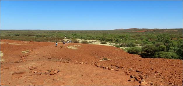
The start of the trail: you can see some of the others a way behind us.
Susan and I did make it to the end of the trail, and a couple of others got within 200 yards of the end before turning around. We also got back to the bus with minutes to spare before departure time. I took a photo of the end of the trail and offered to sell copies of it to anyone who wanted to claim they made it all the way to the end.
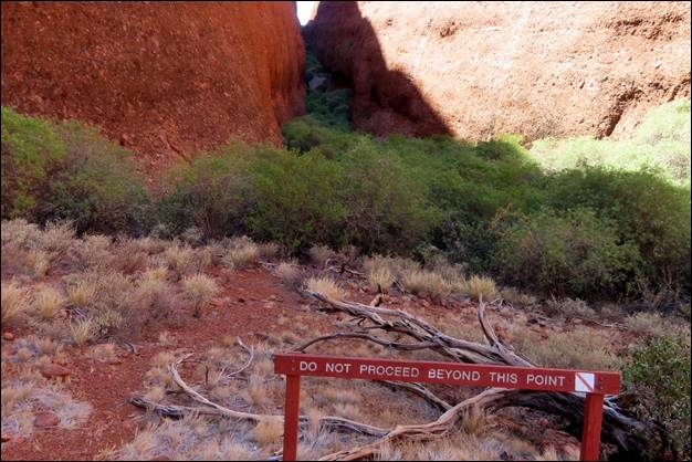
The barrier marking the end of the trail. We made it!
We loaded up again and headed to the resort we were staying at: Sails in the Desert. The driver gave us a little tour of the area around the resort on the way and dropped us off at a restaurant to have lunch. While we were eating lunch (pizza, again!) Evan and the bus driver took the bus and unloaded our bags at the resort so they could be delivered to our assigned rooms.
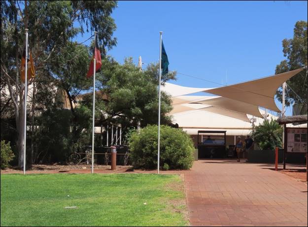
You can probably see why it is called “Sails in the Desert”.
After lunch the bus took us to the resort where we headed to our rooms for a welcome rest, considering our early start to the day. At 3:30 we loaded on the bus again for our exploration of Uluru in several stages. The first stage was at a cultural center that showed many aspects of the Aboriginal people, some of whom still live in the area.
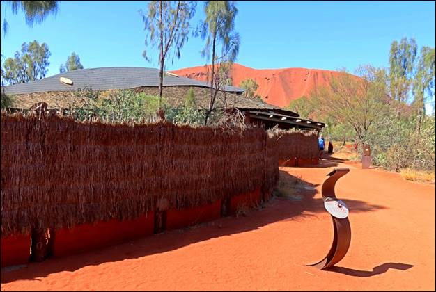
The closest photo we could take of the Cultural Center
No photographs are allowed within the center as capturing images of people who are dead is considered in very bad taste. It was interesting and also pointed out how the Aboriginal people and the European settlers have finally come to terms with each other and are getting along well. For example, the government returned several large chunks of land to the Aboriginal tribes and the tribes, believing that no one can really “own” the land, turned the custodianship of the land back to the government, providing that the land be turned into national parks and the tribes maintain a major voice in the management of the parks. This arrangement seems to be working well.
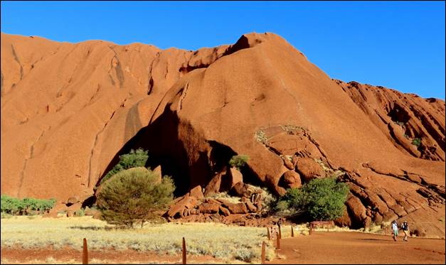
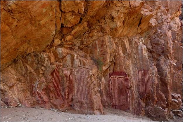
Our next stop was at part of Uluru where there is a trail to some paintings and a water hole. One of our first stops was where an overhanging rock formed a protected area underneath and it was clear the space had had many visitors: some of them had left evidence of their visits.
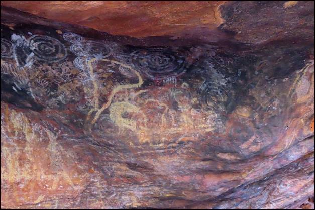
These are just some of the drawings on the rock walls.
Our guide pointed out that these drawings are not just decorative, but frequently give important information, such as the direction to the water hole or where live game might be found. There were drawings on both the walls and the overhanging rock ceiling, although the ceiling had also been blackened somewhat by the smoke from campfires.
The flies were as bad here as we experienced earlier and we were glad that we had the fly-nets.
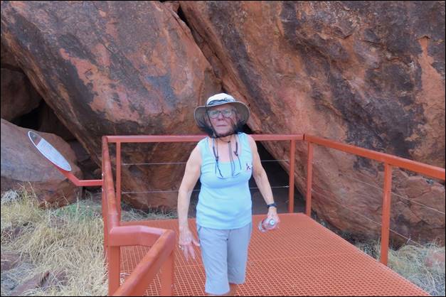
Here is Susan modeling the fly-net.
From the rock drawings we walked further up into a valley into Uluru to where several large boulders formed a “V” shape and in the bottom of the V was a small pond of water. The guide said that water stays here as long as 6 months after the last rain so both the animals and the natives depended on it.
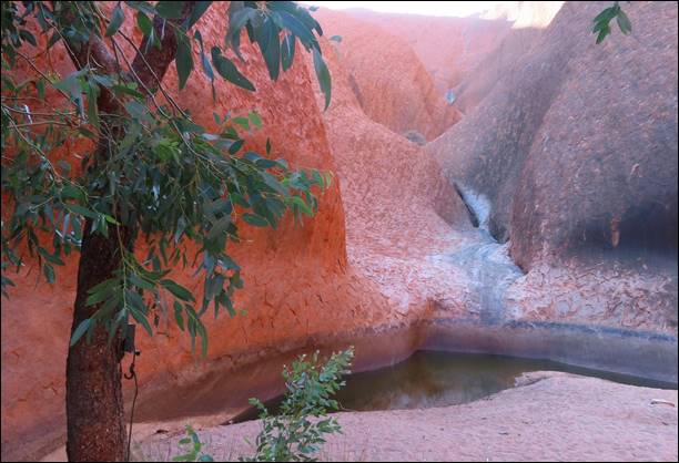 0
0
Water drains into this small pond from much of the surface of Uluru.
I just thought this photo of trees against Uluru made a neat image.
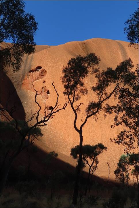
We left that area and took a slow drive around much of the circumference of Uluru, learning about the geology and history of the formation. We stopped at one place where there is a chain and a series of stanchions intended to help people climb to the top of Uluru. However, guests are strongly requested to not climb Uluru as that is an insult to the native Aboriginals.
Look closely and you can see the chains going up the nearest face of
Uluru.
There are only a couple of months of the year when anyone is allowed to make the climb at all, and even then, it is frowned upon by the local people, both Aboriginal and white. I’m not sure I’d want to try to make the climb even if it was not discouraged: it would not be easy. You can get a little better idea of the size of Uluru from this short video.
From here we drove a couple of miles to a sort of viewing area where the main object to be viewed was Uluru in the setting sun. There was a parking area for cars and tour busses and, by sunset, there must have been 10 large busses and 20 or 30 cars. When we got off the bus we were greeted by a local vendor who had a table set up with snacks and champagne ready for us as part of our tour. We had chairs to sit on, snacks to eat, champagne to drink, and a great view of the colors of Uluru at sunset: not bad!
Uluru did seem to change color and shape as the sun set. I’ll try to show a sequence of photos here to give an idea of the changing view, although they cannot convey how it really looked in person.
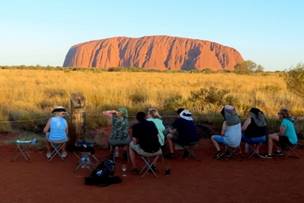
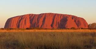
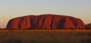
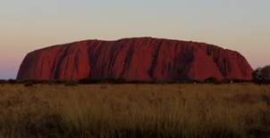
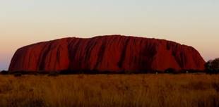
Uluru at sunset
We climbed back on the coach, rode to the hotel, and called it an early night.
Friday, March 1: We got up at a decent hour, had breakfast at the hotel, then picked up some of our tour members who had gotten up early and had a camel ride on the desert. A couple of the ladies, I believe just Bonnie and Michele, had signed up for the early camel ride and, when we picked them up, they reported that it was fun and the camels were surprisingly clean and well behaved. My thanks to Michele for the photo below.
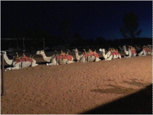
Camels in the desert.
After picking up Bonnie and Michele, we headed to the airport where our flight today was to be a short one to Alice Springs. The visit to Alice Springs was largely a history lesson as it was the first European settlement in the Outback and is still probably the largest town within 600 miles of it. When we arrived, I was surprised at the number of commercial passenger aircraft sitting at the terminal.
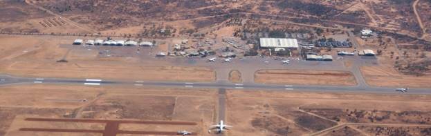
There are three aircraft in front of the terminal, one on the runway,
and we would make 5.
For such a small town, it seemed to be a very busy airport. I guess it is sort of the hub airport for the whole outback area. It would be a bit different when we left.
After getting our luggage and loading on our bus, we headed into Alice Springs with our first stop to be the Telegraph Station. It may seem strange to visit a telegraph station, but that this where the history comes in.
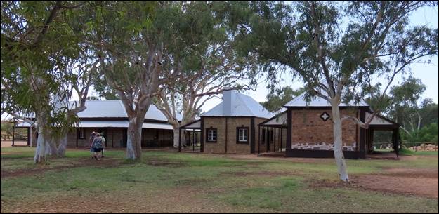
The main buildings of the telegraph station
Telegraph systems in the mid-1800s had to have a repeating station, with humans doing the repeating, every 170 miles or so and Alice Springs was chosen as the site of a major one. One reason it was located at this location is that the explorers determining the route and station locations mistook a seasonal lake for a spring. The area was named Alice Springs before they realized that there really was no spring. As technology and society changed over time, the site was used for several things, including a school and home for native children, although sometimes not with their parent’s permission. The station grounds are now only a historical site and is a reminder of how hard live was in this area until very recently. This video of the station grounds gives a better idea of the scope of the facility.
We got back onto the bus, and rode into downtown Alice Springs where we were dropped off to look around, shop, and find some lunch. We’re not much for shopping so we found a food court in a shopping mall and got some salads for lunch. We spent as much time as we could in the shopping mall because it was air conditioned and it was HOT outside. While we were doing this, Evan and the bus driver delivered our luggage to our hotel so our bags would be in our rooms when we arrived.
Back on the bus, we drove to and made a brief stop at an ANZAC memorial. ANZAC is the “Australian and New Zealand Army Corps” and the memorial commemorates the sacrifices of the Australian and New Zealand armies. The memorials and a national ANZAC holiday were originally started after World War I when both countries lost many men in combat. In the years since the memorials and holidays have been extended to include soldiers lost in combat in the several wars since WW-I and both countries celebrate ANZAC day.
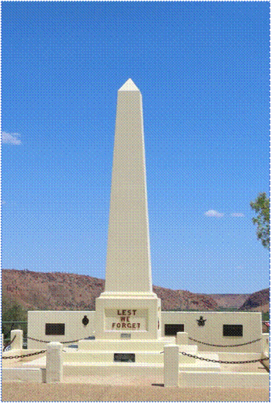
The memorial here was typical of many in Australia and New Zealand.
What was interesting to me is that we saw some form of ANZAC memorial in almost every city and small town we passed through in Australia and New Zealand. Both countries have a deep appreciation for the sacrifices made by the soldiers and their families.
Our next stop was the headquarters of the “School of the Air’. In this case, “Air” refers to airwaves, not airplanes. The school was started in the 1950s to try to reach and educate the many children in remote locations. The technology was initially radio and some telephones but in recent years they have adopted internet and satellite technology. The school has hundreds of students spread across tens of thousands of square miles with some students living as much as 400 miles away from Alice Springs.
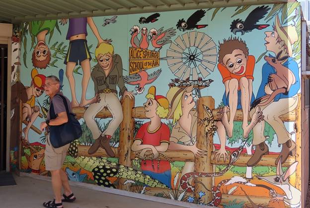
Jack is walking past the mural at the entrance to the School of the Air.
A former student who now works at the school gave an interesting overview of how it works and how it has evolved over time.
We then headed to our hotel for the night to rest up a little, as we had a busy and interesting evening.
The first activity for the evening was a performance by a somewhat unusual percussion group. Collette Tours provides support for a local man who forms a sort of drum band of local native girls who are considered ‘at risk”. As a “thanks” for this support, the girls give a performance for the Collette tours who come through. Besides being interesting for us, it also gets the girls out and into the world a bit more.
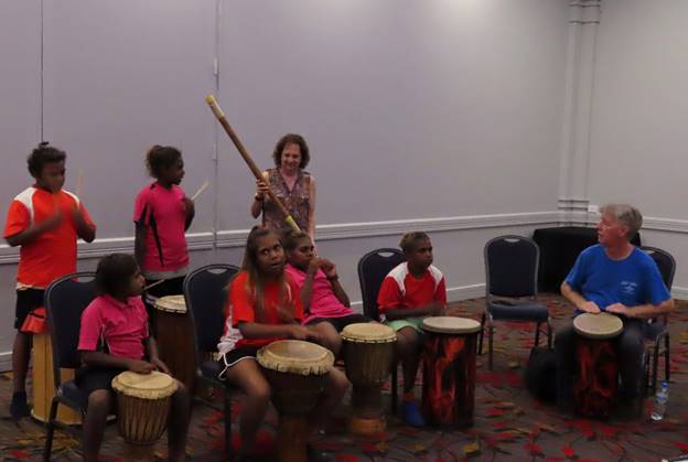
One of our tour group was recruited to assist with one “song”.
From what I could see the leader’s main challenge was not teaching them “music”, but rather controlling their rather short attention spans as you might see some evidence of in this “song” they performed. Most of our group had brought or bought some gifts for the girls such as books and school supplies, so after the “concert” they quickly divided the items up among themselves.
The evening was just getting started for us. We loaded up the bus again and headed to a rather remote area outside of town for dinner. Our hosts and cooks for the dinner would be John and his wife Katherine: John would do the talking and Katherine would do most of the cooking and John was quite a character.
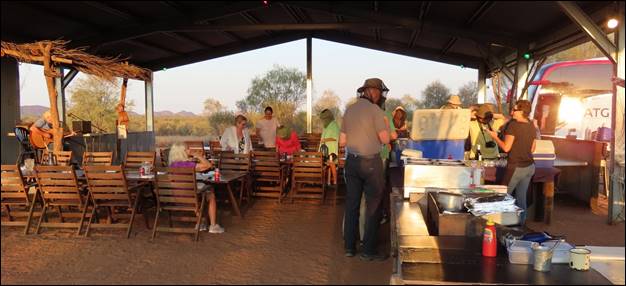
The facilities were not exactly 5-star, but it was fun.
While Katherine prepared most of the dinner, John entertained us with his commentary on how to make a local traditional dessert, “Spotted Dog”. This video should give you an idea of just how the process went as John demonstrates how to measure exactly two half-bags of raisins. There was, of course, considerable discussion of whether the black dots in the Spotted Dog were raisins or some of the flies that had been buzzing around. Interesting side note: as John promised, the flies disappeared completely as soon as the sun set. The Spotted Dog baked on a wood fire as we ate dinner.
As we ate, we were entertained by a guitar player/singer who was pretty good. He told the complete story of the song “Waltzing Matilda” (it is not what you might think) and then we all had to sing along as he played all 4 verses of it.
After dinner, John demonstrated an “interesting” way to remove the Spotted Dog from the pans it baked in and then sliced up pieces for us to eat: not bad. It was very dark outside by now and Katherine had us walk a short distance from the lights of the dining area and gave us a short course in southern hemisphere astronomy. I don’t think I have ever seen the Milky Way stand out so clearly as it did that night. She pointed out the Southern Cross and several other constellations, some only visible from the southern hemisphere. It was a very interesting lesson with a beautiful dark sky to study. We headed back to the hotel and slept well.
Saturday, March 2: After a leisurely wakeup time and breakfast at the hotel (Doubletree by Hilton, Alice Springs) we loaded up and headed out to a somewhat remote area outside of town to learn more about how the native people used to live and some of them still do today. Our “schoolhouse” consisted of a covered area with benches and a local gentleman as our instructor.
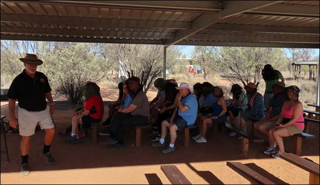
Our instructor and classroom in Alice Springs.
One interesting and somewhat amazing part of the lecture was concerning how the Aboriginal people established rather strict rules governing just who could marry and have children. Since most tribes were really families and may only have 50 – 75 people in an area, it was important to avoid marriage between first and second cousins to maintain DNA diversity. Although the native people did not understand DNA, they apparently recognized the effect of intermarriage and devised a surprisingly effective method to avoid it.
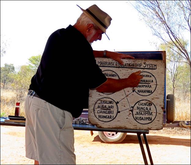
Our instructor explains how the intermarriage chart worked.
Another part of the lecture concerned food sources and there apparently were a surprising number of fruits available in the arid climate. Our instructor named and described six or seven different fruits and passed around a bowl containing some of them.
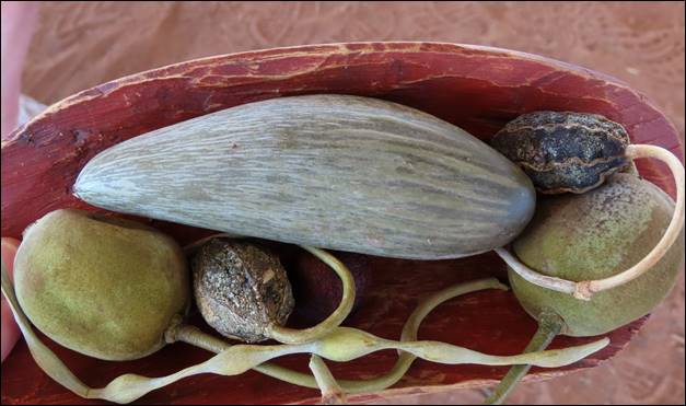
Some of the fruits the native people would eat.
He also talked about some of the seeds that were used to make flour and, from that, various kinds of bread of which he had a sample. It seemed very similar to the Spotted Dog we had the previous night, but without the raisins.
We were then taken to an area where about 10 different Aboriginal people had set up simple shelters for shade and were displaying paintings they had done and were for sale. (We were asked to not take photos of the paintings, so I don’t have any.) They typically used customary native symbols in various combinations, sometimes to tell a story. A couple of people in our group bought paintings, but not many so I hope the natives have another way to sell their artwork. There was a large lizard hanging around and I thought that he better be careful or he might become someone’s dinner.
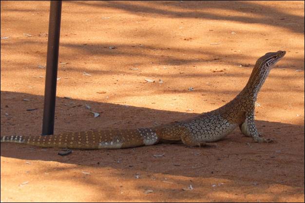
This lizard was plenty big enough to become part of a stew.
Our instructor then showed us some of the weapons the Aboriginal people would use, mostly to hunt wild game, but sometimes against another tribe. The weapons included simple (but effective) clubs, spears (with and without throwing sticks) and boomerangs, although not the type that would return. We then had the opportunity to try throwing a boomerang and it was more difficult than it looked. An outline of a kangaroo placed about 50 feet away was used as a target and I don’t think any of us even got close. You can see Susan trying her hand with the boomerang in this video. Once we had all failed to hit the kangaroo, it was time to load up the bus and head into town for lunch.
We must have been a little ahead of schedule though, as we made an extra stop at a pass through the ridge of hills around Alive Springs. The Aboriginal people have a rather complex story of just how the hills and the pass or gap were formed and they called the gap Anthwerrke while the European name is Emily Gap. Most signs in the parks include both the Aboriginal and European names.
The drawings apparently represent the large caterpillars that play a
role in the story.
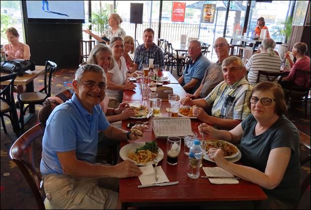
We again loaded the bus and headed for town and lunch. When Evan and the driver let us out, the driver said that a good place to eat was “Uncle’s”, so we went looking for it. So did all the other tour members and we soon all found it. The only problem was that it did not open until 12:00 and we were about 20 minutes early, so we dispersed for a while, with Susan and I again heading toward the air-conditioned mall. About noon all of us wandered back to Uncles and waited for the door to be unlocked and we descended upon them. It was sort of a sports bar and the 19 of us mostly took over the place and set up a couple of large tables. We all ordered and got the food and drinks and laughed and told stories and generally had a good time. It was actually a bit of a “bonding” experience that I think brought us all together as a much closer group.
One of the big tables where the men were allowed to sit.
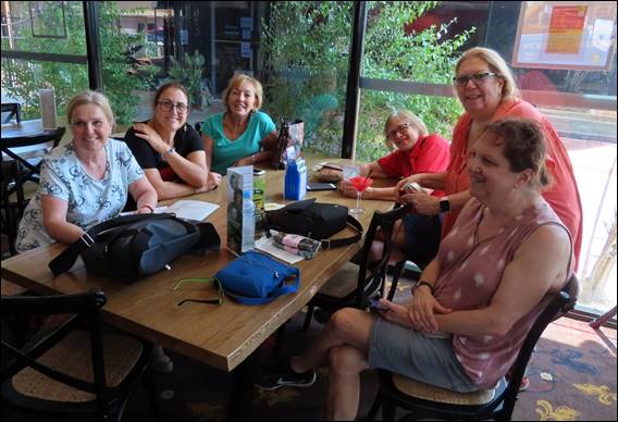
I kidded the ladies that this must be the “No men allowed” table.
The food was pretty good also!
Once more onto the bus and we headed to the airport. Remember how I commented about how busy the airport was the previous day? Well, this afternoon it was just the opposite. We arrived during the counter agent’s lunch hour so we had to wait a few minutes for him to show up, but when he did, we were his only customers. Susan and I were the first ones through ticketing and the security check and when I got to the waiting area that serves 2 or 3 gates, there was no one there! I went into the men’s restroom and there was no one there either, so I had to document a common bathroom fixture in Australia and New Zealand: the men’s urinal. In most “multi-person” restrooms the urinals were stainless steel troughs as in the photo. They are very efficient.
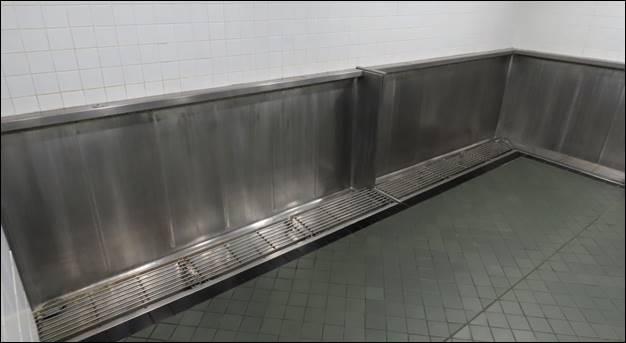
This is one of the larger stainless-steel urinals I saw.
At the appointed time, we boarded the airplane and headed to Darwin, bidding farewell to the Outback and, thankfully, to all those flies.
You should now click on the “Back” button on your browser to return to the main section of the report, then click on “Part 3: Darwin and Kakadu Park” to continue.