Grand Canyon and
Utah Parks
2018
The Setup:
We had planned this trip
for 2017 but had to delay it when Susan had a major ankle injury. Neither of us had ever visited the Grand Canyon
or any of the famous Utah National Parks and we figured it was about time. Things finally came together for a Sept. 2018
trip. The primary scheduling issues were
that we wanted the trip to be in September, the later the better, to avoid
crowds and heat, but we were planning to meet some friends on another trip in
late Sept. or early Oct., so that set the latest date we could be
traveling. We ended up leaving on Sept.
12 and returning on Sept. 22.
This report will be a
little different from most in that it will consist mostly of photos and
relatively little “prose”. I’m not sure
that is a good thing for the reader or not, but hopefully the pictures will
convey what we saw much better than my words possibly could. Regarding the videos that also accompany this
report…. you
will probably notice that the color in the videos are not as vivid as in the
photos. The camera I use does that and I
do not have a video editor that can adjust the colors as I can with the photos
so that that the match what I remember.
There & back:
The plan was to use a
“free” companion ticket I had, so this put some restrictions on us. We flew from Atlanta to Las Vegas, picked up
a rental car there, visited all the parks, then returned to Las Vegas and flew
back to Atlanta. All of this went
reasonably well, although if I was doing it again, I would change some of the
scheduling to save a day or two.
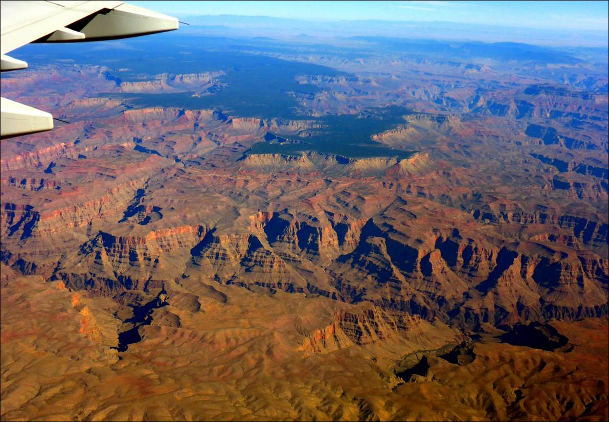
A view of the Grand Canyon as we approach Las Vegas
The flights went
reasonably well with exit row seats in both directions. The flights were on time and as comfortable
as “coach cabin” flights can reasonably be.
The process of getting from the airline terminal to the rental car
center (via shuttle busses) did leave something to be desired though.
Wed. Sept 12
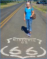
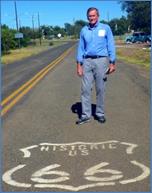
We arrived in Las Vegas in the late morning (Las Vegas time). We picked up the rental car (Hertz) and headed toward the Grand Canyon. On the way out of Las Vegas we first stopped for lunch at a place that ended up being a little strange, but decent. (Hey, it is Las Vegas!) We then went to a close-by supermarket where we picked up a Styrofoam cooler and few things to put in it, like wine, cheese, crackers, apples, etc. On the way to the Grand canyon (actually, Tusayan, Arizona) we had some adventures with a GPS unit that kept wanting us to turn off the new Interstate at places where there were no exits/roads. We managed to get past that and once into Arizona we did stop for a stretch break at a small museum in Ash Fork, AZ. There was a section of the old true “Route 66” close by so we got the photos seen at the top of this page. In this area, Route 66 now co-exists with the interstate (I-40) but I was not about to stand out in the middle of I-40 for a photo.
We rolled into Tusayan in the late afternoon and checked into the Holiday Inn Express, moved into the room, and took a little walk around the area. It did not seem real busy so I was hopeful that the parks would not be too crowded. After walking a while we decided it was time for dinner (we were still on Atlanta time) so went into the “Big E Steak House”. We ended up with decent steaks (surprise!) and a bottle of wine. The steaks were large enough to take some leftovers with us for future meals. A long day made for an early bedtime that night.
Thursday, Sept 13: Grand Canyon
Still somewhat on Atlanta Time, we were up and ready by the time the “complimentary” breakfast was available at the HIE. We finished breakfast and headed toward the Grand Canyon, entering the park before 8:00 AM.
We have arrived!
It started off chilly in the morning and we were a bit cool with our relatively light clothing. By midday, we would be glad we did not dress any warmer. We found our way to a parking lot close to the primary Visitor Center only to find out that it did not open until 9:00. We decided to just start walking the Rim Trail, starting at Mather Point and working our way west.
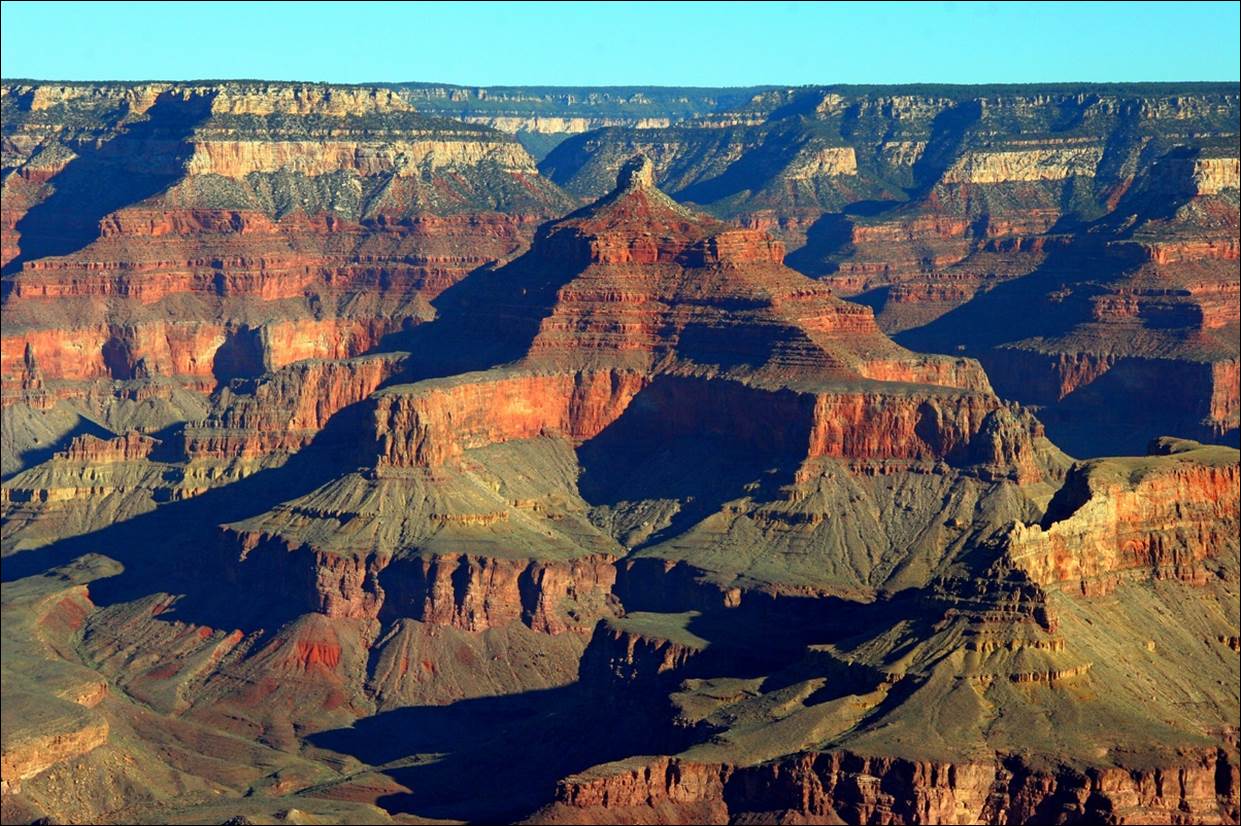
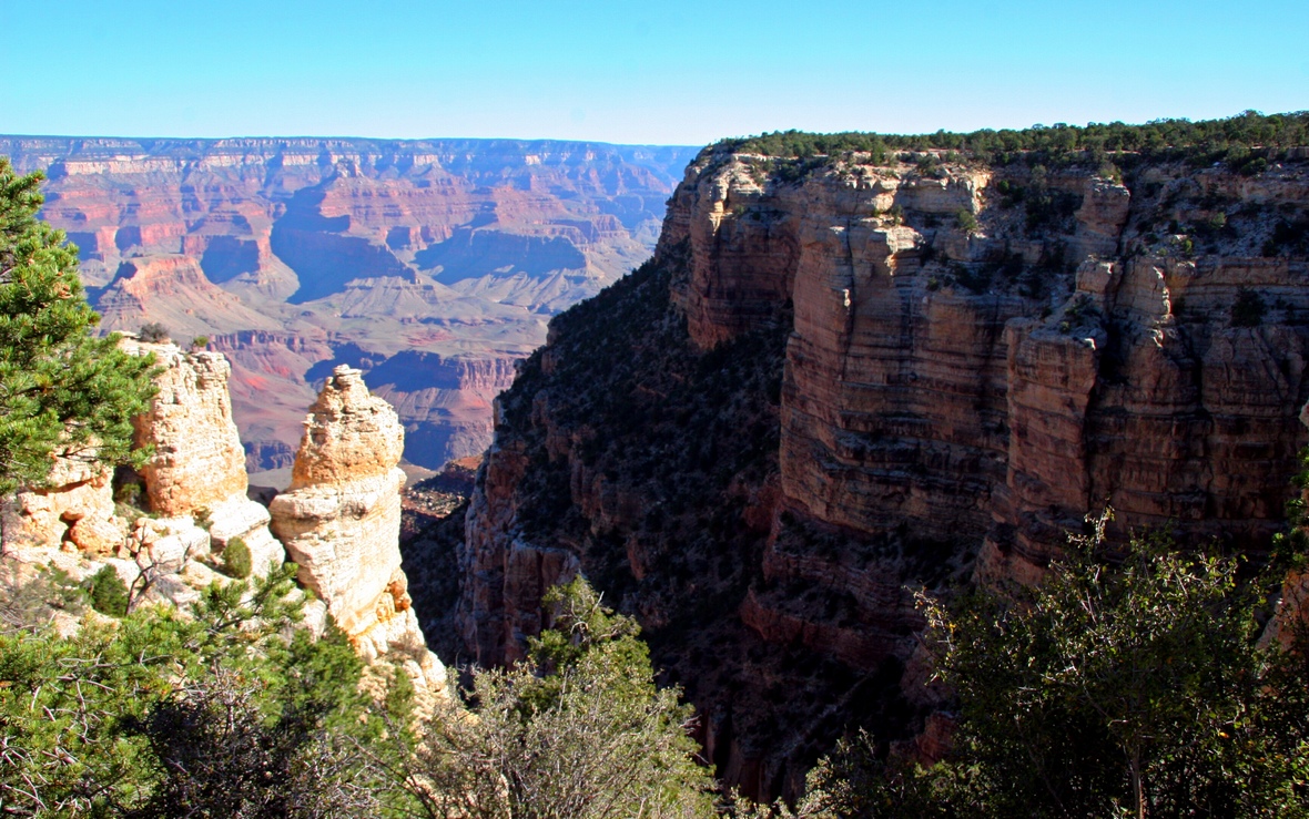
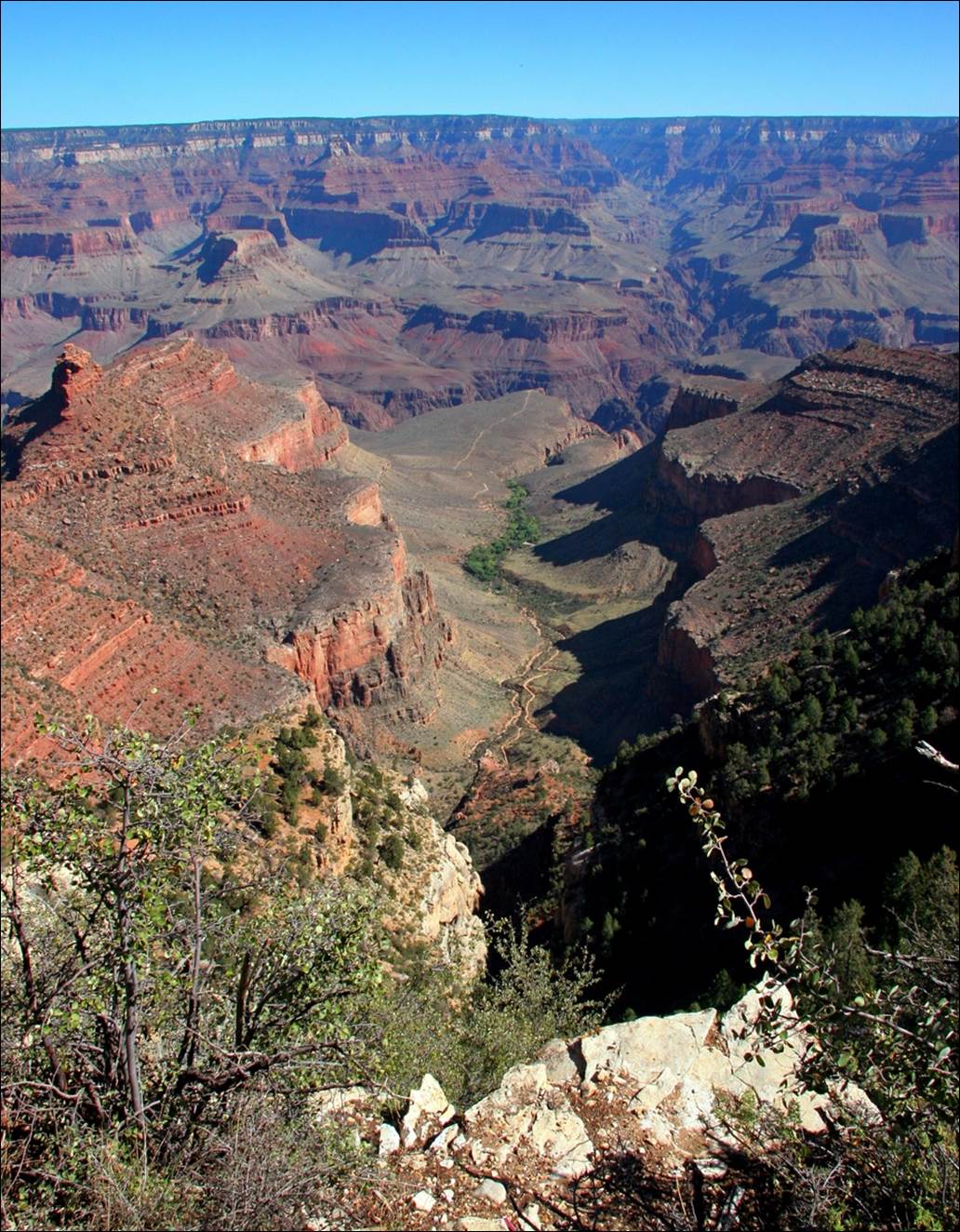
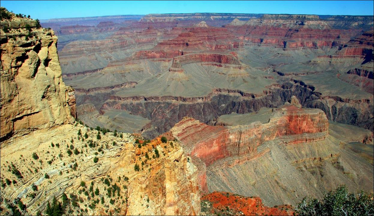
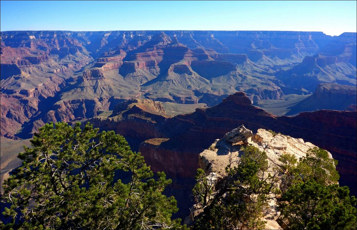
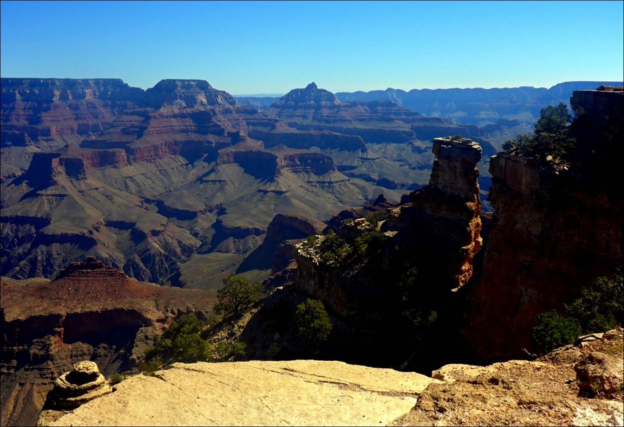
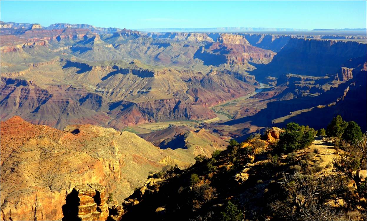
The first view of the Grand Canyon in person is stunning.
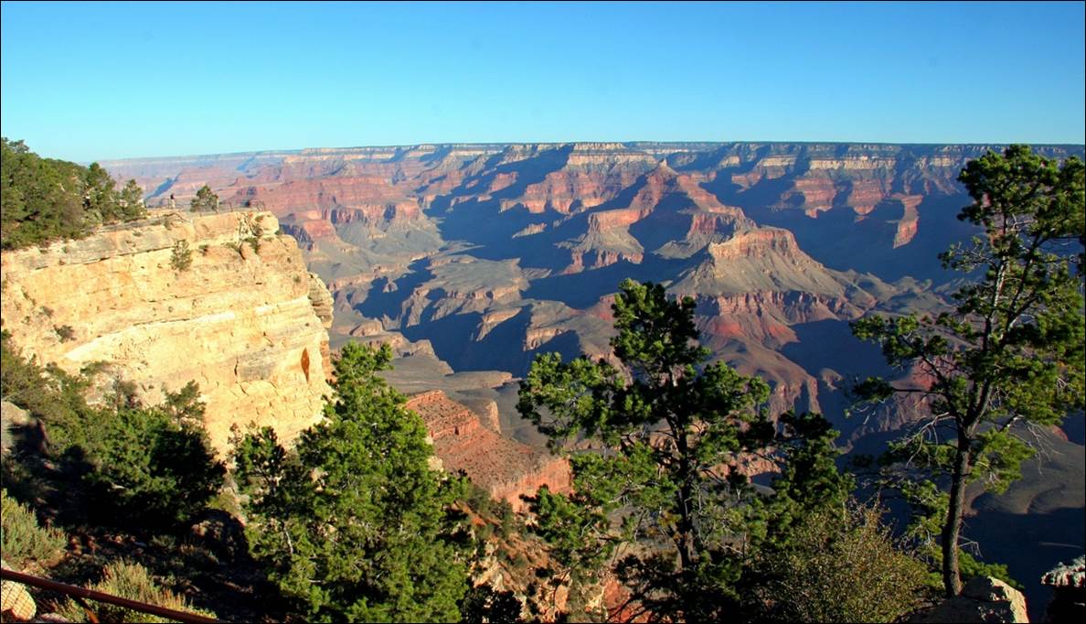
First
view of the Grand canyon from the Mather Point overlook.
I have probably seen thousands of photos and videos of the Grand Canyon, but I can now verify that, until you see the Grand Canyon in person, you have not really seen it. No photo or video (such as this one ) can ever show its full majesty. You have to see it in person.
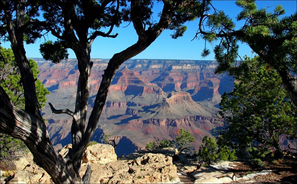
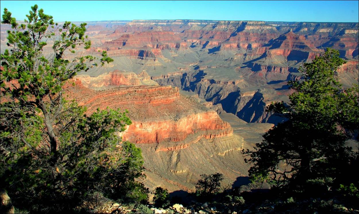
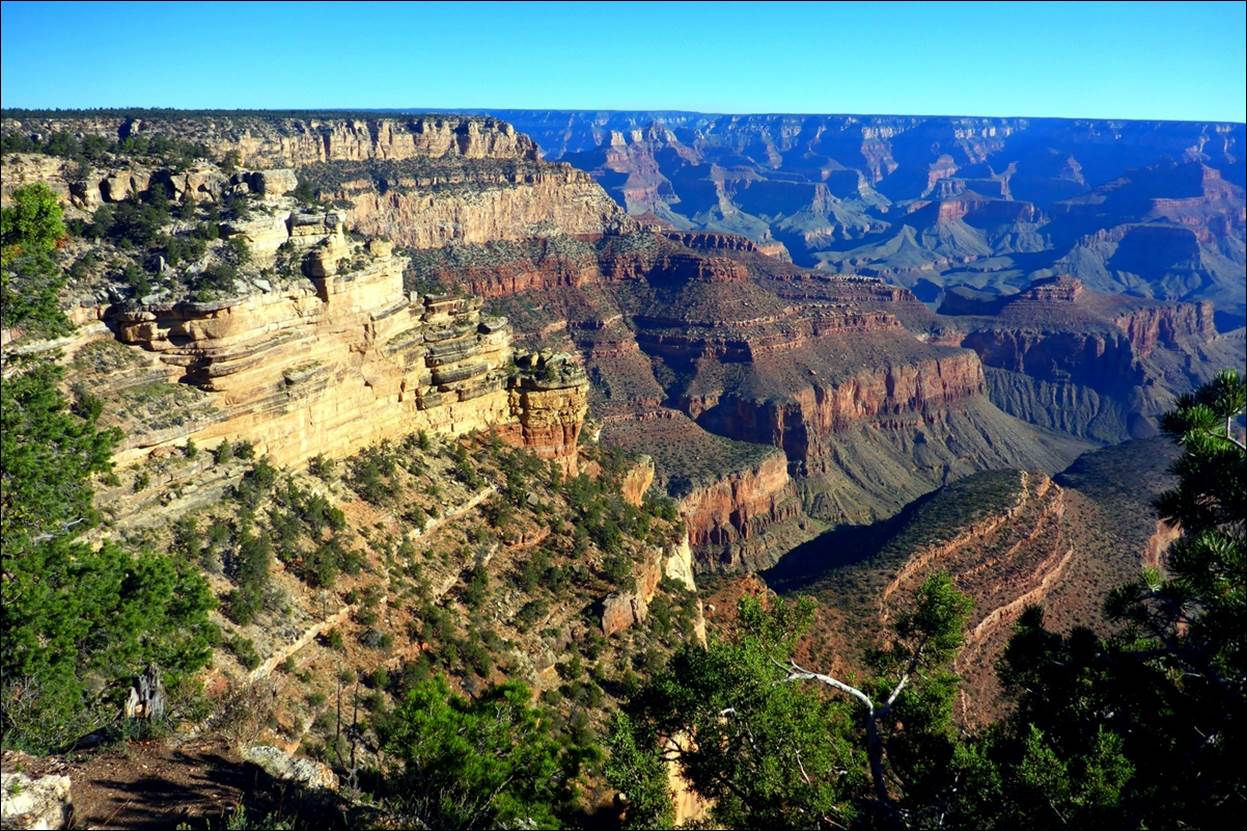
We walked the rim trail westward, from the Visitor Center and Mather Point toward the other main developed area, the Grand Canyon Village. Here are a few of the sights along the say.
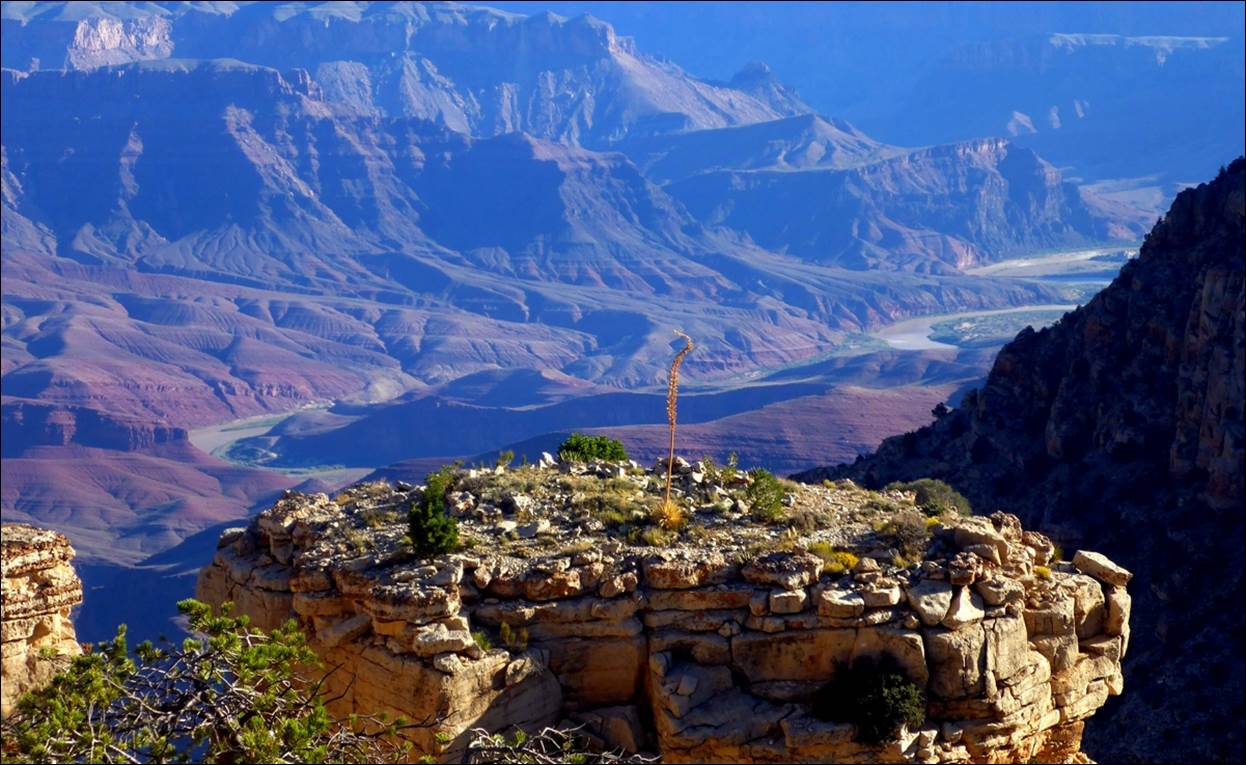
Some
plants were very tenacious: note the
“spear” growing out of the rock close to the middle of the photo.
Sometimes the canyon seems to go on
forever.
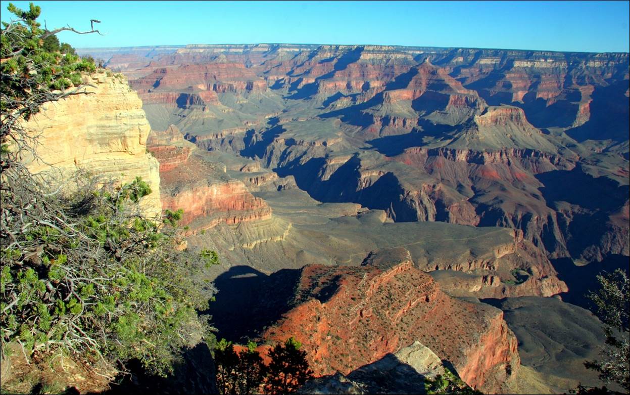
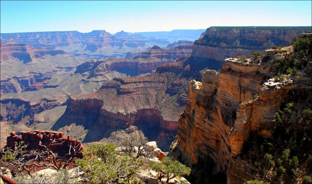
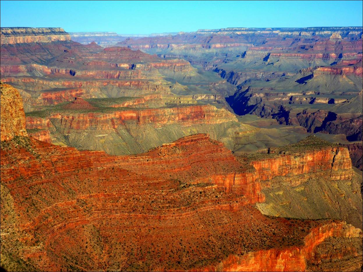
The views from the various overlooks
were similar, yet very different.
The various kinds of rock and soil
making up the many layers created interesting color contrasts.
Along the way was a
“Geology Center” that had various displays to help explain how the canyon was
formed over the millions of years. The
scale model of the canyon was fascinating by itself.
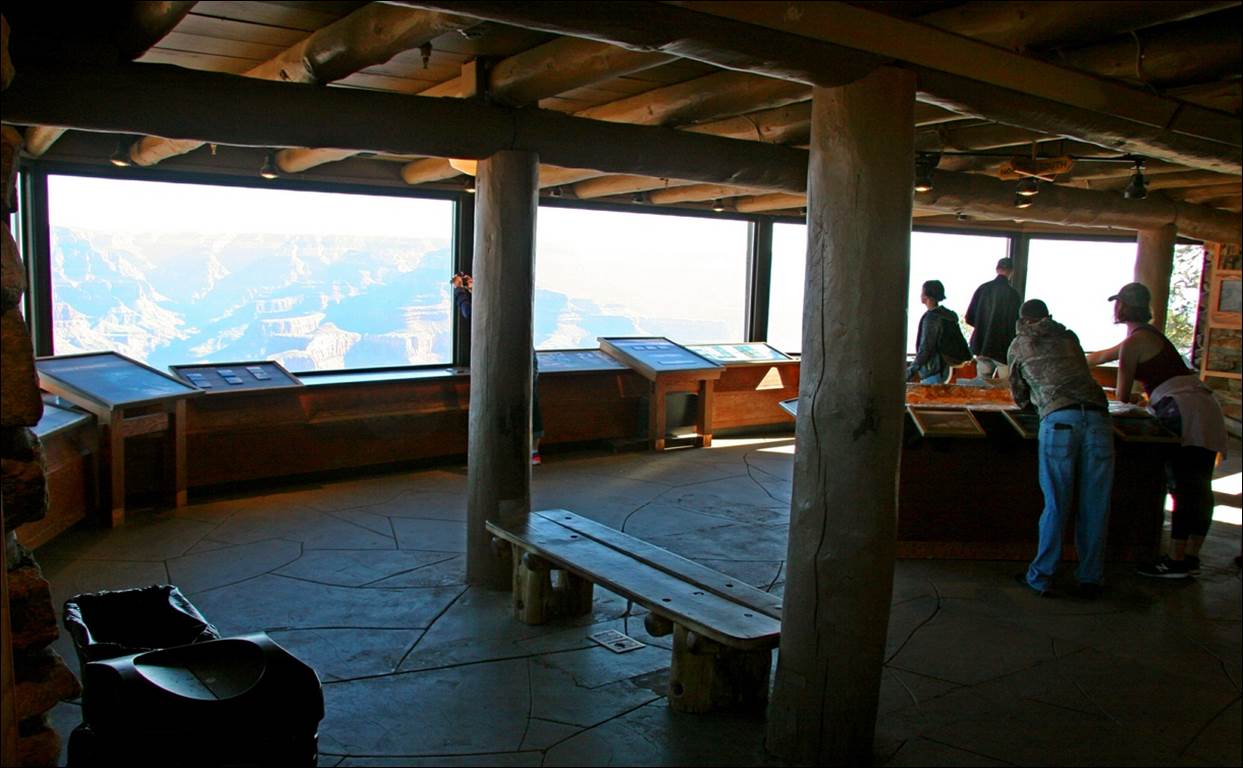
The inside of the Geology Center.
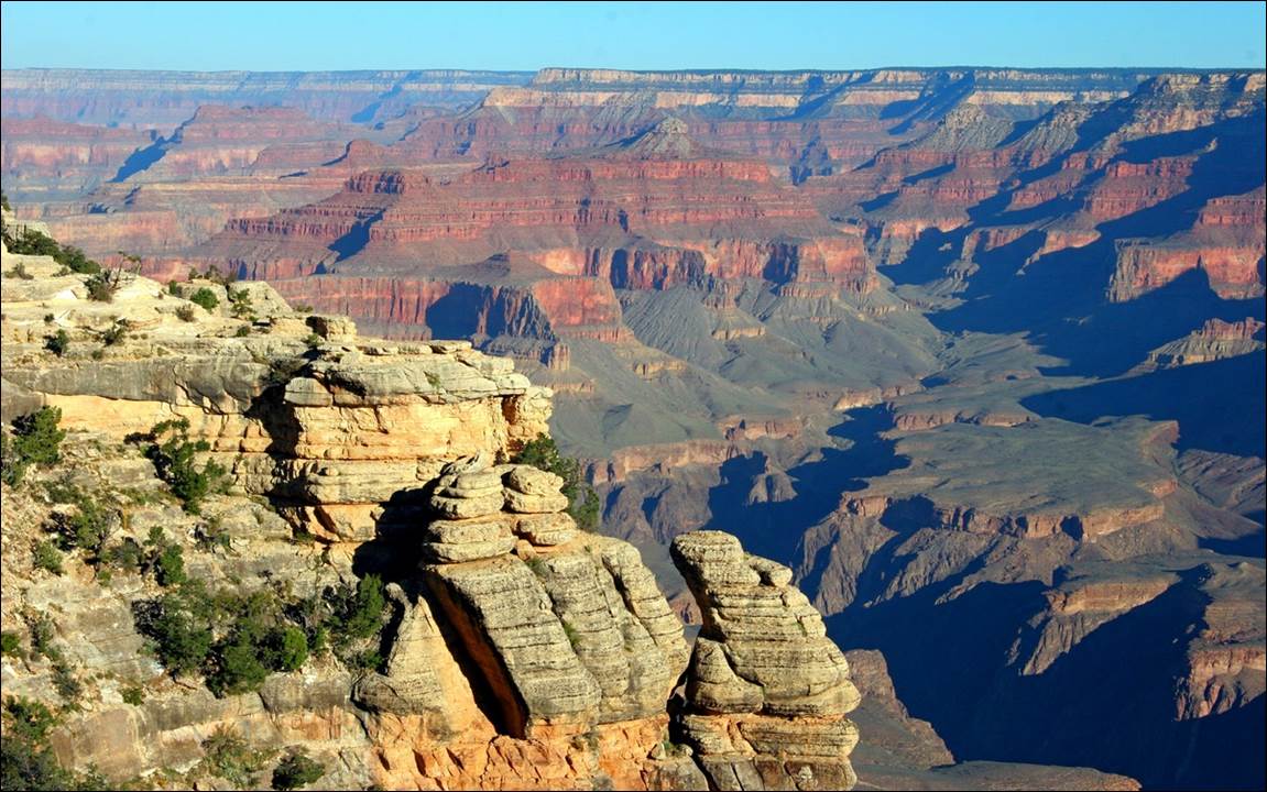
Later in the day I noticed it had gotten much busier.
We continued along the rim
trail, walking toward the west and the village area.
The vegetation growing along the rim has
to be very hardy.
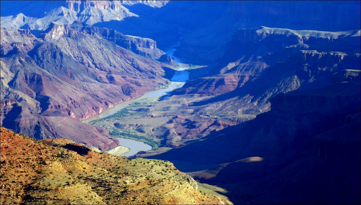
We knew the Colorado River was down
there somewhere but we had not seen it yet.
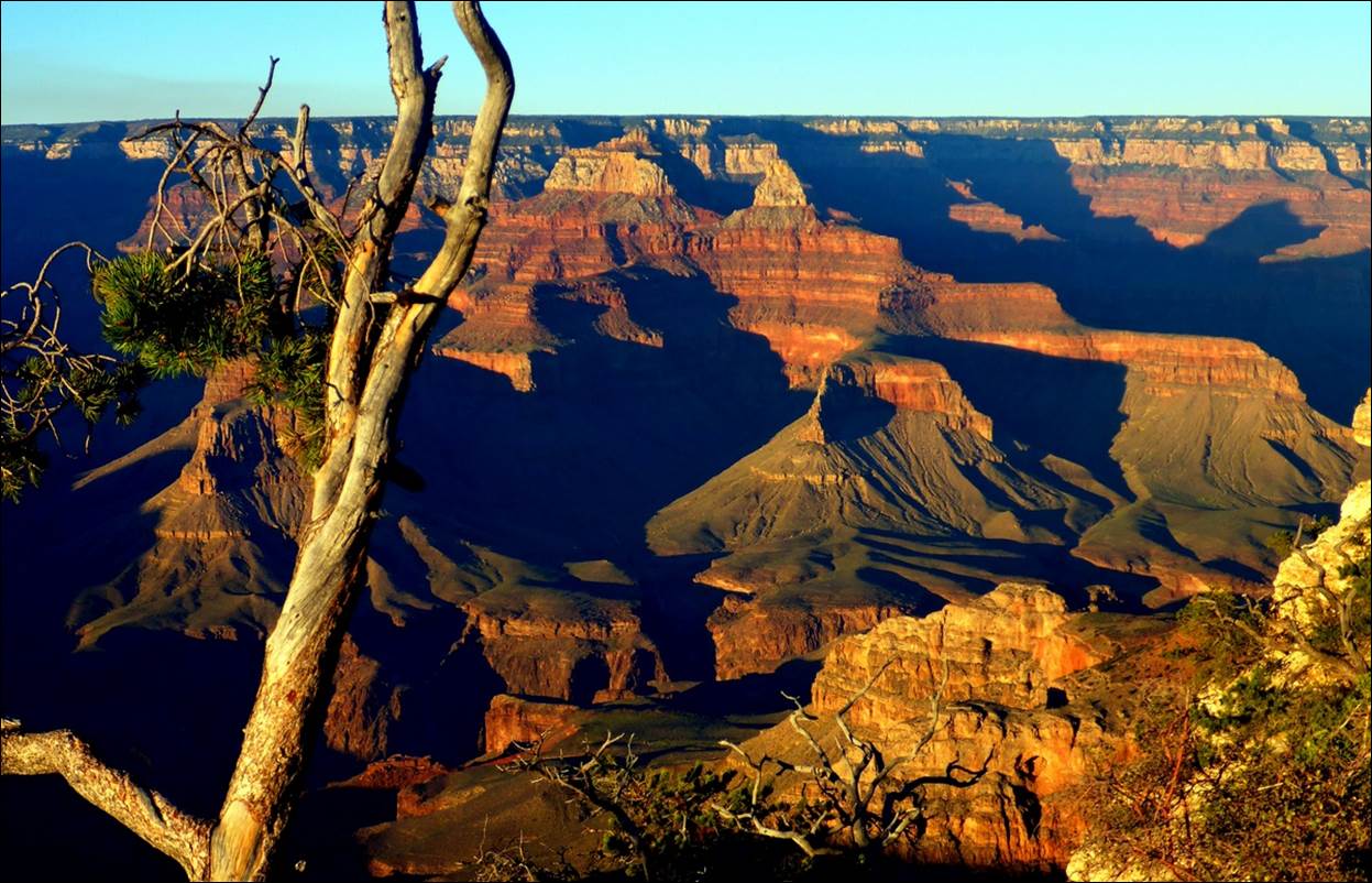
The colors and shapes seemed to change
as the sun went across the sky, changing the shadows.
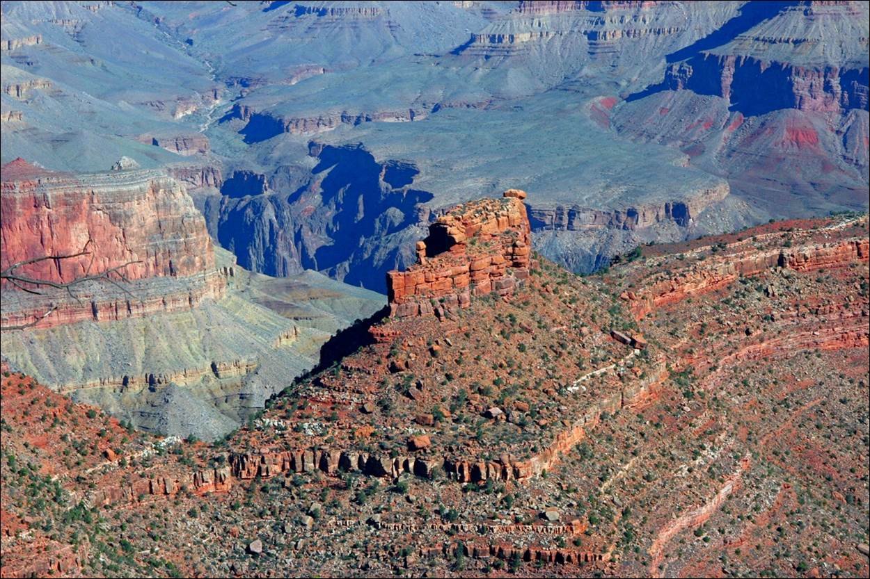
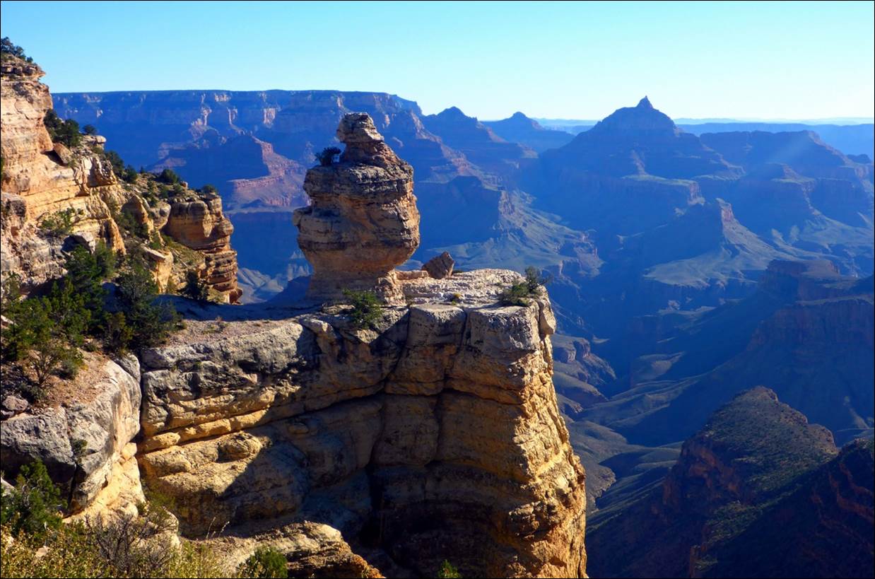
Rock formations that sit on top of a
plateau or ridge line are called “temples” and many have names.
In this video you can hear
the wind starting to come up. It felt
cool at first but very nice later. We
got to the village area about mid-morning, looked around a small museum and got
a soft drink at a snack bar. Sitting for
a while with a cool drink was great!
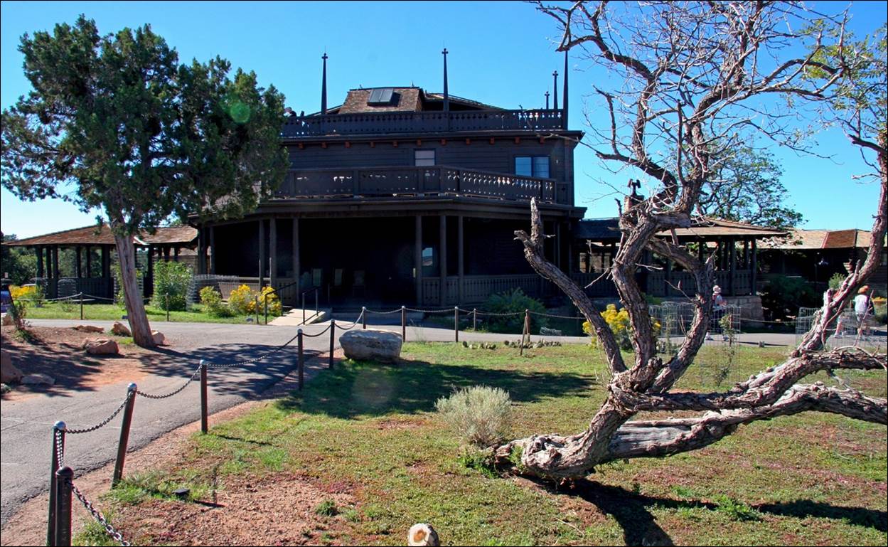
Part of the lodge and shops that make up
the village area.
The village consisted
mainly of several shops, a couple of restaurants and bars, The Bright Angel
Lodge and El Tovar Lodge. During the
popular seasons, reservations for the Lodges have to be made 12 months or more
in advance.
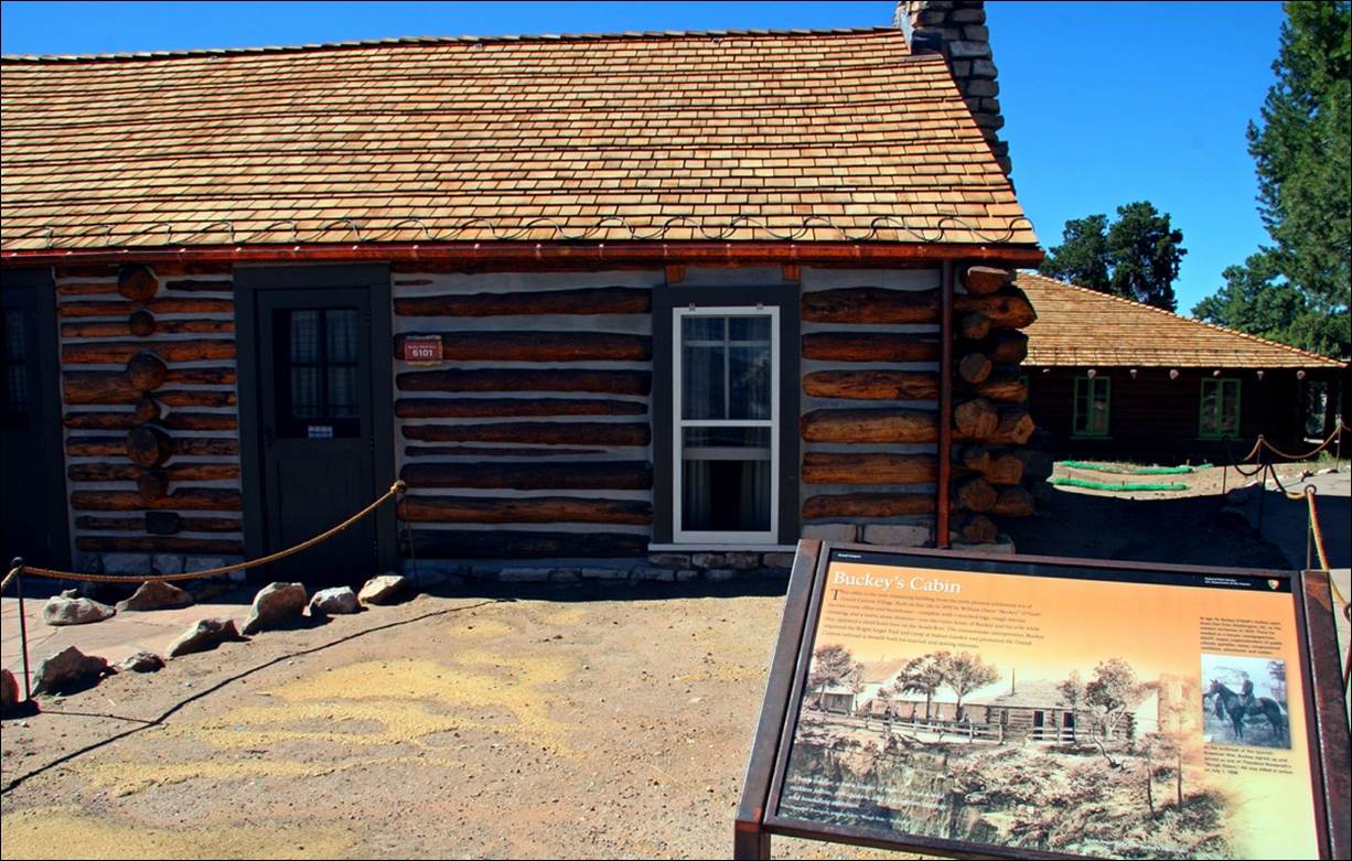
Although it has been rebuilt and
repaired several times, this cabin is representative of the early buildings
here in the village area.
At one point along here we
could look down into a valley and, several thousand feet below, was a stream
with a dirt road running alongside. If
you follow the road, it leads to a small building of some type. We never did figure out just how you would get
a vehicle down there.
Can you find the road leading to the
building (in the trees)?
While we were there, the
Grand Canyon was hosting a number of artists who were practicing their
trade. We saw artists, mostly painters,
in many places around the canyon area.
As part of that event, the Kolb studio was open to the public. There were some beautiful paintings and
photographs by Kolb and others in the studio and, of course, most of them were
available for a price.
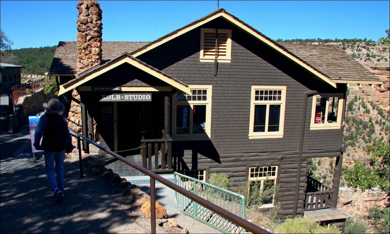
The Kolb Studio was deserving of a quick
look.
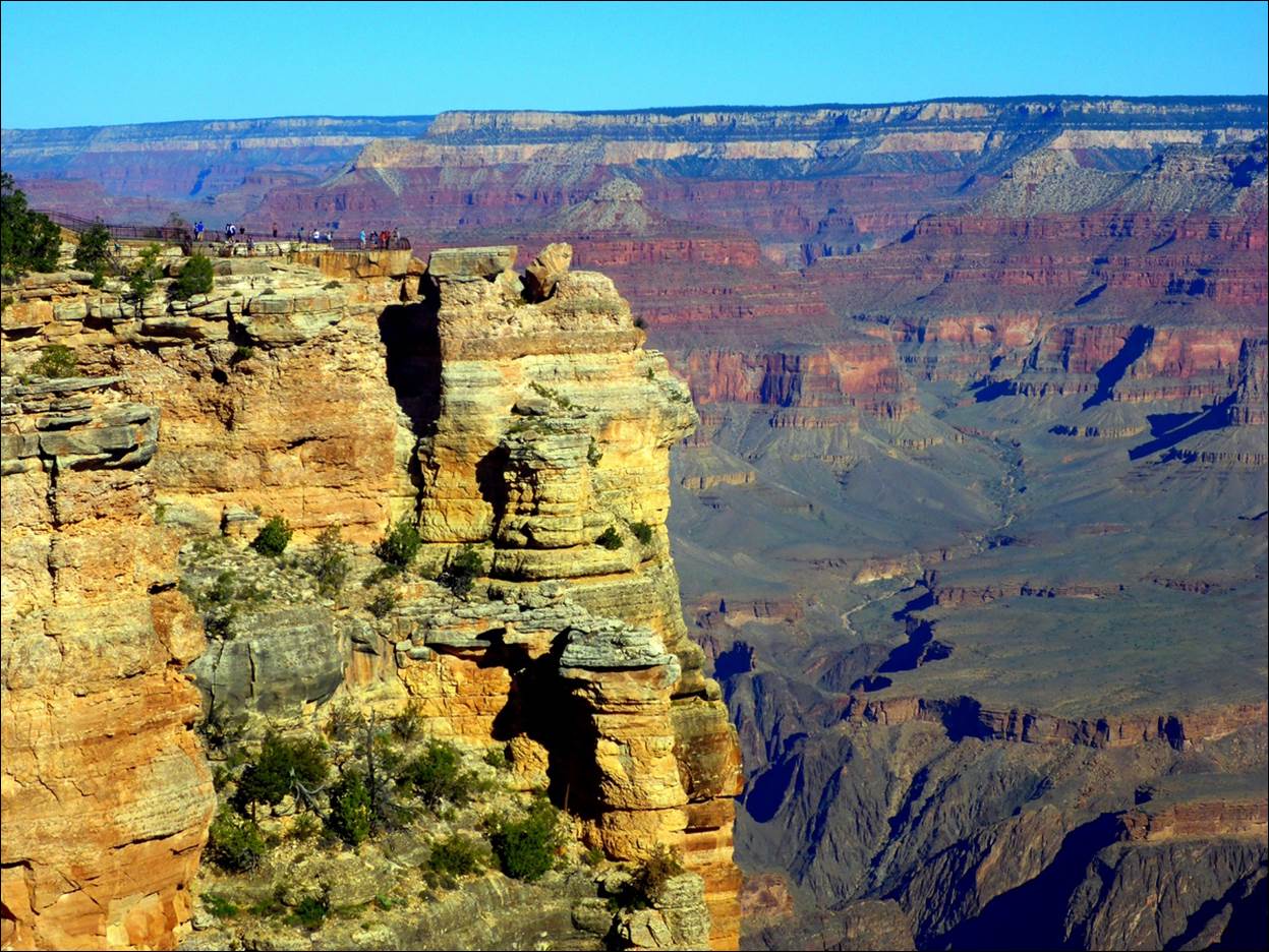
By this point we had
walked a couple of miles along the rim trail and decided that, if we were going
to get to the other end of the trail, we would have to get a little help. There are shuttle busses continuously
operating along the rim trail, with different routes for the different sections
of the trail. There was no charge for
using the busses and you could get off/on at most of the popular overlooks or
trail heads. We decided to make use of
the shuttle and started alternating between walking a while and riding the
bus.
From the Bright Angel Trail head
overlook.
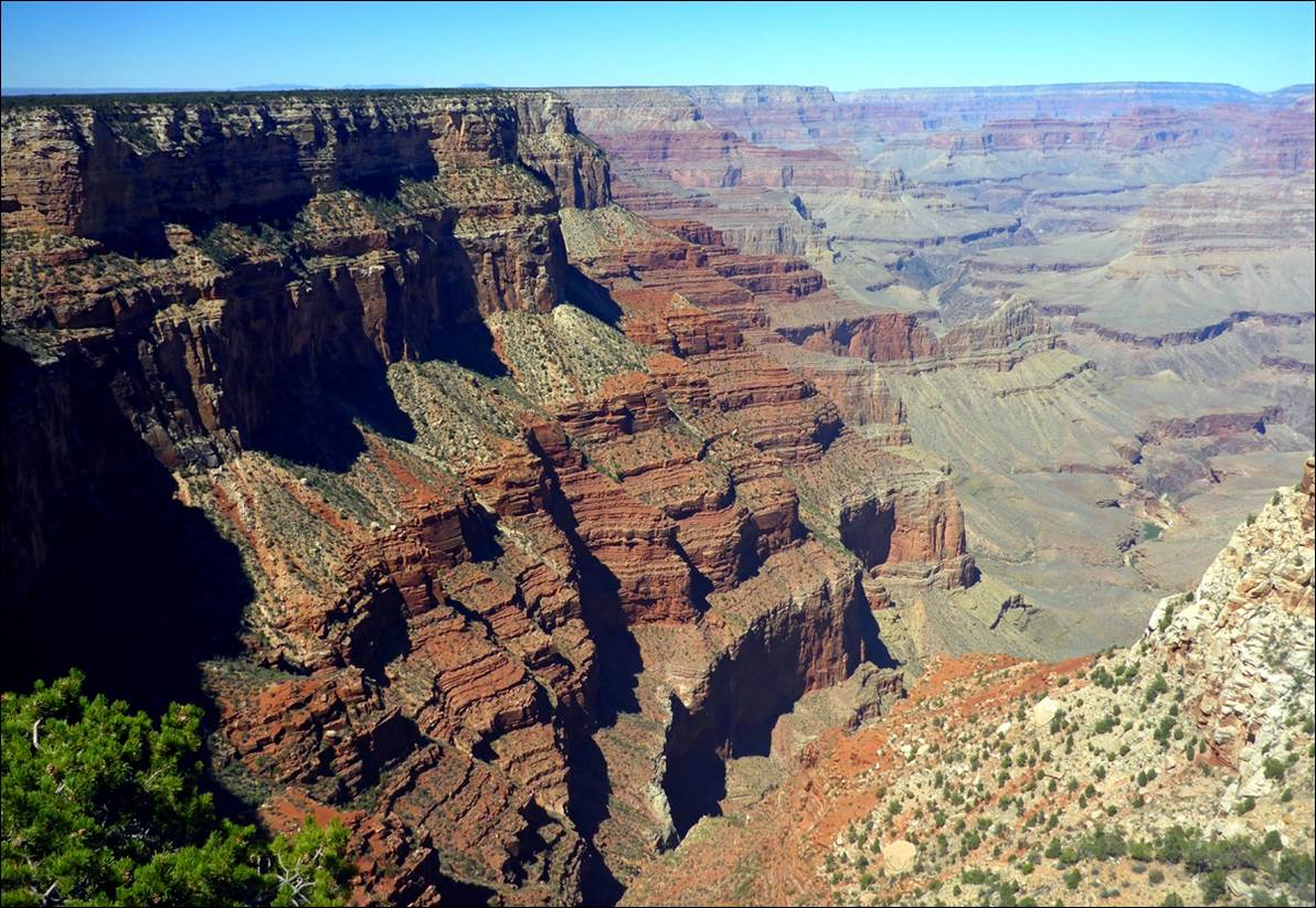
The view from Maricopa point.
All of the photos, such as this one near
Hopi Point, are looking generally northward, across the canyon.
In that same area, this is
a video from Hopi Point. You can see a couple of sections of the
Colorado in this video.
We had planned to get a
quick lunch at the end of the Rim Trail at Hermit’s Rest, but the snack bar
there was overcrowded, so we decided to hop on a bus and go back to the village
area to find lunch. We headed to the El
Tovar Lodge where we knew there was a nice restaurant. We thought we were following the signs to the
restaurant, but when we were seated and looked at the menu, we realized we had
gone into the bar where there were just some appetizers and finger foods. We thanked the waitress and she directed us
to the real restaurant where we found the expected wait for a seat was 30 – 40
minutes. All of a sudden the bar food
looked pretty good! We went back to the
bar, ordered some buffalo wings, some stuffed jalapenos and our first taste of “Polygamy Porter”. I don’t know if we were just that hungry, or
the food was really that good, or both, but it was one of the most enjoyable
meals of our trip.
After a quick look around,
we hopped the bus back to the Visitor Center area where we explored some of the
displays there. About 2 PM we found our
car and headed back to the hotel for a welcome rest. That evening we had leftovers, some of the
food we had bought in Las Vegas, and a bottle of the wine.
Friday, Sept 14: Grand Canyon
The next morning we headed back into the park. We initially planned to drive eastward, close to the rim trail, stopping at some of the overlooks. We soon figured out that this was not a good plan, since it was quite a distance between some of the overlooks and the road did not go to them all. Also, we would be driving along this same road the next morning on our way to Moab, so there was no need to see it now. We did stop at two of the overlooks, one at an overlook that did not appear to be named, and one to take a look at “Duck on a Rock”.
The view from an unnamed roadside
pull-off viewpoint,
It takes a little imagination to see the
“Duck on a Rock”.
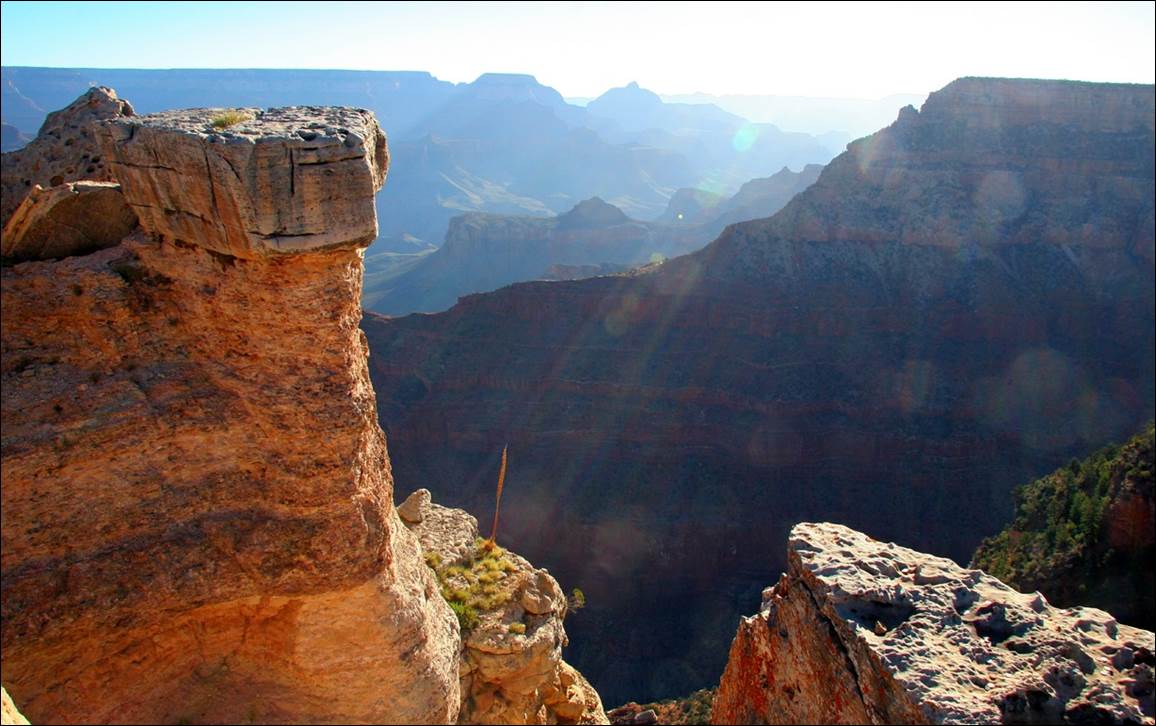
We drove back to the same parking lot that we had used the previous day and again started at Mather Point, but this time we started walking east, toward the Pipe Creek Vista.
Looking
back at the people on Mather Point.
`
From the Pipe Creek Vista overlook.
We walked though one area that I said looked like it had burned several years prior as there were charred tree stumps, but no large trees or plants. A short distance further on was a plaque describing how it had burned about 10 years previously. We did see some flowering plants in this area that we did not see elsewhere.
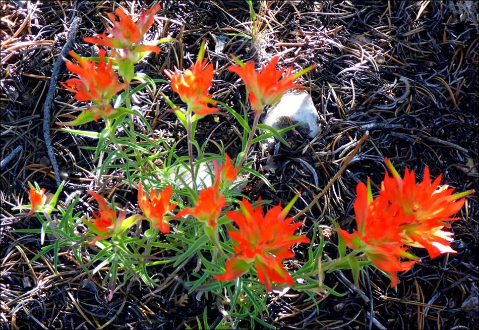
I suspect these plants liked the full
sun provided by the burned area.
We continued our walk to the effective eastern end of the rim trail at the Kaibab Trailhead.
View from the South Kaibab trailhead.
From here we had to take a
shuttle bus to the last overlook that was included in the bus routes, Yaki point. This video from Yaki
point provides an idea of just how expansive the canyon complex is.
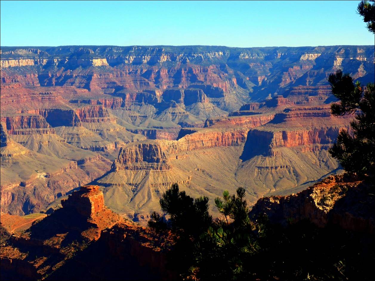
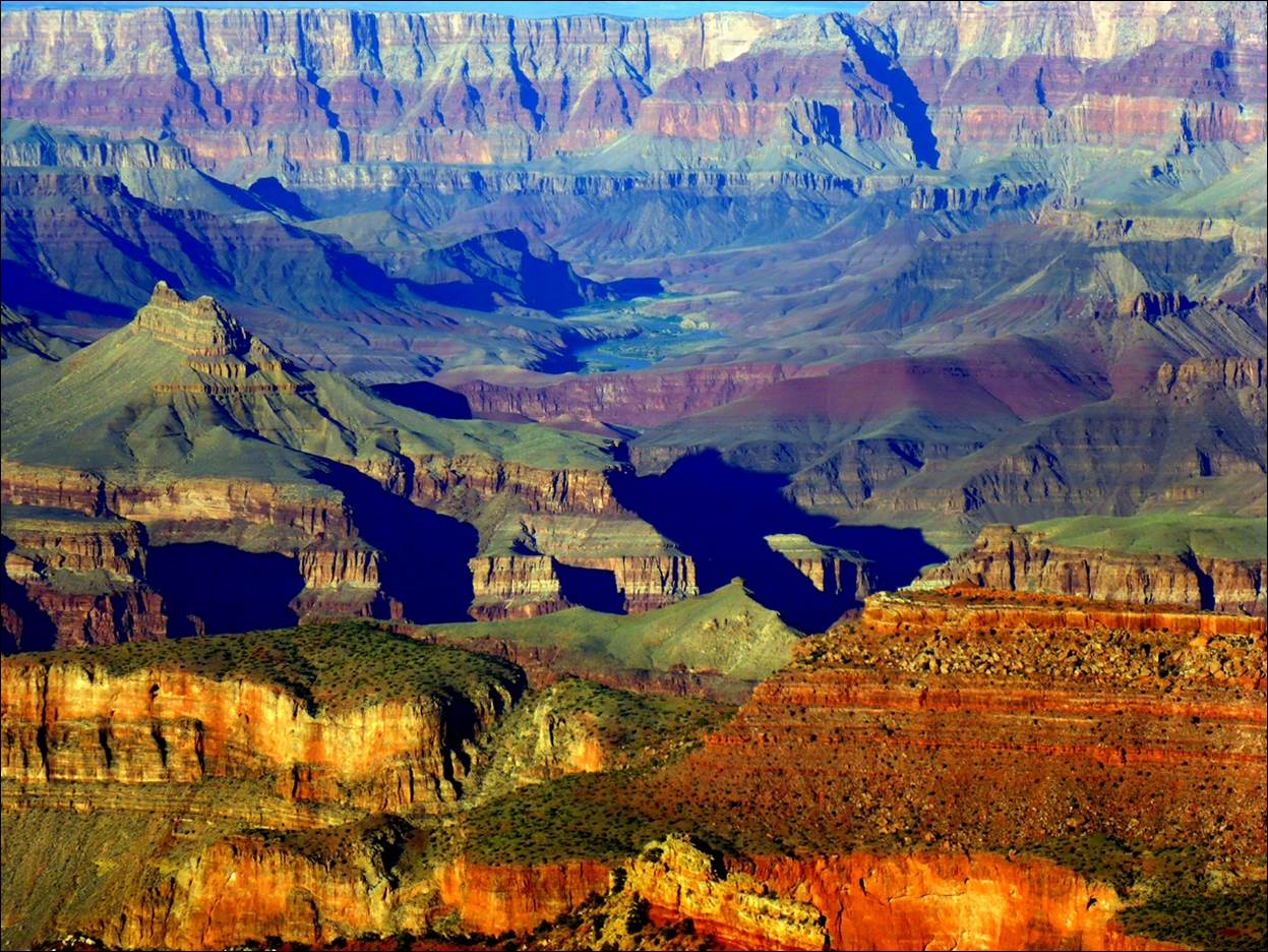
This view from Yaki
Point is looking northwestward and gives a better idea of the true colors than
the video.
This view is from the other side of Yaki Point, looking northeastward.
At this point we got on a
shuttle bus that took us back to the visitor center where we unpacked some
sandwiches and snacks we had brought along.
We had sort of a picnic lunch sitting on a bench in the shuttle bus
terminal, looking at the view and some of the strange people around there. After looking around a little, we headed back
into town to rest for a while.
But, before resting, we
decided that we needed one more visit to the Grand Canyon, but this time we
just wanted to be along for the ride.
Not far from the hotel was the office for a tour guide company named
“Buck Wild Tours”. They used former military
Hum-Vees that had been “domesticated” and
fitted with 10 passenger seats on an elevated platform. It turned out that they never actually take
these vehicles “off-road”, but they certainly looked capable.
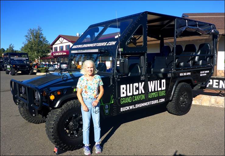
Susan was checking out the tour vehicls.
With arrangements made, we
rested until the 4:30 departure time.
When we returned to the
Buck Wild office, we met our driver/guide for the evening. Jerry was a full blooded Navajo and knew a
lot about the history of the area as he had been raised nearby. He had traveled across much of the US doing
construction work but had come back to the area, partly because his parents
were getting old and lived nearby. Since
he had grown up in the Navajo nation with his parents speaking the Navajo
language, he was fluent in both English and Navajo. It turned out that he could also sing in
Navajo. Along with us was a Chinese
couple who were living in the US and their 4 year old son.
The objective was to
observe the sunset from an appropriate place in the canyon, but we had plenty
of time to visit a couple of other vistas first. Jerry first took us to see “Duck on a Rock”
and was a little disappointed when we mentioned we had been there that morning. He seemed to feel better when we pointed out
that it looked different when viewed in the evening light rather than the
morning light. After Duck on a Rock, we
drove a little further east to Grandview Point, and the view was rather
grand. As the sun went down the colors
were changing.
As the shadows got longer, the colors of
the rocks came out more.
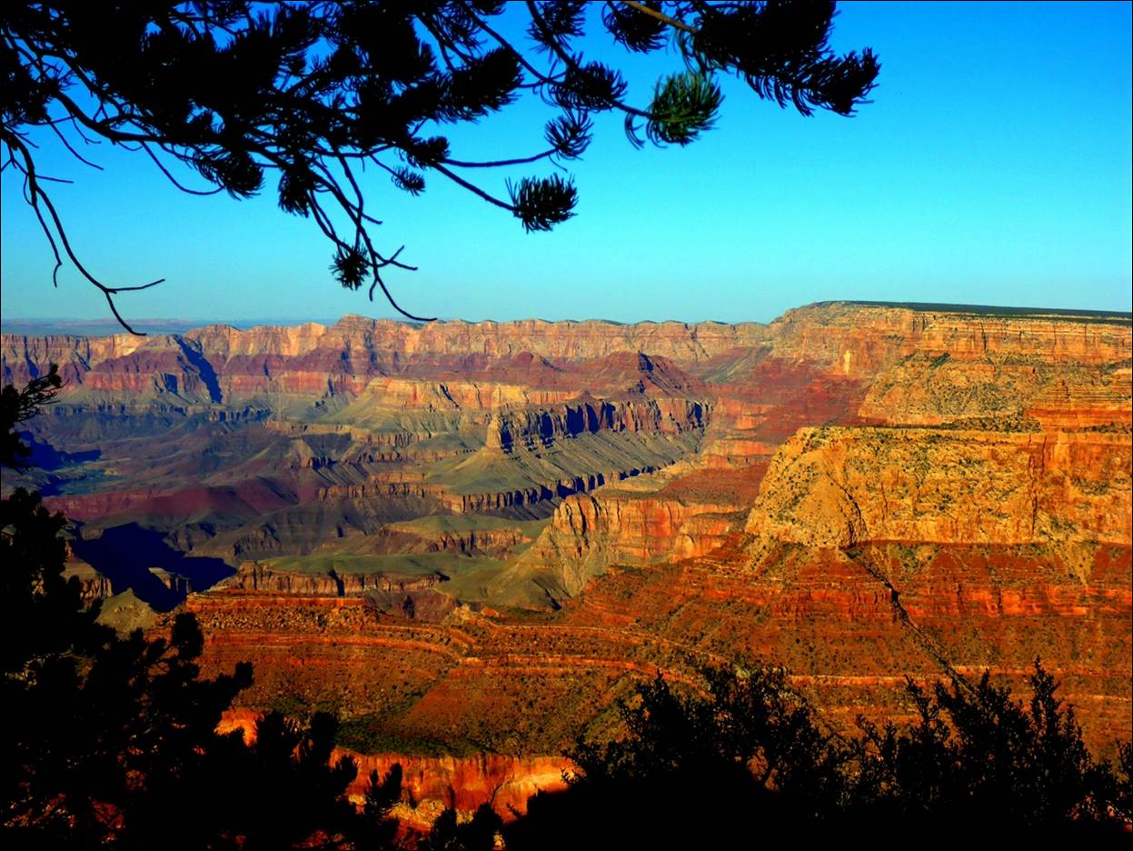
The canyon complex seemed to go on
forever in both directions from Grandview Point.
From Grandview point we
headed back west toward where we would watch the sunset. On the way we stopped to observe some
Mountain Elk foraging alongside the road.
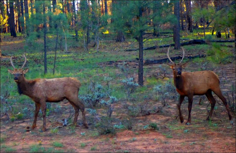
The elk did not see at all bothered by
the vehicles or people.
We continued on a little
past the visitor center to Yapavai point, which Jerry
thought would be a good place from which to watch the sunset.
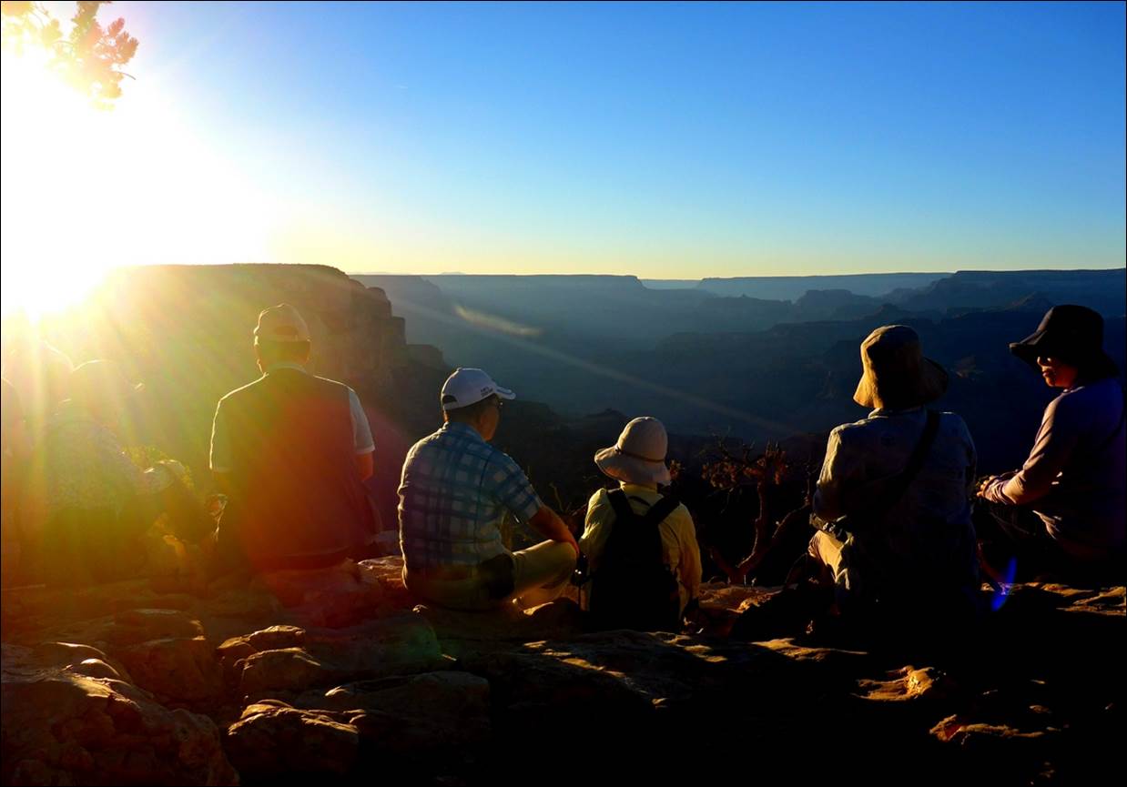
Quite a few people gathered here to
watch the sunset, finding whatever seat they could among the rocks.
We had been here the previous day, but
in the setting sunlight, everything looked different.
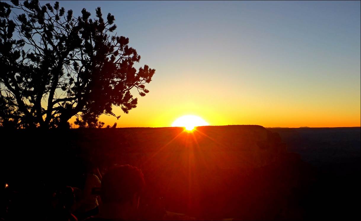
The sun disappears from Yapavai point.
After sunset we all
climbed back into the Hum-vee and headed back to
town. With all the other cars, the
traffic, and dark roads, I was very glad that I was not driving and could relax
during the drive. All in all, it was a
fun and enjoyable evening and we learned quite a bit from our guide Jerry. When we got back to the hotel we relaxed with
a bottle of wine, some cheese, crackers, and other leftovers. Tomorrow would be a “road trip” day.
Saturday, Sept 15: Grand Canyon to Moab, UT
The next morning we drove
back through the park and took US-64 eastward, retracing some of our tracks the
previous day. Before leaving the
boundaries of the park, we stopped at a couple of interesting overlooks and a
visitor center.
The first stop was at
Moran point where I got this video of
Moran Point. Toward the end of it
you can see a section of the Colorado River leading into the canyon complex. If you also look closely, next to the river
you may notice a plant with a vertical “spear” on top of a flat rock. Here is a better view of it below, with the
Colorado River in the background.
An interesting plant with the Colorado
River in the background.
Our next stop was at
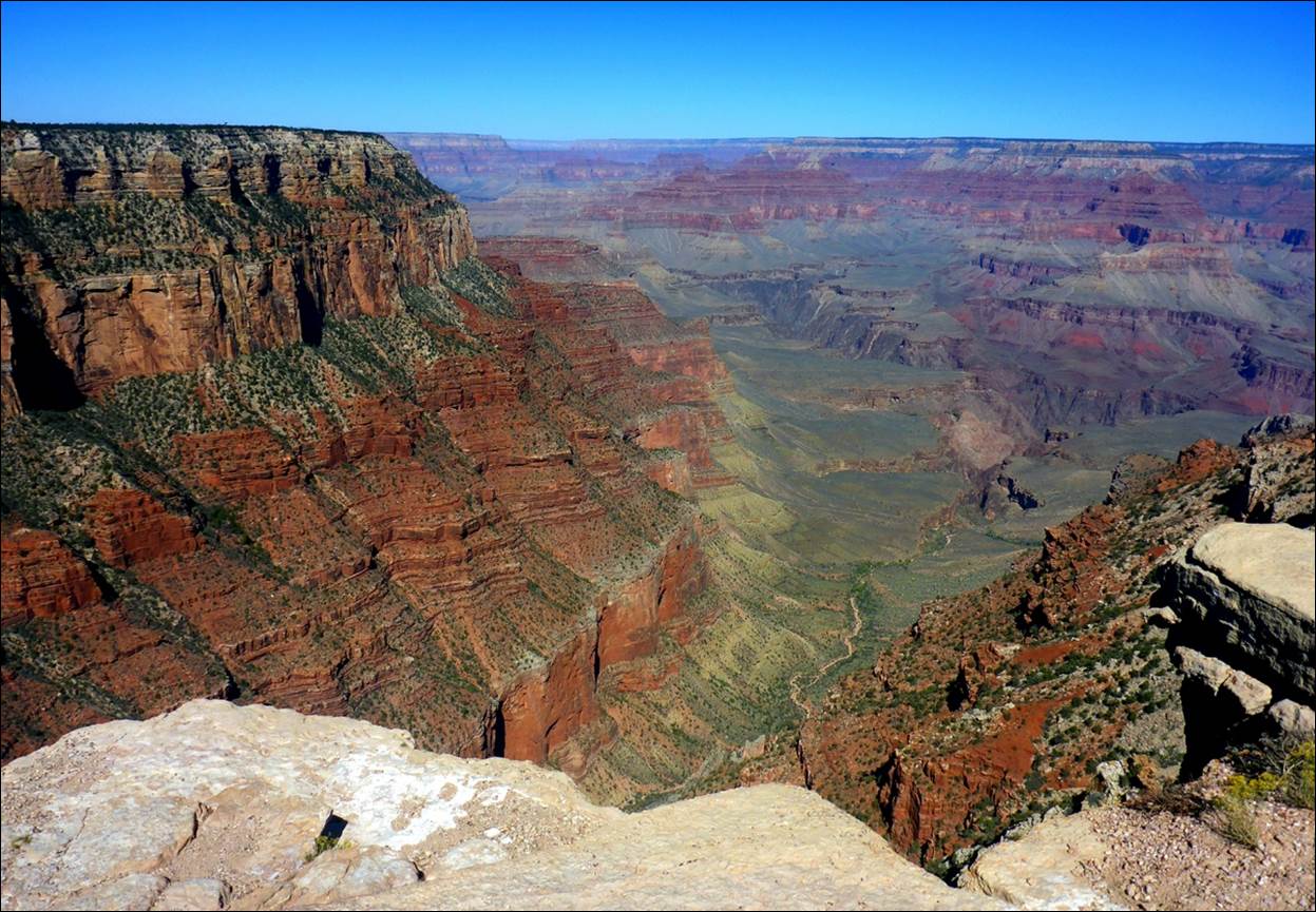
Navajo Point, suggested by Jerry our Navajo guide the night before.
Looking westward from Navajo point, the
morning sun brought out the varied colors of the rocks.
Looking eastward you could see the
Colorado River which created the Grand Canyon.
Our last stop within the
Grand Canyon Park was at the Desert View overlook and visitor’s center. The centerpiece of this visitor center was
the “Watchtower”. Although it was actually
built with relatively modern techniques and materials in 1932, it was designed
to resemble old Puebloan towers of hundreds of years
ago.
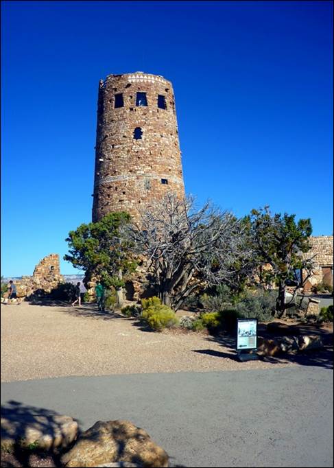
The watchtower looked older than it was.
The watchtower did offer
an excellent view of the surrounding area which included the eastern boundary
of the park.
The eastern extremity of the park with
the Colorado River flowing in.
As we left the park
boundaries the terrain flattened out with only occasional major canyons. There were a couple of roadside overlooks and
pull-offs, sometimes accompanied by local people selling souvenirs.
There were still some major canyons out
there.
We followed US-64 est to Cameron, then US-89 north
to US-160 northeast to “Mexico Water” where we joined US-191 North. At one of the junctions, a “T” intersection,
a 18-wheeler had apparently run through the intersection, out the “top” of the
“T” , off the road and up into a sand dune more than
100 feet off the road. When we came
through there were several police cars and a large wrecker starting to try to
winch the 18-wheeler back onto the road.
I wish I had stopped to take a photo of that.
By the time we got to
Bluff, UT it was a little after noon so when I saw what looked to be a
reasonable restaurant, I suggested we stop for lunch. I did not realize the reason for the name of
the restaurant, “Twin Rocks Cafe” until I opened my car door and looked up.

The twin rocks are in the background
with the aptly named restaurant in the foreground.
The restaurant’s specialty
seemed to be some local Navajo based foods, including Navajo Fry Bread, so we
tried a couple of dishes that included it.
The bread was OK but had a bit of a bland taste. The portions were large enough that we took a
fair amount with us for later.
We were not due to visit
the Arches National Park until the next day so we were a little surprised when,
about 25 miles south of Moab, we saw an arch just off the road.
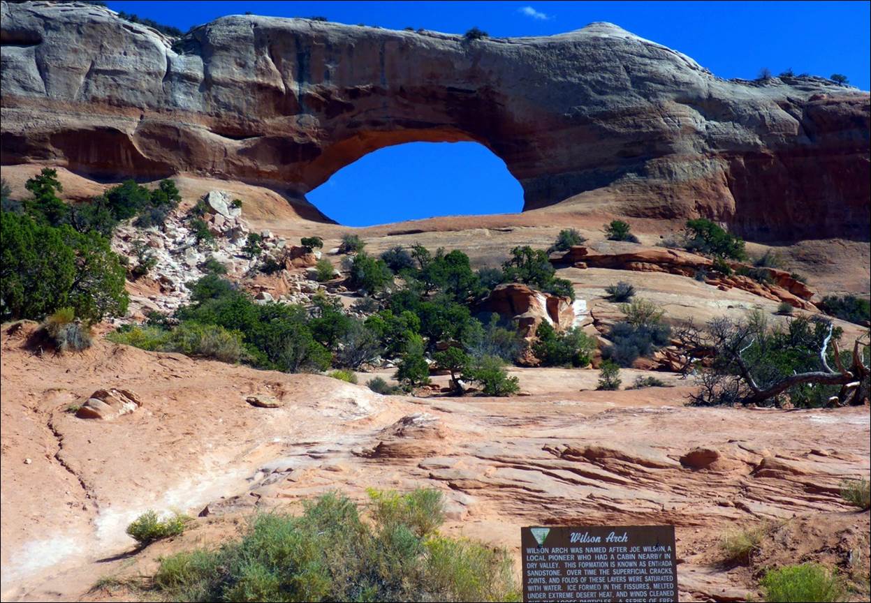
Wilson Arch was a bit of a surprise on
the way to Moab.
Wilson Arch gave us a
taste for what we would find in the national park the next day. We continued on to Moab and found that our
hotel, another Holiday Inn Express, was on the far (or north) end of town. We got settled in and soon found that there
were two wineries in the area and we still had some time left in the day, so
the logical course of action was to visit one of them. We chose to visit the Castle Creek winery,
about 14 miles upstream along the Colorado River. We were a bit surprised to see all the
camping areas along the river; there were both developed and rustic sites and
quite a few campers using them. The
winery itself was a very nice, large, and modern facility
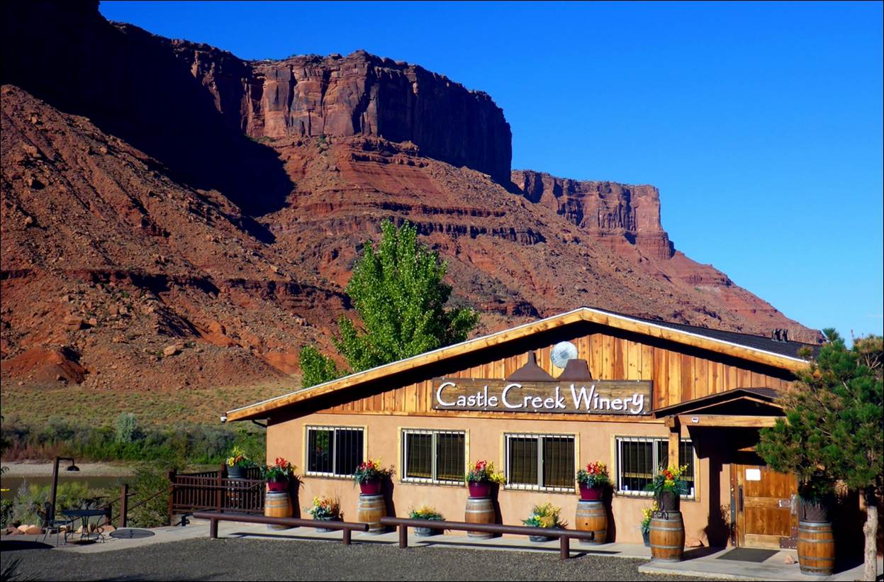
The winery was nice and the views around
it were not bad either.
We had to do a wine
tasting, of course, and were impressed with the quality of their wines. They had a fairly typical selection of reds ( Cabernet, Merlot, two blends, including “Outlaw Red”) and
whites (Chardonnay, Chenin Blanc, and two
blends). We took two bottles with us for later
enjoyment.
By the time we got back to
the hotel, it was time to think about dinner.
We did a little research and decided to give the Antica
Forma restaurant a try as they advertised good pizza. We had some steamed mussels as an appetizer
and then pizza as the main dish, accompanied by another glass of Polygamy
Porter beer. It was all very good. One unusual feature was one of the large flat
screen TVs hung from the ceiling. Most
of the 4 or 5 TVs had the normal sports programming but one of them was tied
into two cameras that were aimed at the kitchen area in the corner of the large
room. The display alternated between the
two views of the cooks going about their business and they were definitely
busy. There was enough pizza that we
could take some back with us for lunch another day.
Sunday, Sept 16: Arches National park.
We wanted to get an early
start to avoid the heat of the mid-day that we knew would appear. We got a breakfast at the HIE (where there
were large tour groups every day we were there and they seemed to always be
getting an early start also). Like our
visit to the Grand Canyon, we arrived before the visitor center was open.
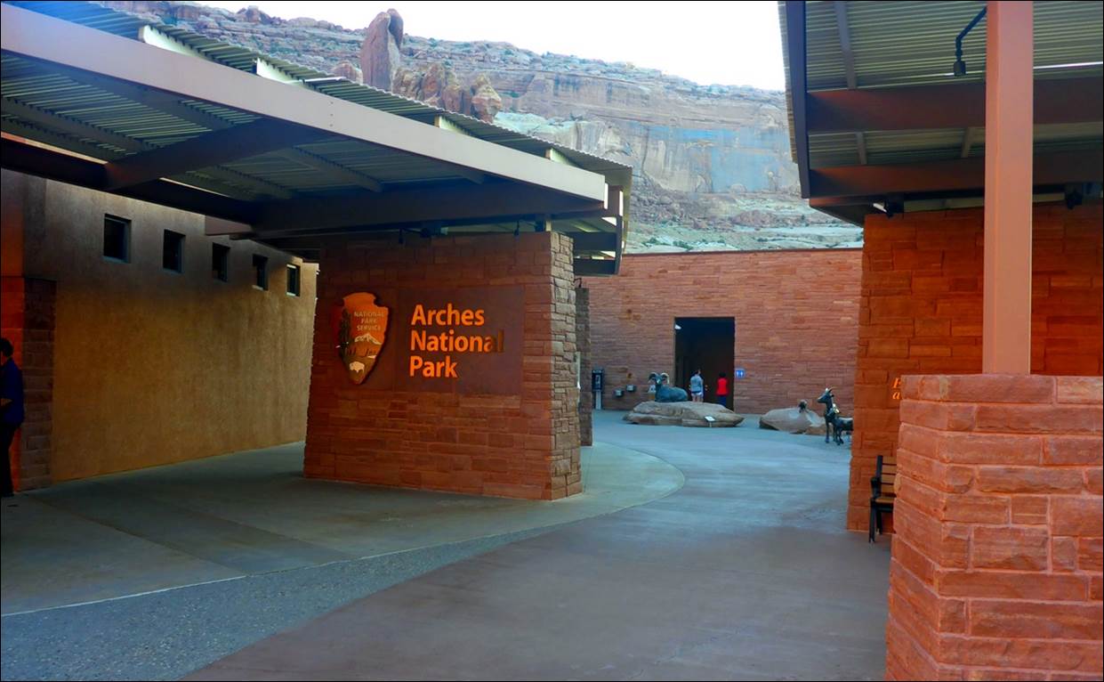
The visitor center was still closed, but
at least the restrooms were open.
We did find a rack of maps
so we grabbed one and headed into the park.
Our first stop was at the area called “Park Avenue”.
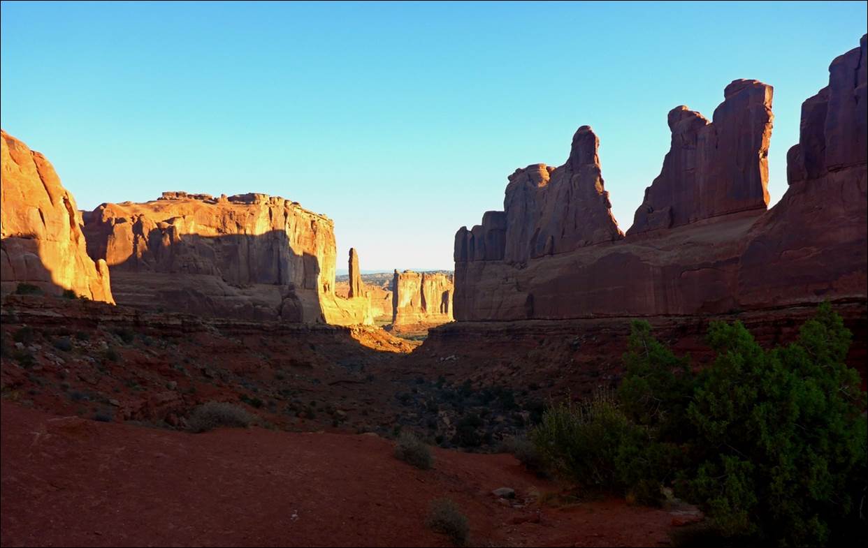
I believe Park Avenue was so named for
the large “towers” lining both sides of the valley.
The temperature so far was
very comfortable, with just a slight chill in the air. We continued on the main (only?) road through
the park, stopping next at the “Courthouse towers” viewpoint.
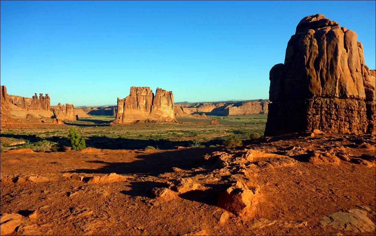
The “towers” seemed to rise up out of
the otherwise flat plain.
One of the better known
sights was next up, the “balanced rock”.
It really appeared that the rock was cemented into place on top of the
base rock, but it actually is all natural.
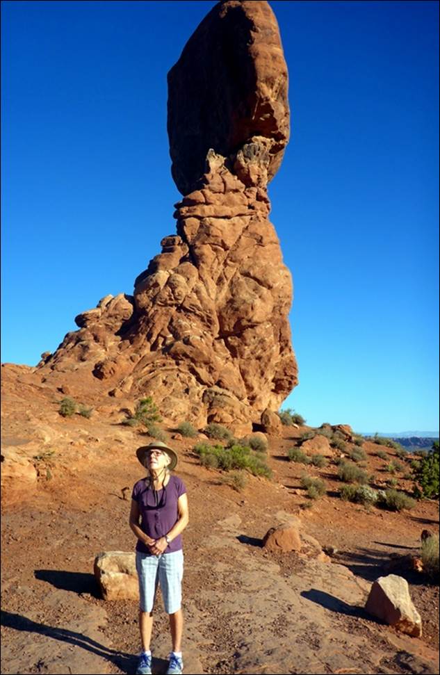
Susan hopes the rock stays balanced a
little longer.
The next stop was an area
of several arches called “the Windows”.
There were a total or 4 or 5 different arches here, across two separate
rock formations.
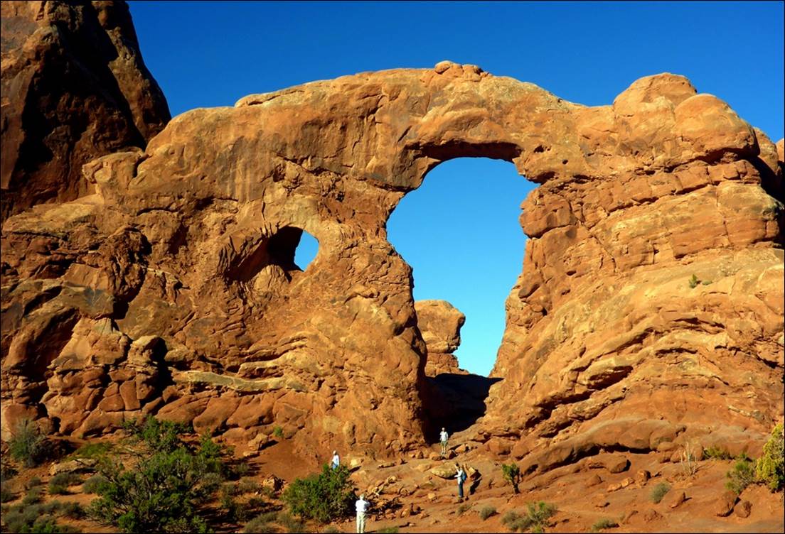
The people give an idea of the size of
the rock formation and arches.
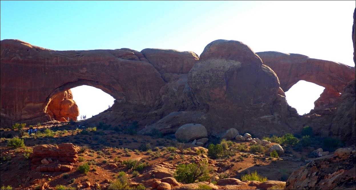
These arches at “Windows” were even larger.
The next stop was at the
“Delicate Arch”. This one did look a bit
delicate and, unlike the other arches so far, it required a bit of a hike and
climb to get a good look. The trail was
not real easy, but about 15 minutes of climbing got us a decent view.
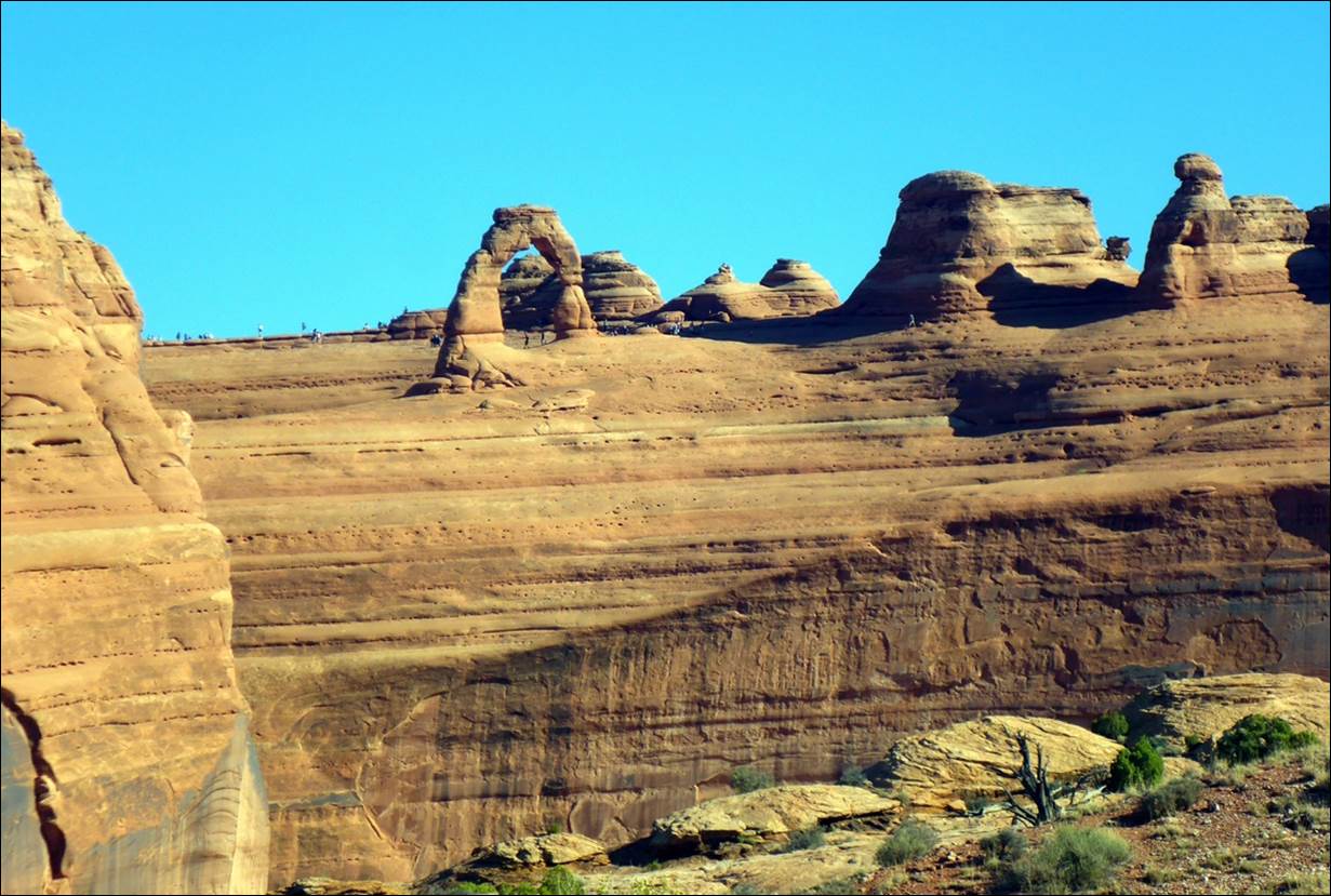
Even the hike and climb did not get us
real close to Delicate Arch.
We later found that there
was another approach to the Delicate Arch that was longer but with a better trail
and less climbing that got people much closer.
If you look closely at the photo above, you can see people who took the
other trail around the base of the arch.
Also in this area was a
old farm house from one of the very early settlers, the Wolfe family.
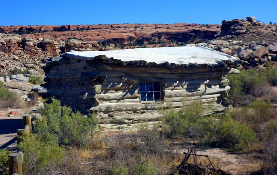
The new and improved Wolfe farmhouse.
The photo above is of the
“new and improved” farmhouse that resulted when a daughter convinced Mr. Wolfe
that the old one was just a bit too rustic.
This one had a wood floor!
Among the wall of rocks
behind the farmhouse in the above photo were some petroglyphs that were done by
the Native Americans probably several hundred years ago.
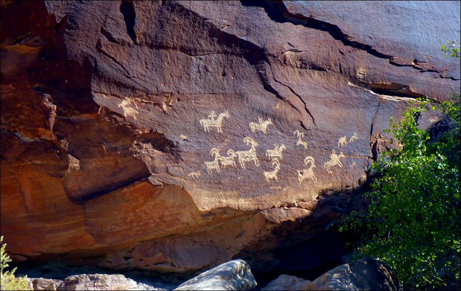
There were some other petroglyphs in the
area, but these were the best preserved.
A short drive brought us
to “Sand Dune Arch” and it was very appropriately named. When walking in the area we thought of walking
in the white sand of Caribbean beaches.
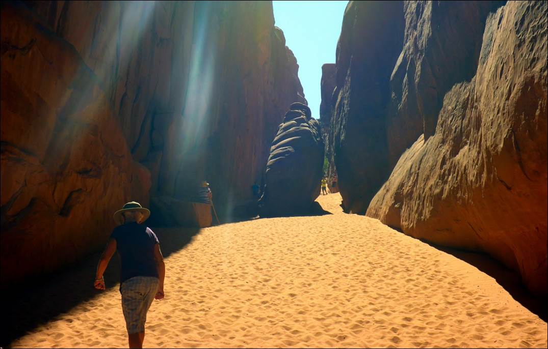
The sand was difficult to walk in and
easily infiltrated our shoes.
The actual arch was
located between several tall blades of stone reaching up about 50 feet.
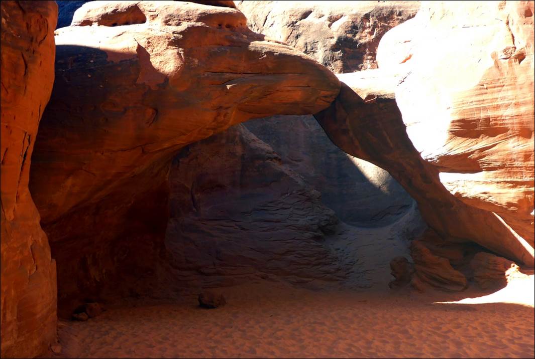
We almost walked right past this arch.
Sand Dune arch was off to
one side in the shadows and not very big so we almost walked right past
it.
The last major stop in
Arches was to see the Skyline Arch. This
required a hike of a little over a mile each way with some pretty good
elevation change and also a couple of sandy patches to walk through. It is an impressive arch though!
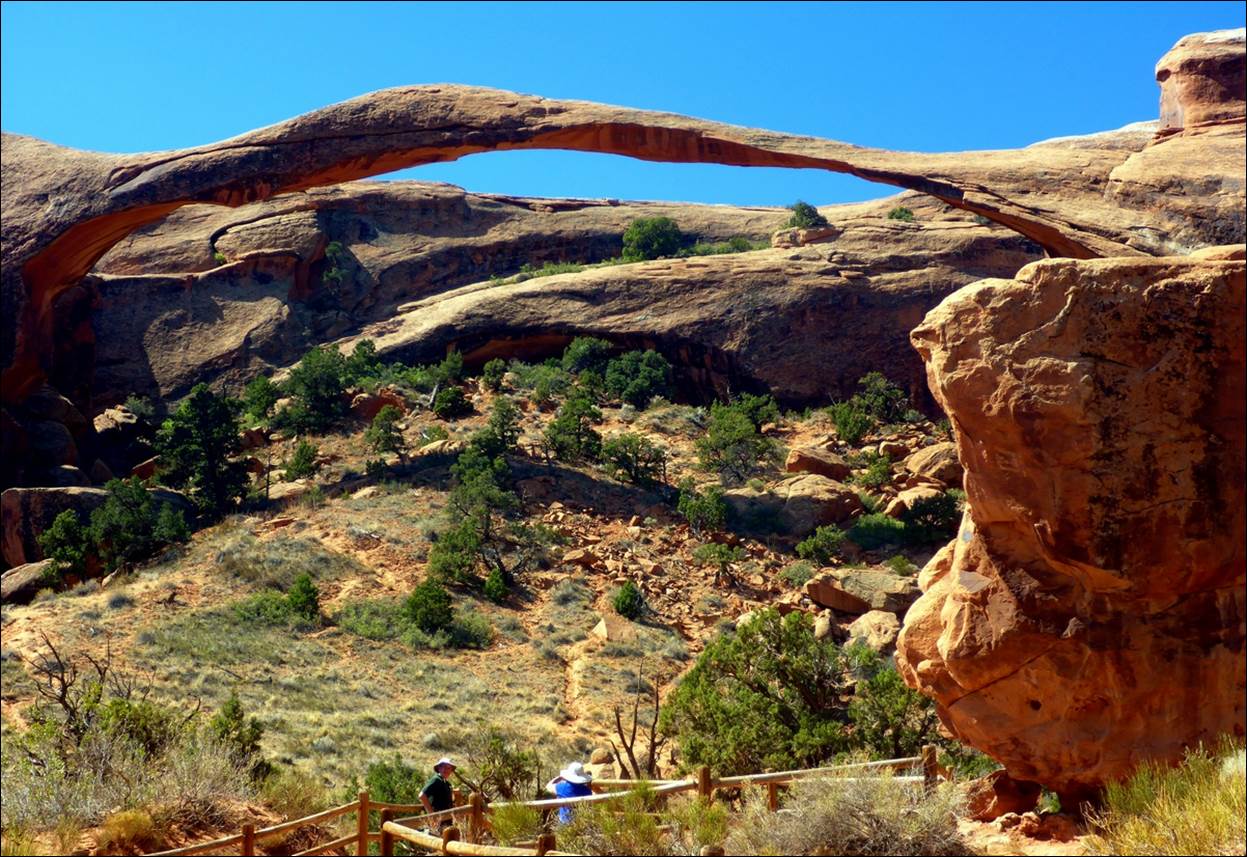
I thought this arch should be called
“Delicate Arch”.
Skyline Arch was so thin
and wide that it looked like it should collapse at any moment, but it has
apparently been like this for many years.
At the base, the opening is over 300 feet wide, or the length of a
football field.
It was now about noon and
starting to get somewhat hot and we had seen all the significant arches within
reasonable hiking distance of the access roads, so we headed back out. We stopped at the visitor center and used
some of their picnic tables to eat some leftovers and snacks we had brought
with us. Although we were under a roof
and in the shade, the nearby rocks blocked the wind and seemed to radiate heat
from the sun, so it was a bit warm. We
had brought the leftover pizza with us and put it on the dash of the car (in
its box) and the sun provided the heat to make it almost as good as an
oven. In a few minutes we had nicely
reheated pizza. After lunch we toured
the cool visitor center for a while to learn more about what we had just
seen. Returning to the hotel a little
after 2:00, we rested in the cool of our room during the heat of the day.
After some indecision and
a false start, we ended up eating at “Pasta Jay’s”. In a form of “seeing the handwriting on the
wall”, we both ordered pasta specials and they were both large enough that we
took almost half of them away with us.
Their house Chianti was quite decent also.
Monday, Sept 17: Canyonlands National park
We again got an early
start to avoid the heat of mid-day and again had to compete with the tour group
at the HIE; this time it was apparently a group of European teenagers. At least they were considerably more polite
than the Asian group the first day, even if a bit louder. It took about 40 minutes to get to the park
entrance for the Canyonlands National park.
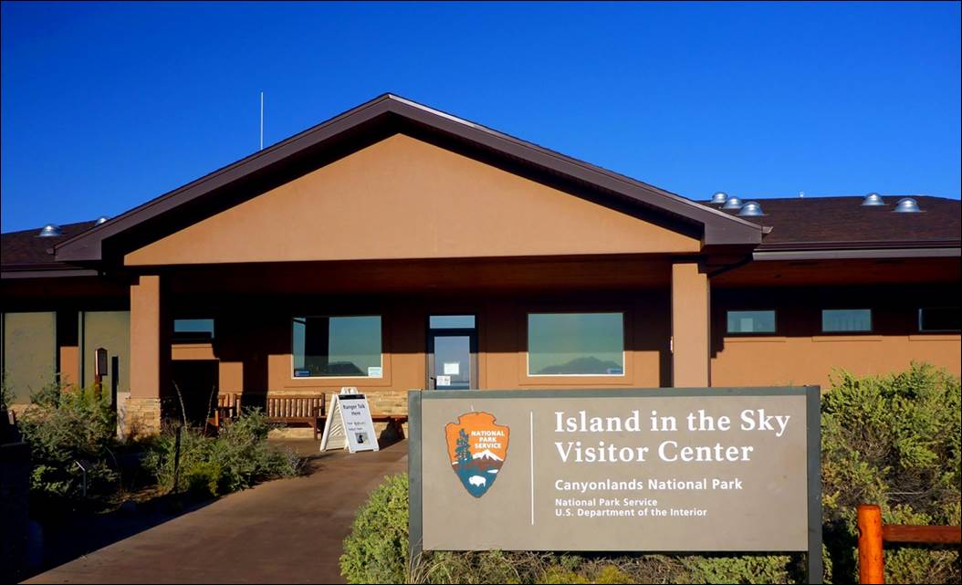
Visitor Center for Canyonlands
National park
There are actually three
sections of Canyonlands National Park but “Island In the Sky” is the most visited section. We picked up a map
and filled our water bottles.
The first stop was just a
very short drive, at an overlook for Shafer Canyon. There had been quite a bit of Uranium mining
activity here in the 1950s and 1960s resulting in some interesting and
challenging roads.
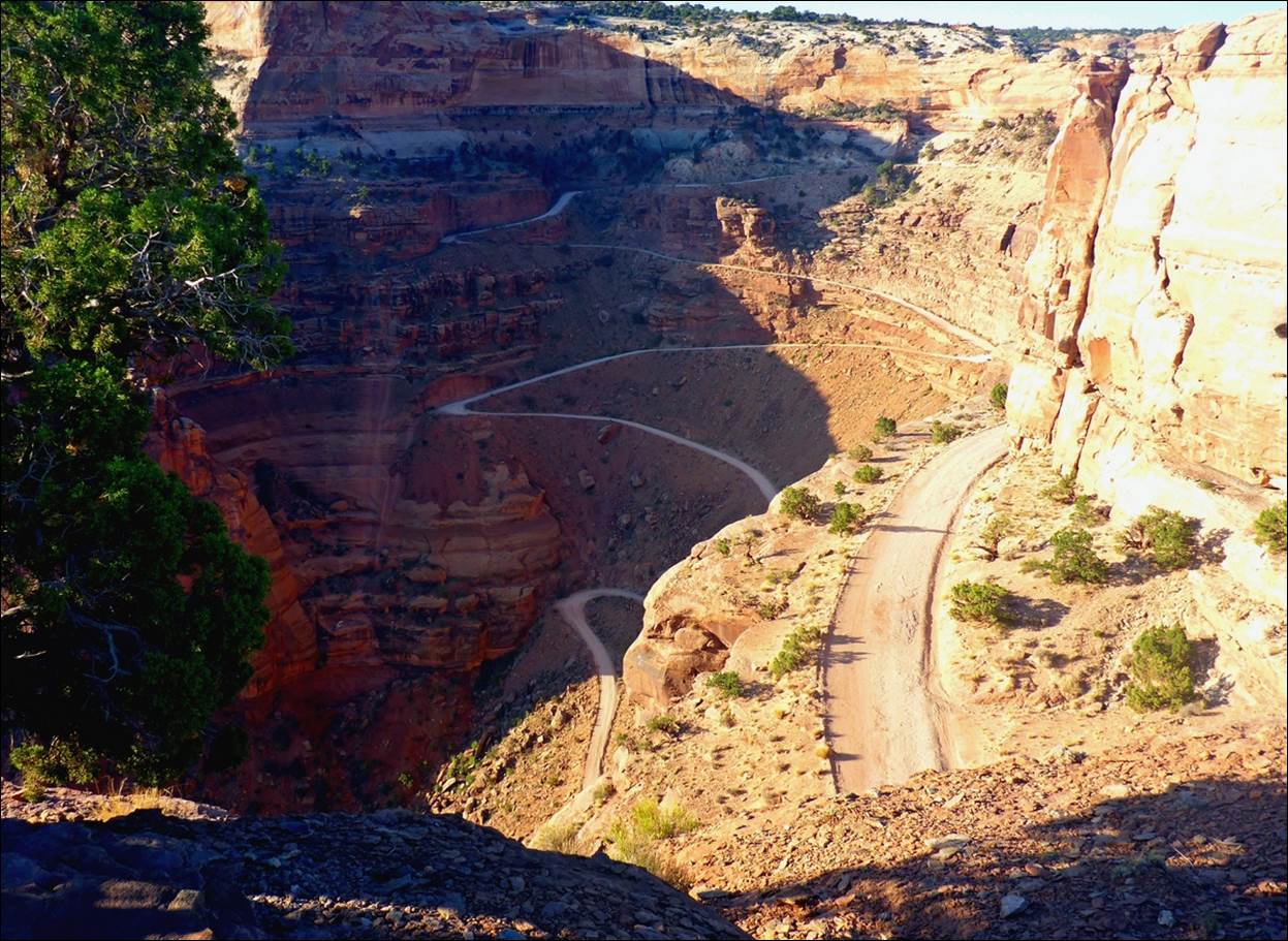
I would not want to drive large earth
moving trucks on this road!
The information suggested
that the roads had actually been improved since the mining days but I would not
want to walk along these roads, much less drive large trucks on them!
A bit further on was a
parking area for the walk to “Mesa Arch” . This arch was impressive not just for its
size and shape, but for the views available looking through the arch.
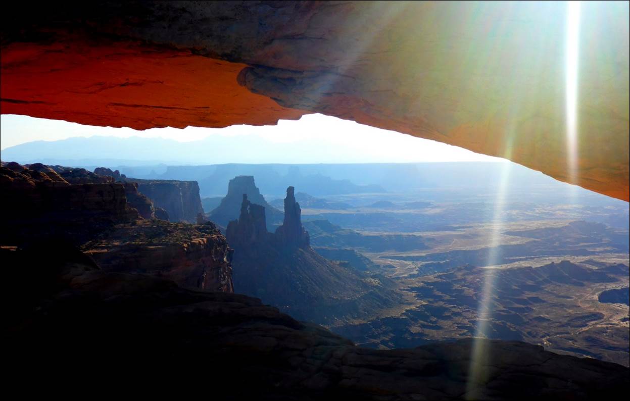
One view through the arch.
By changing the angle, you could get several interesting backgrounds to
the arch.
Apparently many people
come here for photographs of a sunrise through the arch but we were not that
ambitious. This brings up an interesting
item….. Most, if not all of the parks we
visited, are open 24 hours a day. The
visitor centers may not be open and the entrance gates may not be manned, but
the roads are open and you can visit any time of the day or night.
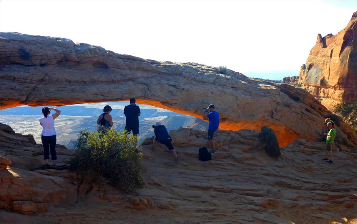
As you can see, I was not the only one
photographing Mesa Arch.
Mesa Arch was just an easy
5 – 10 minute hike from the parking area and offered several interesting
viewpoints.
The next stop was down a
side road to “Upheaval Dome”. This
required a fairly good hike up a trail that took about 10 – 15 minutes to a
good view point for the dome.
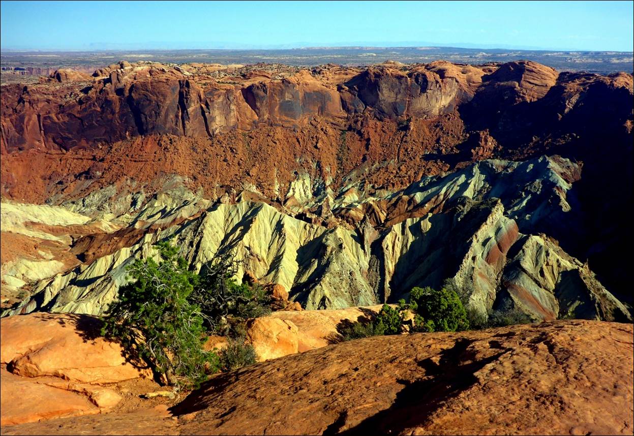
The light colored rock is the dome
within the surrounding crater.
The photo just does not do
the formation justice: it was both larger and more complex than it
appears. For a better idea, check this video of Upheal
Dome. The dome is completely
surrounded by a crater structure that is over 5 KM across and the interior of
the crater that you see in the photo is about half of that. There have been two generally proposed
theories as to its formation, either a salt dome that was pushed up by
surrounding rocks, or an eroded meteor impact crater. The meteor impact crater theory seems to be
the preferred one in recent years.
The next stop was at the
overlook for the Green River. I’d say it
is called the “Green River” for a good reason.
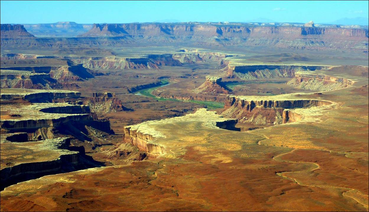
Note the green along the river
itself: thus, the “Green River”.
The Green River and the
Colorado River merge about 25 miles in the distance.
A wide-angle panoramic view from the
Green River overlook.
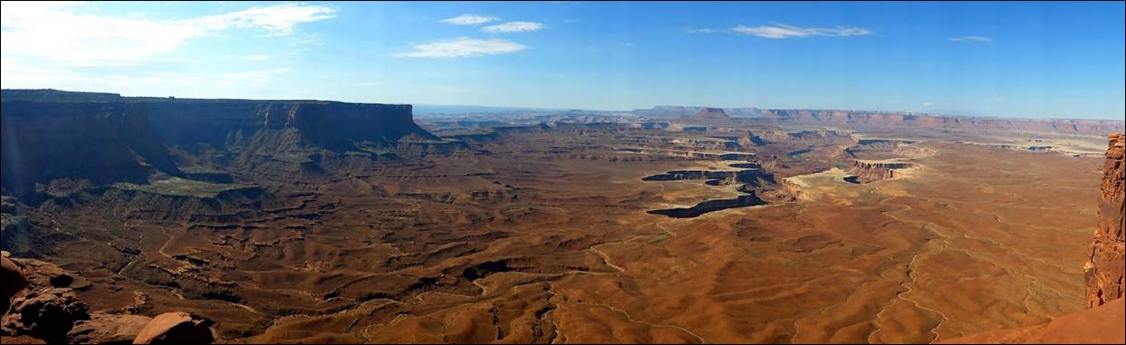
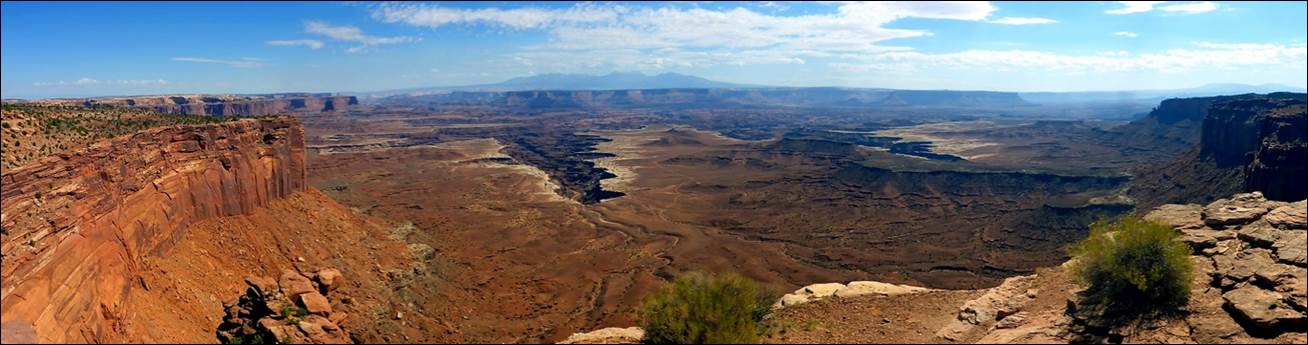
Our next stop was
“Grandview Overlook” and the view was rather “grand”.
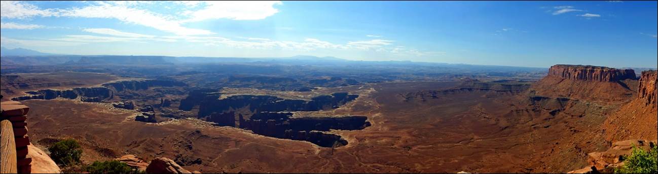
A panoramic look from the Grandview
overlook.
There was a “rim trail”
here that was about a mile out and a mile back.
We started on it and, after about half a mile, decided we had seen
enough. Besides, it was getting warm by
this time.
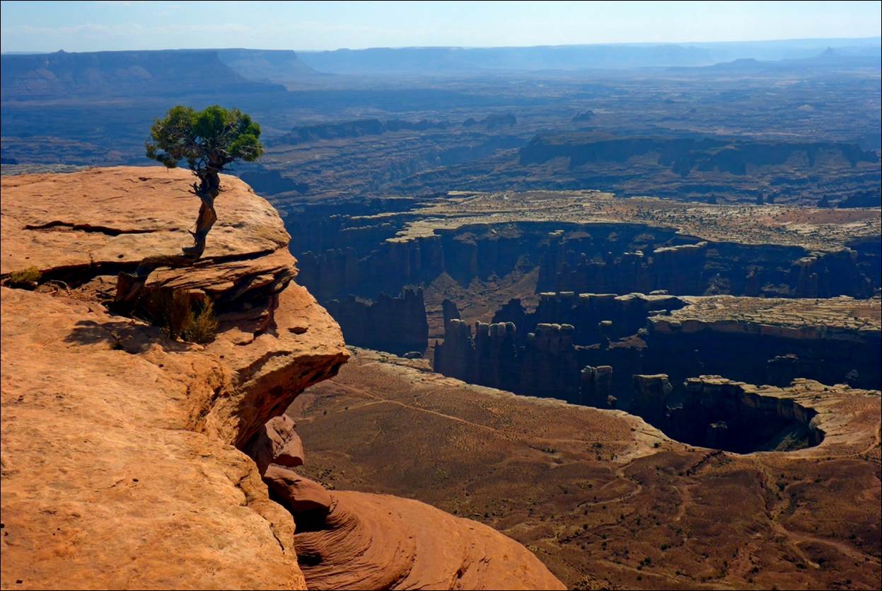
One lone tree along the rim trail at
Grandview overlook.
For a video of Grandview Overlook, click on
the link.
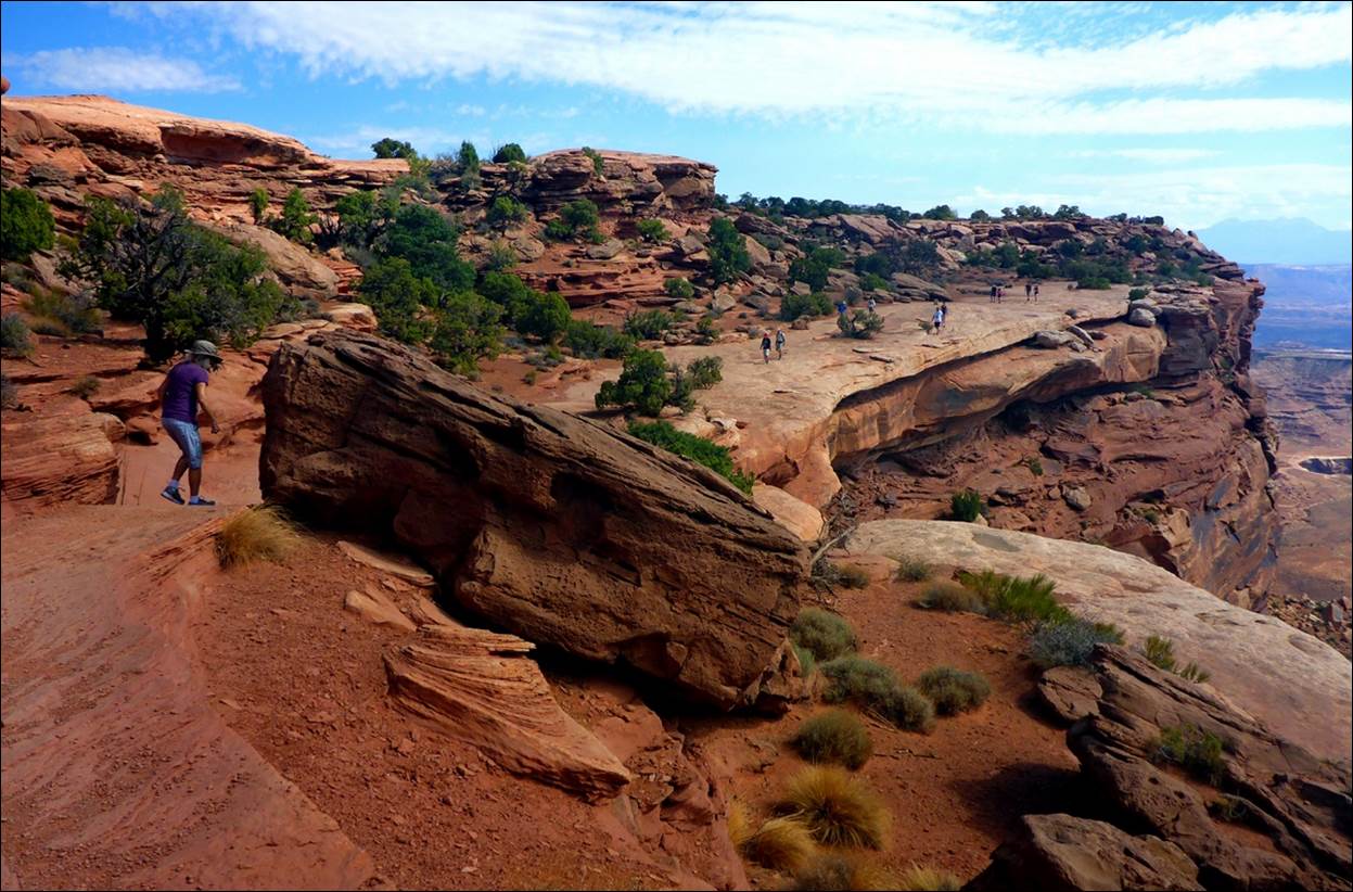
Susan is heading back along the rim
trail to Grandview Overlook.
After we got back from our abbreviated hike, there was a ranger giving a
lecture about the geology of the area.
She was doing a very good job of involving the kids and keeping them
interested in the discussion of what could be a rather dry topic.
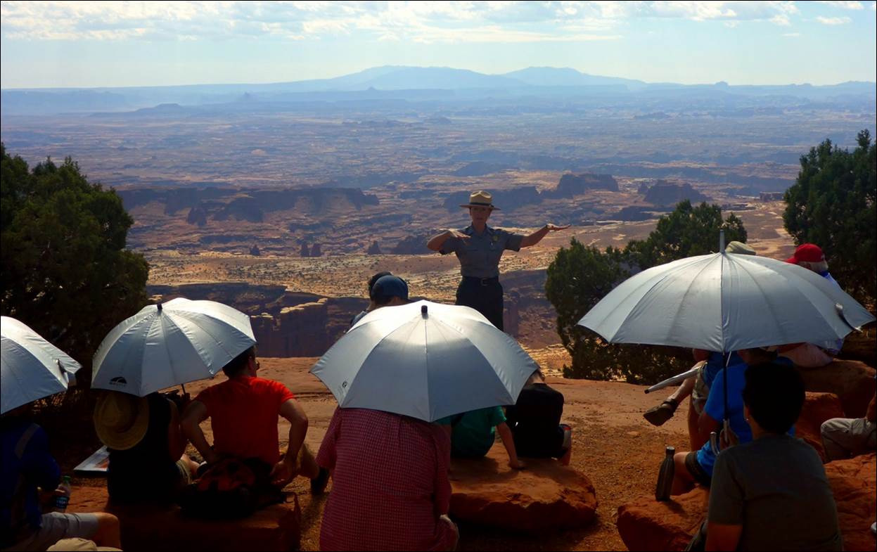
The ranger provided the silvered shade
umbrellas to avoid some of the sun.
On the other hand, we had
heard enough and it was getting warm, so we moved on.
Grandview was the last stop
on the road through this section of the park, so we headed back toward the
entrance. On the way back we did stop at
the Buck Canyon Overlook for another view of the Colorado River.
Although impossible to see, somewhere
out there the Green River and Colorado River are merging.
On the way out of the park
we stopped at the visitor center and made use of a shaded picnic table for a
lunch of snacks and leftovers. This
picnic area was very comfortable because of the cool breeze that we did not get
at Arches.
After resting at the hotel
for a while, we decided that we really needed to visit the other winery in the
area, so we headed out to the “Spanish Valley” winery about 5 miles south of
Moab. This winery provided quite a
contrast to the Castle Creek Winery we had visited a couple of days
previously.
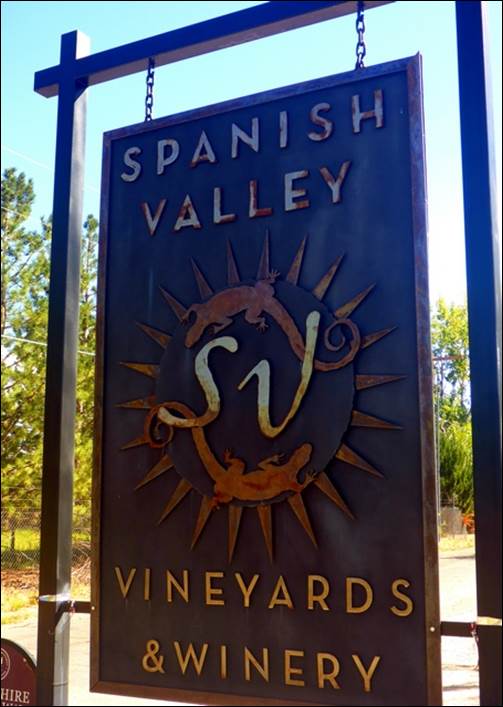
Another sign indicated that the vineyard
and winery was for sale.
We were the only visitors at
the time and had a very personal tasting conducted by the owner/winemaker. The building was used for both the tastings
and some of the wine making process. It
was a bit run-down with many holes in the screens so there were numerous flys and bees attracted to the grape juice in the tasting
room. There was some focus in German
grapes (Riesling, Gewürztraminer)
but also had the standards (Chardonnay, Cabernet). We came away with a bottle of the dryer
Riesling and a 375ml bottle of their sweet dessert style Riesling.
Tuesday,
Sept 18: Moab to Kanab.
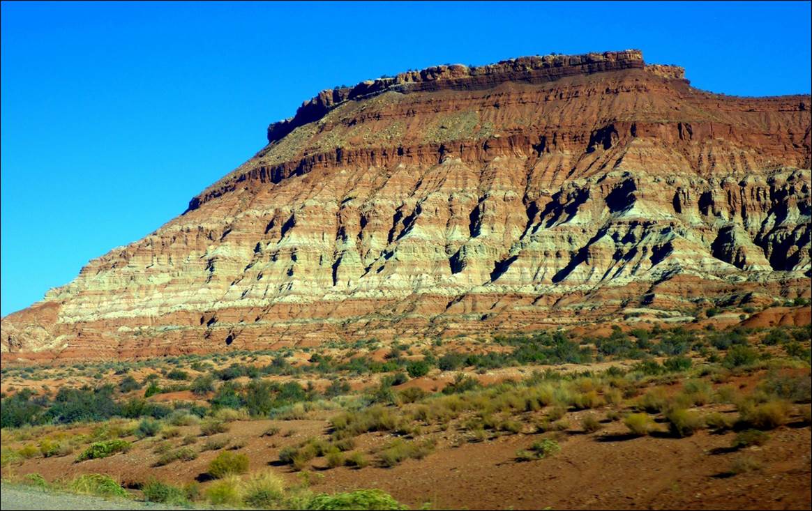
The drive to Kanab, UT was
about 5 hours, taking a route of US-191 north to Interstate 70 west and then
US-89 south to Kanab. We stopped along
the way a couple of times to stretch and take a look at the landscape.
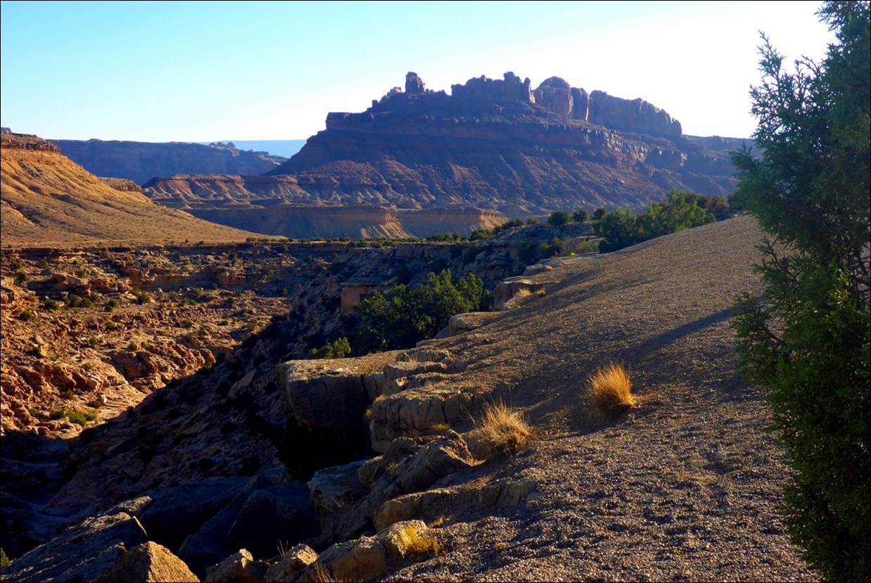
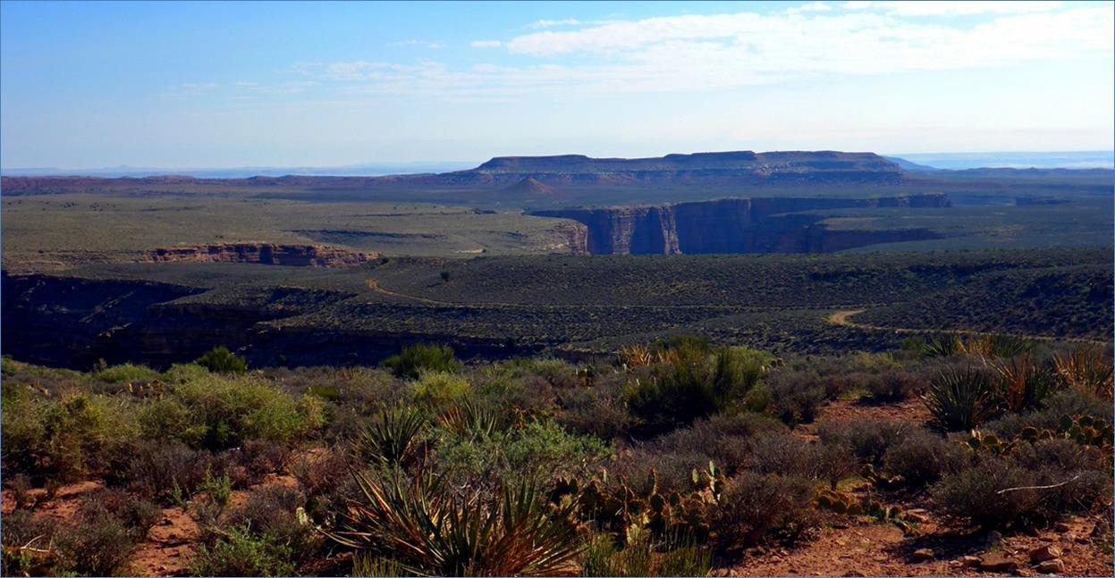
One place we stopped for a stretch just
off Interstate 70 had a nice view.
There were not many places
to eat along US-89 so when we got into Kanab a little after noon, we checked in
and took a walk, looking for something to eat.
We ended up at the Trails End Café where we both had different kinds of
burgers and they were pretty good, as well as good sized. They were big enough so that evening we just
snacked some for dinner and then took a walk through town.
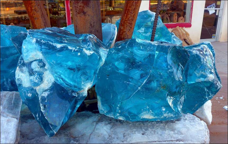
This display was outside one of several
“Rock Shops” in town.
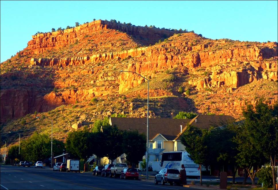
The setting sun shining on some hills
made for a dramatic landscape.
After our walk we stopped
by a small supermarket and picked up some materials to make sandwiches for the
next couple of days as we were almost out of our original snacks and meal
leftovers.
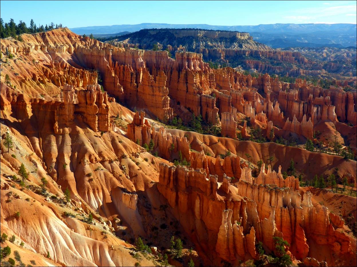
Wed, Sept 19: Bryce Canyon
Bryce Canyon Park was
about a 90 minute drive from Kanab: back
up US-89 a ways then a road to the east into the park. I kept watching the car’s outside air
thermometer as it dropped into temperatures somewhat cooler than we
expected. The elevation in the area of
Bryce Canyon is about 7,000 ft, so it was a bit
cool. As we approached the park the
thermometer was down well into the 40s and we were only dressed in shorts and
T-shirts. Thankfully, there was not much
wind, but it was still a bit “brisk”.
We made a brief stop in
the Visitor Center to pick up a map and take a quick look around and then
started driving along the park’s main road the short distance to the Sunrise
Point viewing area. This was the first
viewing point that overlooks what is called the “Amphitheater” and it did put
on quite a show.
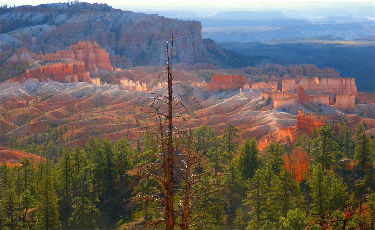
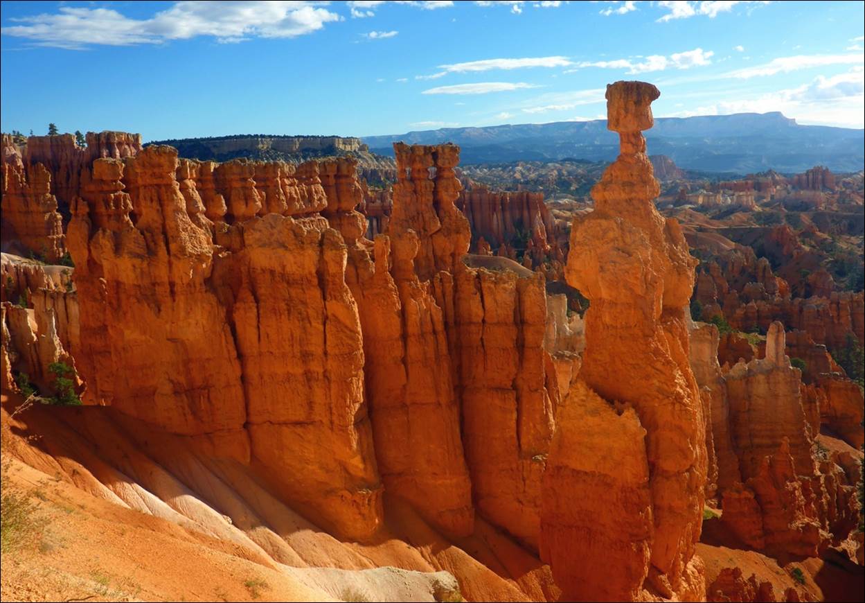
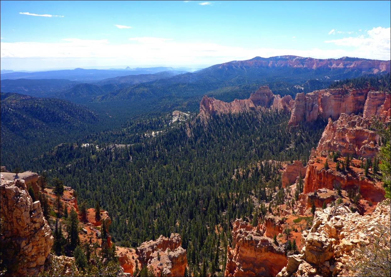
This landscape was truly surreal.
There were “blades” and “Hoodoos”
everywhere.
Several trails led down among the
blades.
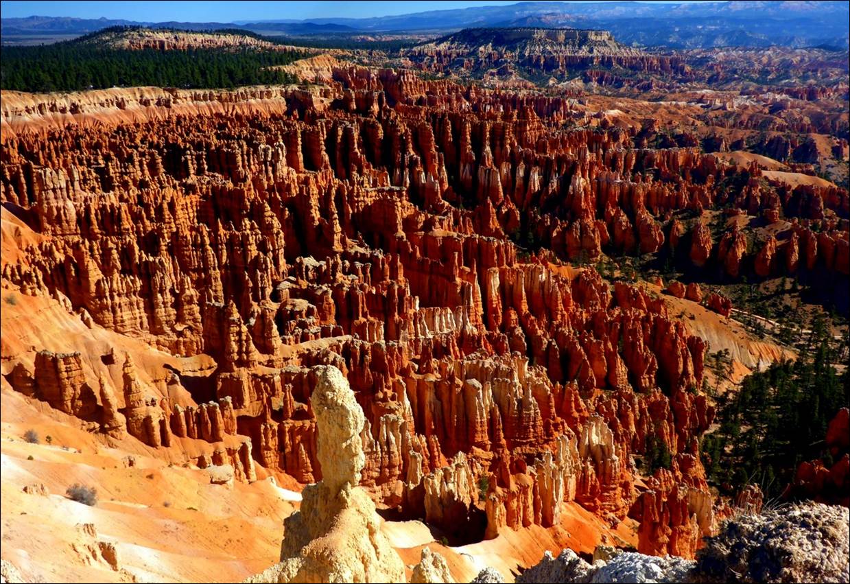
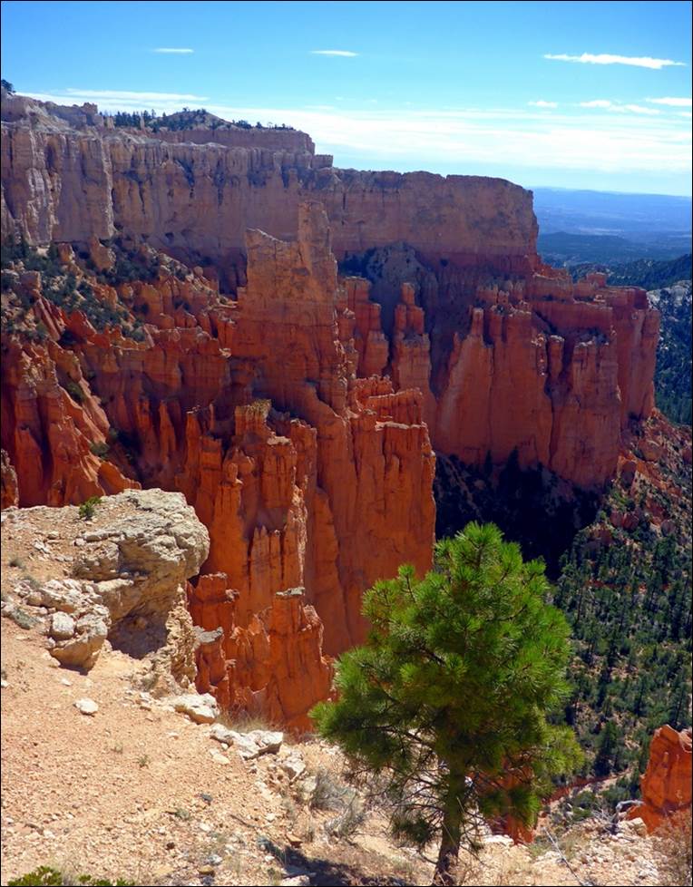
The rock formations were
really stunning: thin rock walls called
blades and rock towers called Hoodoos decorated the landscape. There were not small either, many blades and
hoodoos rose up 70 feet or more from their base. We observed this area for a while, then made the fairly short hike to Sunset Point.
Some areas looked like a forest of
hoodoos.
A video might give a little
better idea of the scope of the
Amphitheater.
We walked the first part
of the Navajo Trail, about a quarter mile winding around and 150 feet down, but
could see where the trail was headed and it did not look interesting enough to
make the climb down and back up, so we reversed course and went back up. It did give us some “up close and personal”
looks at the hoodos.
The hoodoo in the center-right had to be
over 100 feet tall.
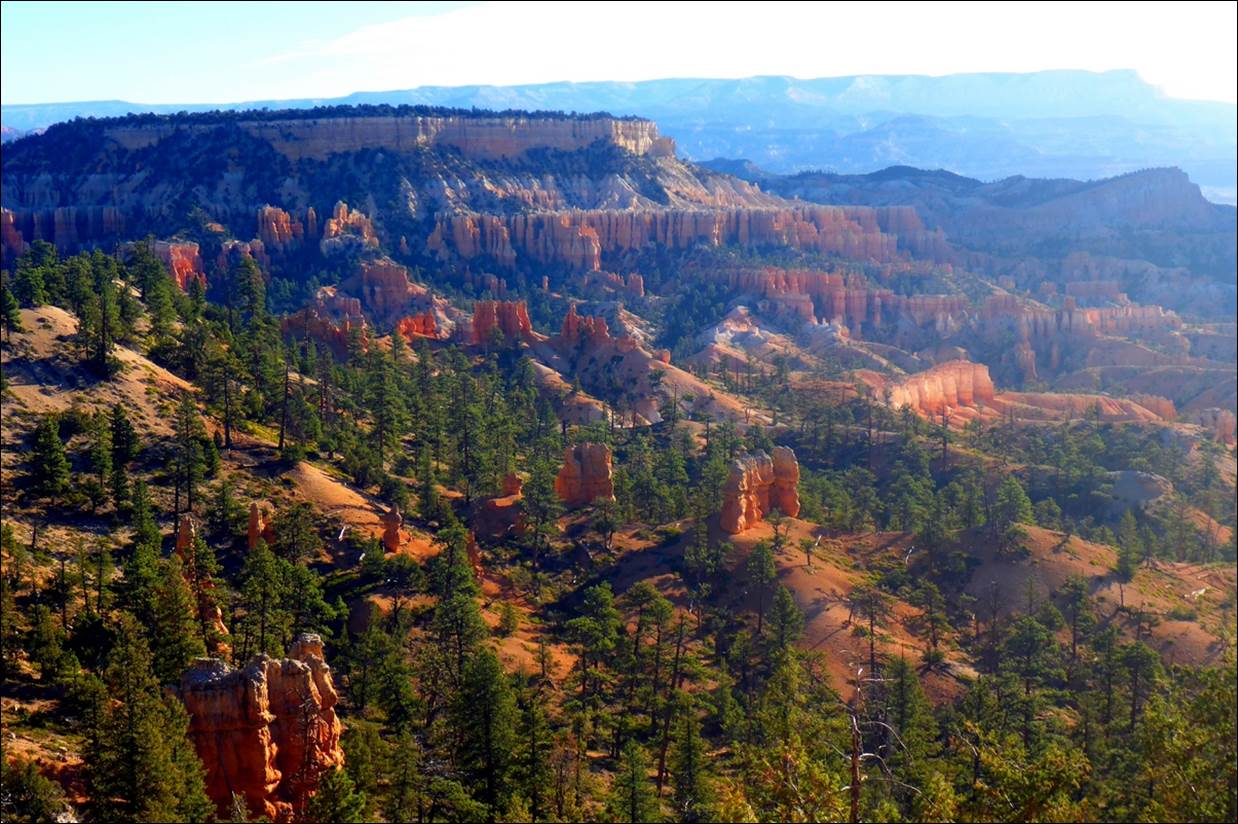
We got back in the car and
drove on to “Inspiration Point” where there were three different overlooks.
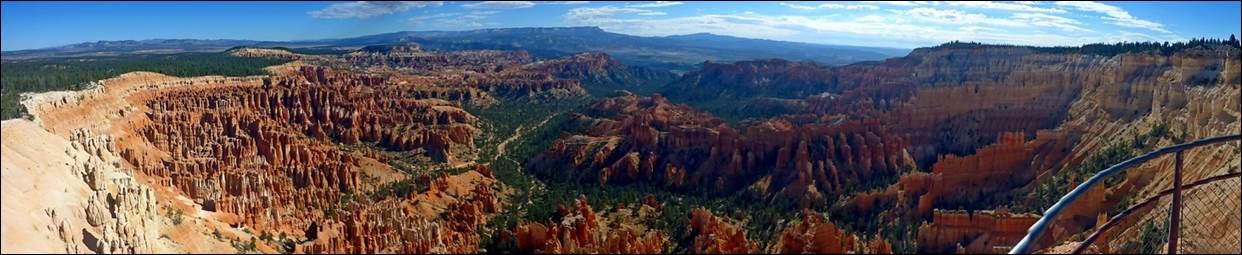
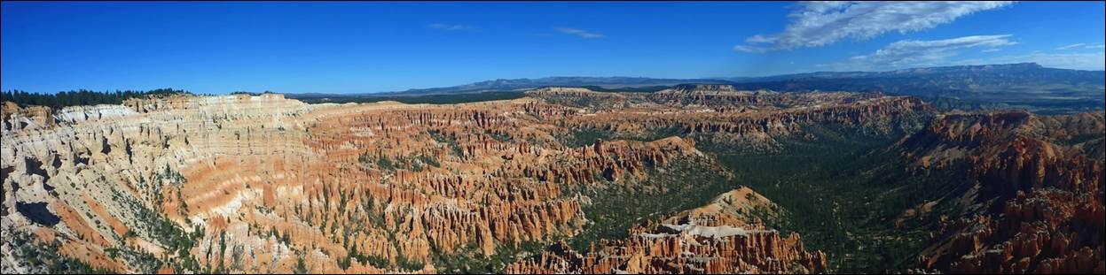
A panoramic view from the highest of the Inspiration
Point overlooks.
In one direction (to the
left) there was a forest of hoodoos.
There is a Navajo legend about the
formation of the hoodoos, but it is a bit long to get into here. Consider that as “homework”.
To the right were more
hoodoos as well as blades on their way to becoming hoodoos.
Looks a bit like a giant sand castle
experiment.
There was a pretty good
walk between the overlooks at Inspiration Point, including a good climb to the
highest one. There are very few trees
close to the rim of the canyon but some do manage to survive in this harsh
environment.
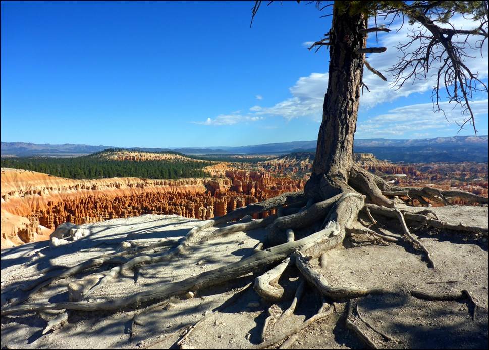
The tree roots have to find cracks in
the bare rock for a foothold.
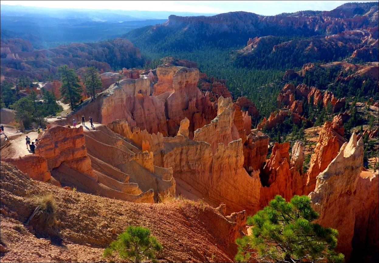
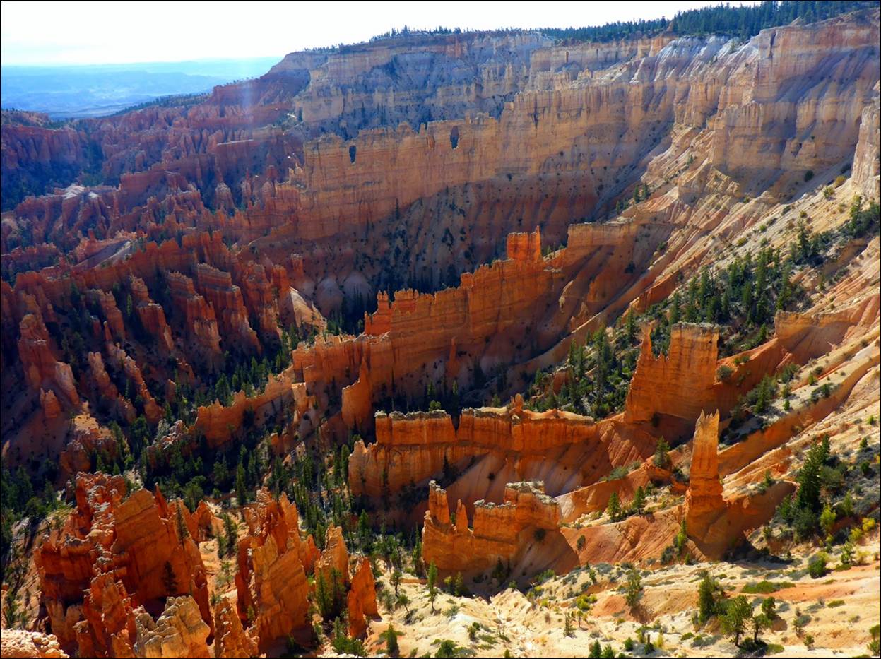
The next stop on our driving tour was “Bryce
Point”, an overlook that actually juts out over the canyon a bit and overlooks
a part of the Peekaboo Loop trail far below.
This was all very impressive, but after
a while one hoodoo looks about like another.
Getting back in the car,
we drove on to Paria Point which overlooks a
different canyon to the south but with similar formations.
Paria Point offered views in a different
direction, although similar subject matter.
Another couple of miles
along the road and we got to “Natural Bridge”.
Although they called it a natural bridge, it looked suspiciously like
the arches we saw at Arches National Park.
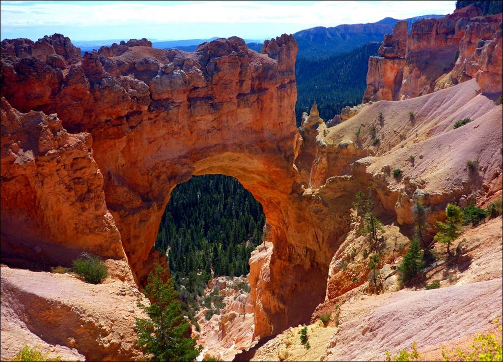
Is it a “natural bridge” or an “arch”?
This was a temporary end
of the road because there was a small forest fire further along and the park
rangers did not want visitors getting close to it. It was not a large fire and we could barely
see any smoke from it, but they do not usually make any effort to put out such
natural fires unless they get very large or out of control. Such fires are a natural part of the
environment and occasional small fires actually prevent the very large wild
fires we hear about on the news.
We had to turn around so
we headed back to the Fairview Point overlook which we had bypassed
previously.
This is also part of the “Dixie National
Forest” and there were more trees in this area.
A sign at the Fairview
Point overlook said that the altitude in that area was 8,819 feet, the highest
in the park. By now it was a little after noon so we found a picnic table in
the sun (it was still rather cool at this altitude with a light breeze) and ate
the sandwiches we had brought with us.
After one last look at the hoodoos at Fairview Point, we left Bryce
Canyon and made the 90 minute drive back to Kanab and a quiet evening.
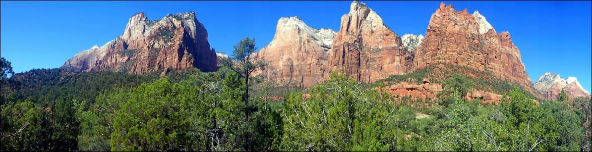
Thursday, Sept 20: Zion National Park.
A couple of weeks before our trip I had an appointment with my “primary care physician” and, in the conversation, mentioned that we were going to visit the various Utah parks. He mentioned that his family had done that recently and that Zion was his favorite. I think I now understand why but will wait until the end of this report to explain: see if you can pick out the big difference(s) between Zion and the other parks.
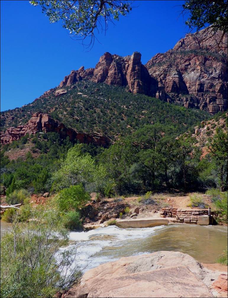
Zion National Park was about a 40 minute drive from our hotel in Kanab. I had seen multiple rather stern warnings about the lack of parking for private cars in the park, so I wanted to get there early enough to make sure we got a parking place for the car. This is especially important as private cars are not allowed on most of the park roads; you have to use the shuttle busses to get around the park. We were early enough that we got a parking place close to the Visitor Center and then rode the shuttles from there. The shuttles ran in kind of a loop, departing from the visitor center and running all the way to the end of the line (the Temple of Sinawava) before stopping. Then, on the return trip, they stopped at every shuttle stop, about 6 of them on the return route.
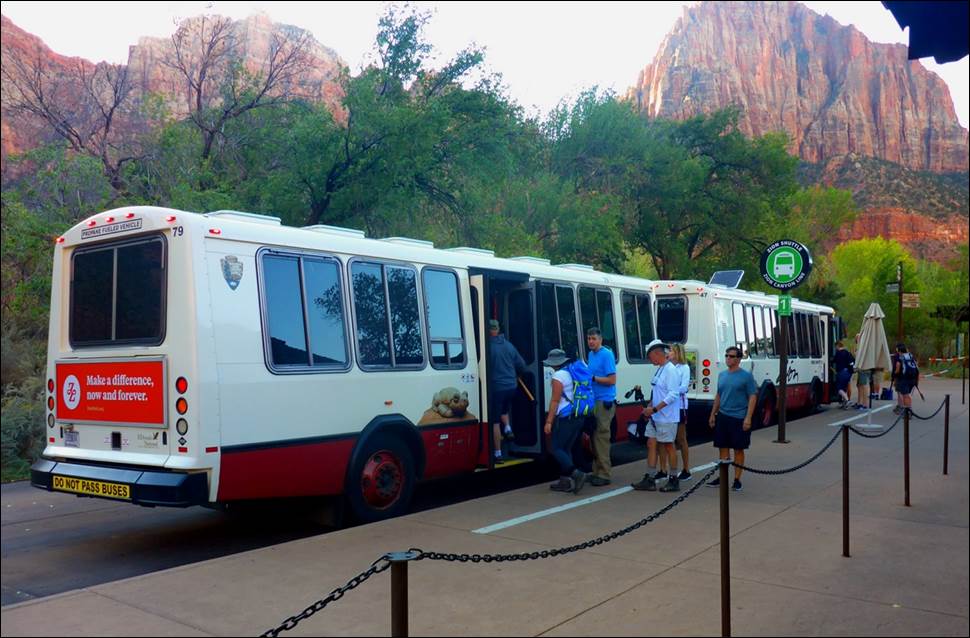
A shuttle bus loading up at the Visitor Center terminal.
We boarded a bus at the
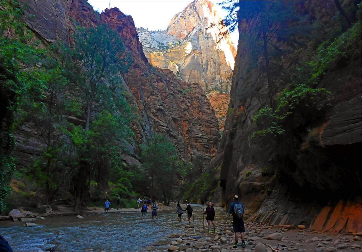
main terminal at the visitor center and rode it up to the “Temple of Sinawava”, the end of the line. In this area you could take the “River Walk”
trail that winds along the Virgin River for a mile or so and then encounters a
wet crossing of the river. The trail
actually continues from here and on to the area called “the Narrows”, but to
get there you have to get your feet wet.
There were several
interesting rock formations along the trail, such as what appeared to be an
arch in the making.
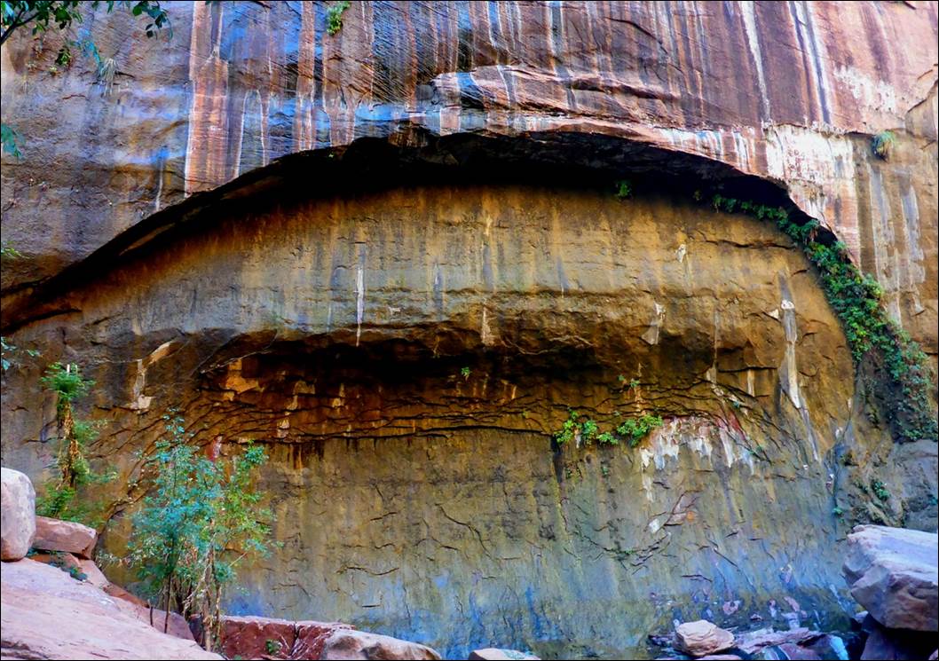
This might turn into a full arch in a couple
of thousand years.
Most of the visitors were
like us and stopped at the end of the dry trail, but some people continued on
to the narrows.
These people were going to have wet shoes
and feet. Hopefully they had dry ones to
change into.
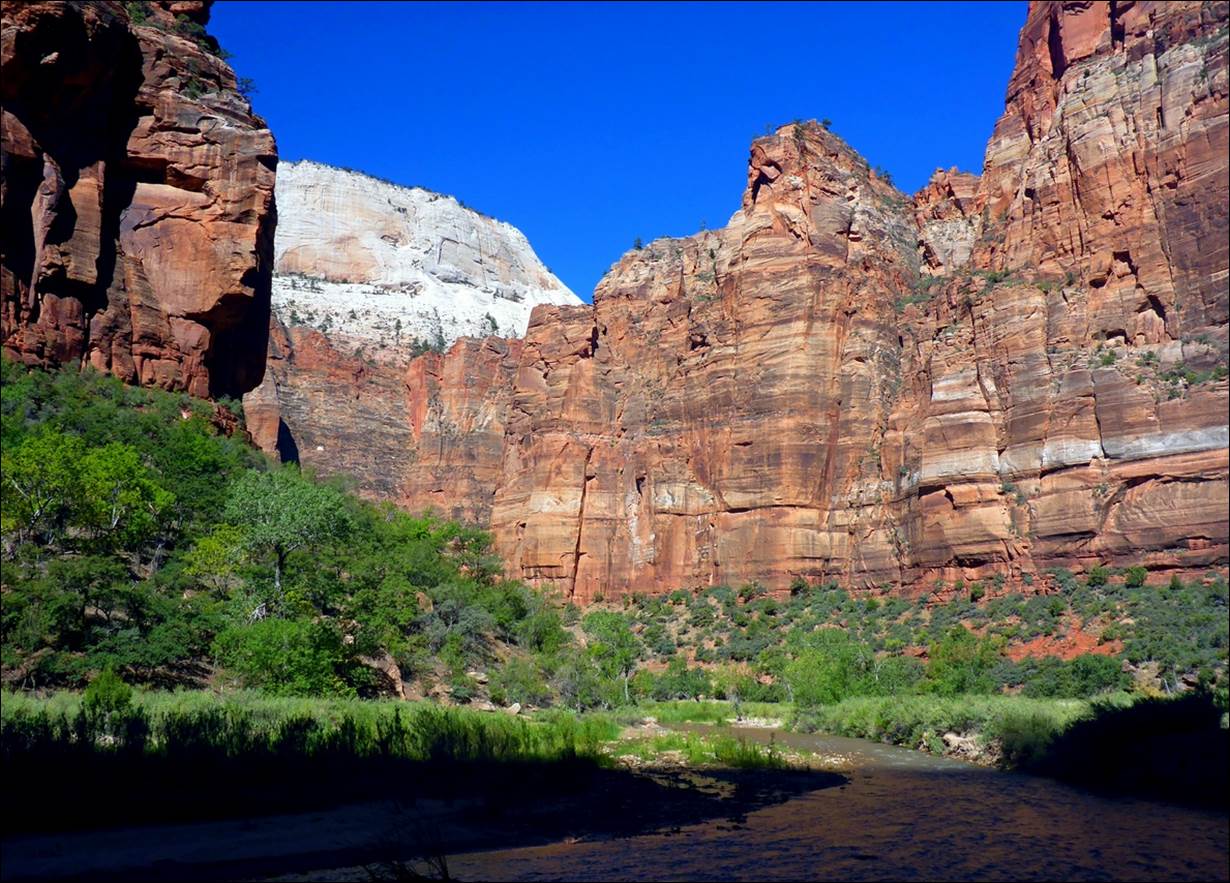
There were high cliffs along both sides of the river and, before the day was over, my neck would get sore from looking up all the time.
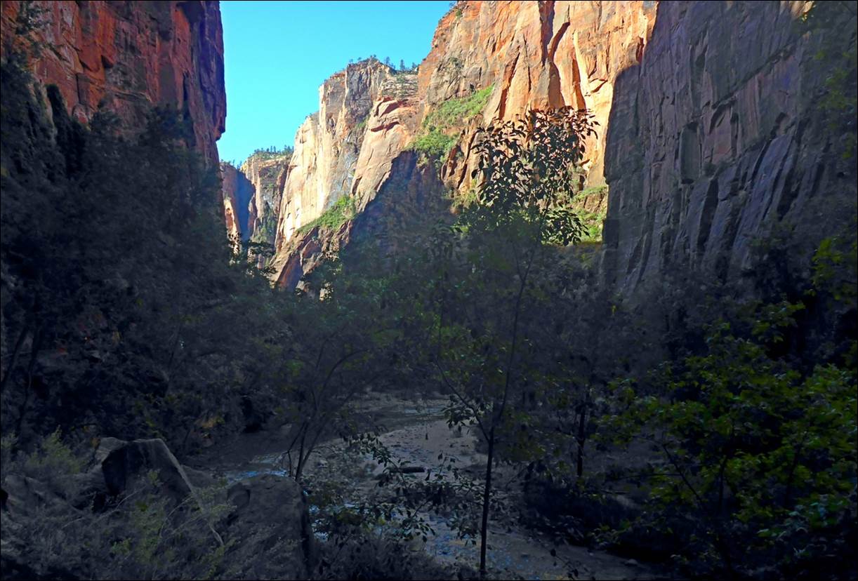
The valley was rather narrow in the area
around the “Temple of Sinawava”
You can get an idea of the
surrounding cliffs from this video.
Back on the shuttle and
the next stop was “Big Bend”. This was
basically a wide point in the valley with a lot of green grass and trees.
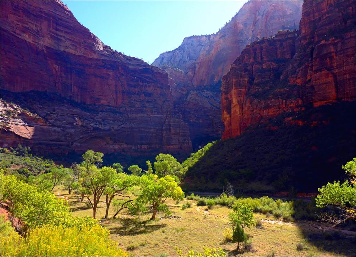
This was a pretty and relaxing place,
but no special views.
After enjoying the peace
and quiet of Big Bend, we got back on a bus and headed for the next stop,
Weeping Rock. At this stop there was a
trail up to some “weeping rocks”.
The walk to the weeping rocks was more
interesting than the rocks were.
The trail did rise above
the valley floor quite a bit and provided some nice views.
The trail to weeping rocks was high
enough to provide some good views.
The weeping rocks
themselves were somewhat of a disappointment… they were weeping so little that it
was difficult to tell just which rocks were supposed to be weeping and which
ones were not. By the time we got back
from the trail and onto the valley floor, the sun had risen
high enough to be penetrating down into the valley, warming it up some, which
felt good.
Despite how it may look, I was NOT
standing in the river when I took this photo.
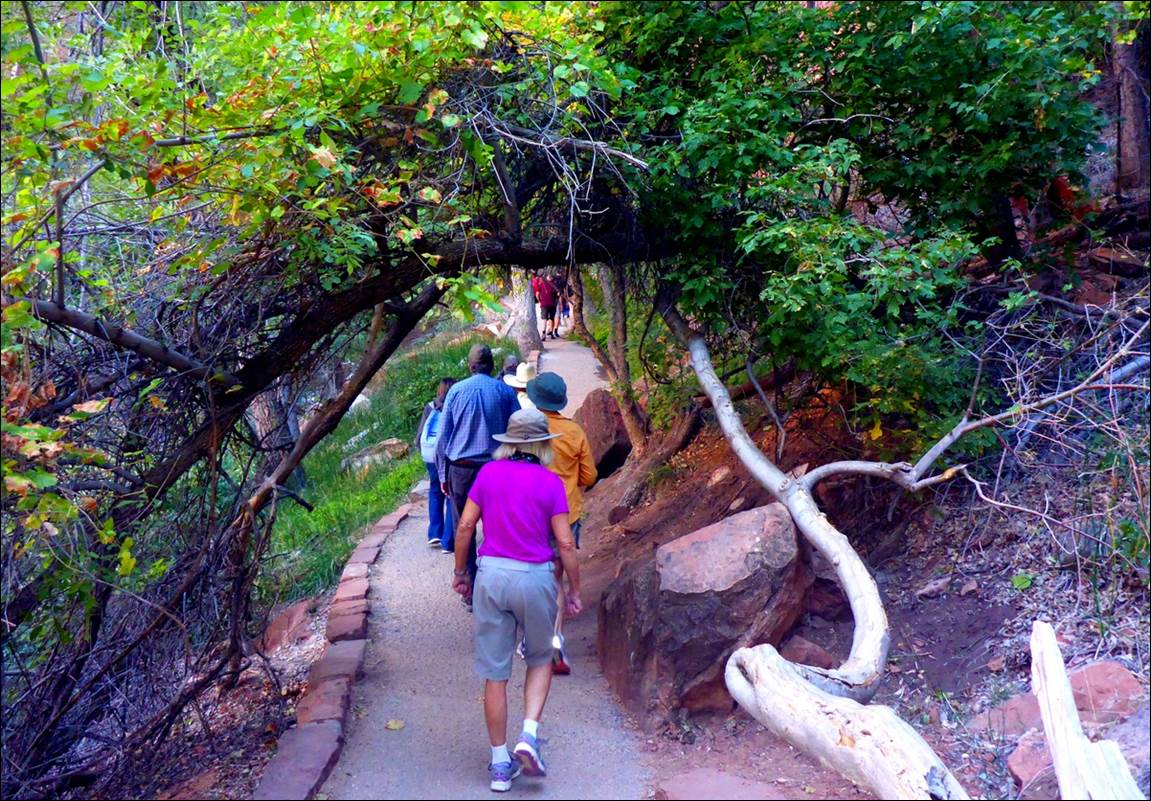
The next stop on the bus
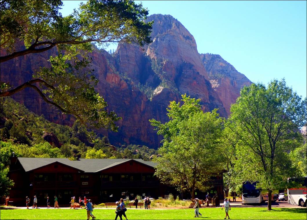
route was the Zion Lodge. There were
people coming and going to the lodge and large commercial tour busses so this
was a busy area. The primary thing to
see or do here was a nice
trail to the Emerald Pools, so we headed off to see what these
pools were.
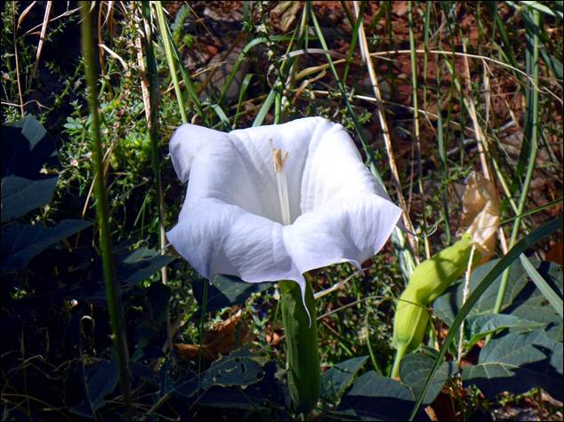
We had been seeing quite a few of these
flowers at Zion.
The
trail crossed a little bridge over the Virgin River and I had to wonder just
what this looked like during the wet season or during snow melt. I suspect the river would look a little
different then.

The Virgin River was very calm and slow
moving on this day.
The bridge did provide
nice unobstructed views up and down the river.
The trail wound around the area and provided some more good views of the
surrounding mountains and cliffs, and in about 20 minutes, we got to the
pools. There were ‘water falls” dripping
into the pools and you could walk under/behind the water falling down to the
pools. The pools were fairly small and
the water was a green color, but I’m not sure I’d call them “emerald”. After getting a little wet in the falling
water, we headed back along the trail toward the lodge. By the time we got back it was a little after
noon and we were ready for some lunch, but the lodge restaurant was packed with
a waiting line. We had brought some
sandwiches with us so we found a fallen log to sit on and pulled them out to
enjoy. .
The lodge area was busy with tour groups
and people looking for lunch.
With lunch complete and us
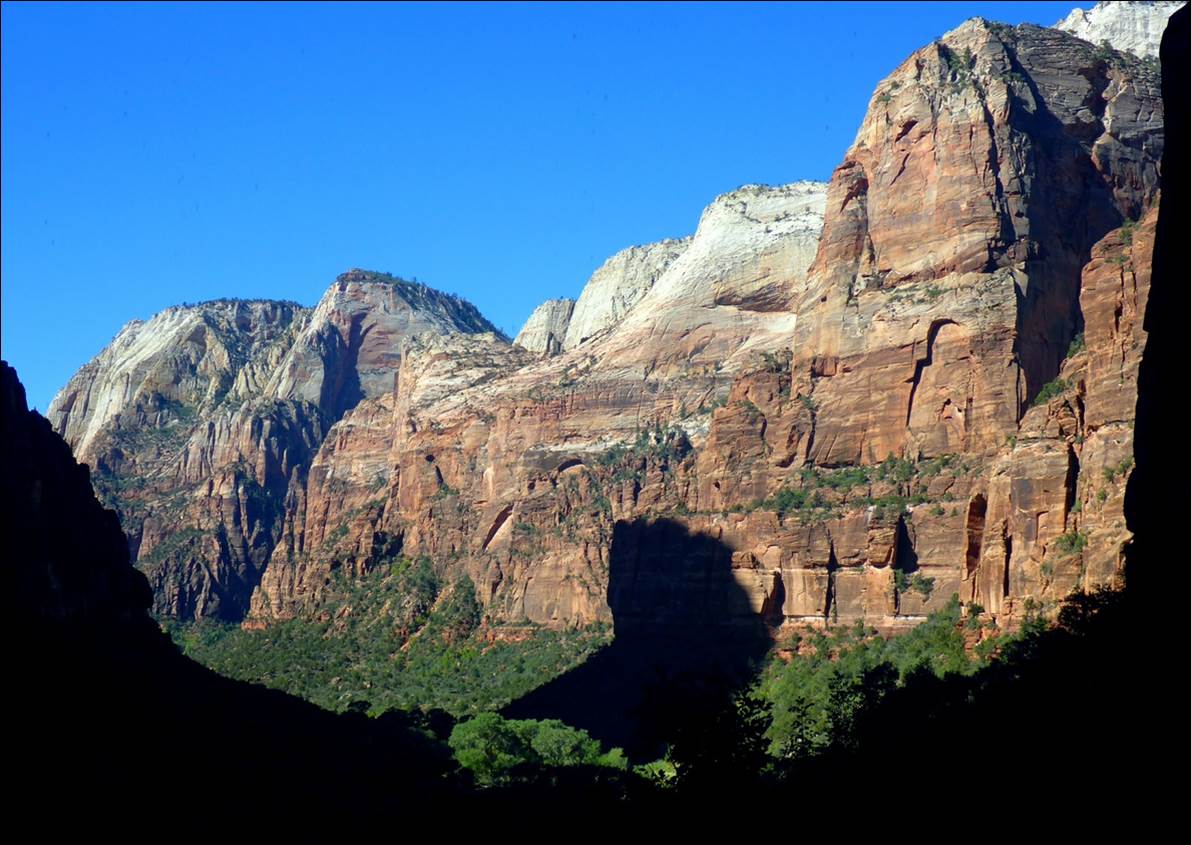
well rested, we got back on the bus and headed for the next stop, the “Court of
the Patriarchs”. As might be expected in
Utah, the initial European settlers in this area were very religious so, when
they saw three large rock outcroppings next to each other, the rocks were given
religious names. They were named after
the biblical Abraham, Isaac, and Jacob and the three together are referred to
as the Three Patriarchs so the area in front of them is the “Court of the
Patriarchs”.
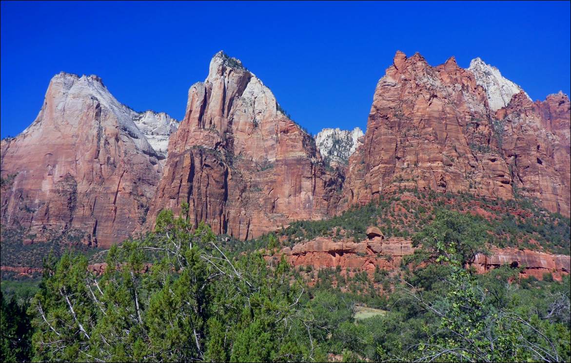
The Three Patriarchs do look rather
stern and formidable.
Expand you view a little
to the left and you include
The Sentinel with the
Patriarchs.
The Sentinel with the Patriarchs.
At this shuttle stop there
was just a short trail to get to a better view of the peaks but there was also
a somewhat hidden little trail that gave access to the banks of the river. There was what seemed to be a natural dam in
the river, with some smooth flat rocks almost perfectly horizontal holding back
the water.
The positioning of the rock was almost
perfect for a dam, but it appeared natural.
After debating whether the
dam was natural or “man-influenced”, we boarded the bus for the last time and
made our way back to the Visitor Center.
It had gotten busy and was packed with people, so we did not linger very
long there. We made our way to the car
and, based on the number of vehicles apparently circling, looking for a parking
place, we probably could have sold our space if we were so inclined.
We left the park and
headed back to the hotel in Kanab for a quiet evening.
Now, why so you think my
doctor liked Zion best of the Utah parks?
I can think of two things that made it unique among the parks:
1.
In all the other
parks (except perhaps Arches), you were up on the “high ground” looking down at
the valleys and rivers while at Zion you were down in the valley, looking up at
the mountains.
2.
Zion was by far
the greenest and most lush of all the parks.
Fri, Sept 21: Kanab to Las Vegas
Friday morning we got up,
had breakfast at the Hampton Inn, and headed to Las Vegas,
This is one place we could
have saved a day. If I had been
observant, I would have realized that we would gain an hour (going from
mountain to west coast time zone) and so we could have easily taken a flight
out of LAS around noon and gotten to Atlanta at a late but reasonable
hour. As it was, we had a three hour
drive to Las Vegas, then most of the day to look around and we would catch a
flight the next morning. The drive was
decent, with some of the sights that have become commonplace.
These sights may be common out here, but not at
home!
As we approached Las Vegas
from the north on Interstate 15, around the Nellis Air Force base I noticed there
was practically no traffic coming in the opposite direction. This seemed rather strange. Then we noticed police cars stationed at
every exit and on-ramp and that raised a flag.
I remembered that President Trump had been in Las Vegas the prior night
and there is a Trump Hotel in the city.
It was now obvious that he was about to depart Las Vegas, probably via
the interstate to Nellis where Air Force One was probably parked. As we got close to Las Vegas we did see a
“caravan” of probably 10 black SUVs and multiple police cars going in the
opposite direction that might have been President Trump. However, we noticed that the northbound
interstate continued to be blockaded for at least another hour after that, so I
suspect it was either a decoy or a practice run.
We made it to our hotel, a
Fairfield Inn close to the airport, before noon and they had a room ready for
us. When checking in the desk clerk
mentioned that they ran a regular shuttle twice an hour to the Las Vegas strip
if we wanted to go visit that area. We
had the rest of the day to kill, so why not?
We caught a shuttle that dropped us off at the Mandalay Bay, on the
south end of the strip. It took us a
while to navigate through the Mandalay Bay and find our way to the main part of
the strip. By a little after noon it was
already getting hot and there were a LOT of people all over. After the kinds of views we has been looking at for the past week, the scenery here was much different.
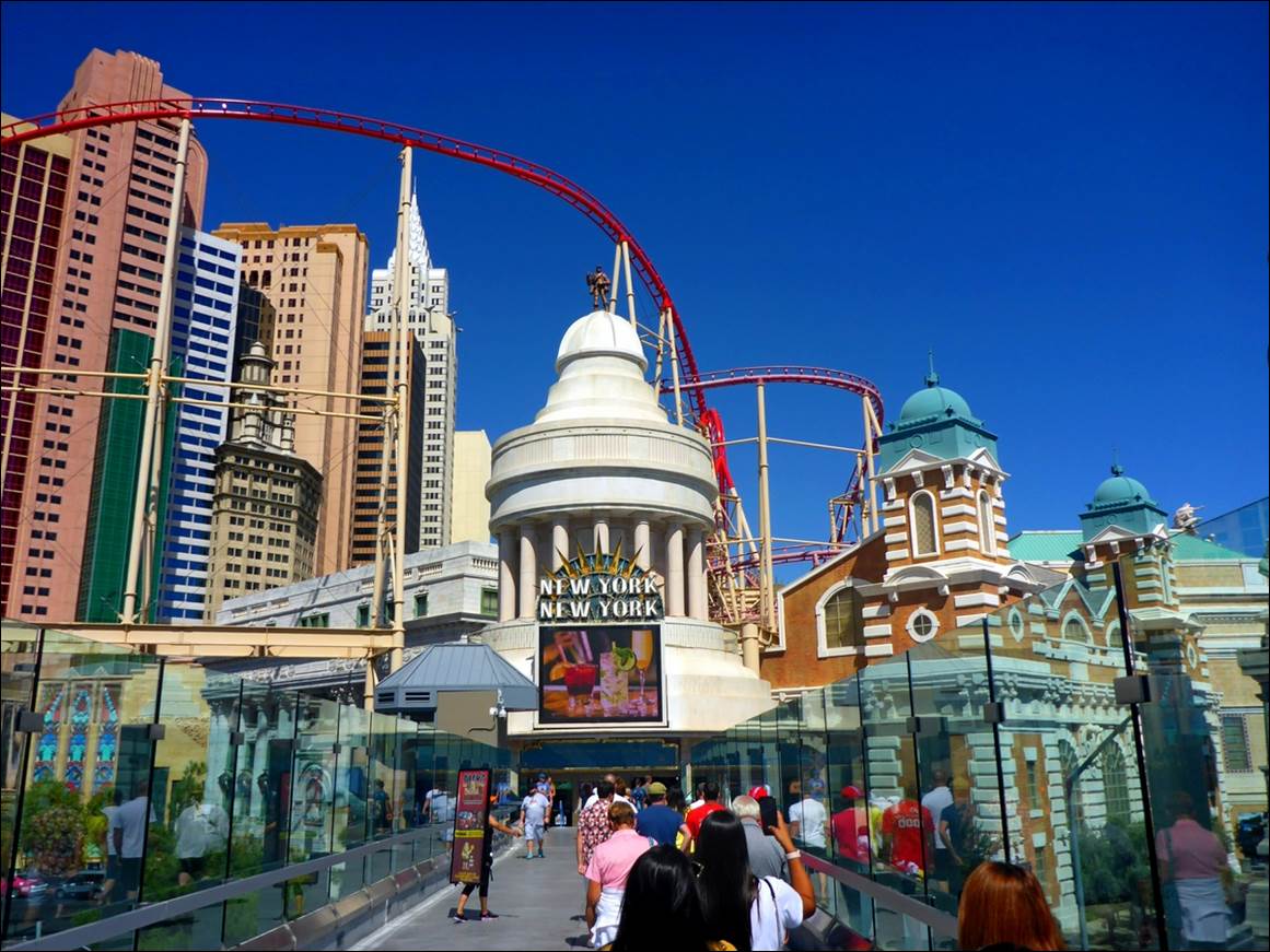
Susan, we’re not in the Grand Canyon
anymore!
After wandering around a
little, we decided we were hungry and found an “Irish Pub” named “Nine Fine
Irishmen” that looked interesting.
Although we later found they had lots of inside tables, we staked out a
table on the edge of a plaza area and ordered lunch. There was a bandstand close by where a 4 man
Irish Band was entertaining. We were not
expecting much in either the food or the music, but both of them turned out to
be surprisingly good so we took our time with lunch and enjoyed the music.
We wandered around a
little while longer but the streets, shops, and casinos were all crowded and it
was only getting hotter outside, so by mid-afternoon we made our way back to
the Mandalay Bay and the shuttle pickup location. Somehow, Las Vegas just did not seem very
inviting or exciting after our visit to the more natural wonders of the area.
That evening we drove to a
nearby shopping area that was also close to the car return area so we had some
“practice”. We topped off the car with
gas and picked up a couple of sub sandwiches that we took back to the hotel and
enjoyed with the last of the wine we had bought.
.
Sat. Sept 22: Heading home.
We had breakfast at the
Fairfield and headed to the
airport for a unexciting trip home. The most exciting part was probably when I
turned into the wrong entrance at the car rental center. By the time we returned the car, took the
shuttle to the airport, and got checked in for our flight, we still had 90
minutes until time to board. On the
departure from LAS we did get a decent view of the city.
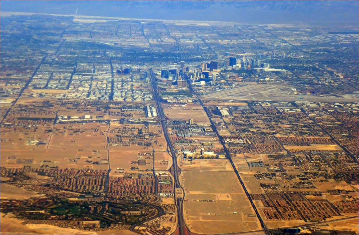
This photo makes you realize just how
small Las Vegas really is.
Continuing east, I wanted
to get a good photo of the Grand Canyon area that we had just visited, but we
flew just a little too far north.
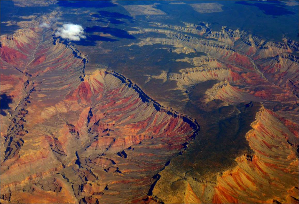
This would be the very northern part of the
Grand Canyon, not where we had visited.
The flight was fairly
comfortable: we had an exit row and no one claimed the middle seat, so we had a
little extra space between us. The
flight attendants were good and cheerful and we arrived in Atlanta on time, so
all-in-all, a decent flight.
Five major national parks
and 1800 miles of driving in 10 days: it
was a good trip but I’m now in no hurry to see another canyon, blade, or hoodoo
for quite a while!
As always, you can contact
me at: mike@hammocktree.us
Happy travels!