 A trip to
Yellowstone
And other sights.
Sept. 2020
The Setup
For the past several years, we have been visiting the better-known National Parks in the western United States (Grand Canyon, Arches, Cloudland Canyon, Bryce, Zion, Yosemite). This year it was time for Yellowstone, although considerations for the COVID-19 pandemic complicated things and affected several aspects of the trip.
We had initially planned to do a guided tour to simplify our planning and I had gone through our usual travel agent company, Vacations to Go, to schedule a tour with Collette, the same tour company as we used for our Australia- New Zealand tour. The specific agent I was using was out of the office a lot while we were planning the trip and I suspect this had something to do with the results: four days before we were to leave on the trip, I got a voice mail that Collette could not get the additional hotel room for us, so that tour was unavailable to us. Since we already had our air arrangements set, I took a quick look and decided I could set up a trip on a DIY basis, using the Collette itinerary as a rough guide. I quickly made hotel reservations (as expected, nothing was available inside the park) and reserved a rental car. (Strange enough, Hertz only had a mini-van available, and at over $900 for the week: I changed to Alamo and got a sedan for less than half that).
One thing I should point out, for those who don’t know us well: we both had and recovered from the COVID-19 virus back in July, so we are very unlikely to either get or pass along the virus. We did attempt to follow all COVID-19 related protocols, such as wearing face masks on the planes.
Getting there and
back
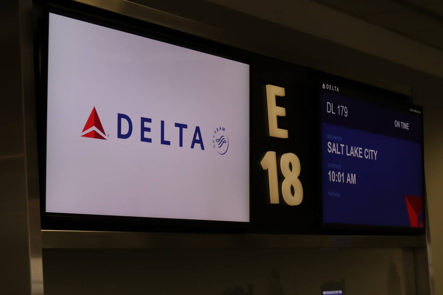
As usual for us, flights were on Delta.
Departure sign
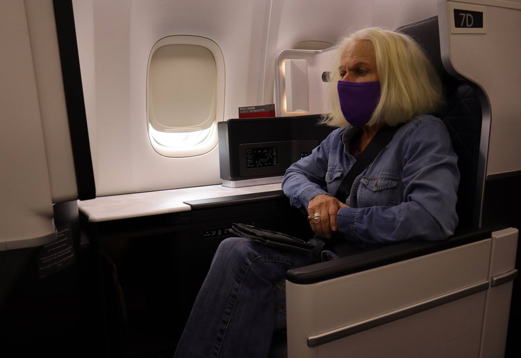
On the trip outbound, first class was available at a very good rate, so I took advantage of that. Somewhat surprisingly, seats were very scarce on the return flight, but at least Delta’s policy of blocking off all middle seats gave us a bit more room. All flights were on time and reasonably comfortable.
Susan in First
On the outbound trip, we had a stop in Salt Lake City and a wait of about an hour for our connecting flight to Jackson Hole Wyoming. On the return trip, we flew out of Rapid City, SD and connected through Minneapolis, Minnesota.
Everyone seemed to be very good about the use of face masks and limited in-flight services. All passengers got a plastic bag with a small bottle of water and simple snack. In first class we also got a little nicer “snack in a bag” which included some cheese and sliced salami and a choice of wine in the single serving plastic bottles. Each snack bag included an antiseptic wipe.
About the smoke
During our trip, the fires in California and Oregon were going full on. There was noticeable smoke in the air every day and some days were worse than others. The smoke certainly affected our view of the more distant sights. In the photos in this report, I have used a “haze filter” extensively in a photo editing program in order to try to make the photos look a bit more like I think they would without the smoke. I don’t have a way to do that for the videos, so you may notice that the videos have much more smoke and haze than the photos. Keep in mind that what we saw was much more like the videos rather than the photos.
Day 1 –
Sunday: Atlanta to Jackson Hole
As mentioned above, we flew from Atlanta to Jackson Hole via Salt Lake City. (Technically, the town is just “Jackson”, but there are numerous towns in the US named “Jackson”, so it becomes convenient to call it “Jackson Hole”. The term “Jackson Hole” is really the name of the valley in which Jackson sits.)
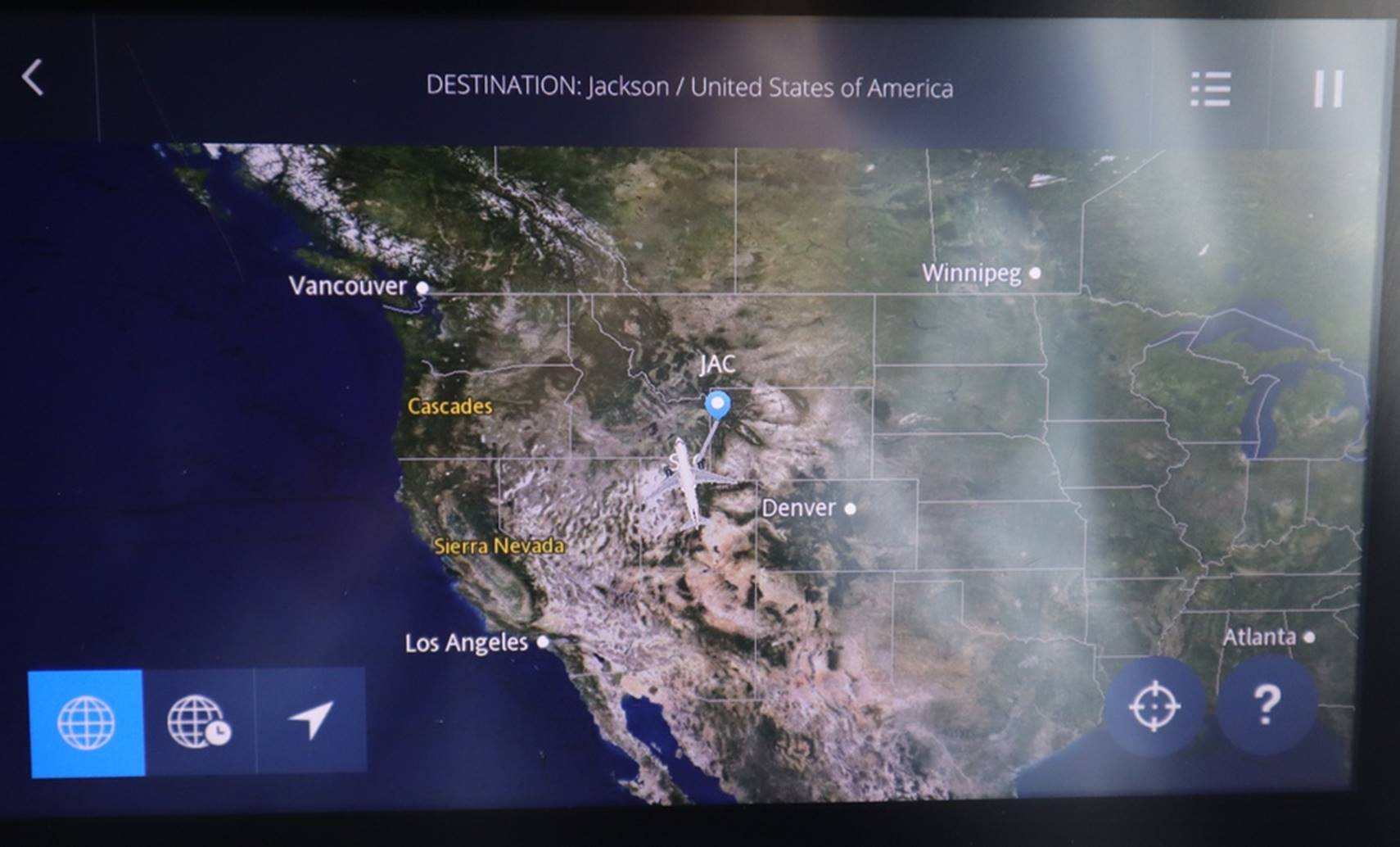
Flight map going to
Jackson Hole
We stayed in the Hampton Inn at Jackson Hole. The service was very good and the facilities were very clean. Since we were using the Collette itinerary as a general guide, we checked it and a “Million Dollar Steakhouse” was one recommended restaurant. When we called it for a reservation (reservations were required at almost all restaurants we visited) there was a bit of confusion. It turned out that the Million Dollar Steakhouse had been replaced by “Paulies” restaurant, which seemed to be an Italian restaurant with a western/cowboy flair. Food and service was good, but did not really seem in keeping with the local environment.
While in Jackson (Hole) we took advantage of an Albertson’s supermarket next door and, as our practice lately, picked up a small Styrofoam cooler, wine, cheese, salami, apples, crackers, and bananas. Combined with leftovers from dinner and the airline snack bags, this would provide picnic lunches for several days.
Jackson (Hole) was a typical tourist-oriented town but the downtown was very walkable with sufficient free parking. Based on the crowds we saw, I did wonder just what it would be like in the middle of the high season in a normal year.
Day 2 –
Monday: Jackson Hole to West Yellowstone.
Because we were still somewhat on Eastern time, we were up early for breakfast. With the COVID-19 safety protocols in effect, there was no self-service buffet for breakfast. Instead, a server took your order (for scrambled eggs, sausage, cereals, breads, yogurt, etc.) and put them on a tray for you. This seemed to work pretty well and turned out to be one of the better arrangements we encountered.
Grand
Teton National Park
With the early start, we were on the road and into the Grand Teton National Park before sunrise. The sun coming up through the smoke did make a bit of a sight.
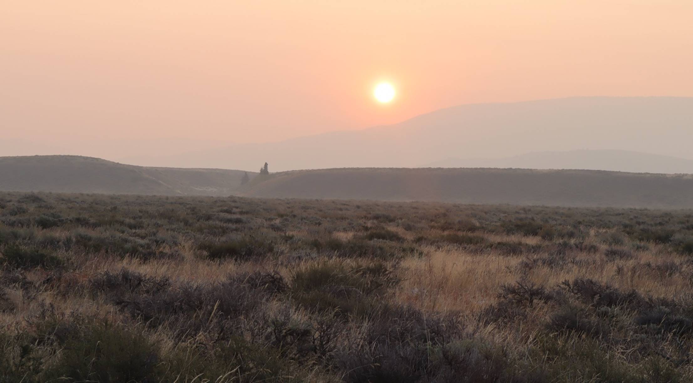
Rising sun through
the smoke
Here is a good opportunity to see what the smoke really looked like in this video of the mountains and rising sun. Compare the view of the mountains in the beginning of the video with the photos just below.
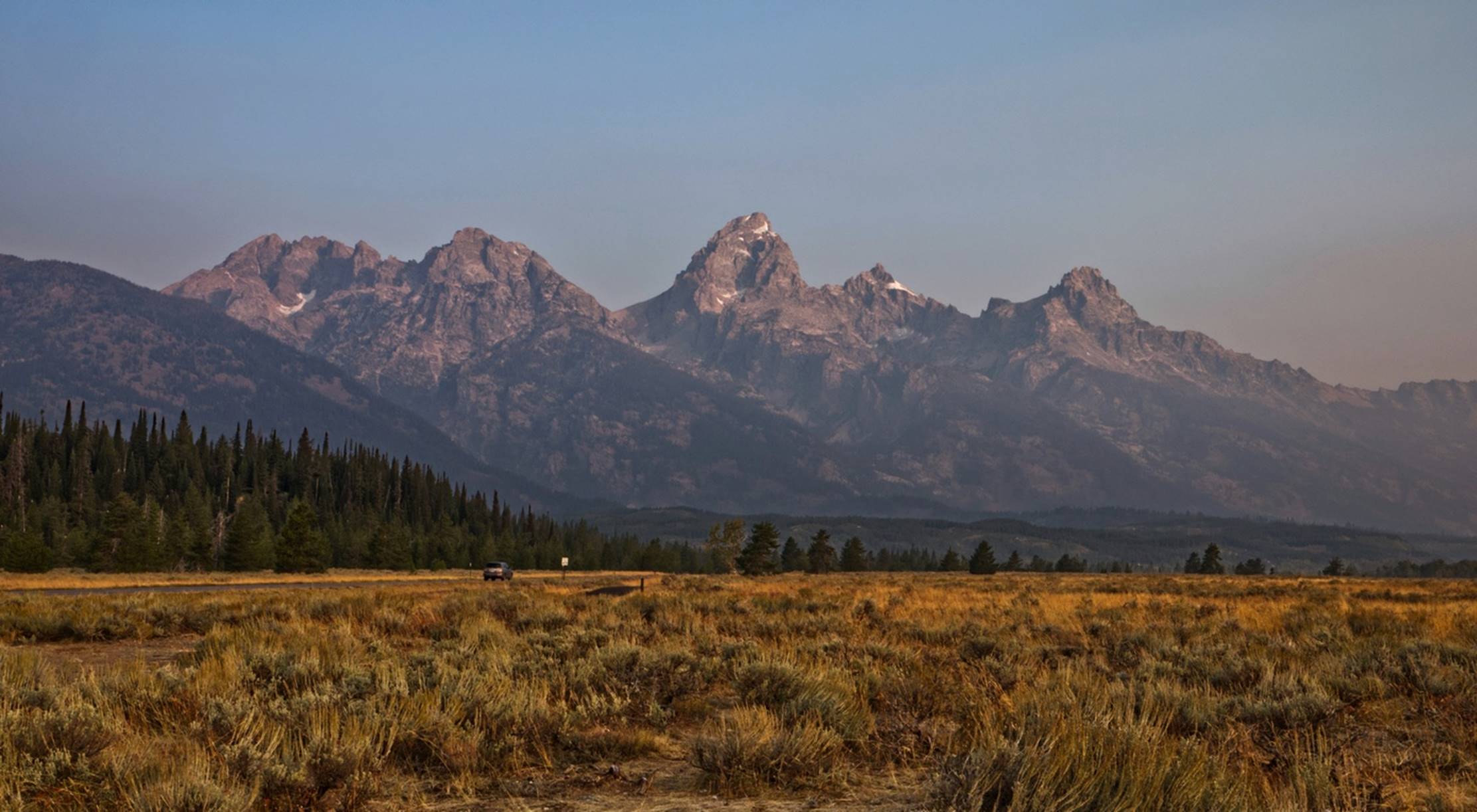
Part of the Grand
Teton Mountains
Slightly north of Jackson Hole, you could turn off the main road (US 191) onto a road that ran through the park (Teton Park Road) and offered numerous beautiful views of the mountains. There had been an early snowfall about 5 days prior to our visit, and the remaining snow make the mountains even more impressive.
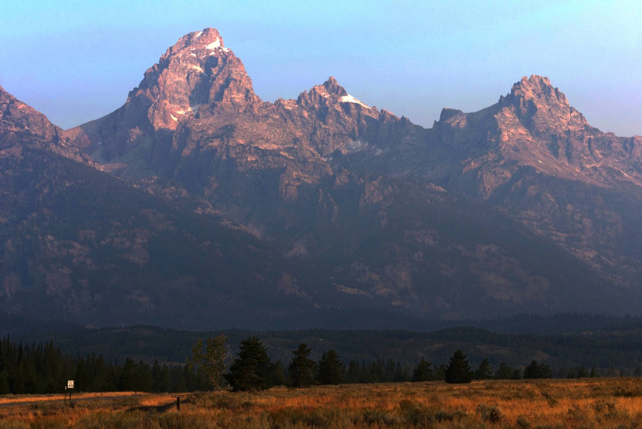
Mountain peaks
There were several short scenic drives available off the main road, such as the “Jenny Lake Scenic Drive. As with most such drives, there were several places to pull off the road and enjoy the views, such as the one below, looking at the mountain over Jenny Lake.
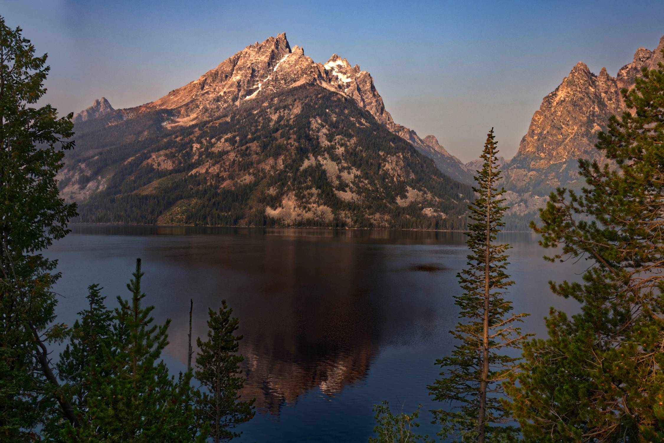
Jenny Lake mountain
view (210)
At one point, there was an overlook from a dam that looked across a lake at distant mountains. The smoke had settled low over the water and created an impression of the top of the mountains just floating above the lake.
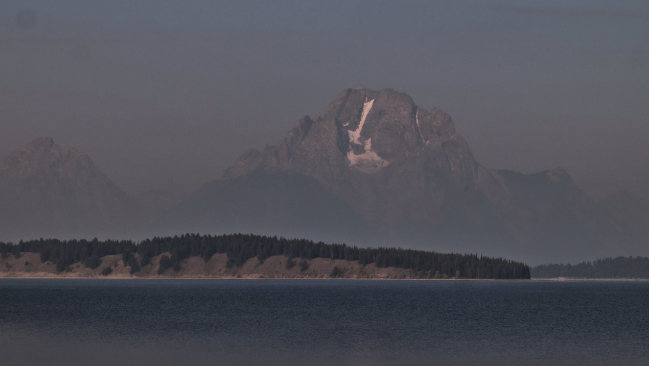
Floating mountains
Near the northern end of Grand Teton National Park, we rejoined highway 191 and soon crossed into Yellowstone National Park at the southern entrance.
Yellowstone
National Park
There were several places to stop and check the local sights, including several pretty waterfalls, such as Lewis Falls.
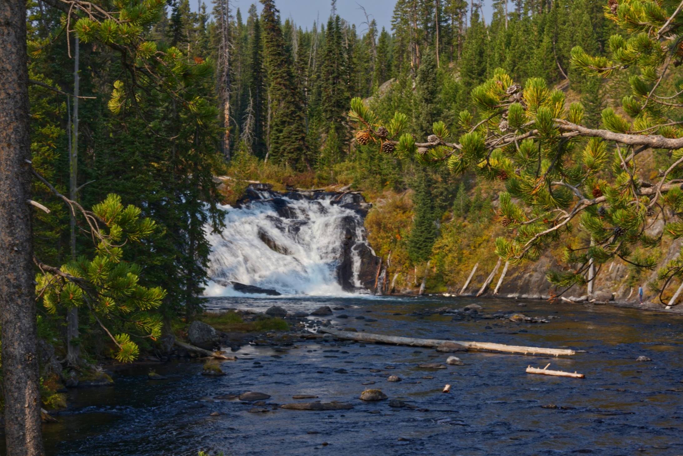
Lewis Falls
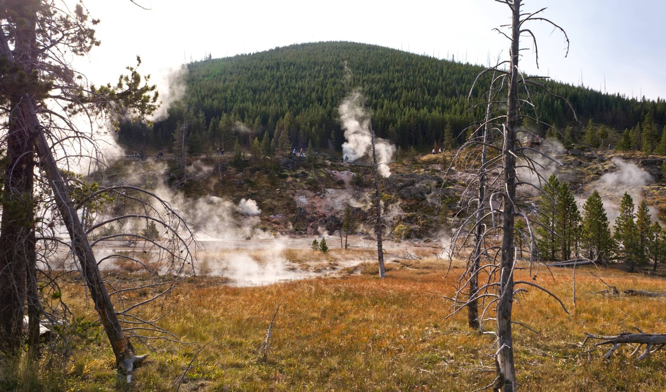
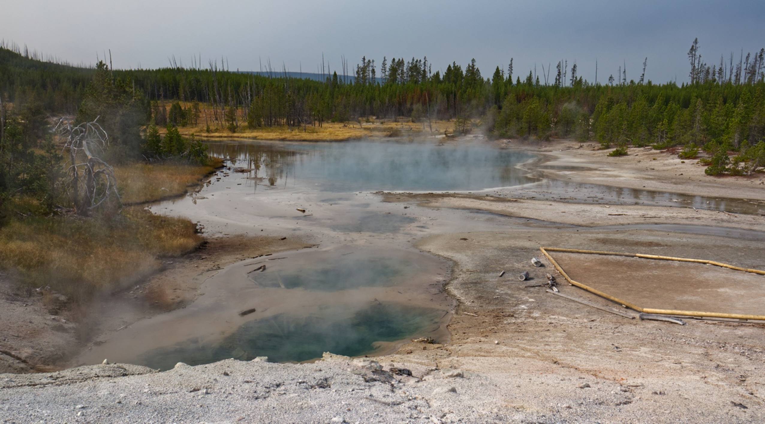
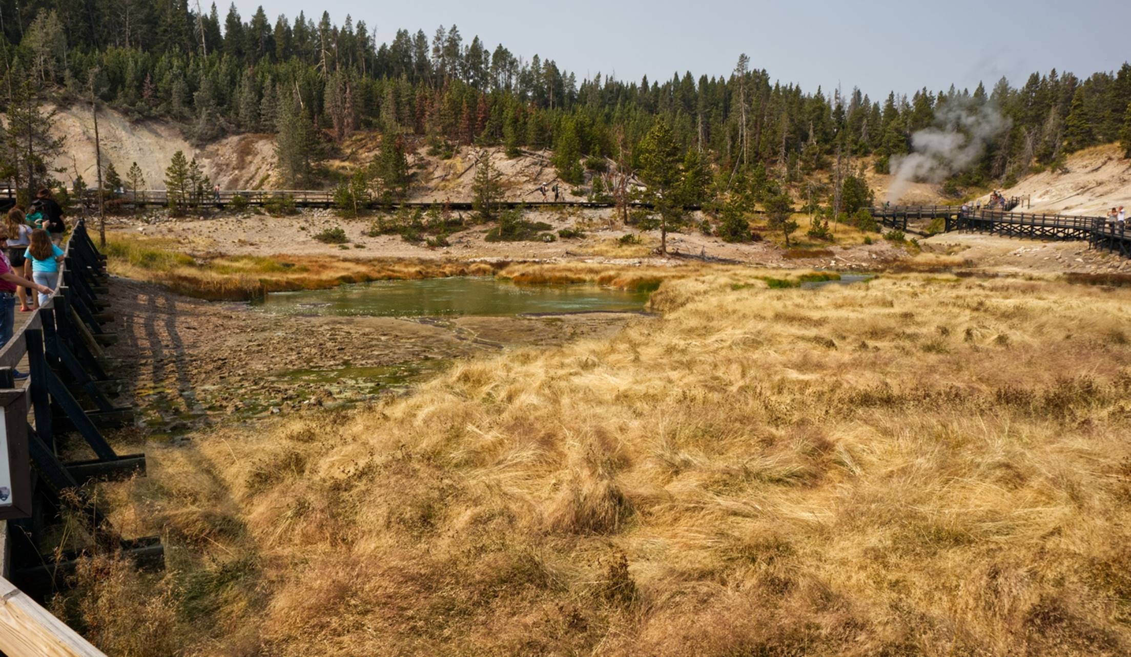
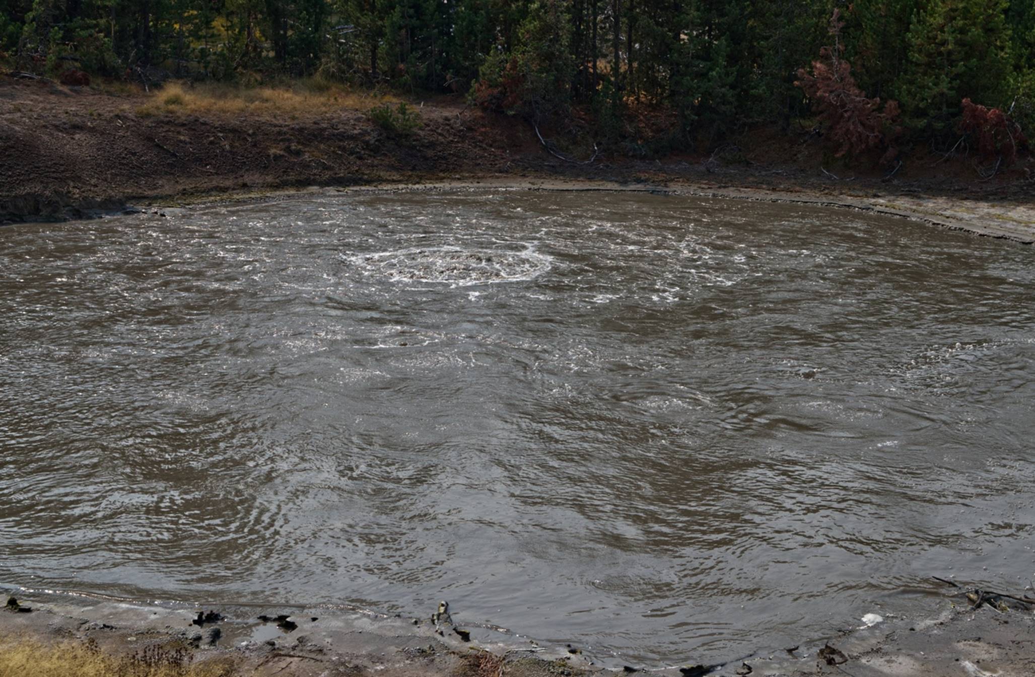
The first significant place to stop was the Grant Village and its Visitor’s Center. Here we discovered something that was to be true through most of our trip. All Information Centers or other park facilities were closed, including all park restaurants and lodging that we saw. On the other hand, it appeared that any privately run facility that was selling something was open. Since there was not much to see here at Grant Village, we continued just a couple of miles to the West Thumb Geyser Basin. (So called because it sat alongside a bay or “thumb” on the west side of Yellowstone Lake.) You can see the “West Thumb” in this video of a steam vent at the edge of the lake. This was the first of a lot of areas with thermal activity that we were to see.
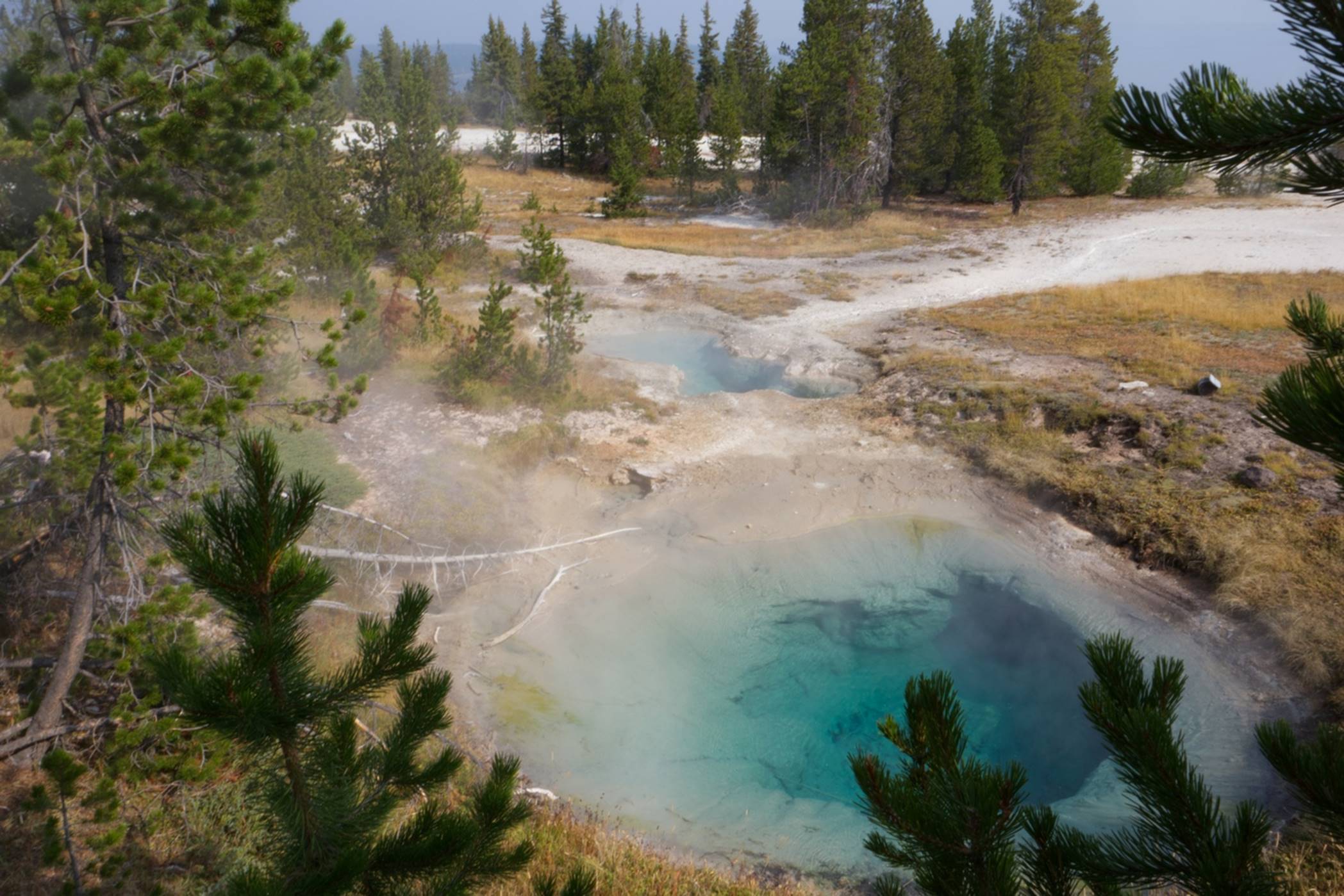
Steam above a small
pond
This area was rather spread out, with boardwalks above the ground and many warnings to not stray off the boardwalks and marked trails. The water in the small ponds was clear and obviously warm.
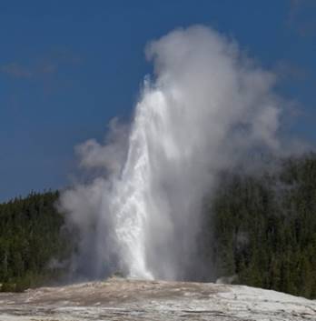
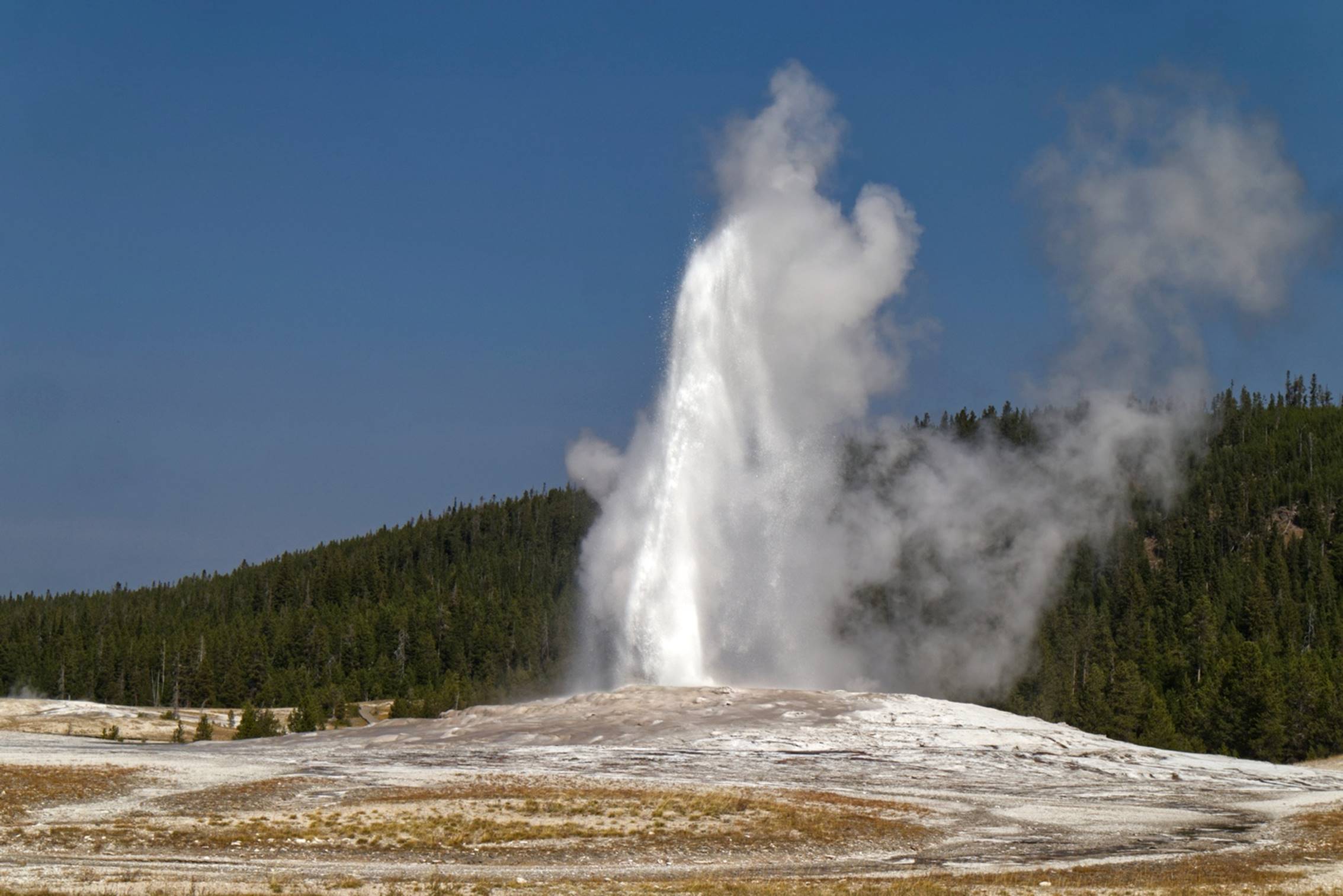
At our next stop, Old Faithful, we turned out to be very lucky. We arrived in the Old Faithful viewing and education center and took the first parking place we could find, as most of the spaces appeared to be taken. We walked where most of the people seemed to be headed and it led us to the viewing area. We had no idea when Old Faithful was scheduled to erupt, but it turned out to be very soon. There were quite a few people in the viewing area and, again, I wondered what this would be like during peak season of a normal year. We only waited about 5 minutes when Old Faithful was true to her name and started erupting.
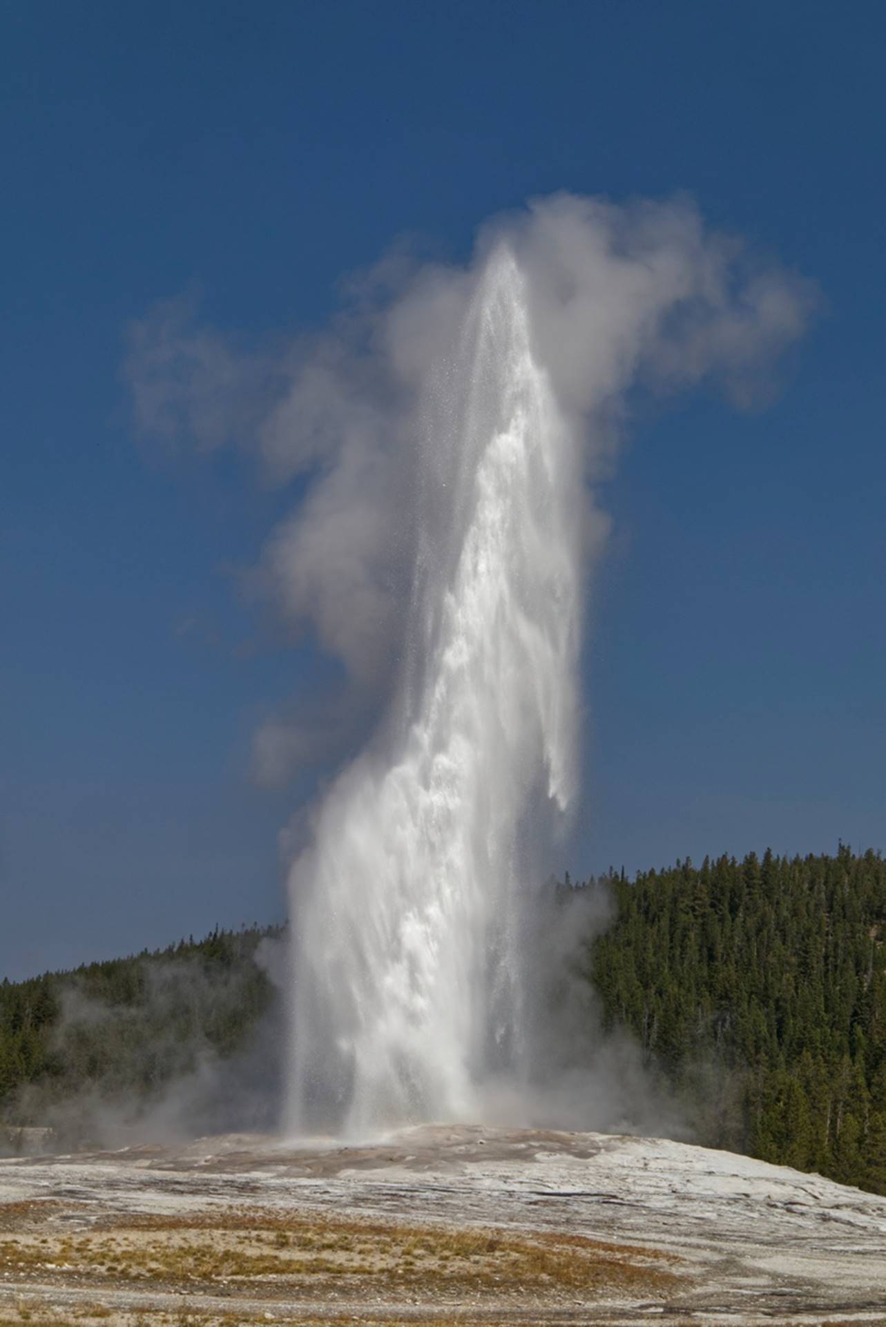
Old Faithful
I have to apologize for my video of Old Faithful. I had been taking photos in portrait (vertical) mode and forgot to change back to landscape (horizontal) mode for the video. But, if you turn your head sidewise, it still looks impressive.
Old Faithful
We found that Old Faithful erupts an average of every 94 minutes, but with a variation of plus or minus 10 minutes. Purely by accident, we had timed our arrival almost perfectly.
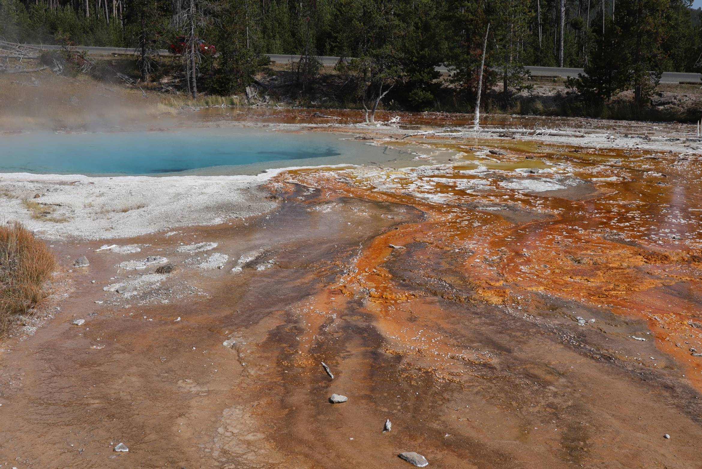
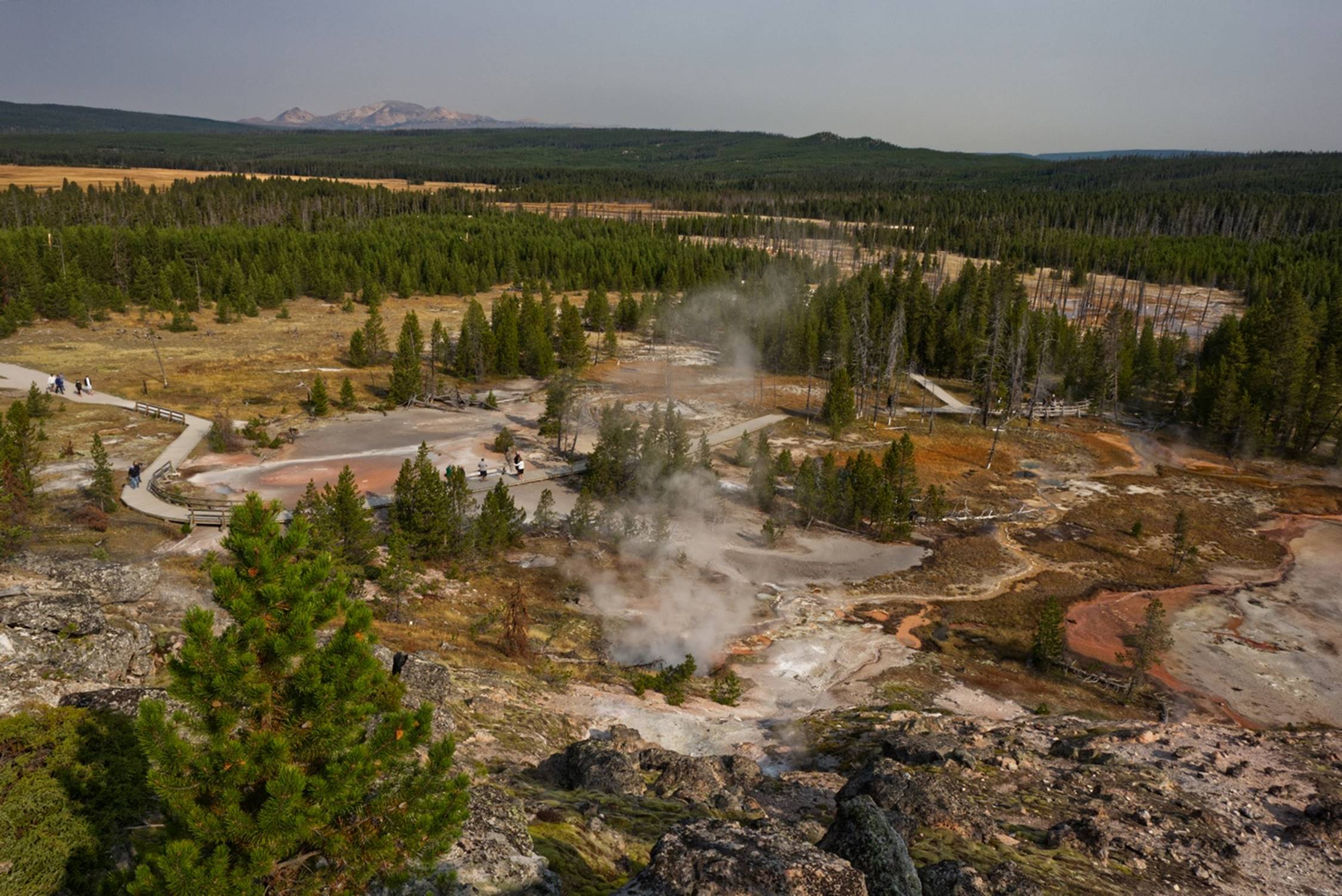
The next stop along the way was the Midway Geyser Basin which included the Grand Prismatic Spring.
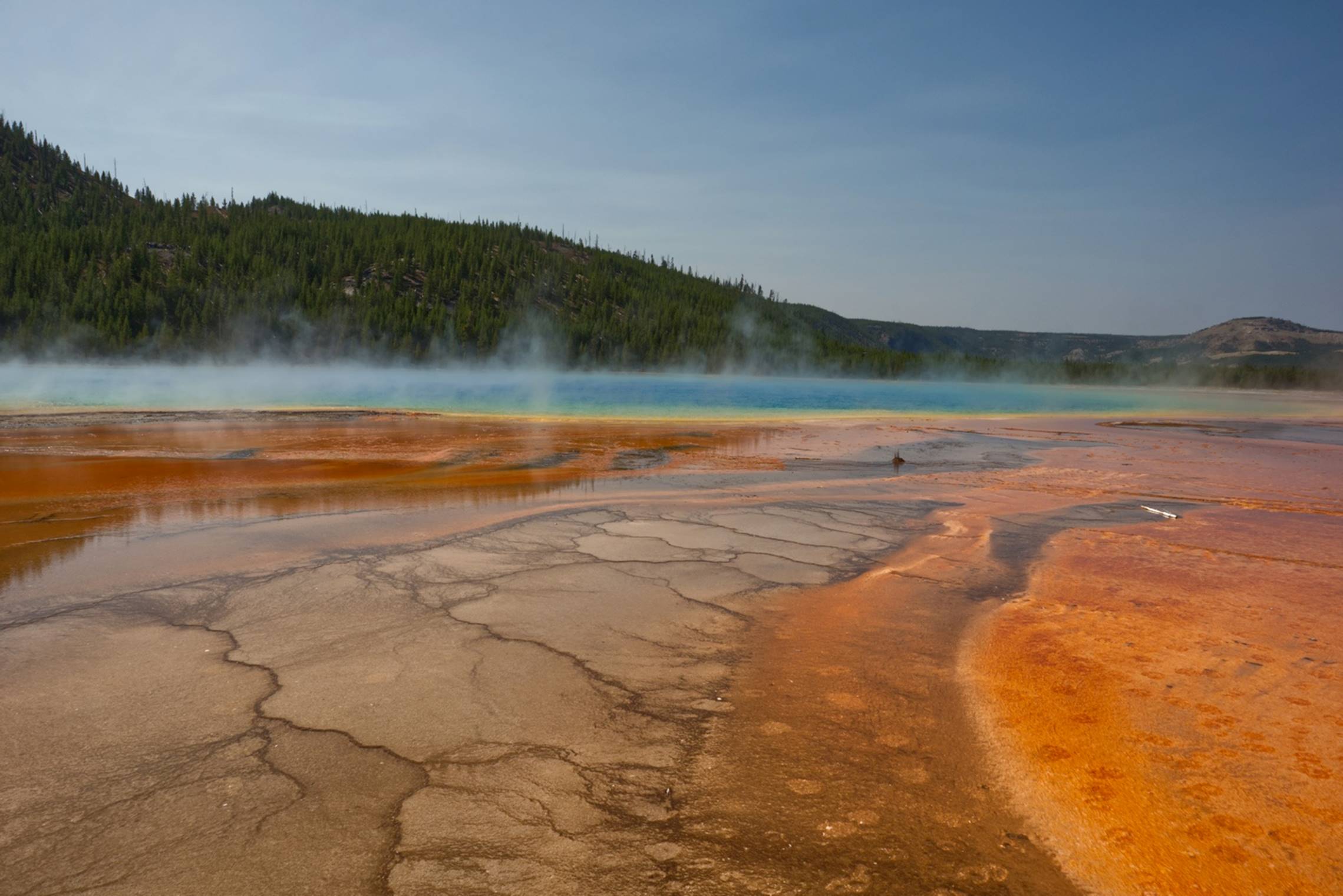
Some of the vivid
colors of the Grand Prismatic Spring
Each of the areas we visited throughout our trip included information panels/signs with educational and interesting facts about what we were looking at. Here at the Grand Prismatic Spring, the colors are actually millions of microscopic organisms that thrive in the hot and mineral rich environment of the spring. There were no geysers or bubbling springs here, but the low boardwalk, with no side rails to spoil the view, provided an excellent viewing platform, as you can see in this video of the spring. The colors were rather intense and, during our couple of days in the park, we saw other springs with bright colors of varying hues.
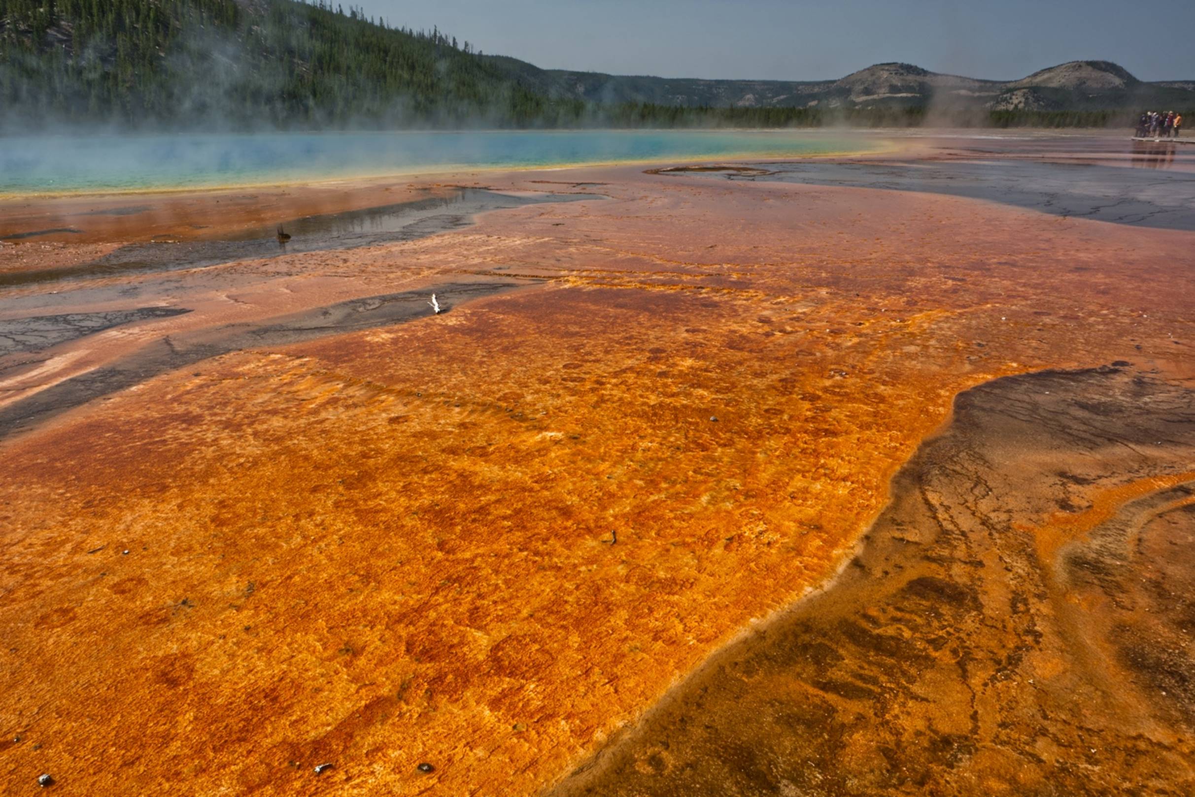
Another view of the
colorful Prismatic Spring
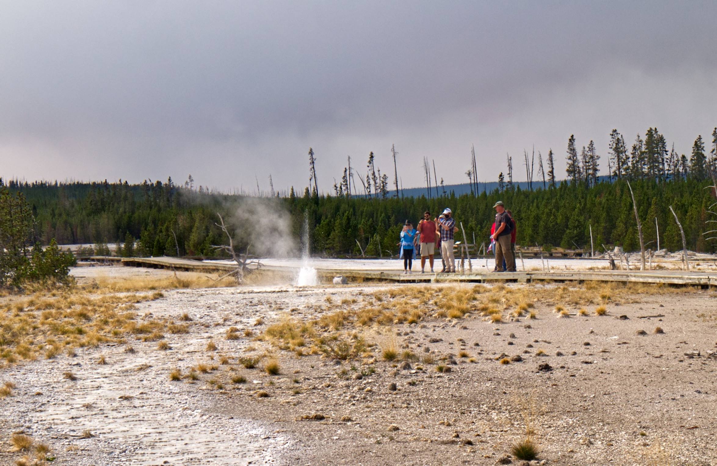
Our next stop, just a couple of miles up the road, was the Lower Geyser Basin with the Great Fountain Geyser. This area of thermal activity included a spring with more of the colorful microbes, also referred to as thermophiles.
Colorful
thermophiles around the Great Fountain Geyser.
The Great Fountain Geyser was not nearly as big or impressive as Old Faithful, and it only erupts about every 9 to 15 hours, but again, we were lucky as it was erupting the entire time we were at the area. This geyser comes up out of a series of small pools of water and, if you look close at this video, you can see the water boiling in these other pools. Several times we saw a very small geyser coming out of one of these pools. This geyser normally reaches a height of 75 to 200 feet, but the day we were there it was probably in the lower part of that range.
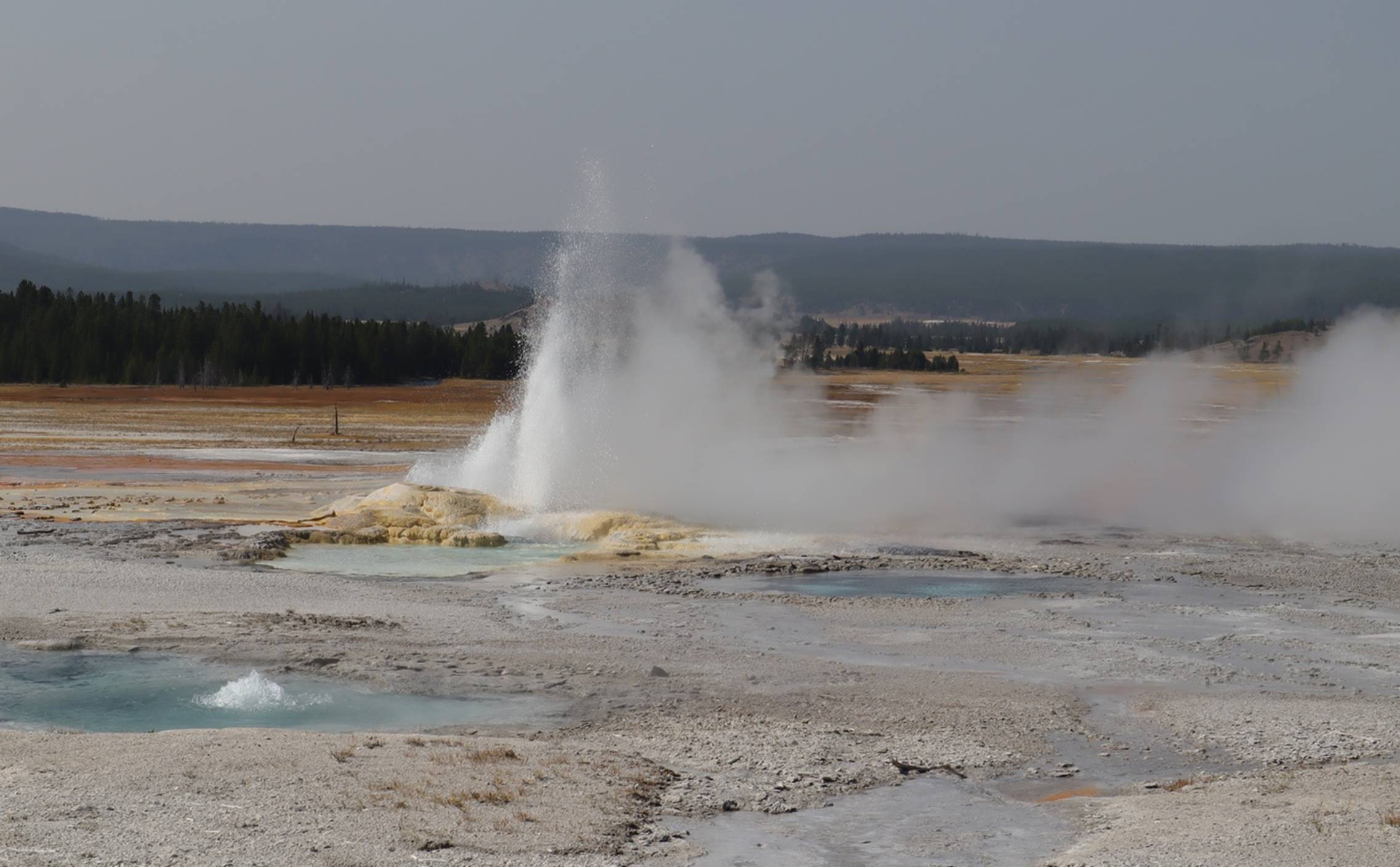
The Great Fountain
Geyser itself
By this time, we had seen about enough sights for the day, so we headed toward the West Entrance to Yellowstone and the town of West Yellowstone and checked into the Holiday Inn there. This Holiday Inn had a restaurant attached to it, but the restaurant was closed because of the COVID-19 impact. We decided to walk two or three blocks to the “Wild West Pizzeria and Saloon”. It turned out to be rather busy and an “interesting” place, but both the pizza and local dark beer were excellent. Half of the pizza returned with us to the hotel room for dinner the next night.
Day 3 –
Tuesday: Yellowstone Park
Since the Holiday Inn did not have a restaurant open, they handed out “breakfast bags” which included a bottle of water and a breakfast bar. The room also had a coffee maker. We took one look at the breakfast bar, decided to keep it for a snack later, and walked down the street to restaurant that was open. It was about 8:00 and we had to wait about 10 minutes for a table as the restaurant (The Three Bears restaurant) had reduced capacity to provide some social distancing. We had simple pancakes and coffee and that worked well for us.
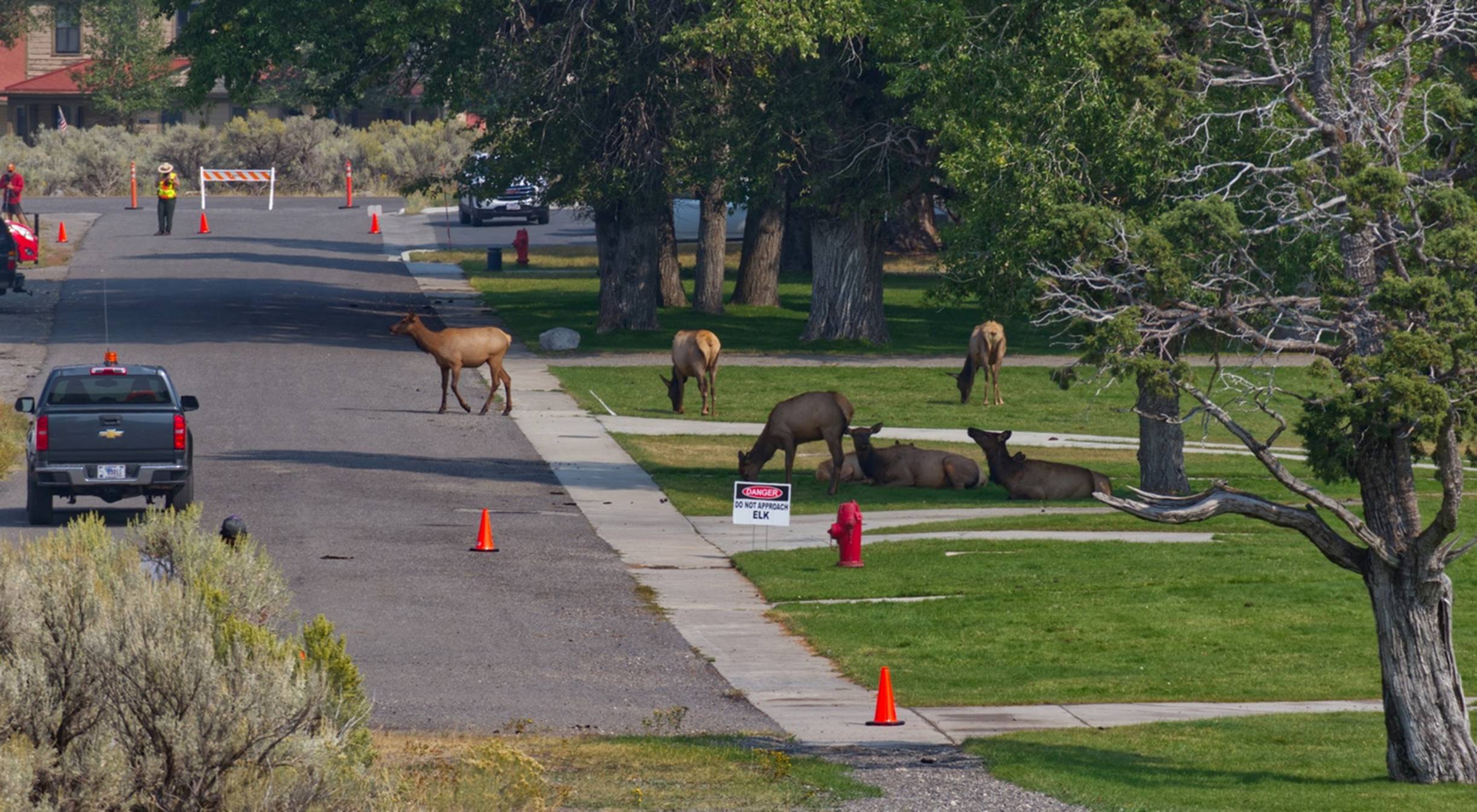
Today we planned to drive into the park and head to the northern areas, up to Mammoth Springs. We headed into the park and had entered before 9:00, although there was a bit of a line at the entrance station. We had driven about 4 or 5 miles when the traffic slowed to a crawl. We crawled for about 10 minutes and I assumed that there was some kind of wildlife ahead that everyone was looking at. As we approached a bridge, we saw the reason for the slowdown: a bison peacefully ambling down the side of the road.
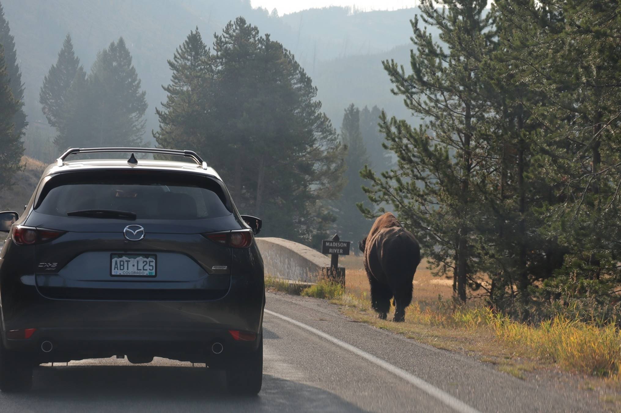
Bison alongside the
road
Purely by coincidence, we got to the bridge the same time as the bison, and he nonchalantly moved onto the road, walking immediately in front of us.
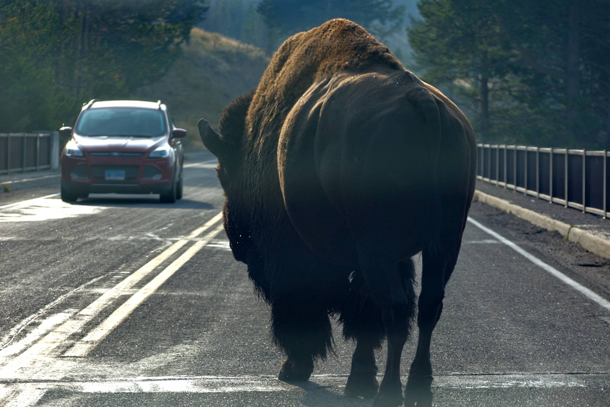
Bison in front
Please excuse the poor quality of the photo above as it was taken through the windshield of our car as was this video showing the bison just ambling across the bridge. After crossing the bridge, the bison strolled off the road and continued on his way as if he did this every day.
Just a mile or two further along the road, the traffic slowed again and we soon saw a large field with a herd of Elk grazing and resting.
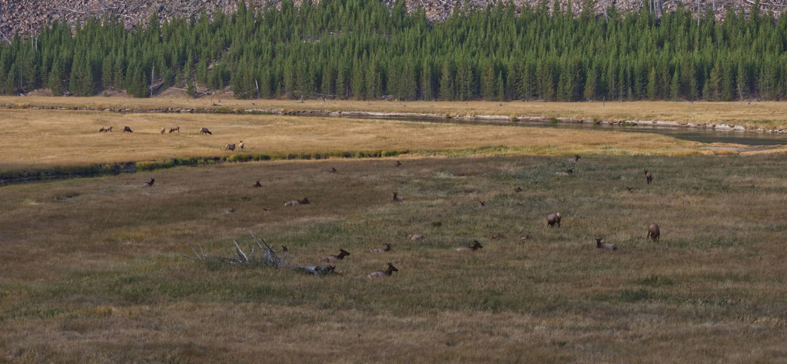
Elk in field
I could only find one bull in the large group of cows in the field. See if you can find that bull in the photo above. The animals here seem to be very accustomed to people gathering and watching them as they really paid us no attention.
A short distance further on there were two bison grazing in a field, so we had to stop and get a photo of them also.
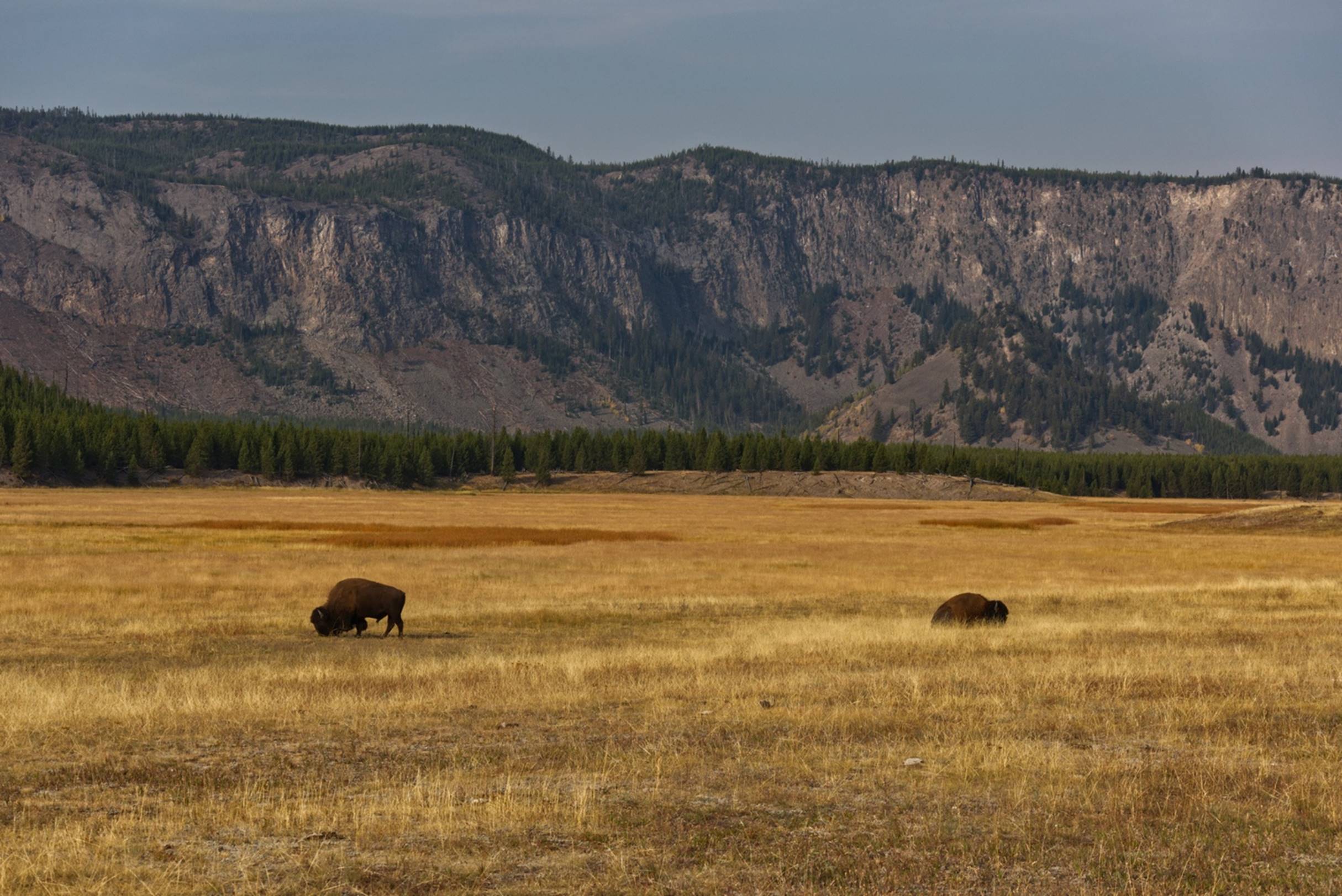
Two Bison in field
The next stopping point was a viewing area for the Gibbon Falls. There are several rivers within the park, but they seem to flow into each other and change names frequently for no apparent reason.
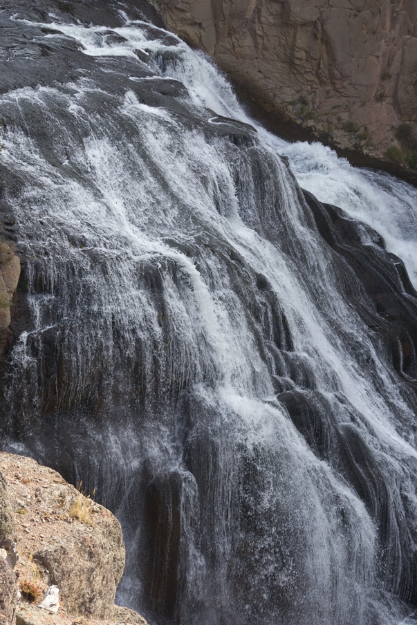
Gibbon Falls
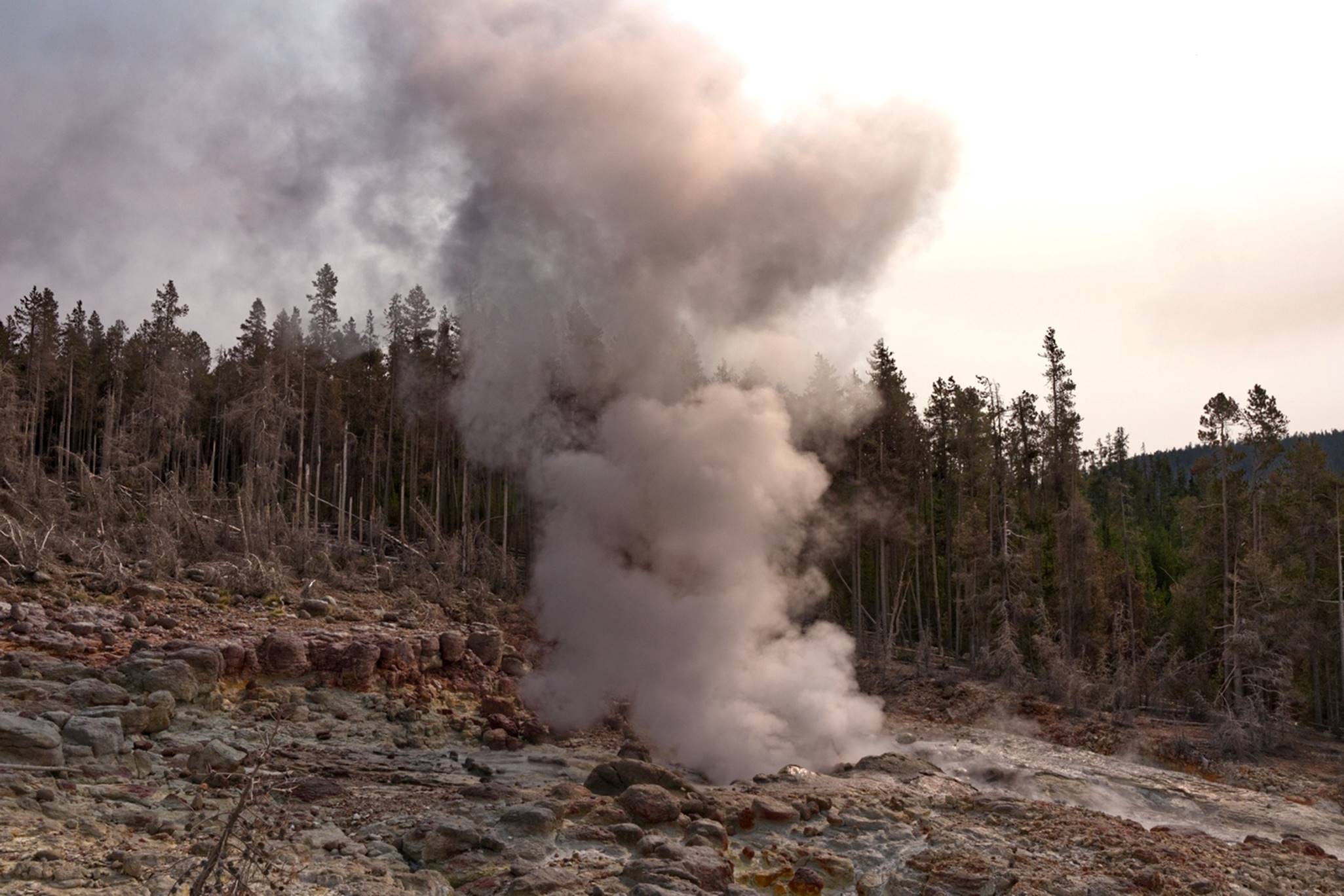
A little further along, there is a steam vent and spring right alongside the road named Beryl Spring. There was only a small area for stopping and parking, but we stopped long enough to investigate and take a few photos.
Beryl Spring steam
vent
This video of the Beryl spring may give you a better idea of the power of the steam.
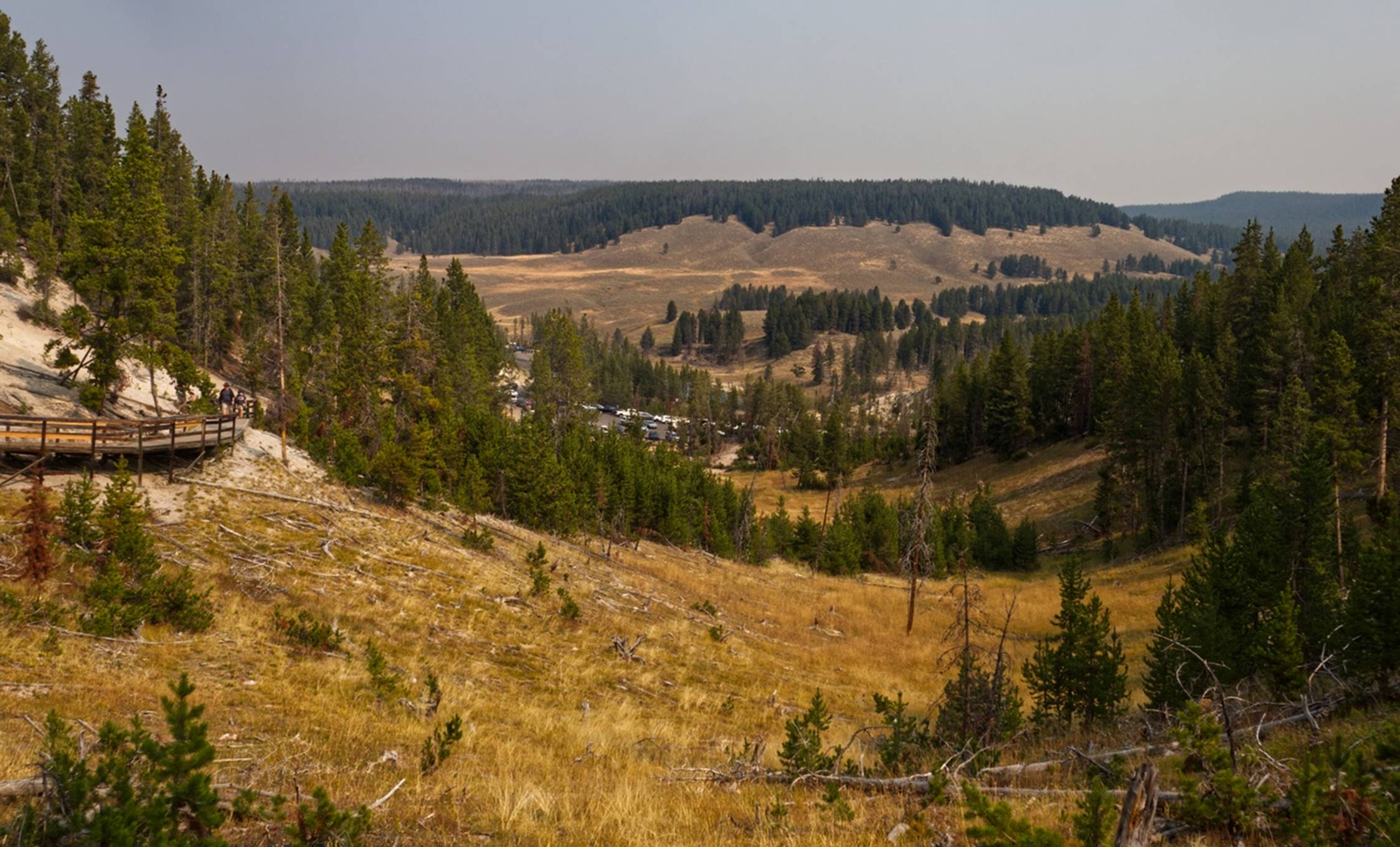
The next stop along the way was at the “Artists Paint Pots”. Places where the steam bubbles up through mud are referred to as “Paint Pots” (for reasons I don’t fully understand). There were several such formations in this area. One common sight at these areas of thermal activity were forests of dead trees. Apparently, the trees had grown and then the thermal activity shifted, making the area with the trees too hot and wet for them to survive, creating a forest of dead trees.
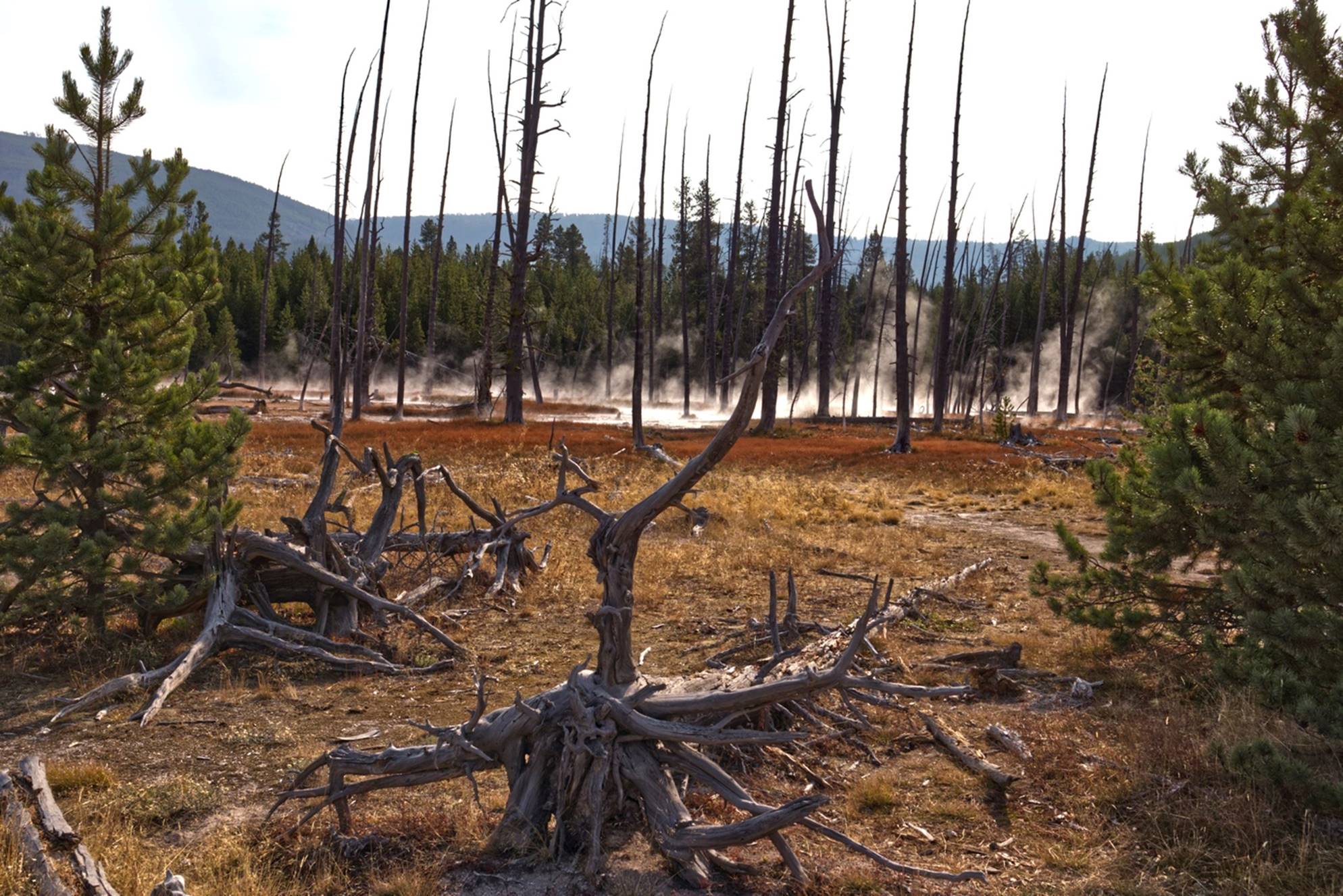
Dead Trees at
Artist Paint Pots
There was a fairly extensive boardwalk and trails that led around the thermal basin and up along a ridge where the paint pots were bubbling.
Looking across the
basin. You can see people up on the ridge.
Here is a video of the paint pots to give you an idea of what they look and sound like. Up on the boardwalk on the ridge, we had a nice view of the basin and distant mountains.
Looking across the
thermal basin toward some mountains
In a couple of places, you could actually stand in the path of the steam coming out of the vents. Thankfully, the steam is not all that hot, but it does smell like Sulphur. Although you cannot feel the warmth or smell the odor, here is a video to give you an idea what it looks like.
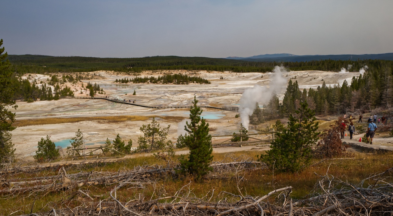
Just a short distance from the Artist Paint Pots is the Norris Geyser Basin, a large area of various thermal activity. There are two primary different paths with boardwalks, the Porcelain Basin and the Back Basin. The trail around the Back Basin was longer (1.5 mile) so we took that route. One of the first sights on this route was Steamboat Geyser, said to be the world’s highest Geyser (300 – 400 ft high) when it erupts. The problem is that it does not erupt very often. Apparently, it had erupted a couple of days prior to our visit, so there were several people gathered around Steamboat, waiting for it to erupt again.
A view of Steamboat
Geyser
You can hear some of the spectators discussing the geyser in this video. Unfortunately, Steamboat did not have a significant eruption while we were in the area. We continued around the path through the various thermal areas.
View of some of the
Back Basin area
Toward the end of the trail, we noticed a little geyser ahead that was erupting in spurts abut 10 – 15 feet into the air. It seemed to be going continuously, so we did not hurry to get to it for photos. Just as we got to the little geyser and I was pulling out my camera, it stopped! We waited around several minutes, hoping it would resume, but not much happened, so we walked away. When we had gotten about 100 feet away, it started erupting again!
Small geyser
erupting
I was sure that if I walked back closer to the geyser, it would stop, but finally I gave in and headed back: it kept erupting. As you can see in this video, it was a cute little geyser.
Now for something a little strange: as we were standing at an overlook of both basins, someone walked up and asked Susan if we did not live in Somerset subdivision (which we do). It turns out that the wife and husband also live in Somerset and recognized us from our frequent walks and bike rides by their house. Sometimes it is a very small world.
Overlook of Norris
Basin where we met our neighbors
By now it was lunch time and it was time to find a picnic table for the lunch we had brought with us. Within the park there were numerous picnic tables and we usually had no problems finding one.
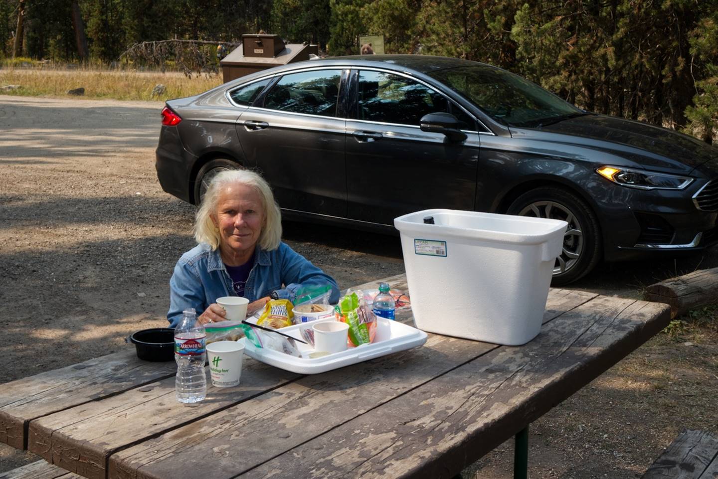
Susan at picnic
table
Most days we had picnics like this, eating leftovers from dinners and some of the cheese, crackers, carrots, and apples we had accumulated. (Don’t tell the park service, but we also usually had a bottle of wine with us.)
After lunch we decided that we needed to get moving and head on to the Mammoth Springs if we were going to finish our day’s tour at a reasonable time. Mammoth Spring is interesting in that there was a hot spring and possibly a geyser that over time formed a almost perfectly flat plateau. As the hot water boiled up with lots of dissolved minerals, it flowed onto the plateau and, as the water cooled, the minerals were deposited in various patterns.
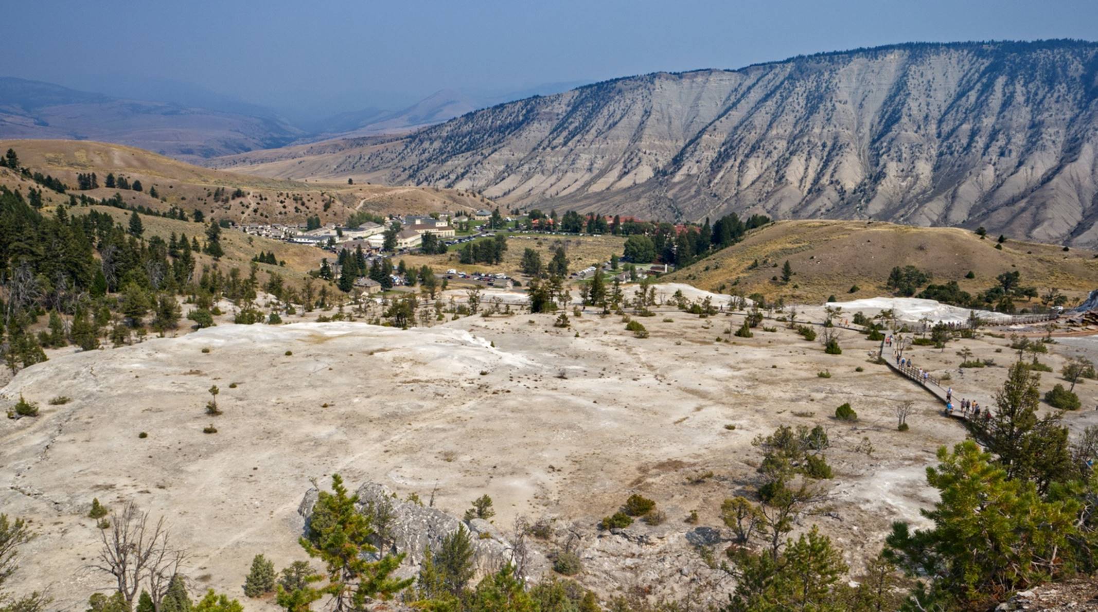
Upper Plateau with
Mammoth Springs town and fort in background
We stopped first on the upper plateau for a look around and also to see the small town and Fort Yellowstone, a former Army fort and now the official headquarters of of the National Park. We could see that the upper plateau was almost perfectly flat, like it had been graded smooth by giant earth moving equipment.
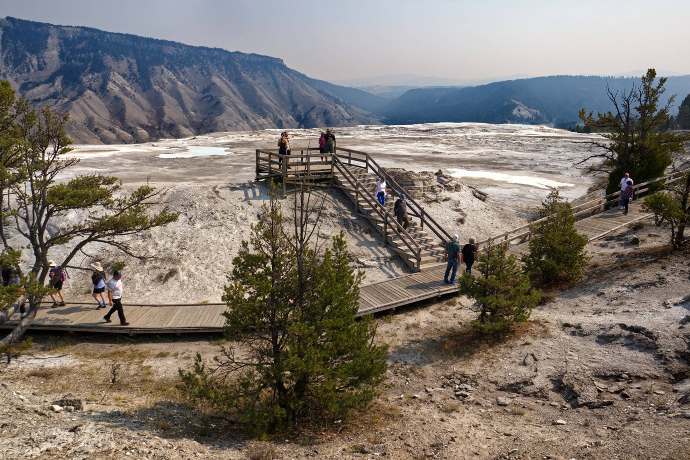
More of the upper
plateau and viewing platform
We then drove down to the lower level and found a parking place and headed back to see where the minerals had been deposited downhill from the upper plateau. One of the first formations was a strange rock, named the Liberty Cap. It was thought to have been formed by the action of a hot spring, although I’m not sure exactly how.
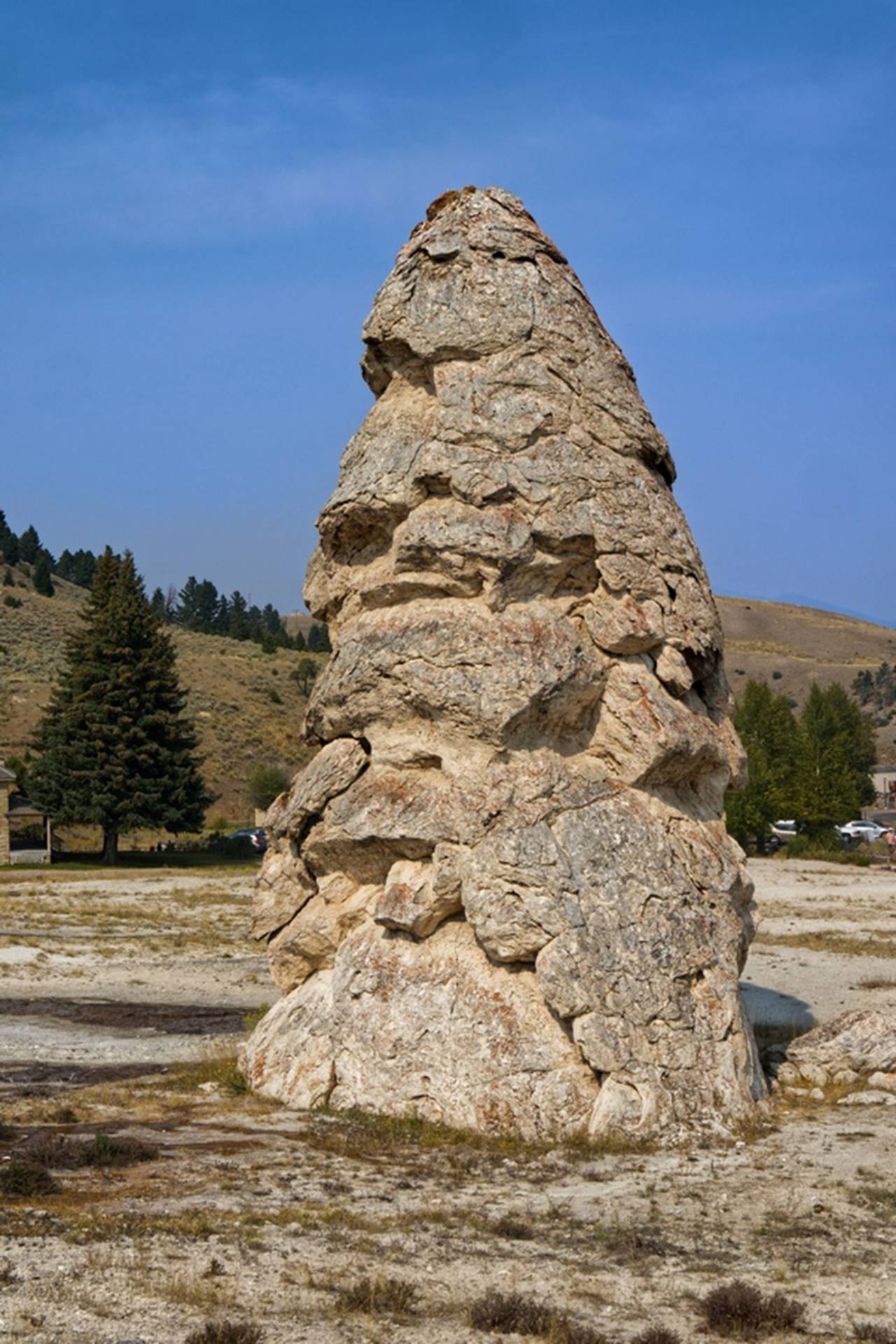
The Liberty Cap
Walking a little further, we could see here different minerals had been deposited at different times, making rather unusual patterns.
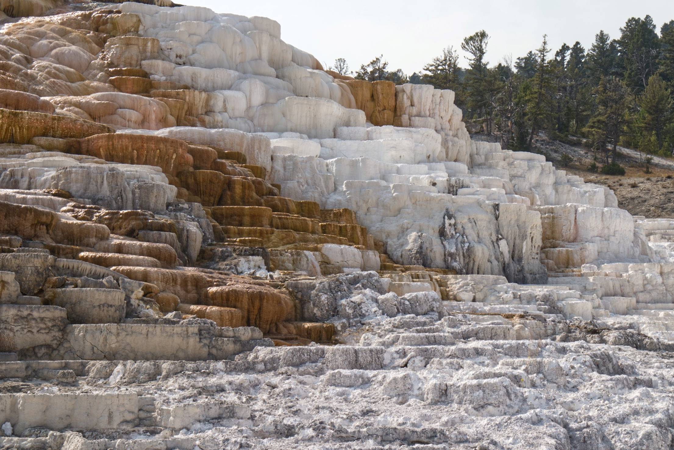
Multiple types and
colors of minerals
As is frequently the case, this colorful formation is even more impressive when seen as a video. We looked around this area for a while then headed back to the car, but on the way, we noticed people looking at what appeared to be a residential area on the other side of the road. A closer look revealed the presence of a heard of elk right in the residential area.
Elk in the yards of
homes
We walked a little closer and noticed a number of cows (the Elk type of cows) in a field close to the homes and they seemed to be heading, in general, to the left.
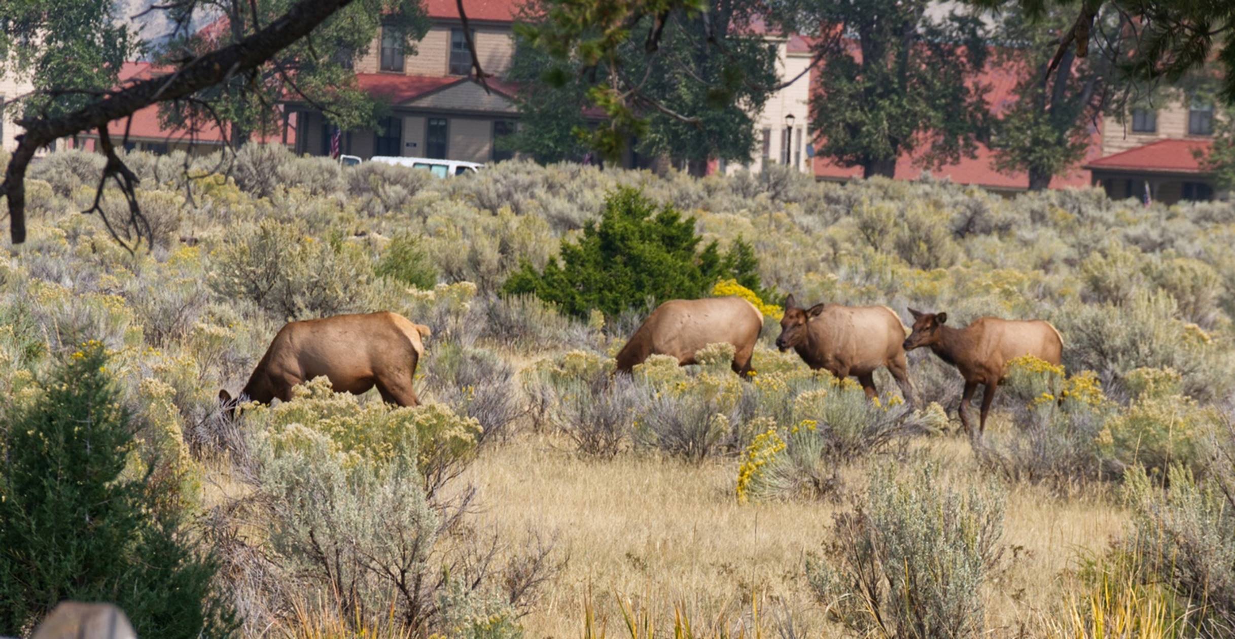
Elk cows in the
field
I finally spotted the bull of the heard in some tall grass in the field. He was laying down but if you watch toward the end of this video, you will see him lift his head and his impressive rack of antlers.
By now it was mid-afternoon and we had a pretty good drive back to the hotel, so we headed out, retracing our steps from earlier in the day. We were glad that we got a fairly early start that morning as the park had gotten busier as the day went on. We returned to the Holiday Inn and rested for a while before having a dinner of leftover pizza and other snacks we had collected (and a glass of wine).
Day 4 –
Wednesday: Yellowstone and on to Cody, WY
Today our objective was to tour the central part of Yellowstone Park, then head out the eastern entrance to the park and stop for the night at Cody, Wyoming. This morning we walked down the street to a smaller restaurant than the previous day. The service was very friendly and, since the temperature outside was brisk, oatmeal sounded good to both of us. The oatmeal came with appropriate “fixings” and was very good: an excellent way to start the day.
We checked out of the Holiday Inn and headed back into the park. About 40 minutes after entering the park, there was a side road, paralleling the main road, identified as the “Virginia Cascade”. Expecting to find a series of small waterfalls, we took the little one lane road that continued for about 3 miles before rejoining the main road. Although there was a small stream running alongside part of the road, we saw no sign of any cascades.
Along the “Virginia
Cascade” road, a nice view
We did see a couple of fishermen and when we stopped to enjoy the view just above, there were two young women stopped there and it appears as though one of them had just washed her hair, after wading in the stream in the photo. We did not ask any questions.
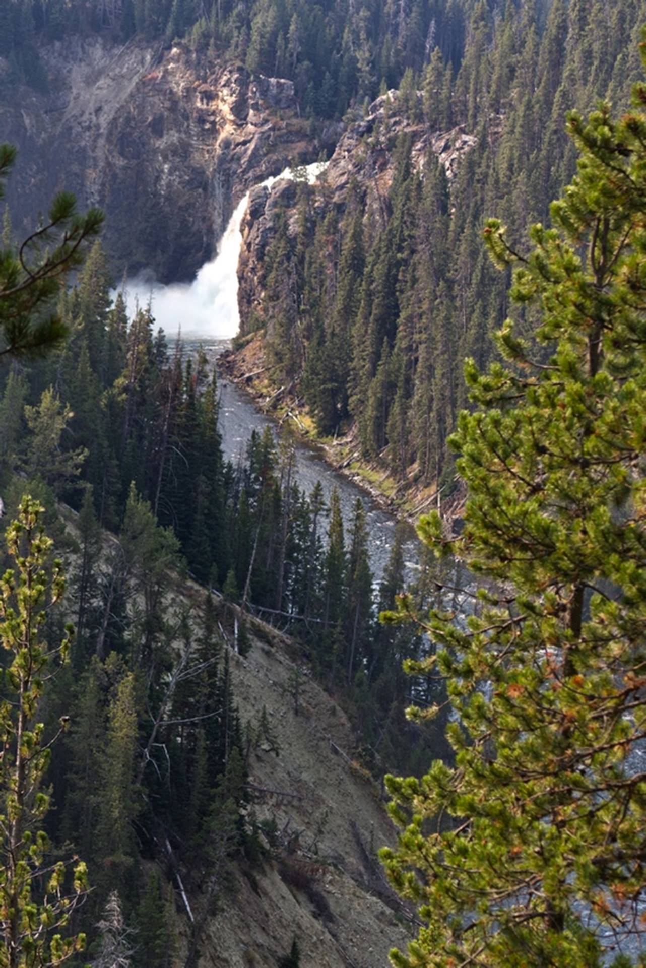
We continued on to the first major destination for the day, the Canyon Village area. As all other information centers we found, nothing was open except the stores selling things. The main attraction here was the “Grand Canyon of Yellowstone” and two nice waterfalls.
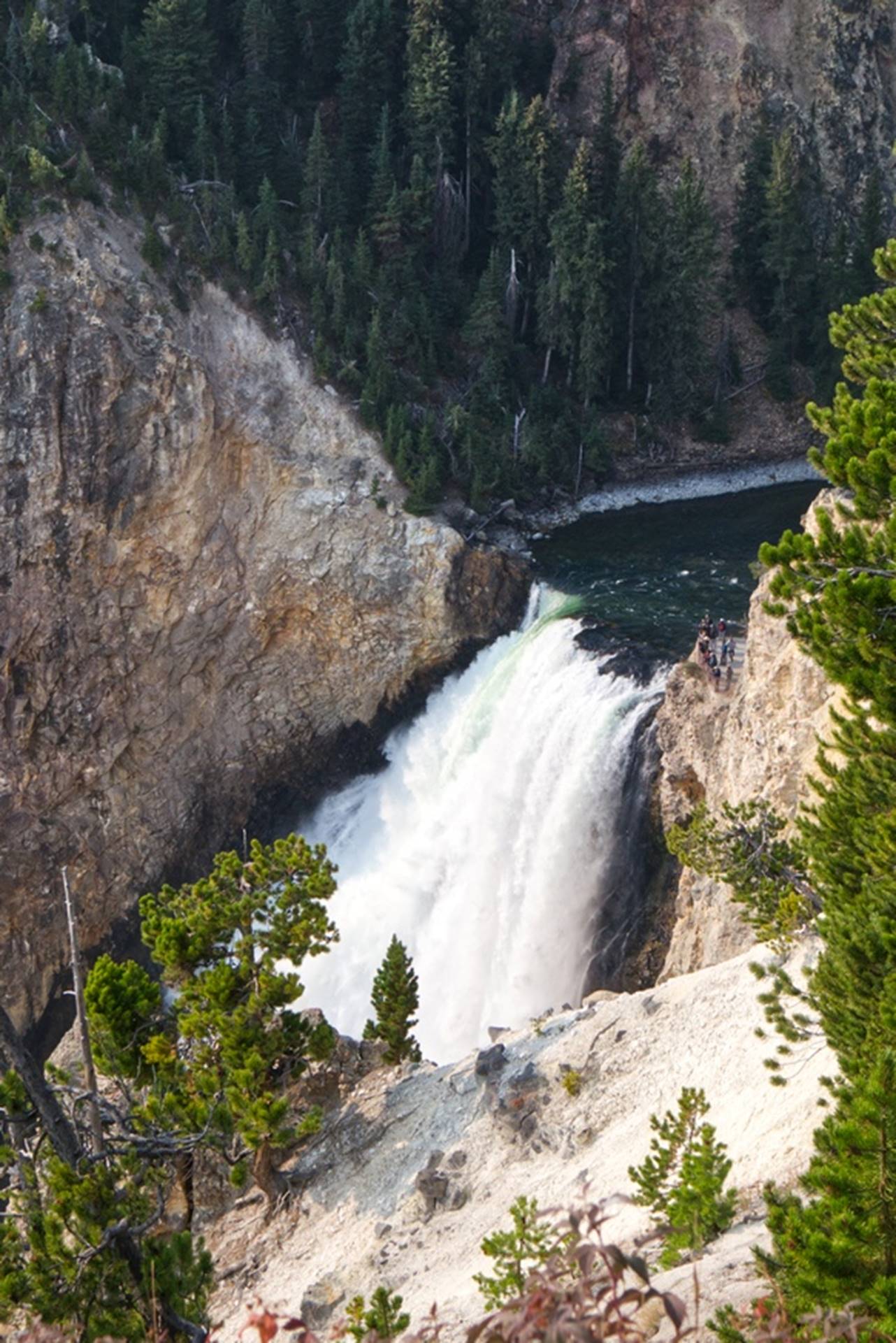
View of the lower
falls from overlook and parking area
The Yellowstone river had carved a valley or canyon through this area, and there were two major waterfalls called the “Upper Falls” (further up-river) and the “Lower Falls” (down-river). The view in the photo above is of the lower falls, which is the first one seen from the overlook area. In this video you can see the Lower Falls and the resulting canyon downstream. If you look closely at the video, you can see people on a viewing platform close to the falls: they reached this point by taking a trail covering about a half mile horizontally and 600 feet vertically. Well, we needed some exercise, so we headed down.
On the way down the trail, we had some good views of the Upper Falls, which we would get another look at later.
Upper falls as seen
from the trail to lower falls
Getting down to the bottom of the trail was relatively easy and, from there, we had a good view of the lower falls and the impressive canyon downstream.
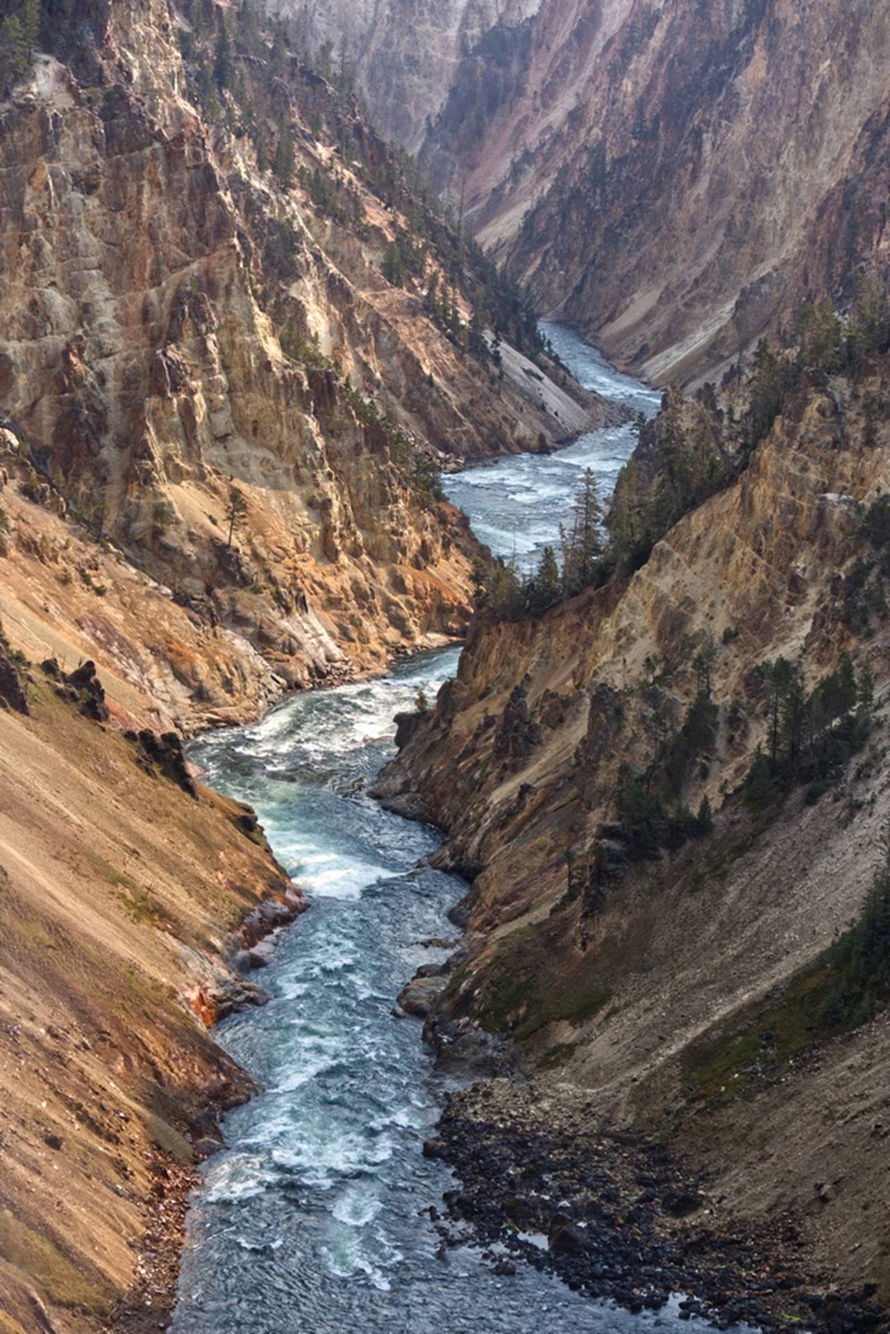
Canyon downstream
of the lower falls
Standing just a few feet from the lower falls was a bit intimidating with the noise and rushing water. This video of the lower falls will give you an idea, but nothing is quite like being there in person.
Now, it was time for that exercise, climbing back up that 600 foot trail at an elevation of about 9000 ft. We did pretty good: we didn’t even stop to rest on any of the multiple benches that were placed along the trail. Along the way there were some nice views of the river. (My stops on the way up were purely to take photos: I really did not need to stop and rest. That is my story and I’m sticking to it.)
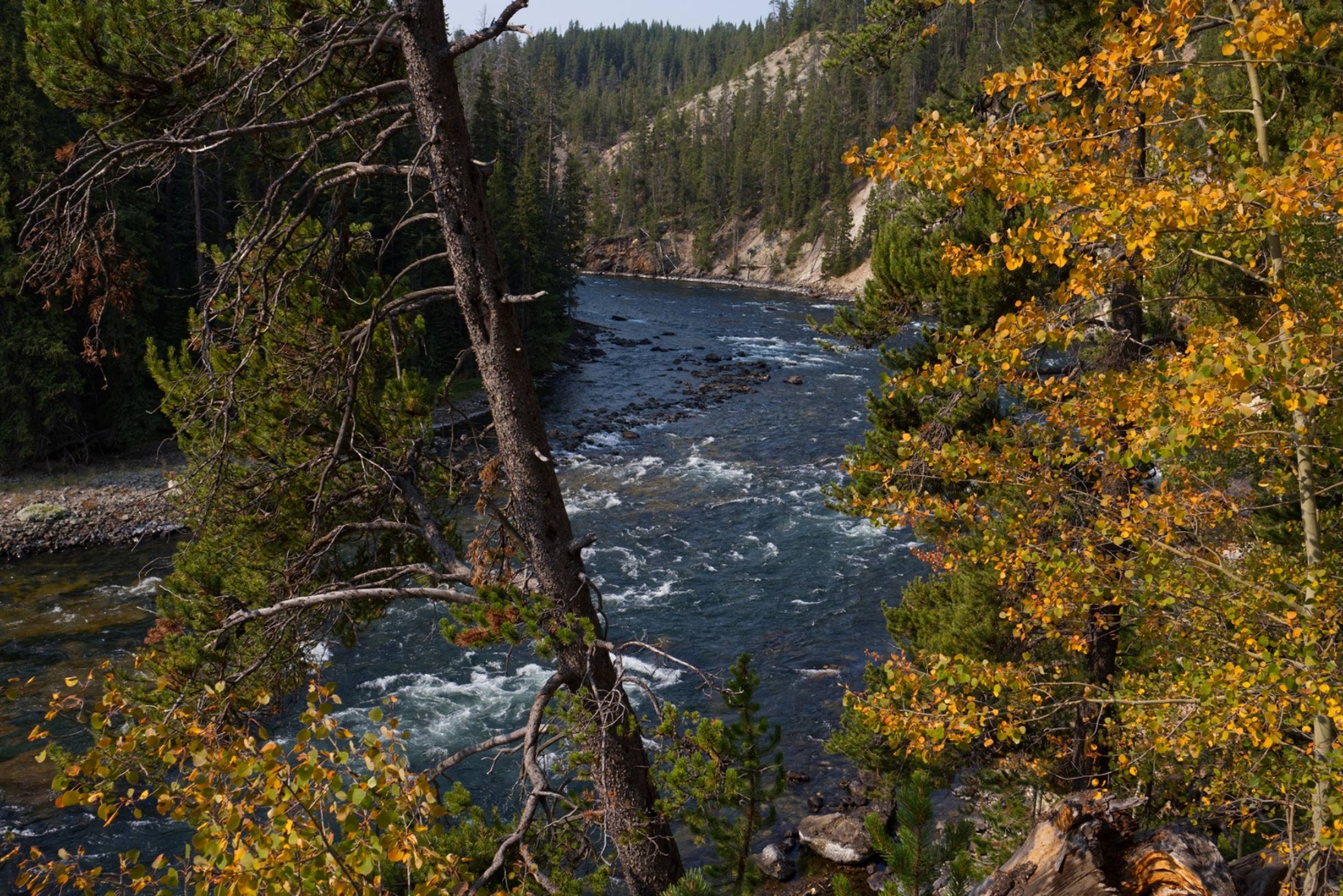
Upstream from the
lower falls
We did not realize it initially, but we had been viewing the falls and river from the “North Rim” of the canyon and there was another area to explore along the “South Rim”. We drove a short distance to the main South Rim parking area and started exploring from there. If anything, the views and scenery from here was more impressive than from the North Rim.
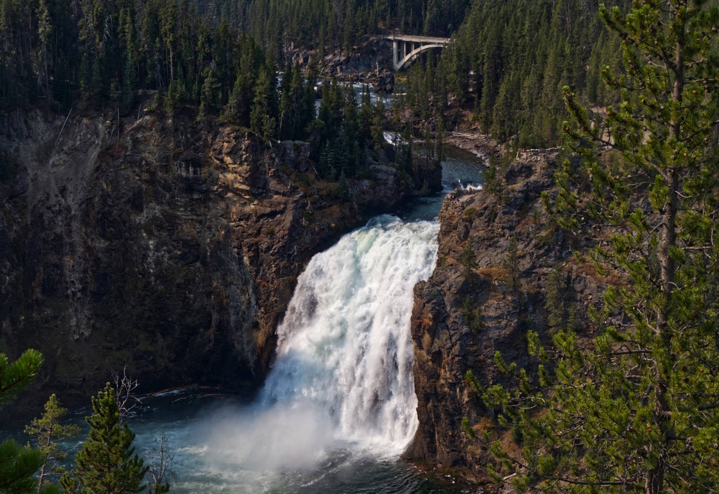
Upper Falls and
bridge, seen from South Rim
A video of the upper falls from the South Rim is also impressive. We drove further along the south rim to a viewing area called “Artist Point” and the views were certainly deserving of an artist. From here you got a good view of the upper falls and canyon. We stayed around here for a while looking at the canyon and falls (and getting lots more photos not seen here), then headed eastward again. It was getting to be about lunch time, so we found another picnic table and enjoyed our usual meal of cheese, sausage, crackers, apples, carrots and snack bars from the flights.
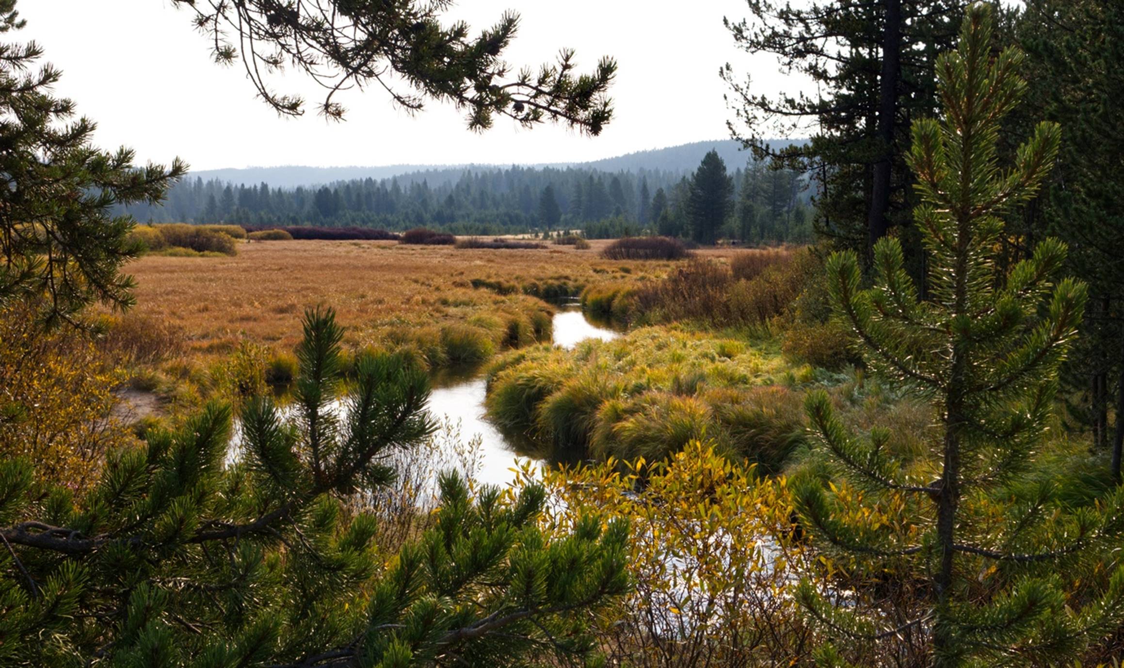
Part of the road went through the Lamar Valley, a wide grassy area of rolling terrain.
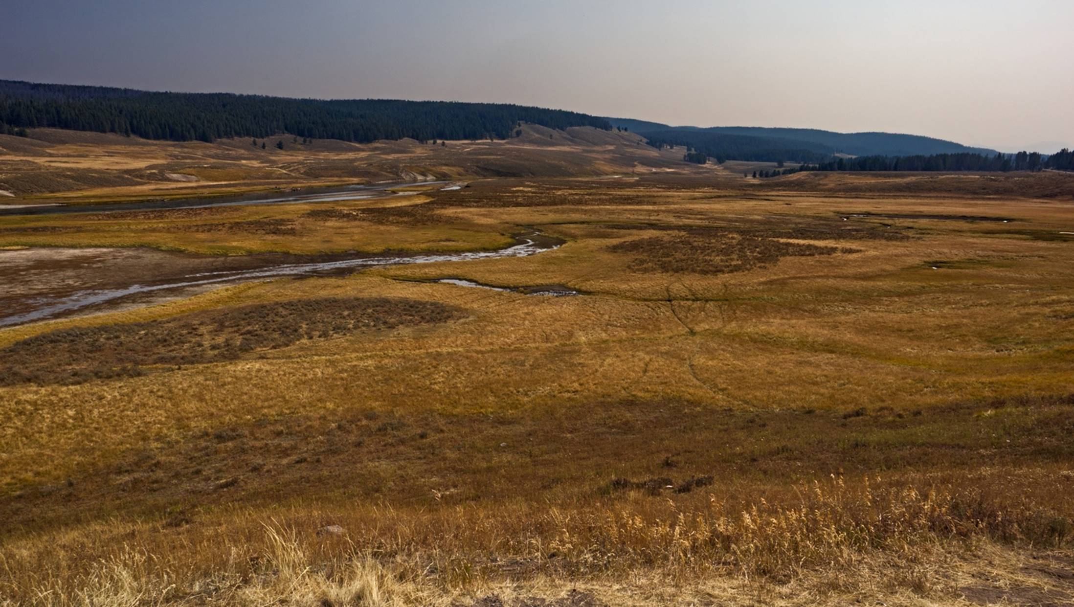
Lamar Valley’s
grassy plain
Some of the park information says the Gray Wolves that have been reintroduced like to hang out in this area during the winter. But, as hard as you want to look at this video of Lamar Valley, I don’t think you will see any wolves. (We never did either.)
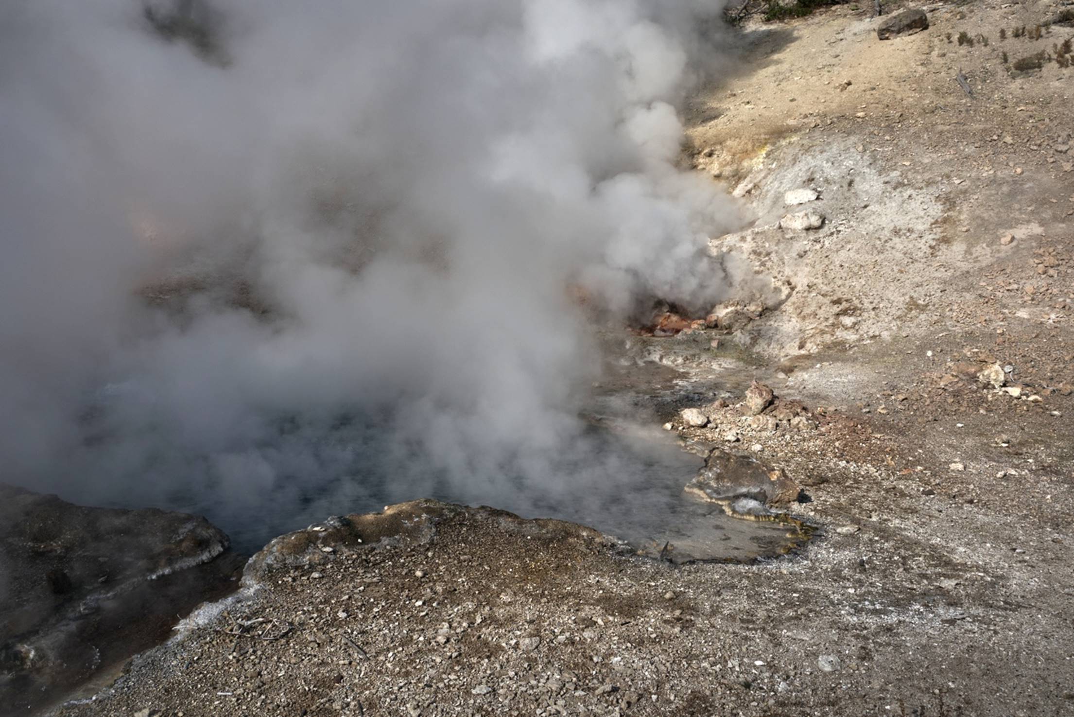
Off to one side of the Lamar Valley was another area of thermal activity. The first place we came to was called the Sulfur Caldron because of the strong Sulfur smell (Sulfur dioxide, actually) coming from the hot bubbling pool.
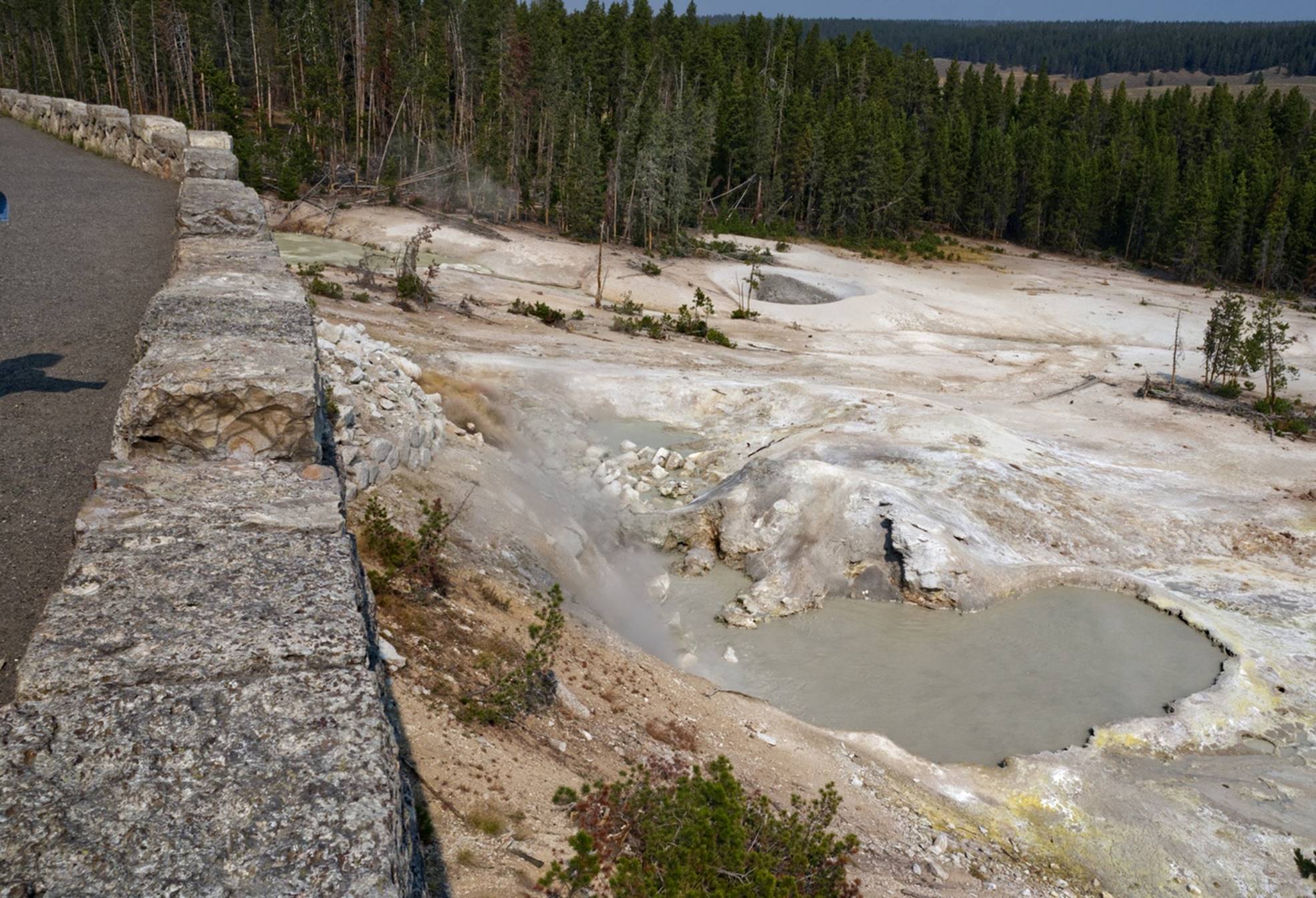
Too bad you cannot
smell the sulfur from the caldron.
Just a little further on was the “Mud Volcano Area”. As the name implies, this is an area with several rather muddy bubbling pools. There were really two areas here, a lower level with an easy boardwalk path and a couple of hot muddy pools, and a higher level that required walking up a pretty good hill to see.
The lower level of
the mud pools
The larger of the lower level mud pools definitely earned its name. We headed up the trail to the larger pools on the upper level. This boardwalk did give a nice view of the area, with part of the Lamar Valley in the distance.
Part of boardwalk
on left, parking lot below, and Lamar Valley in distance
On the upper level were several large pools, some active and some rather quiet. One of these was named “The Black Dragon” by a forest ranger, supposably because of its resemblance to a “dark demon of the backwoods”.
The Black Dragon is
relatively quiet these days.
The next pool along the boardwalk was just downhill from the Black Dragon but was somewhat more active.
On the way back down the hill we passed several other pools and an area of dead trees that had been killed when the hot water and steam had shifted locations,
The road in this area stayed fairly close to the Yellowstone river and at one point there was an overlook for the Yellowstone River Rapids. These rapids were not especially wild or large, but probably would be fun in a kayak. For us, it was just a pretty view.
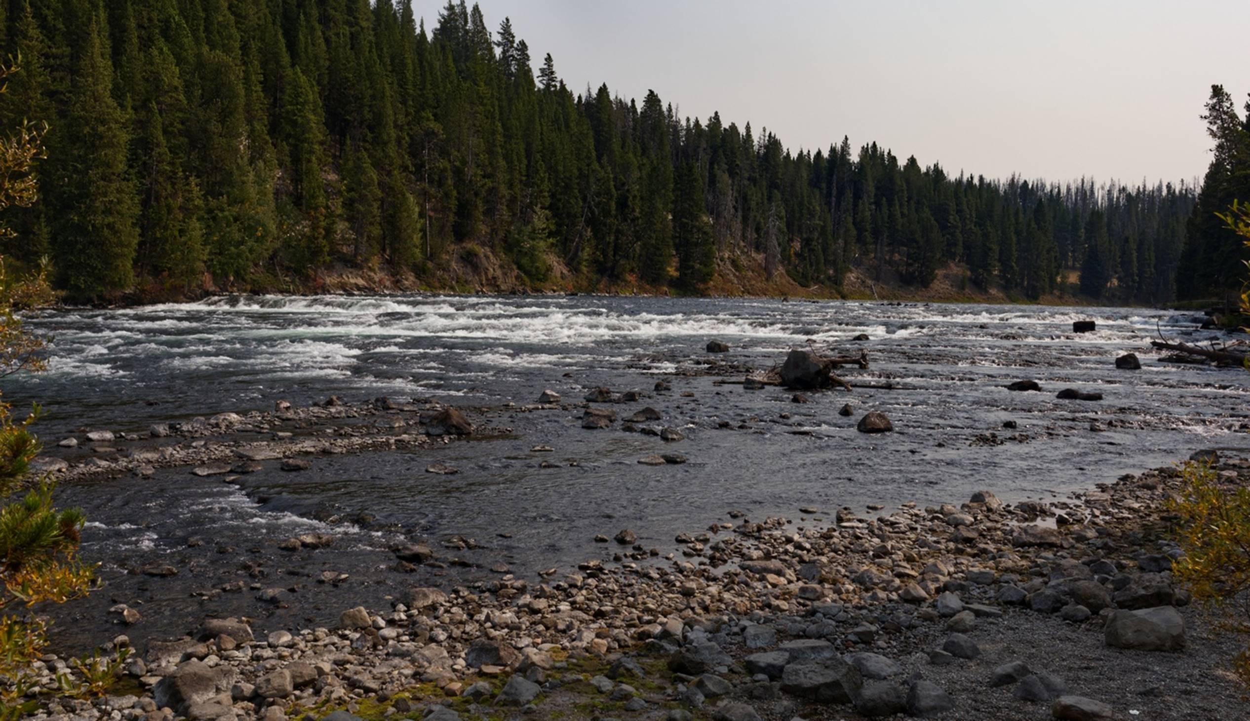
The Yellowstone
River Rapids
Shortly after this we passed out of Yellowstone park at the eastern entrance. We continued on a short distance to the town of Cody for the night. Our hotel, the “Cody Hotel” turned out to be very nice and the young man at the front desk gave us a couple of suggestions for dinner. His first suggestion was booked, but the 2nd suggestion, the Proud Cut Saloon, was a small restaurant in the middle of town and provided a couple of very good steaks. We also stopped at a Walmart and replenished our wine supply and a couple of other items.
Day 5 –
Thursday: Cody to Grand Rapids, SD
Today was primarily one of getting from one place (Cody, WY) to another (Rapid City, SD). We got the decent “breakfast bag” from the hotel, along with a cup of coffee and juice and enjoyed that in our room before packing up and leaving. It was rather smoky this morning, and the rising sun made for a very red circle in the eastern sky.
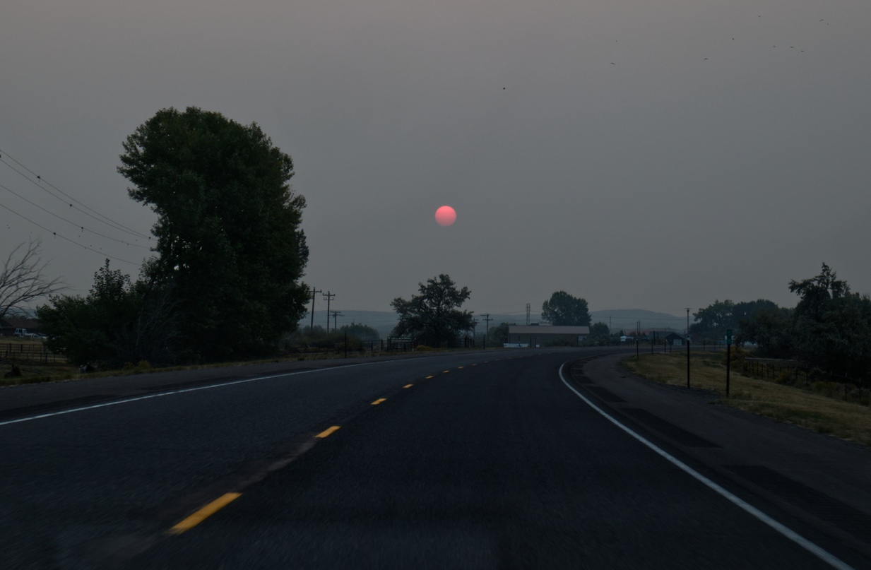
Rising smoky sun as we leave Cody.
As we drove, the rolling hills got steeper, and soon we were in some real mountains. The multiple layers of soil apparent in the cliffs suggested a geologist’s dream.
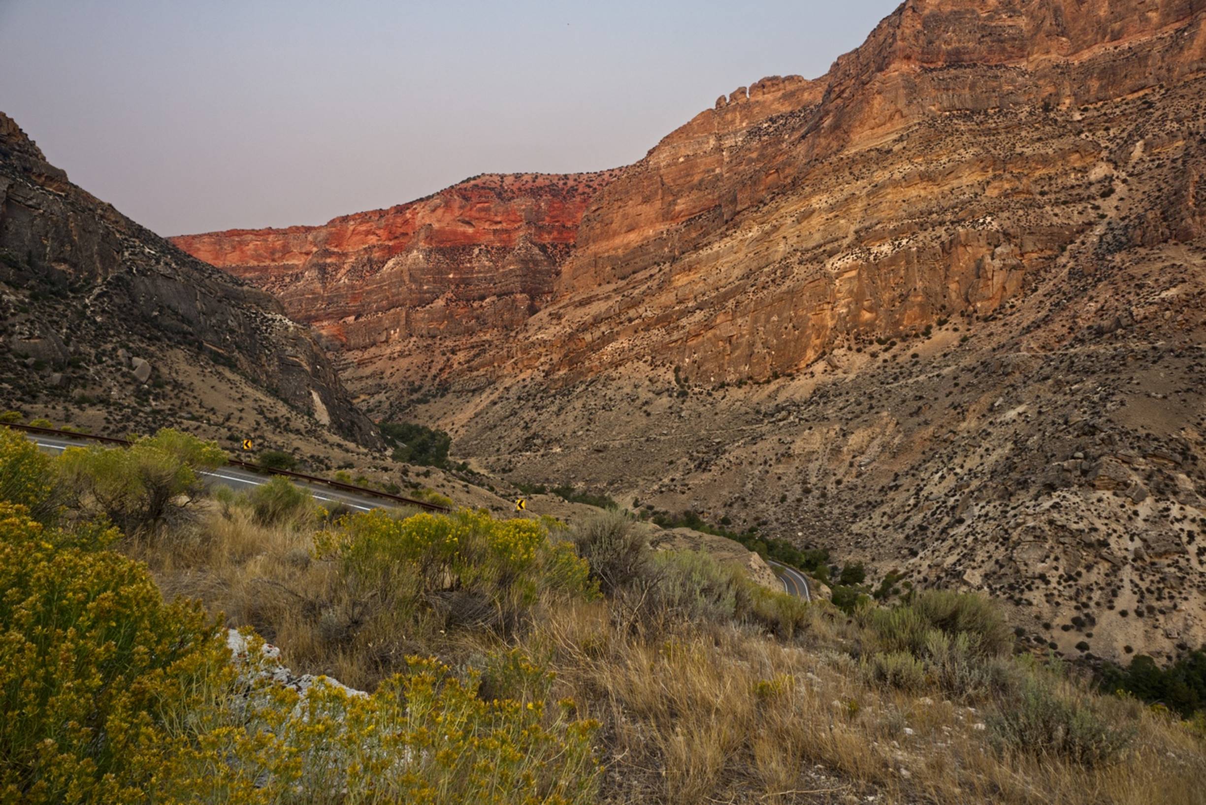
Multiple layers of
different colors in the cliff faces
This video,
taken from the same overlook as the above photo, may give you a little better
idea of the terrain in the area. About this time, we passed a biker (as
in bicycle, not motorcycle) climbing the hills: he had a long series of climbs
ahead of him.
The drive through the Bighorn Mountain Range was beautiful, but a bit tiring as the driver. The views continued to be very nice for an hour or so.
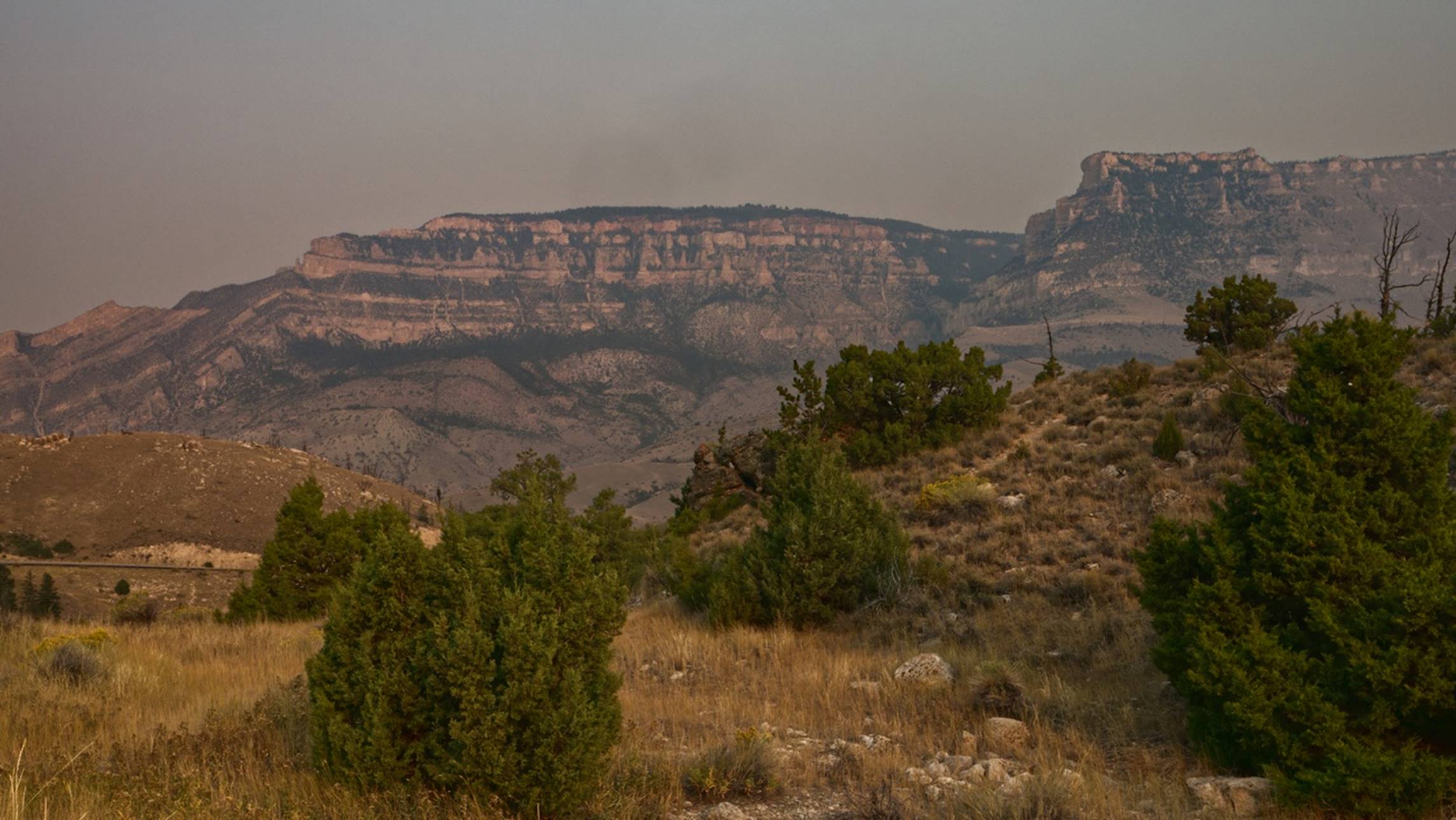
Some of the cliffs
and hills along highway 16 through the mountains
We got through the mountains and into onto flatter, rolling land and got onto Interstate 90, following that until we took the exit toward a very “touristy” town: Deadwood.
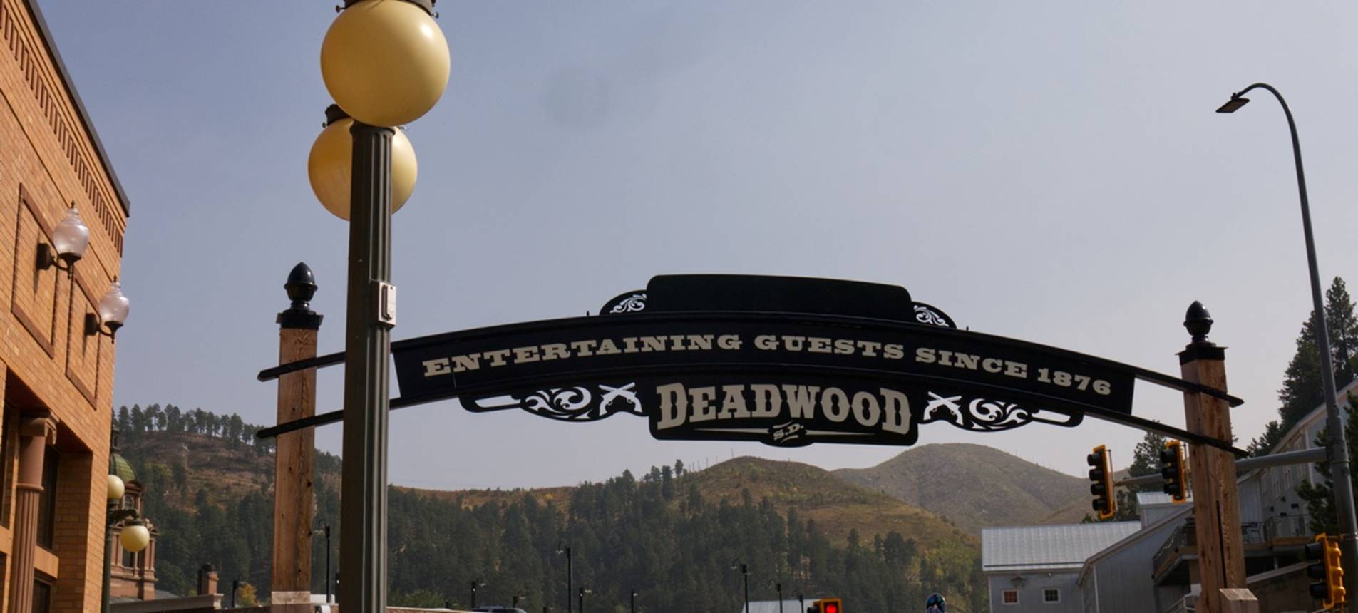
Welcome to Deadwood
Deadwood was a bit touristy, but sort of fun anyway. Much of the town was about “Buffalo Bill” Cody and they did not let you forget him!.
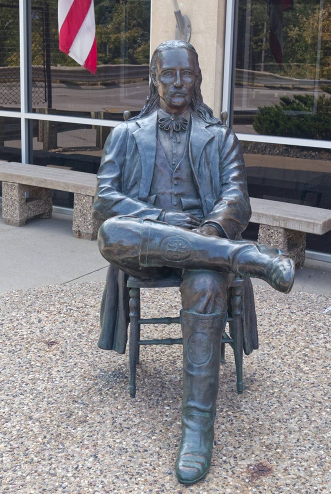
Buffalo Bill
They had a couple of statues of Buffalo Bill and even a marker for the saloon where he was shot.
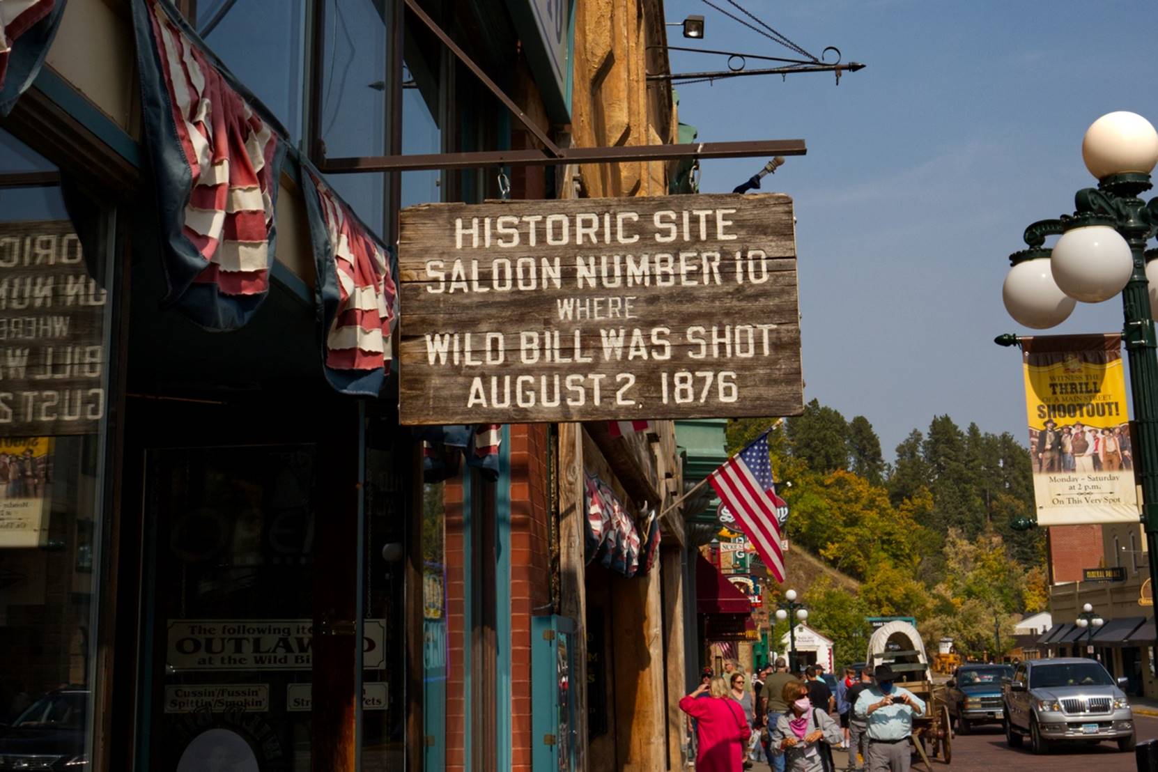
Location where
Buffalo Bill was shot
They even had a horse drawn stage coach giving rides to those willing to pay for it.
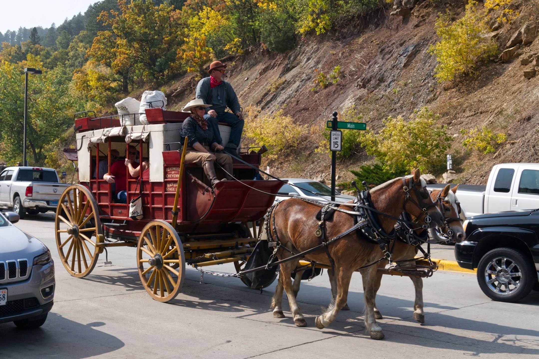
Deadwood stage
coach
About this time, we had an interesting meeting. I knew the Collette tour was scheduled to becoming through Deadwood this same afternoon and we had seen the tour bus sitting in a parking lot. As we were walking down one street, I noticed a couple of people with Collette name tags talking to a young man with a notebook and some papers: I figured that he was likely the tour manager who had sent us the trip information so I asked him if he was Mark. I had guessed right and he was a bit surprised that a stranger would know his name, so I introduced us as the missing two people on the tour. We had a good conversation and I explained how we had used “his” itinerary and modified it to our purposes.
I have no idea if
they were every actually in Deadwood….
We completed our walking tour of Deadwood and headed on toward our base for the next several days, Rapid City, SD. We considered paying a visit to Sturgis, sight of the yearly giant motorcycle rally, but decided we’d had enough touring for the day and just headed for our hotel, a Hampton Inn.
Day 6 –
Friday: Mt Rushmore and Chief Crazyhorse
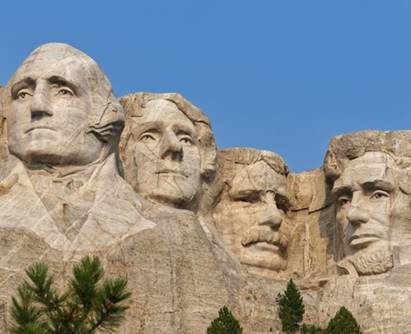
We figured that Mount Rushmore might get busy later in the day, so we headed there first, about 30 – 40 minutes from our hotel. There was some construction going on so it was not obvious just where to park and then go, but we found our way around well enough.
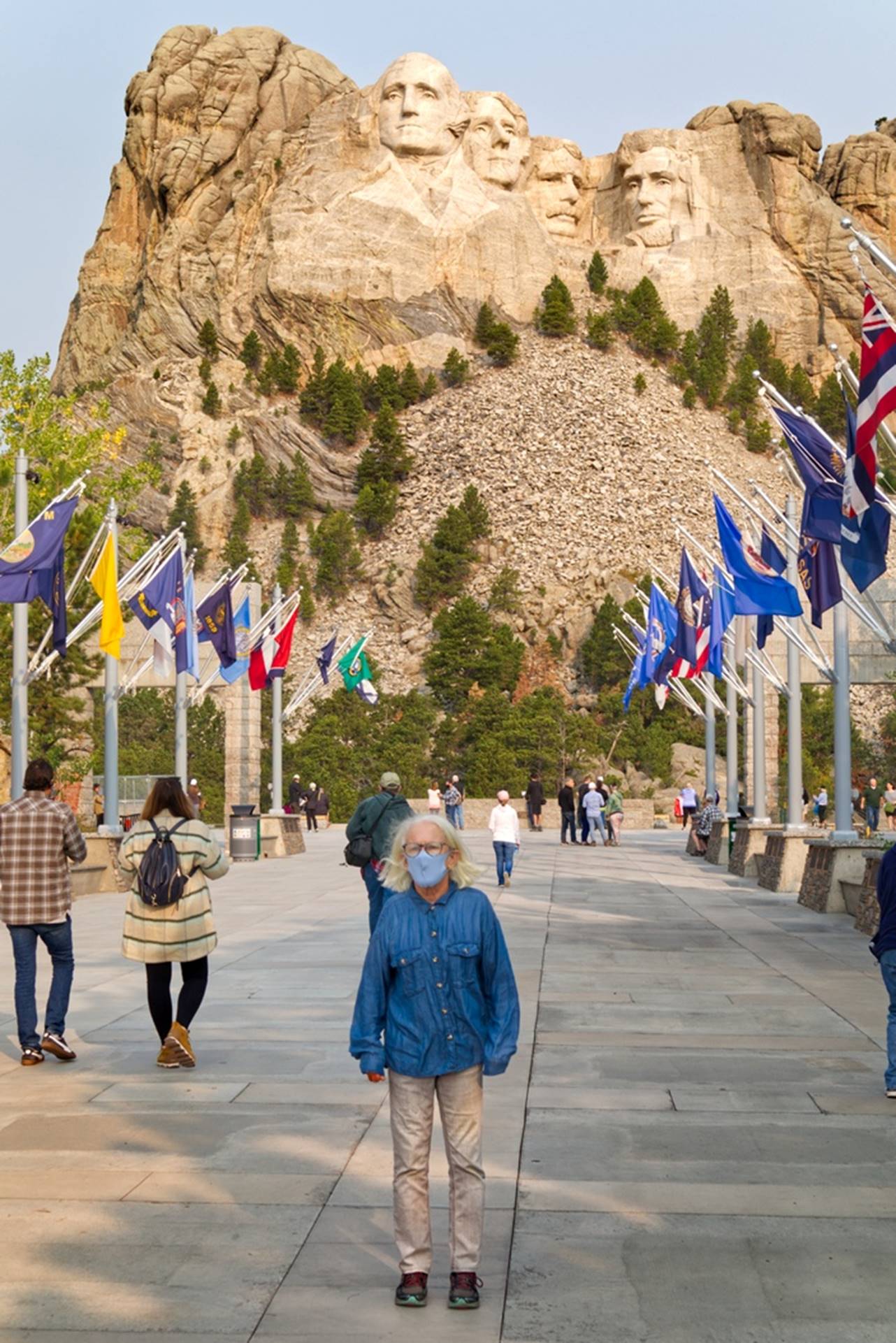
Susan in the
“Avenue of Flags”
The “Avenue of Flags” (above) has the state flags of all the states and leads toward the carving of the presidents. As with most other National Parks we visited, the official “Visitor Center” was closed, but the Gift Shop was open and doing a pretty good business. As you can see from the photo above, we did use face masks most of the time we were anywhere close to other people, although it is highly unlikely that we could get COVID-19 again.
Of course, all paths lead to a view of the main carving.
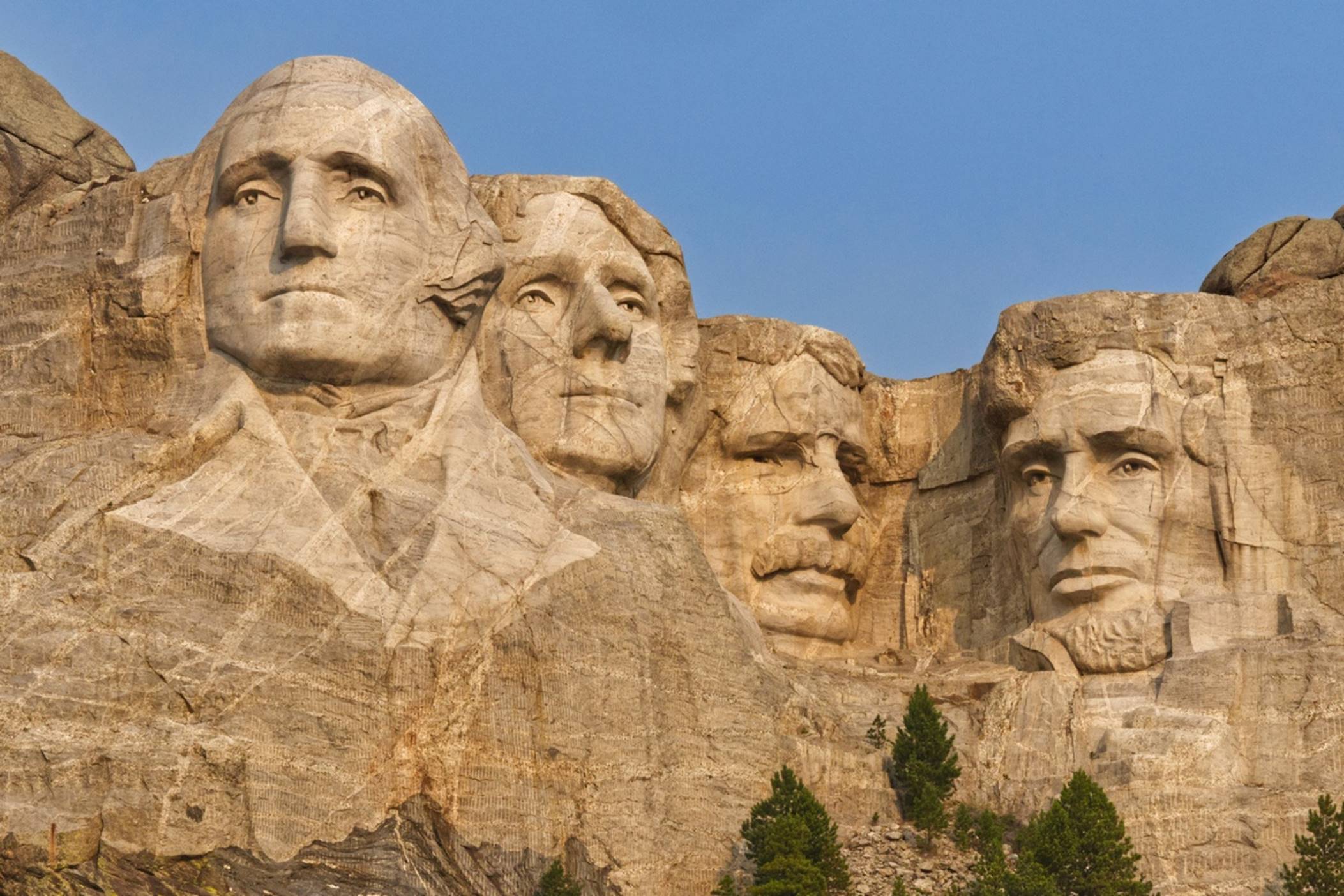
A good view of the
carving
There is a trail, called the “Presidential Trail”, that you can walk which goes up close underneath the carving. It provided some unusual views of the carving, as well as a chance to stretch our legs a bit.
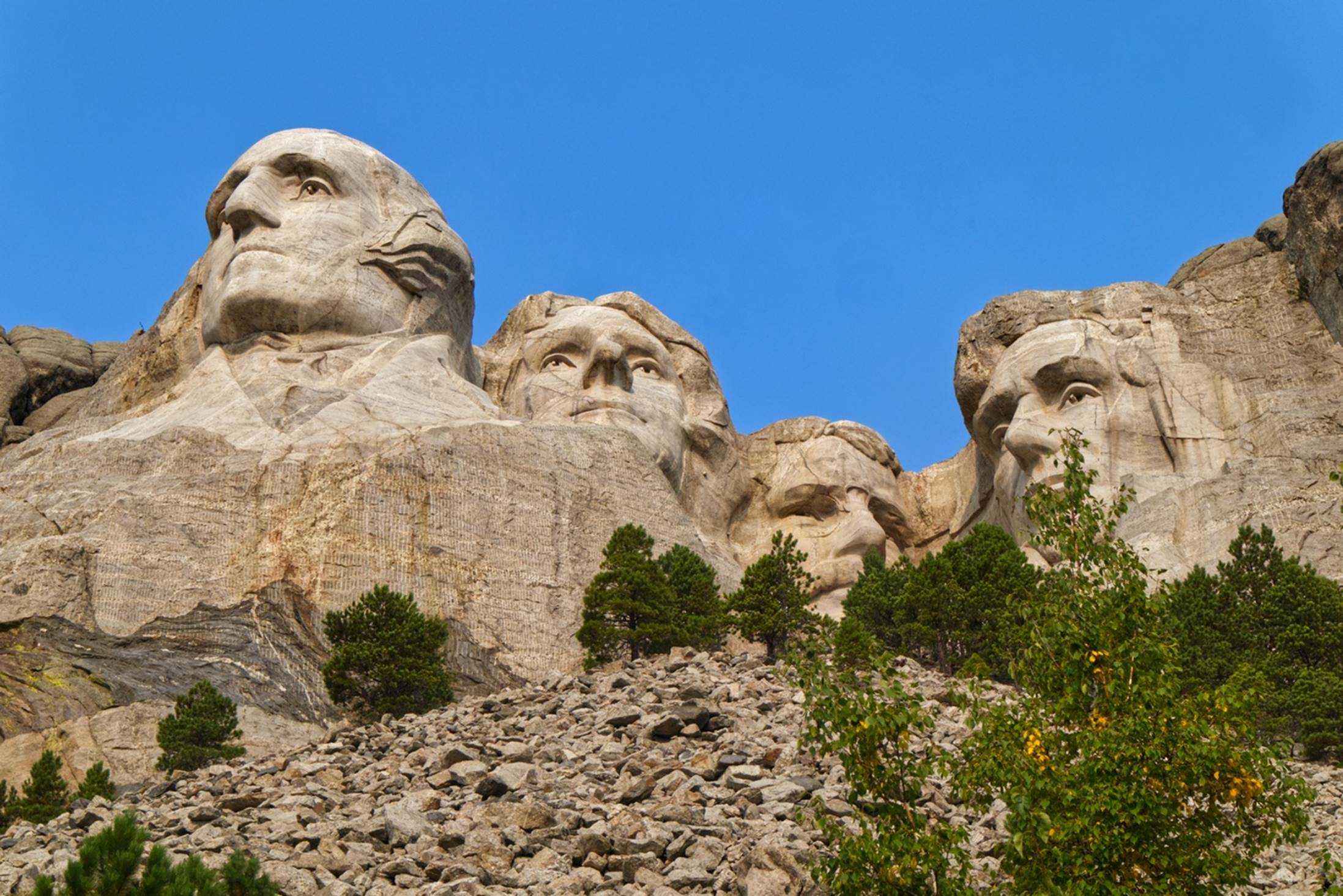
The carving, seen
from just below it
There are numerous signs and displays which tell much of the history of the carving and Gutson Borglum, the primary sculpturer/artist who designed it and promoted the carving. The carving of the presidents was impressive but, having heard so much about it over the years, it was almost a disappointment. In many ways, our next destination was even more impressive.
Although almost everyone has heard about the Mount Rushmore carving, relatively few people know about the carving of Chief Crazy Horse that is still very much a work in progress. I had heard about the Chief Crazy Horse monument some years ago and my only disappointment here was the apparent lack of progress.
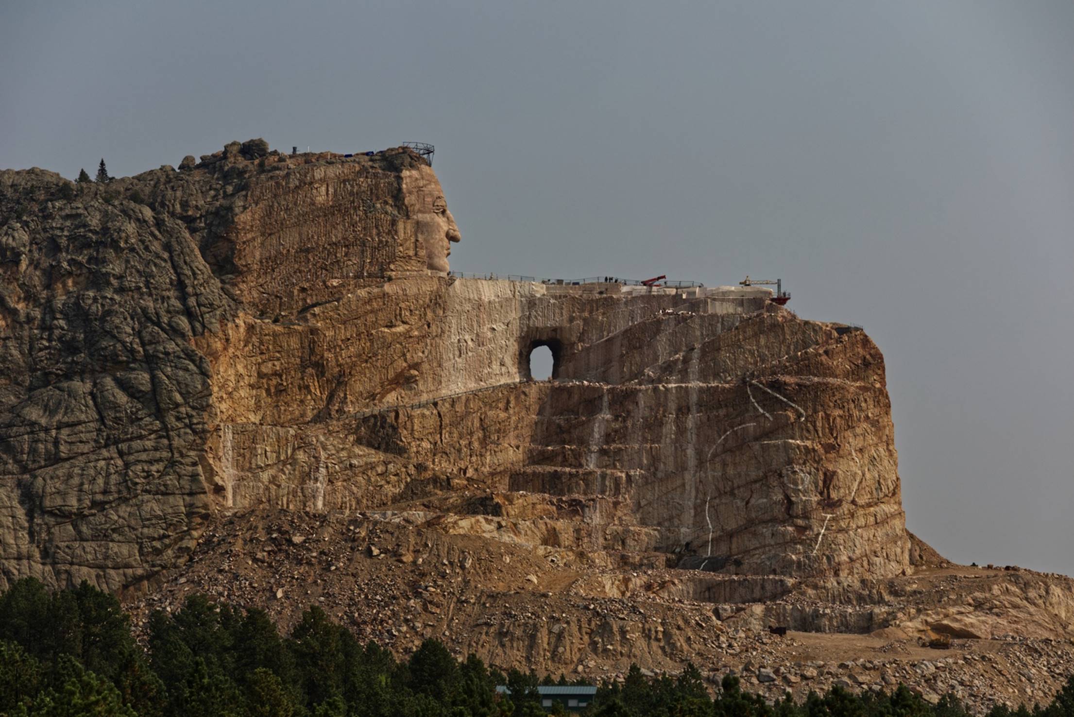
View of Crazy Horse
from the visitor Center
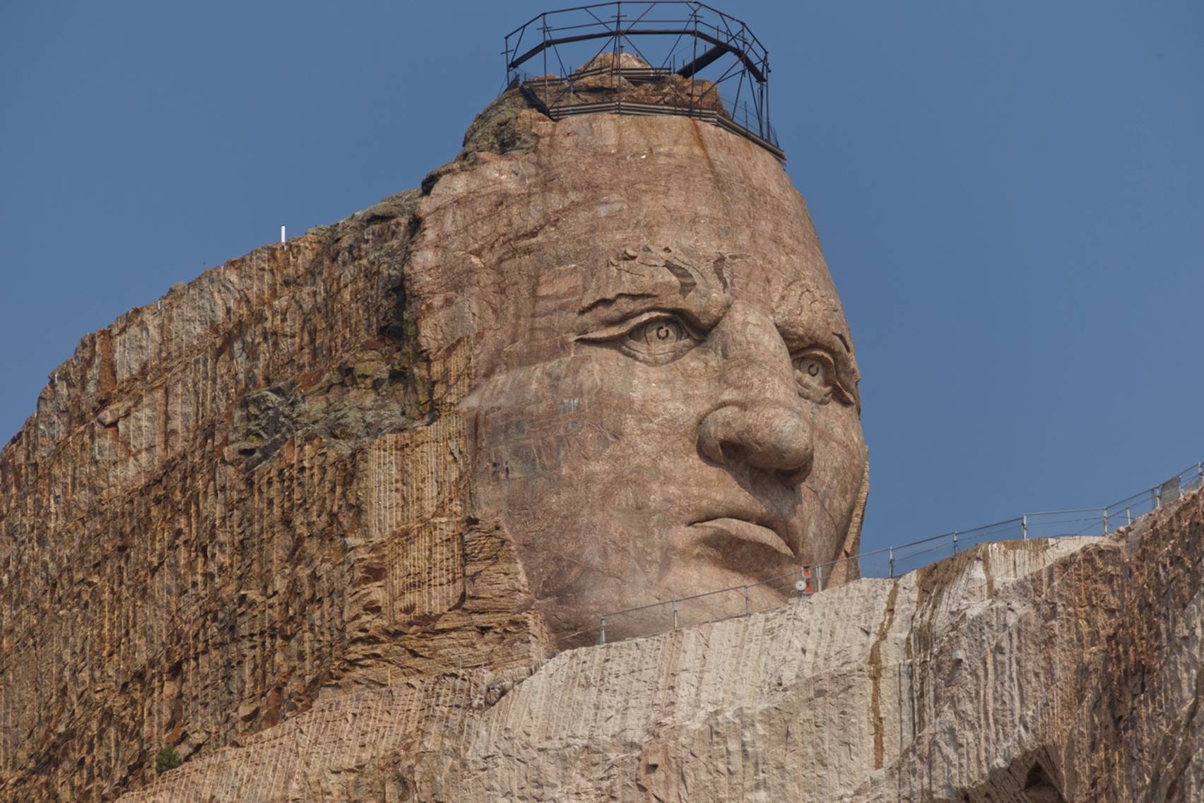
If you look closely in the photo above, in the area of the rock on the lower right side of the carving, you can see a rough drawing: just some white lines. That will someday be the head of the horse Crazy Horse is riding. To give you a feeling for the size of the carving, the faces at Mount Rushmore are about 60 feet high while the face of Crazy Horse is over 87 feet high. In addition, there is a lot more to this monument than just the face, as you will see below.
This is a private undertaking, not part of any park service, so it is on a “pay as you go” plan. Visiting the area and the visitor center is free, but to get a closer look, you have to pay $4 to take a bus closer to the foot of the mountain.
A look at Crazy
Horse’s face from the closer viewing area (telephoto lens).
The “crown” on his head is a temporary structure during construction and will be removed when that part of the carving is done. In its place will be a single 43-foot-tall feather. When the carving is done, several other components of the monument will be added, including a reflecting pond around the base, a Native American University on the grounds, an airport, and a resort area. The monument is intended to honor all the Native Americans through the likeness of Crazy Horse.
The sculptor and main person behind the project is Korczak Ziolkowsi and in the early steps of the project he created a scale model of the final carving.
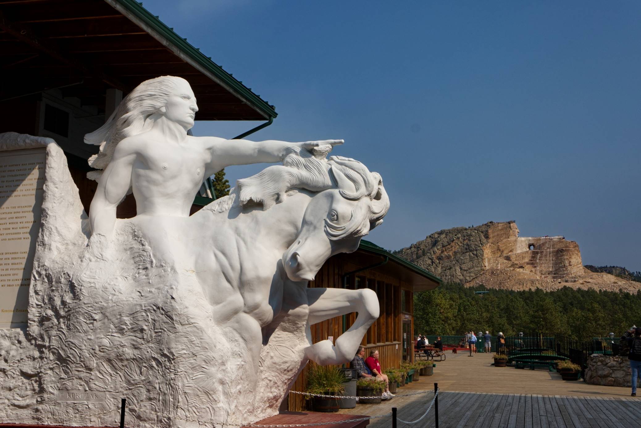
Scale Model with
carving in background
If it is still hard to visualize just how the current carving will turn into the final sculpture, the drawing overlaid on top of a photo of the carving might help.
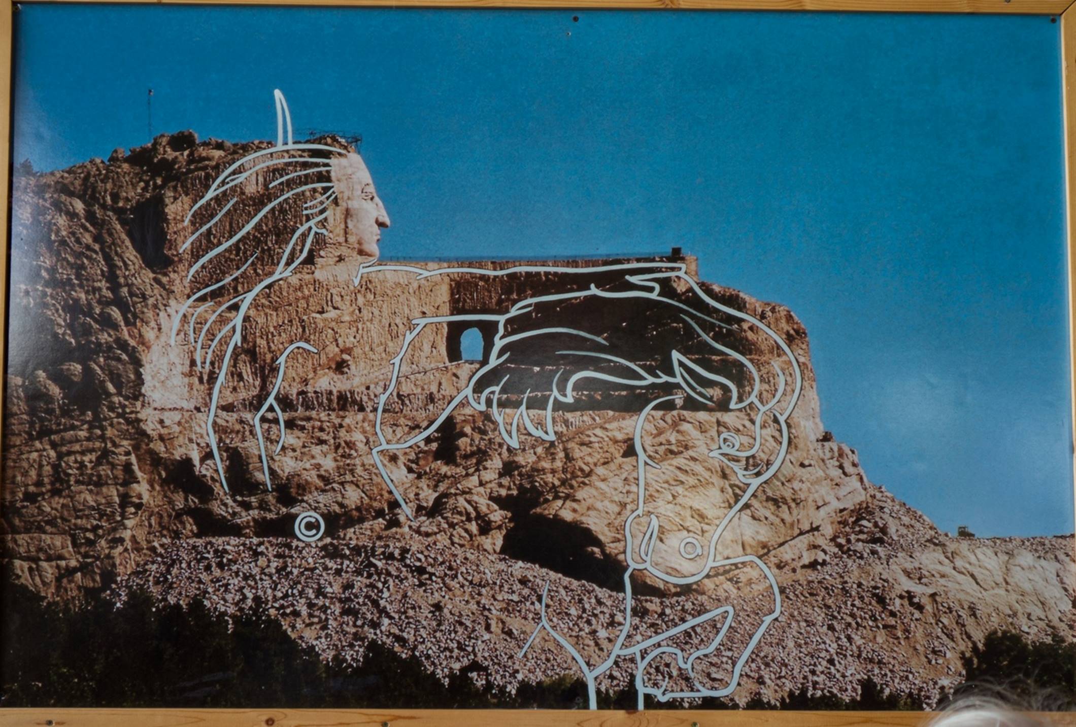
Drawing overlaid
over the current status of the carving
By the time we were done with Crazy Horse, it was about lunch time and we were getting thirsty. My research had turned up a couple of wineries (yes, in South Dakota) in the immediate area that offered wine tastings. Obviously, we had to check them out.
The first winery “Prairie Berry” was a very nice facility which was doing a surprising amount of business. It turned out that tastings had to be arranged and reserved ahead of time, so that was out, but they did offer flights of three different wines (our choice among their offerings). I ordered a flight of wines while Susan retrieved our cheese, crackers, sausage, and an apple from the car. While the winery offered some “interesting” wines (“Red Ass Rhubarb” – Rhubarb and raspberry,”Calamity Jane” – Concord grapes, and Lawrence Elk – black currents) I stuck to the more conservative things like chardonnay and merlot.
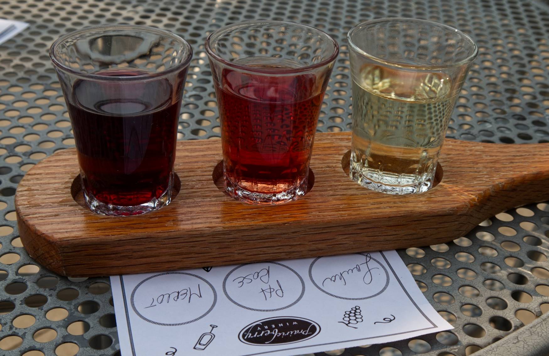
Prairie Berry
flight of three wines
Just a mile or so down the road was another winery, the “Naked Winery”.
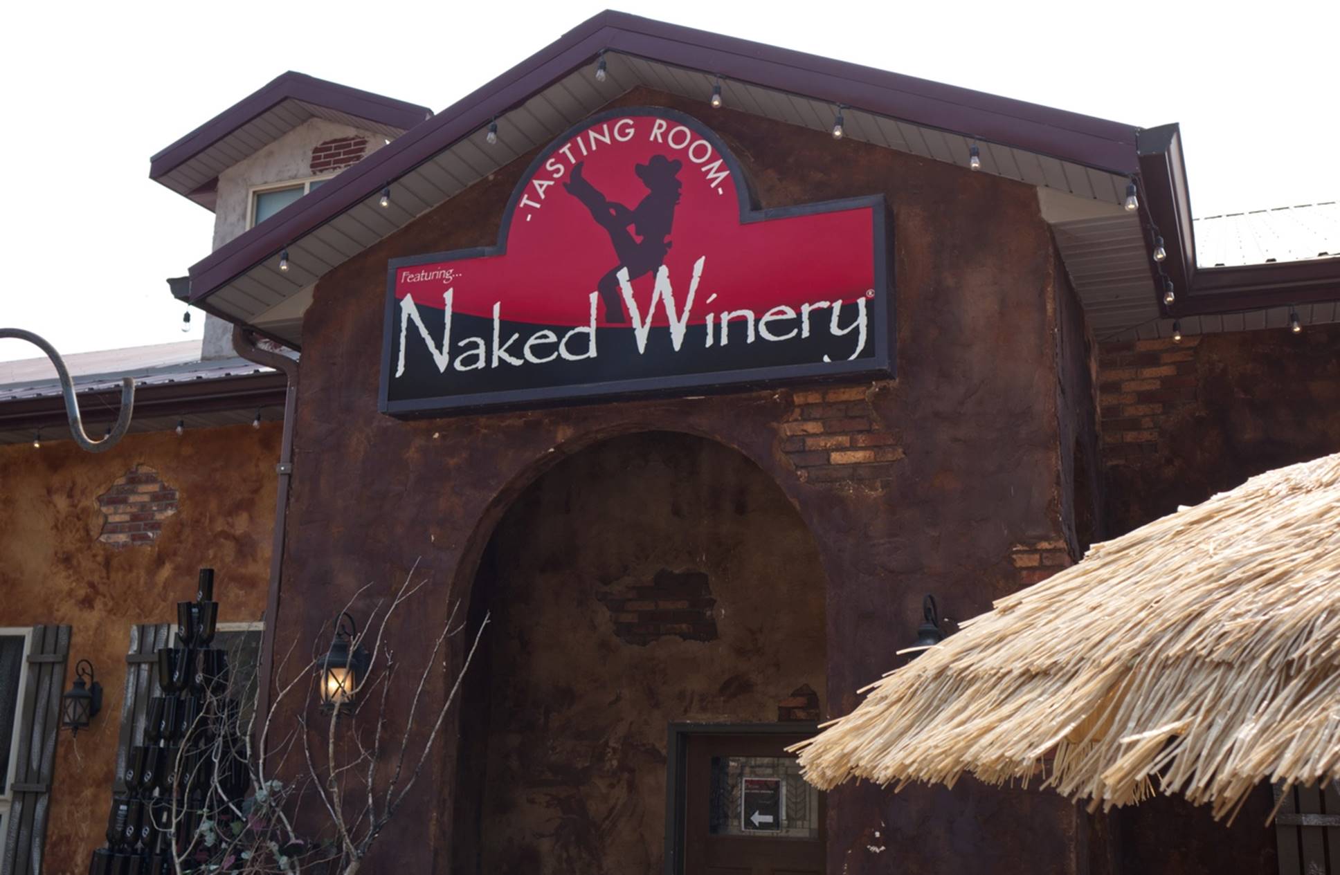
The Naked
Winery
This place was more laid-back and the names of the wines (and also the beers from the adjoining micro-brewery) considerably more risqué, in keeping with the name of the winery, such as “Take it off” (red blend), Oh! Orgasmic Nebbiolo, “It’s not you, it’s Merlot”, Dominatrix Pinot Noir, Never Have I Ever Riesling and many others in that vein. Interesting place. We did get a tasting here, and I think we ended up tasting at least 6 and probably 7 different wines and the staff was very friendly and helpful. We asked the young woman leading the tasting where the grapes came from as we had not seen any evidence of any vineyards. She said all the grapes come from Washington and Oregon; they do not grow any really usable wine varieties in this area.
Tasting all those wild wines had tired us out, so it was time to head back to our hotel and rest up for a while.
Day 7 –
Saturday: The Badlands and other things
I initially thought Saturday would be a bit of a fill-in day, just something to do before it was time to head home on Sunday. I was pleasantly surprised by how wrong I was.
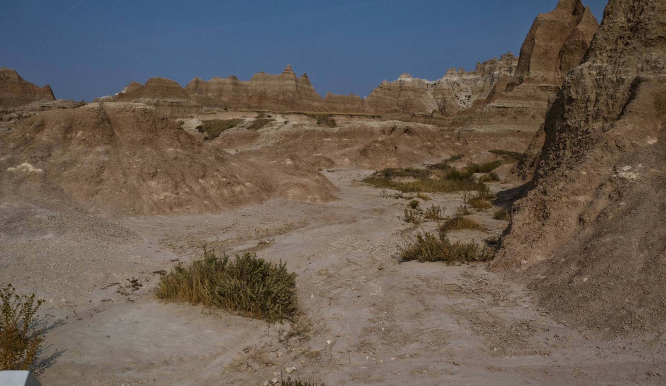
We first headed to the Badlands National Park, about 40 – 50 minutes east of Rapid City. I really had no idea what to expect here. The most popular way to see the Badlands is via the “Loop Road”, which we entered a bit south of Interstate 90, on Highway 280 into the park proper. Highway 280 continues southeast through the northern part of the park and exits the park at the Northeast Entrance, about 6 miles south of I-90 at that point.
Soon after entering the park, there was a gravel road off to the right and we saw some wildlife, so decided to head off the main road a bit.
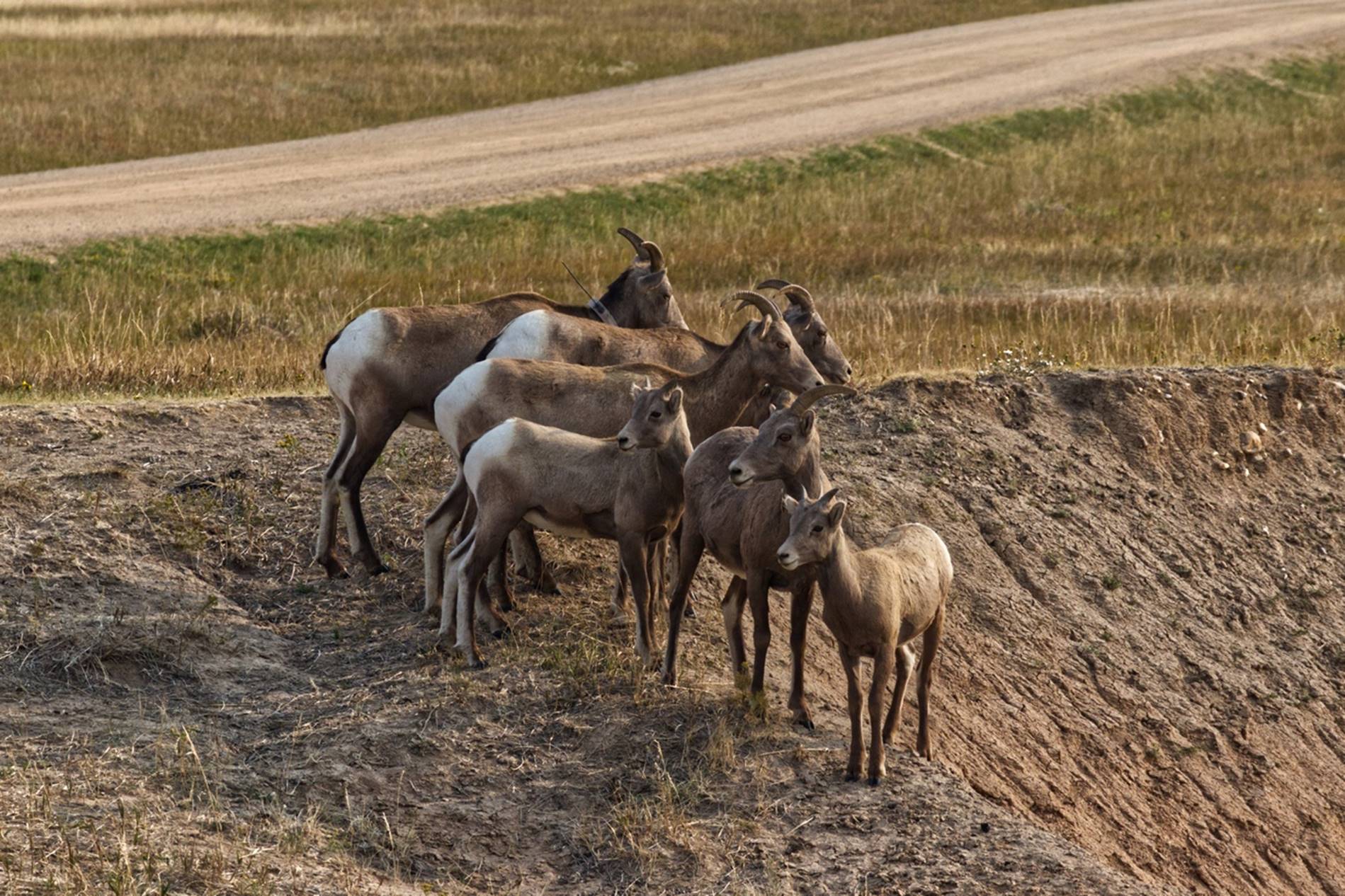
Goats in the park
There are supposed to be several kinds of wildlife in the park, like Big-Horn Sheep and Bison, but this was the only kind of significant wildlife we saw, and we did see several herds of these goats.
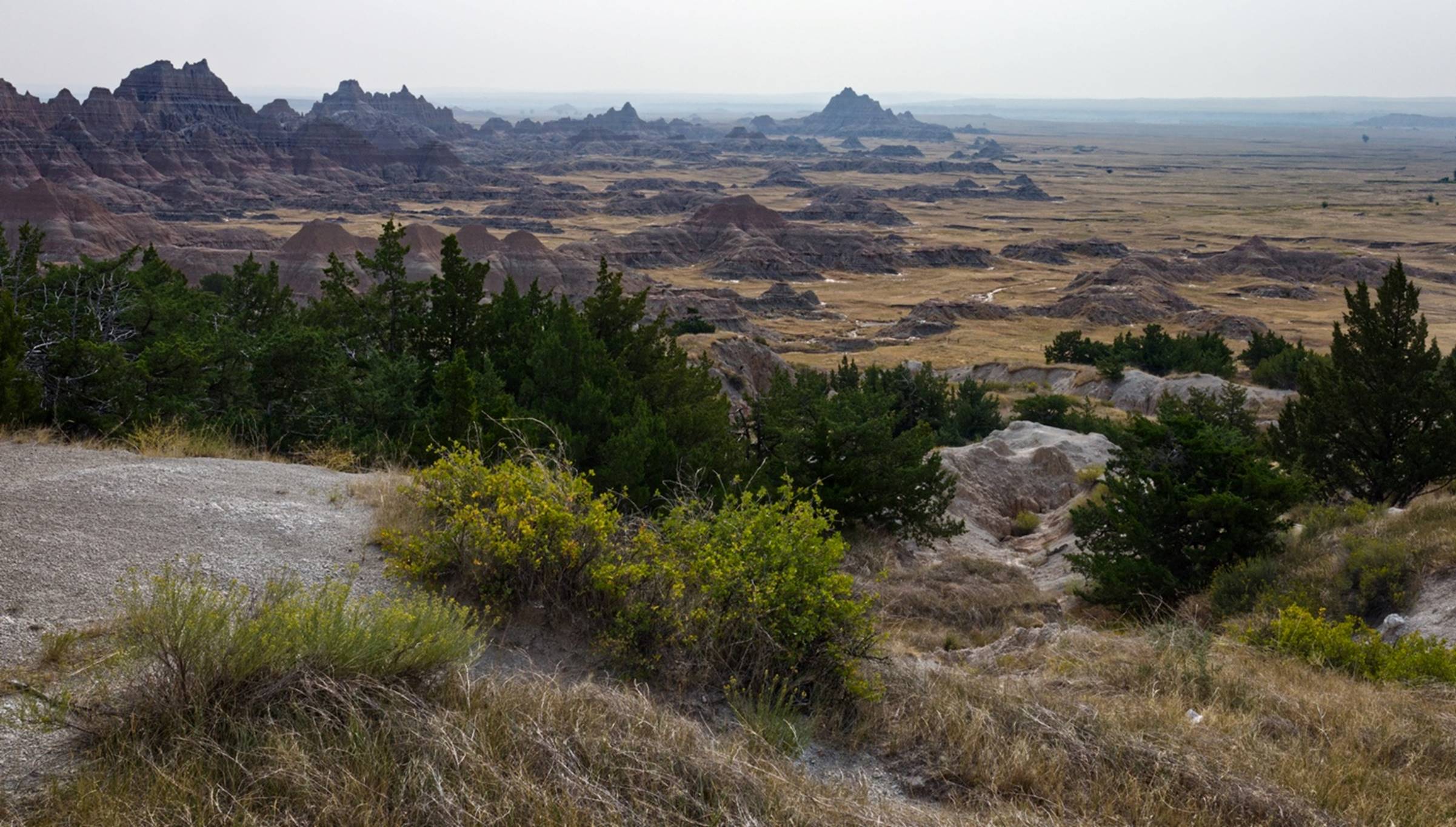
This stop also offered us our first view of what the Badlands Park is all about and it was impressive.
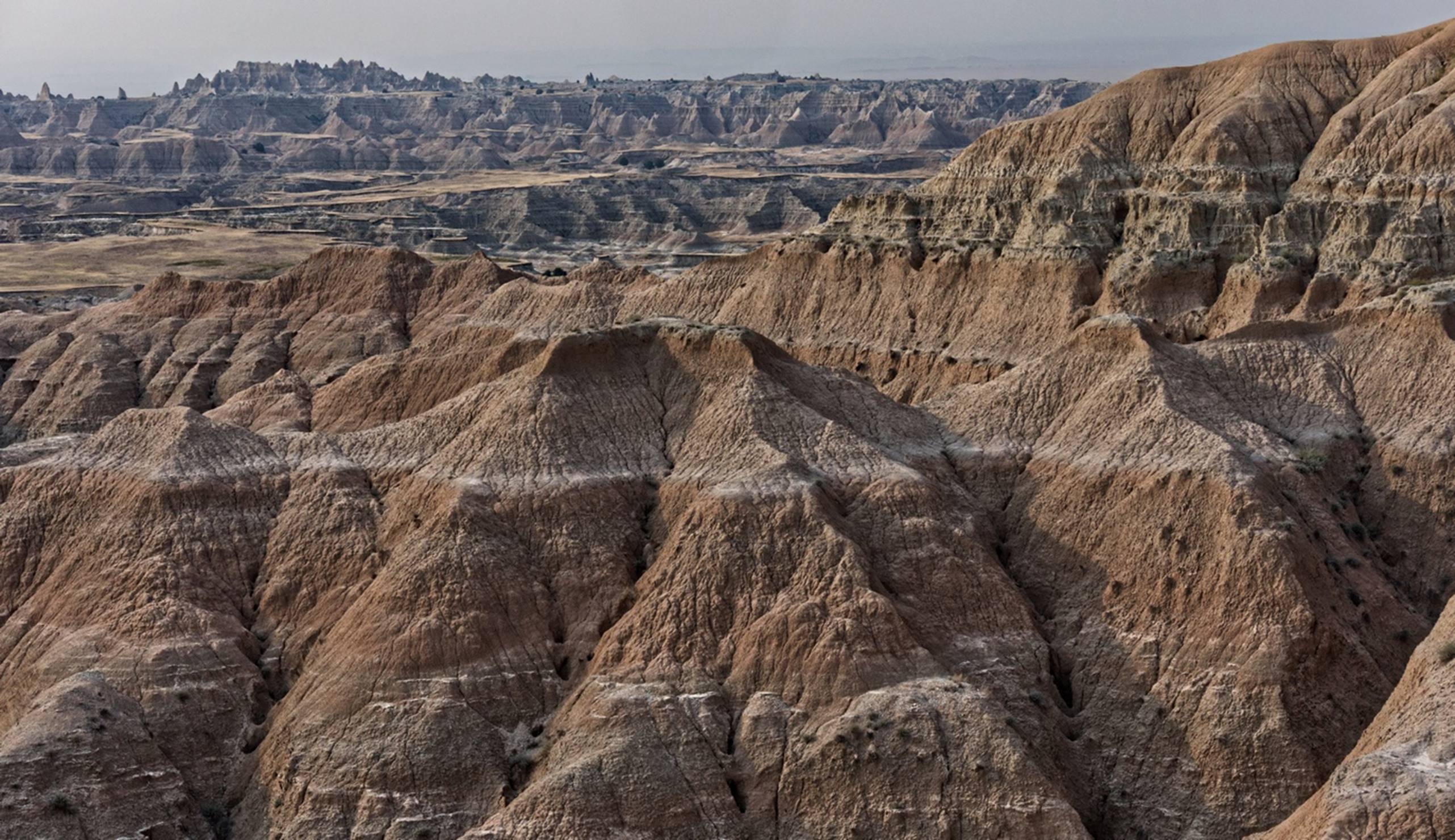
First view of the
Badlands
It was a bit more imposing that I had expected and this video might give you a better idea of the expanse. We hopped back in the car and a very short drive brought us to the first “official” overlook, the “Pinnacles Overlook”.
A view from the
appropriately named Pinnacles Overlook
One of my first thoughts was to wonder just what settlers in Conestoga wagons in the 1800s would have thought when they looked out over this landscape. Hopefully they found a good way around this area.
Another view from
the Pinncales Overlook
At this overlook, I did see another couple of forms of “wildlife”. There were a number of plants with yellow flowers in the area and I noticed what looked to be a wasp walking around one of the leaves. Being a bit curious, I took a closer look and noticed an ant on the underside of one of the plant leaves. They were almost doing a dance, with the wasp walking around the leaf and the ant trying to stay on the other side of it, somewhat out of sight. We didn’t stay around long enough to see what happened.
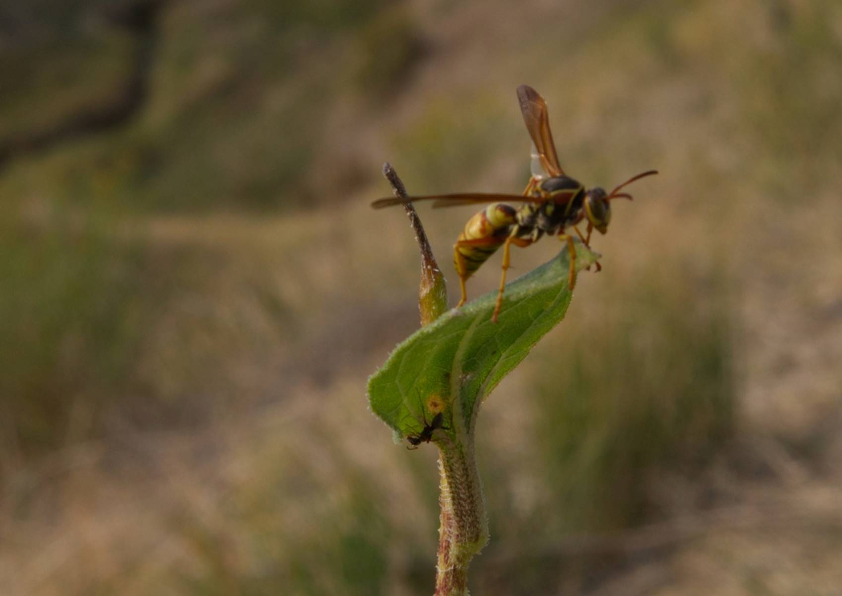
Wasp and Ant on
flower
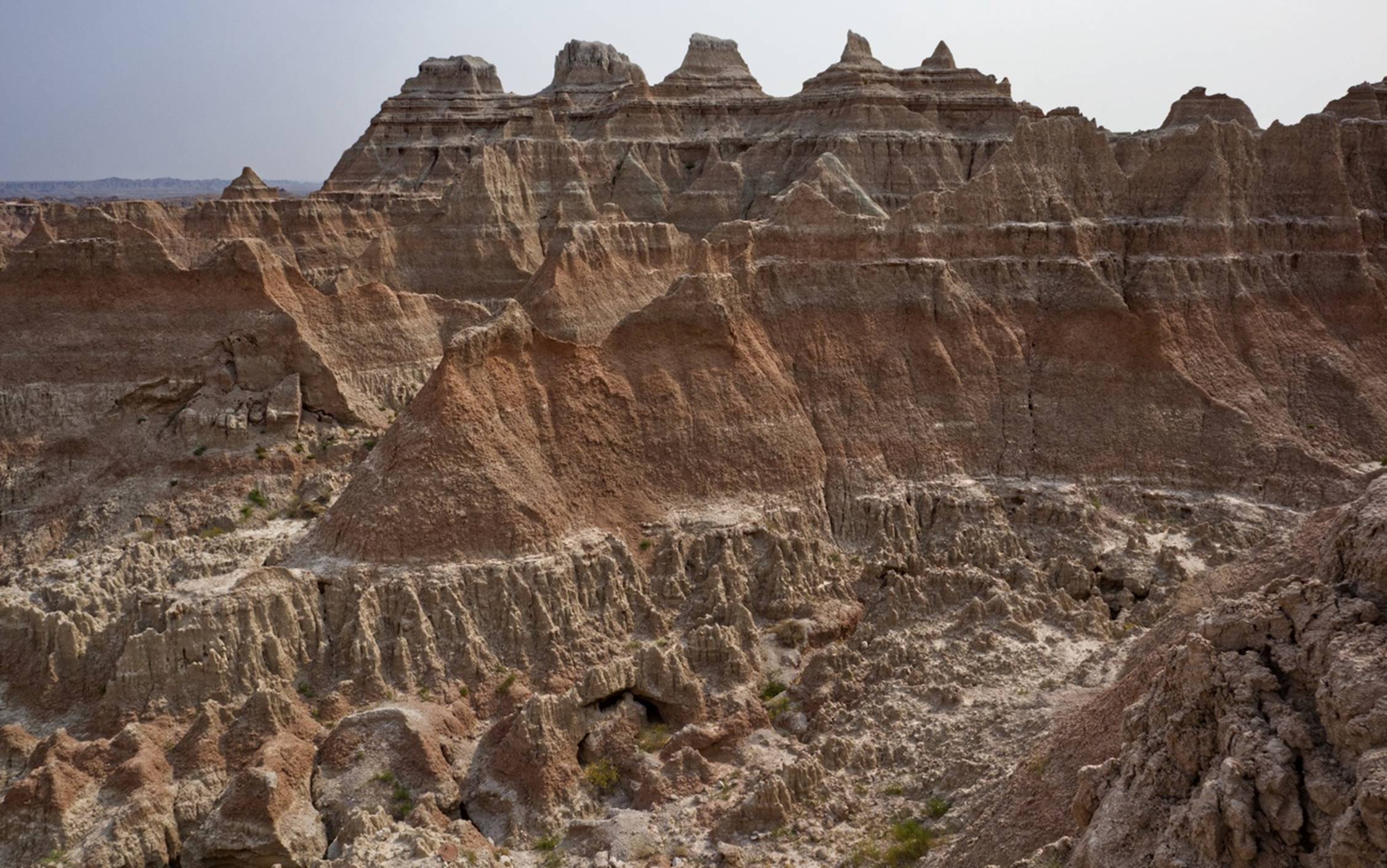
A little further along the loop road, the “Homestead Overlook” offered a view of some rough terrain, but also a prairie beyond where some early settlers did homestead, although with very limited success. Another stop was at “Panorama Point”, which was aptly named for the views it afforded.
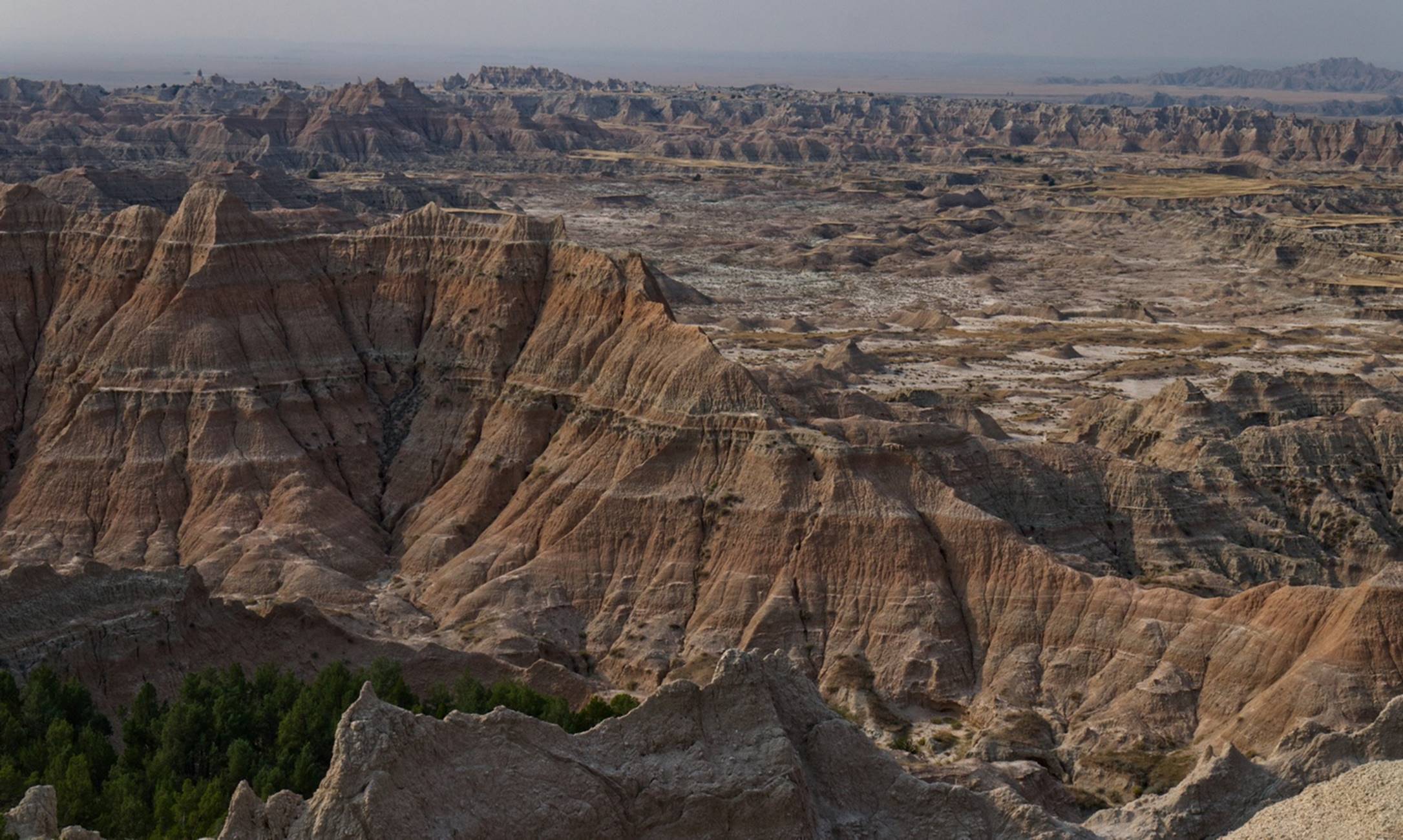
Note the rock
layers on the cliffs at Panorama Point.
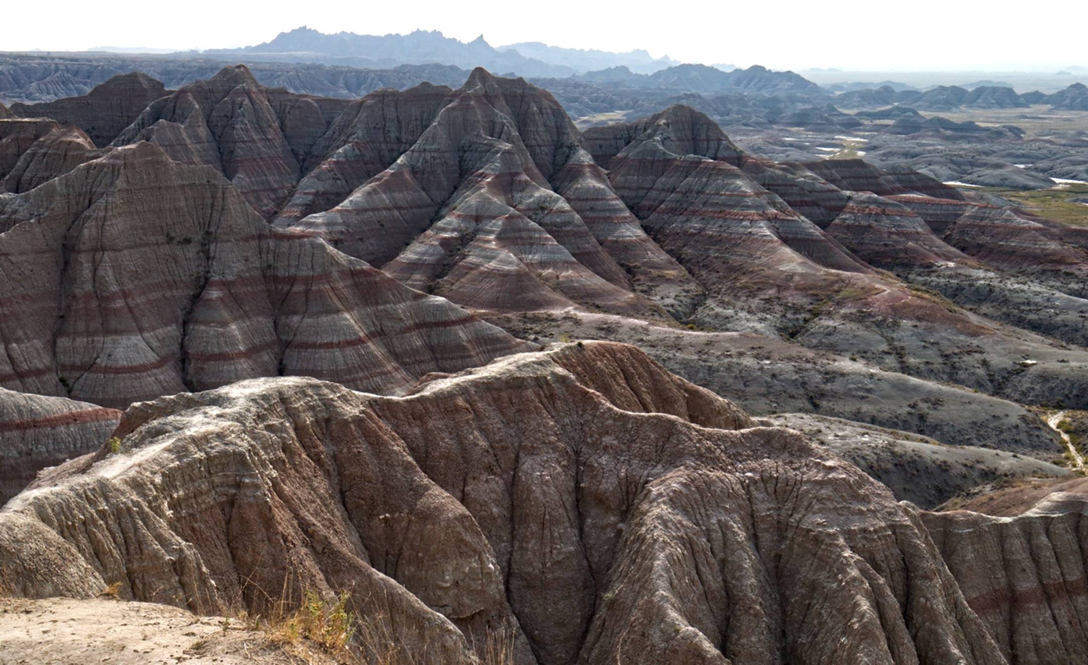
This is a good time to point out the rather obvious multiple layers visible in almost all the hills and cliffs in the Badlands. These represent the various kinds of sediment that occurred as the area rose and fell in and out of the oceans over millions of years. At one time this area was a tropical swamp, much like the Everglades of today and there were reptiles that looked very much like the Alligators in the Everglades today.
Part of the Fossil
Trail: note the rock layers here also.
One interesting trail was the Fossil Exhibit Trail: it included multiple (probably 10 or 12) information signs, each with replicas of fossilized skeletons of animals that once lived in this area. For each animal, the information pointed out in which rock layer the fossil was found and how long ago it would have been deposited. The signs pointed out that animals had three choices when the climate changed drastically around them: change to accommodate the new climate, move to where there was a climate they were used to, or die out, possibly going extinct.
Across from the Fossil Trail was a trail head for one of the major hiking trails in the park, the Castle Trail. It looked interesting, but the estimated time to hike it was 2 hours and we didn’t want to spend that much time.
Beginning of the
Castle Trail
A short distance further was the Ben Reifel Visitor Center.
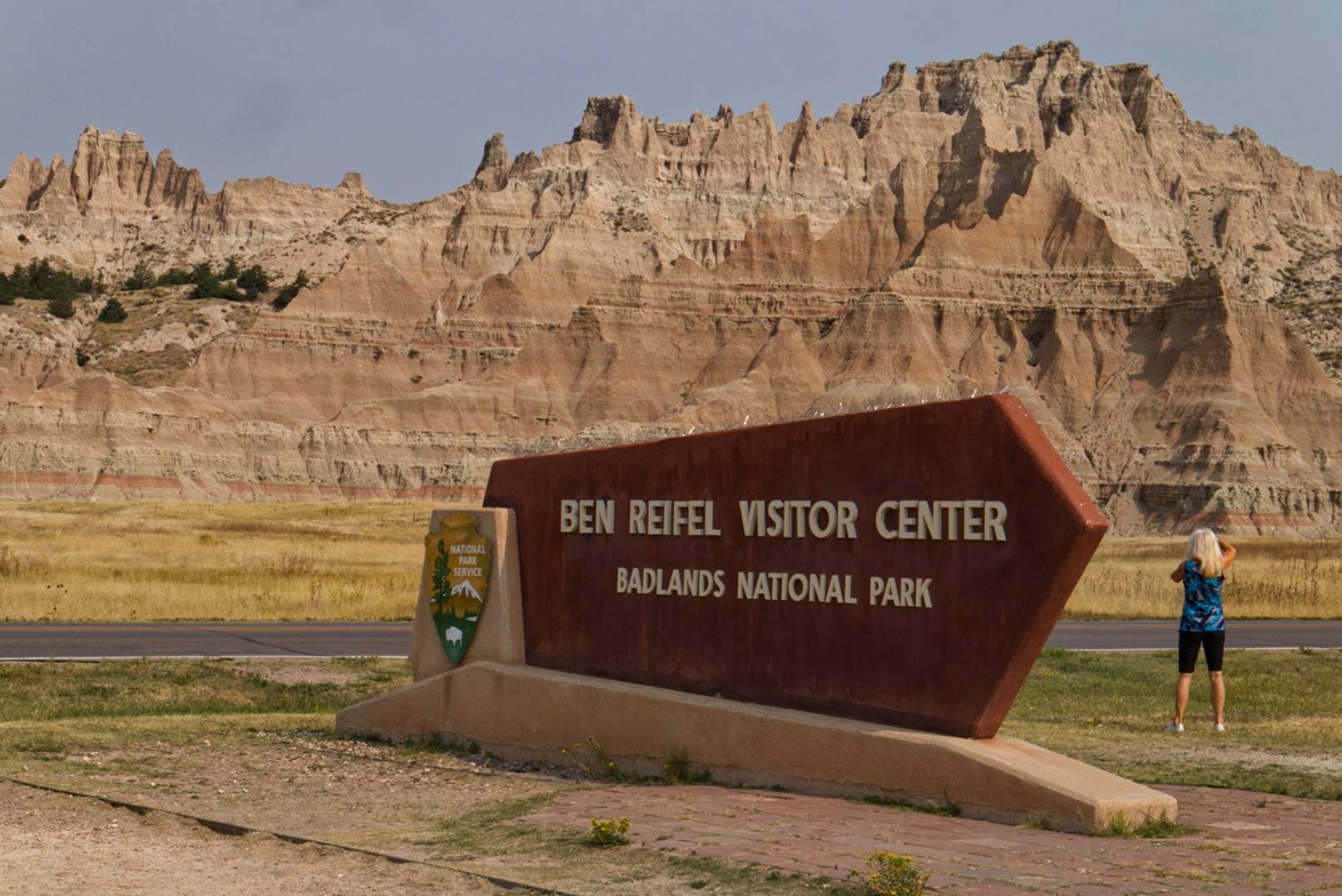
Visitor Center sign
This visitor center was marginally open: park rangers were only allowing a few people in at a time, so as one person came out, one person went in. We noticed the Collette tour bus and people with Collette badges were there, so I suspect the visitor center might have been opened mainly to accommodate the tour. We had already seen most of the accessible park, so we did not wait around for our turn to enter the visitor center.
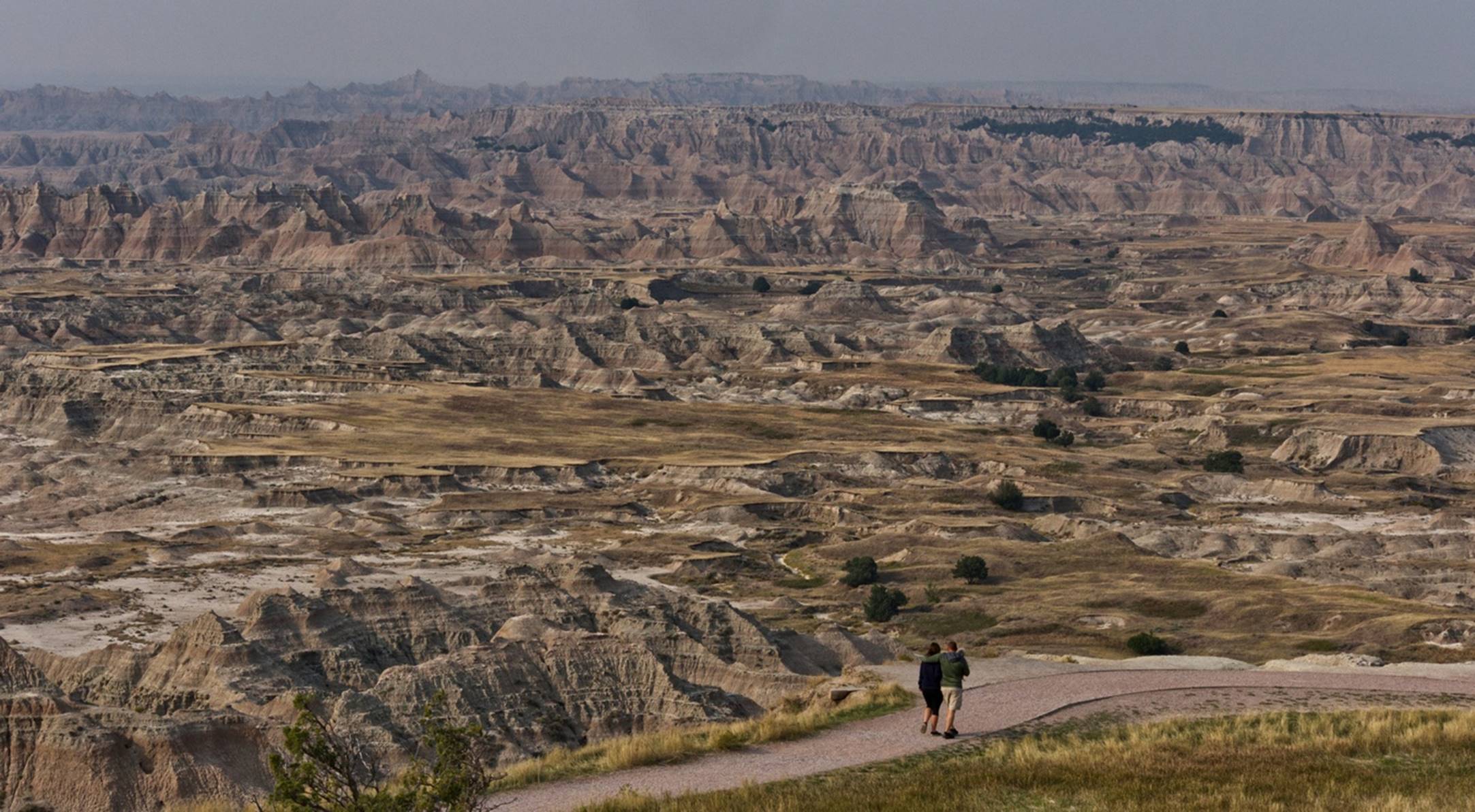
Another short distance up the road and we found the “Cliff Shelf Nature Trail”. This trail was about a mile long and had both gravel trails and boardwalks, so we decided it was time to get a little exercise. There were some nice views from the higher points of the trail.
Looking back over
the Badlands from the Cliff Shelf Trail
When we were still on a lower part of the trail, we noticed a “saddle” area between two hills that rose above the trail and there were people standing in the saddle area.
Notice the people
standing in the saddle.
We thought perhaps our trail would lead us to the saddle, but it only came close. If you look at the photo above, you can see the trail’s boardwalk slightly below the saddle and that is as close as we got. We discovered later that the trail to the saddle came down from the other direction and was actually an extension of the Castle trail called the Notch Trail.
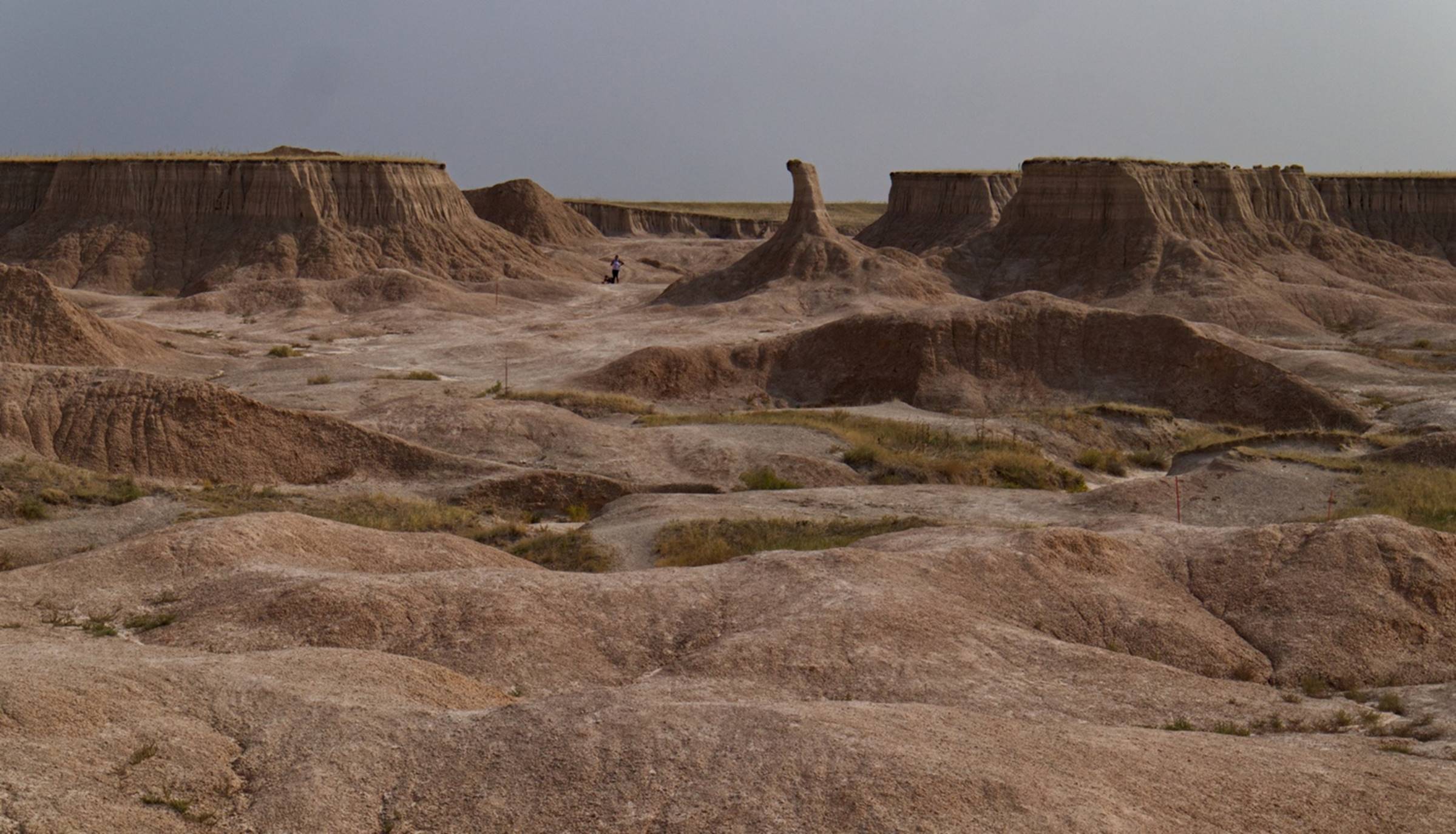
Our last stop in the park was at the “Big Badlands Overlook” and it provided an interesting view of a small but impressive canyon.
The view from Big
Badlands Overlook
We exited the park and looked for some place to stop and have a picnic lunch. I need to back up a little here: soon after entering the park, Susan noticed an area marked on the map as “Prairie Dog Town” where a colony of Prairie Dogs live and could be observed by visitors. We had already gone the other way when she saw this, so we did not go back but when we exited the park, Susan mentioned that she would have liked to see some prairie dogs. Soon after leaving the park, we saw a gas station and convenience store with a shelter over some picnic tables off to one side. Susan went to the store to get a couple of drinks while I carried the cooler to a picnic table. As I approached the tables, I noticed several holes in the ground and quickly realized that the shelter was in the middle of a prairie dog colony! We got to see those prairie dogs up close.
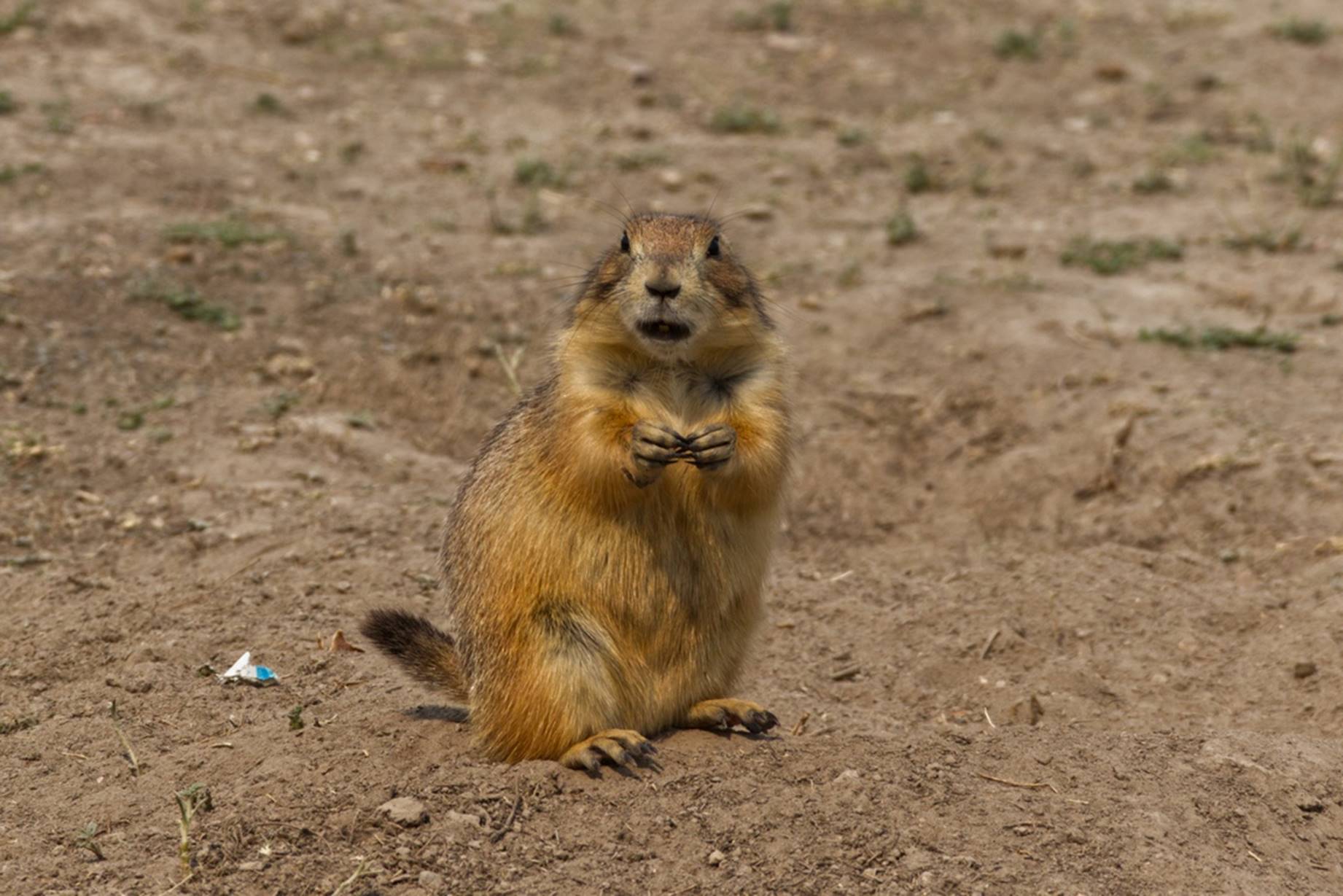
A prairie dog
posing for a photo
A sign said to not feed the prairie dogs, so we did not, technically. A group of three women came to the shelter to look at the prairie dogs and wanted to feed them some, but did not have much to give them. Susan simply helped them by giving the women some of our food (crackers and pieces of apple) to give to the prairie dogs. The prairie dogs seemed to appreciate the little snack and, while some were running around, one was staying in its hole and continually sounding off. That talkative prairie dog can be seen toward the end of this video.
After lunch we drove the short distance across I-90 to the Minuteman Missile Historic Site visitor center, which is one of the few visitor centers we found manned and open. The visitor center explains a lot about the cold war theory of “Mutually Assured Destruction” (yes, it is MAD) and information about the many Minuteman missiles that were based in the area. For several years, there were hundreds of active missiles buried in their silos in this area.
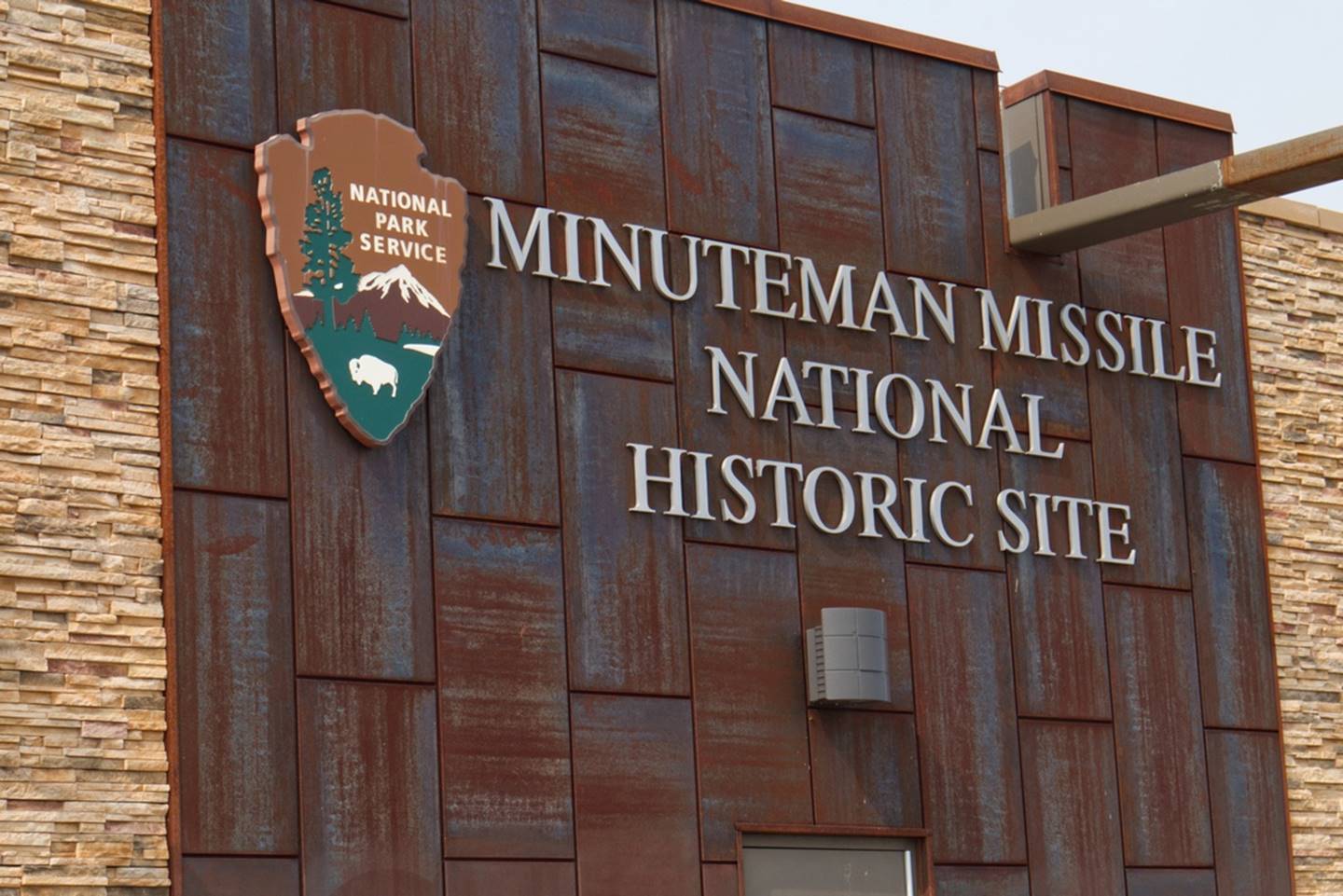
The entrance to the
Visitor Center
There are three parts to the historic sight: the visitor center, a control center which controlled 10 of the missiles, and an actual Minuteman silo with a (deactivated) missile in it. Visitors have to have a reservation to enter the control center and we did not have a reservation, so we skipped that and headed toward the silo location two exits west, just off the interstate.
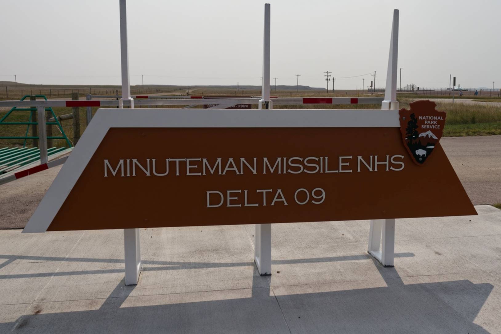
The Minuteman Missile
silo site
The silo had a transparent plastic cover through which you could see the missile in the silo. There was a nice audio system available via your cellphone which described the various components of the silo area.
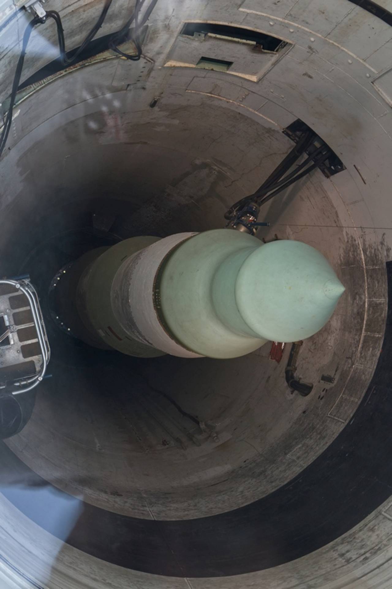
Looking through the
cover at the Minuteman missile
Our final destination for the day was another exit west on the interstate in the town of Wall, SD. In the town of Wall is a large, rambling store called Wall Drugs which is one of the biggest “attractions” in the area.
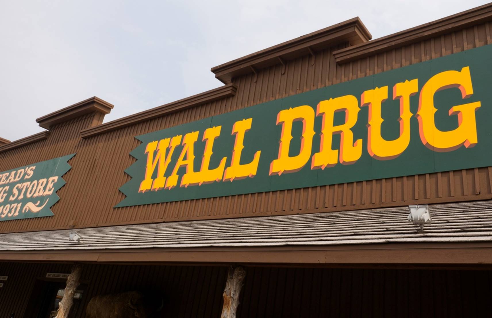
Welcome to the Wall
Drug store.
There are multiple different areas within the Wall Drug complex, with restaurants, kids’ entertainment area, historical photos, and plenty of different shopping areas connected by what seemed almost like a maze of hallways.
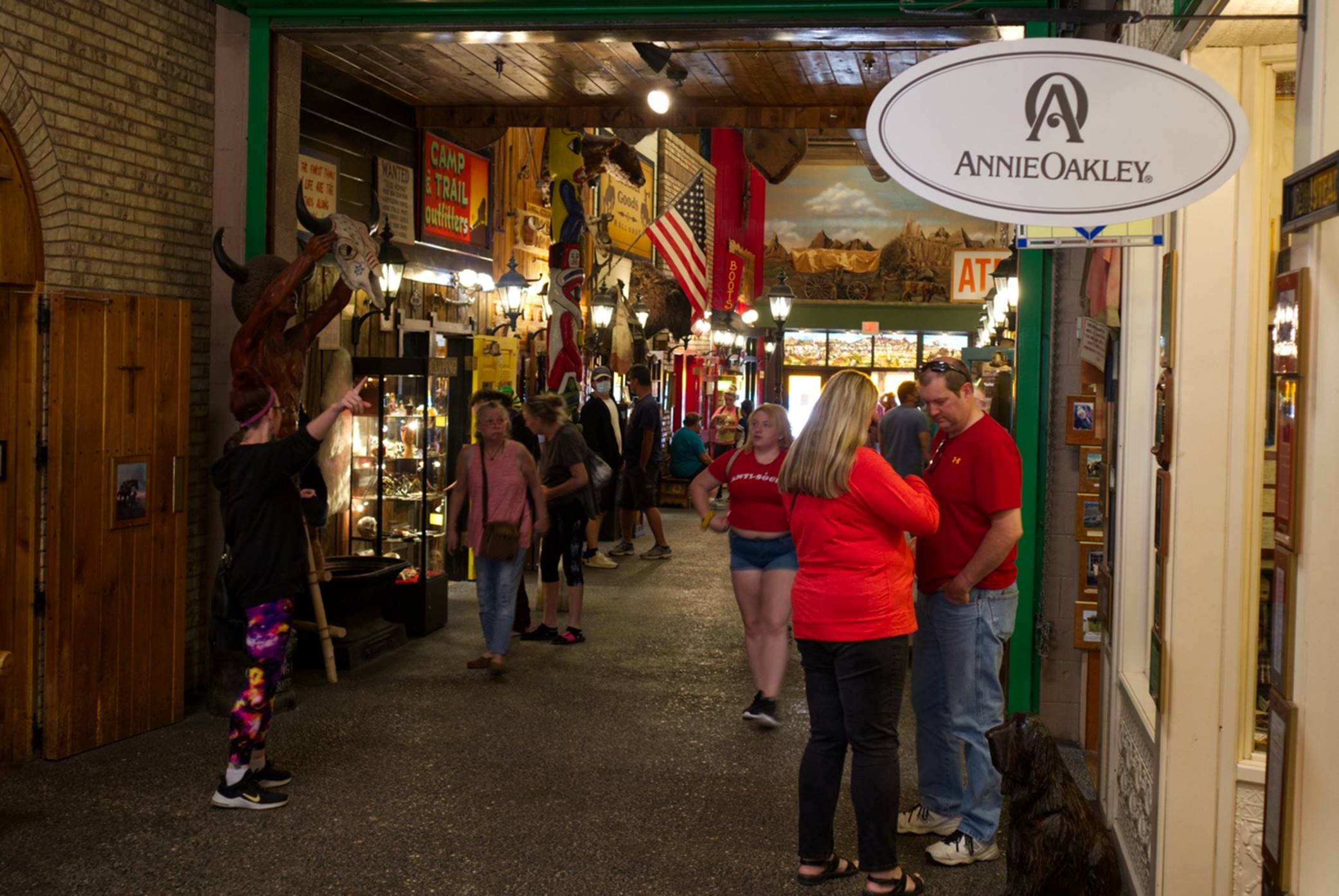
One of the many
areas within Wall Drug.
While at Wall Drug, we once again saw the Collett tour bus but I suspect most of the people were eating lunch as I didn’t see any Collette badges. We wandered around for a while but didn’t see anything that we could not live without so we found our way out, narrowly escaping the jaws of their pet dinosaur.
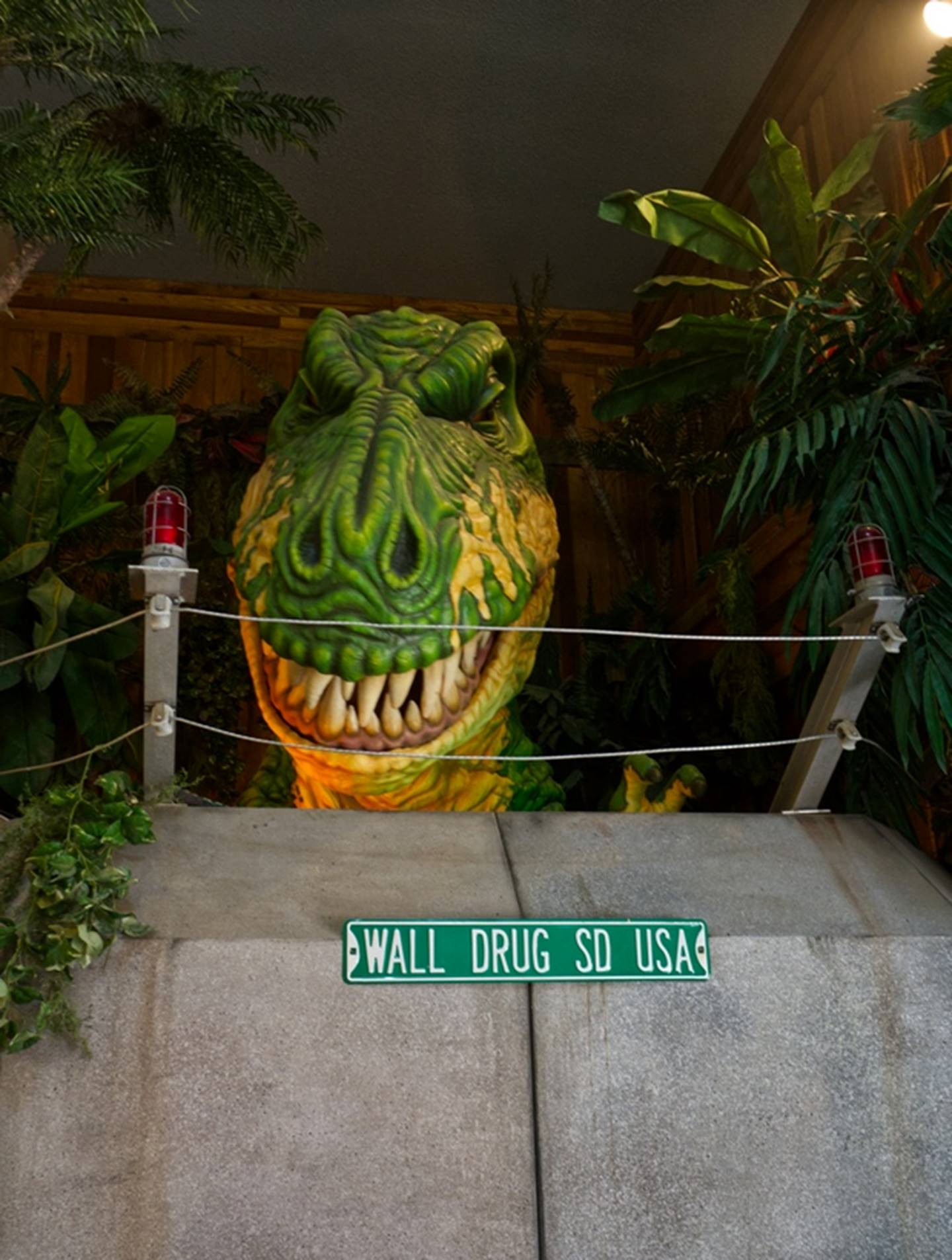
This T Rex looked
lonely.
After saying good-by to the T-Rex, we headed back to the hotel to rest up prior to going out to a nice restaurant for dinner. We also made a “test run” from the hotel to the airport to make sure we knew the way and how long it would take.
Day 8 –
Sunday: Heading home
We got up, had breakfast, and headed to the airport to return the car, check in with Delta, and go through TSA security. There was some construction in the terminal but everything went smoothly and we only had to wait a while for our flight from Rapid City to Minneapolis. The flight was on time and we arrived in Minneapolis and had to find our way through a somewhat confusing airport. Again, a short wait for our flight and we were headed home.
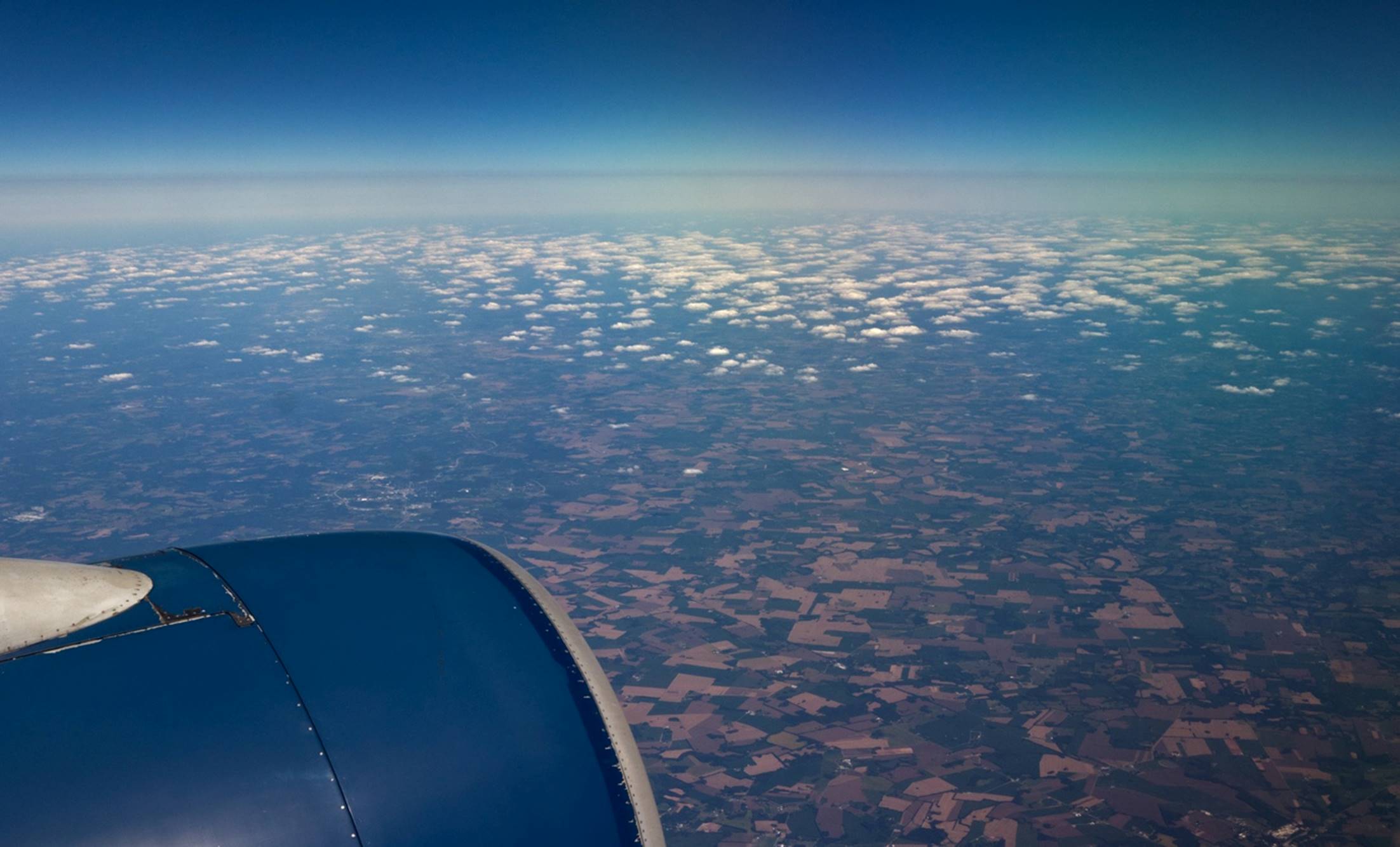
Leaving Minneapolis
and heading home
It was a good trip and we certainly saw some interesting sights, but it is always good to get home again.